-
OpenLandMap の Clay コンテンツ
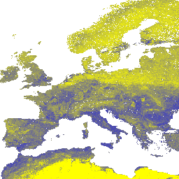
6 つの標準深度(0、10、30、60、100、200 cm)の粘土含有量(%(kg / kg))を 250 m 解像度で示しています。土壌プロファイルとサンプルのグローバルなコンピレーションから得られた機械学習予測に基づいています。処理手順について詳しくは、こちらをご覧ください。南極は ... clay envirometrix opengeohub openlandmap soil usda -
iSDAsoil 粘土含有量
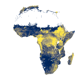
土壌深度 0 ~ 20 cm と 20 ~ 50 cm の粘土含有量、\n 予測平均と標準偏差。密林の多い地域(一般的には中央アフリカ)では、モデルの精度が低いため、バンディング(ストライプ)などのアーティファクトが表示されることがあります。土壌特性の予測は Innovative ... africa clay isda soil
Datasets tagged clay in Earth Engine
[null,null,[],[],["The data provides information on soil clay content from two sources. The first, iSDAsoil, offers predicted mean and standard deviation of clay content for 0-20 cm and 20-50 cm depths in Africa, noting potential banding artifacts in dense jungle areas. The second, OpenLandMap, details clay content in percentages (kg/kg) at six standard depths (0-200 cm) globally, using machine learning with a 250 m resolution.\n"]]