Page Summary
-
This page provides access to a variety of JAXA ALOS PALSAR and PALSAR-2 datasets, including ScanSAR, StripMap, and mosaic products.
-
Datasets include both raw SAR data and derived products, such as forest/non-forest classifications.
-
Global mosaics are available at 25m resolution and are created by mosaicking strips of SAR imagery with careful selection to minimize cloud and snow effects.
-
Emergency observation data from ALOS-2 PALSAR-2, starting January 1st, 2024, is being made available for disaster management purposes.
-
Yearly global forest/non-forest maps are available in both 3-class and 4-class versions, distinguishing between forest and non-forest areas with varying levels of detail.
-
ALOS-2 PALSAR-2 StripMap Level 2.1
Starting from the night of January 1st, 2024, based on the request from Japanese ministries and related organization, JAXA implemented ALOS-2 PALSAR-2 emergency observation. Since JAXA expects these emergency observation data to be extremely useful for disaster management, JAXA decided to open these data on … alos2 eroc jaxa palsar2 radar sar -
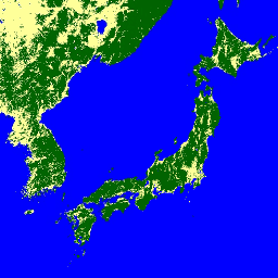
Global 3-class PALSAR-2/PALSAR Forest/Non-Forest Map
A newer version of this dataset with 4 classes for 2017-2020 can be found in JAXA/ALOS/PALSAR/YEARLY/FNF4 The global forest/non-forest map (FNF) is generated by classifying the SAR image (backscattering coefficient) in the global 25m resolution PALSAR-2/PALSAR SAR mosaic so that strong and low backscatter pixels … alos alos2 classification eroc forest forest-biomass -
Global 4-class PALSAR-2/PALSAR Forest/Non-Forest Map

The global forest/non-forest map (FNF) is generated by classifying the SAR image (backscattering coefficient) in the global 25m resolution PALSAR-2/PALSAR SAR mosaic so that strong and low backscatter pixels are assigned as "forest" and "non-forest", respectively. Here, "forest" is defined as the natural forest with … alos alos2 classification eroc forest forest-biomass -
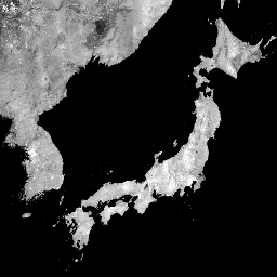
Global PALSAR-2/PALSAR Yearly Mosaic, version 1

A newer version of this dataset with data for 2015-2021 can be found in JAXA/ALOS/PALSAR/YEARLY/SAR_EPOCH The global 25m PALSAR/PALSAR-2 mosaic is a seamless global SAR image created by mosaicking strips of SAR imagery from PALSAR/PALSAR-2. For each year and location, the strip data were selected … alos alos2 eroc jaxa palsar palsar2 -
Global PALSAR-2/PALSAR Yearly Mosaic, version 2.5.0
The global 25m PALSAR/PALSAR-2 mosaic is a seamless global SAR image created by mosaicking strips of SAR imagery from PALSAR/PALSAR-2. For each year and location, the strip data were selected through visual inspection of the browse mosaics available over the period, with those showing minimum … alos alos2 eroc jaxa palsar palsar2 -
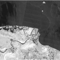
PALSAR-2 ScanSAR Level 2.2
The 25 m PALSAR-2 ScanSAR is normalized backscatter data of PALSAR-2 broad area observation mode with observation width of 350 km. The SAR imagery was ortho-rectificatied and slope corrected using the ALOS World 3D - 30 m (AW3D30) Digital Surface Model. Polarization data are stored … alos2 eroc jaxa palsar2 radar sar