-
GLCF: Landsat Global Inland Water
グローバル内陸水データセットには、淡水湖、塩水湖、河川、貯水池などの内陸地表水域が表示されます。GLS 2000 エポックから、3,650,723 km2 の陸水域が特定されました。そのうち約 3 分の 4 が北米とアジアにありました。北方樹林とツンドラ glcf landsat-derived nasa surface-ground-water umd water -
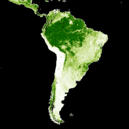
グローバル森林被覆変化(GFCC)樹木被覆マルチイヤー グローバル 30 m
Landsat 植生連続フィールド(VCF)の樹木被覆レイヤには、高さ 5 m を超える木本植物に覆われている各 30 m ピクセルの水平地面の割合の推定値が含まれています。このデータセットは、2000 年、2005 年、2010 年を中心とする 4 つのエポックで利用できます。 森林 森林バイオマス glcf landsat 由来 nasa umd
Datasets tagged glcf in Earth Engine
[null,null,[],[[["\u003cp\u003eThe Global Inland Water dataset identifies inland surface water bodies, including lakes, rivers, and reservoirs, with a majority found in North America and Asia.\u003c/p\u003e\n"],["\u003cp\u003eThe Global Forest Cover Change dataset provides estimates of tree cover percentage in 30-meter pixels for four epochs centered on the years 2000, 2005, 2010, and 2015.\u003c/p\u003e\n"],["\u003cp\u003eBoth datasets are derived from Landsat imagery and are part of the Global Land Cover Facility (GLCF) collection.\u003c/p\u003e\n"]]],[],null,["# Datasets tagged glcf in Earth Engine\n\n-\n\n |-------------------------------------------------------------------------------------------------------------------------------------------------------------------------------------------------------------------------------------------------------------------------------------------------------------|\n | [### GLCF: Landsat Global Inland Water](/earth-engine/datasets/catalog/GLCF_GLS_WATER) |\n | The Global Inland Water dataset shows inland surface water bodies, including fresh and saline lakes, rivers, and reservoirs. From the GLS 2000 epoch, 3,650,723 km2 of inland water were identified, around three quarters of which were in North America and Asia. Boreal forests and tundra ... |\n | [glcf](/earth-engine/datasets/tags/glcf) [landsat-derived](/earth-engine/datasets/tags/landsat-derived) [nasa](/earth-engine/datasets/tags/nasa) [surface-ground-water](/earth-engine/datasets/tags/surface-ground-water) [umd](/earth-engine/datasets/tags/umd) [water](/earth-engine/datasets/tags/water) |\n\n-\n\n |---------------------------------------------------------------------------------------------------------------------------------------------------------------------------------------------------------------------------------------------------------------------------------------------------|\n | [### Global Forest Cover Change (GFCC) Tree Cover Multi-Year Global 30m](/earth-engine/datasets/catalog/NASA_MEASURES_GFCC_TC_v3) |\n | The Landsat Vegetation Continuous Fields (VCF) tree cover layers contain estimates of the percentage of horizontal ground in each 30-m pixel covered by woody vegetation greater than 5 meters in height. The dataset is available for four epochs centered on the years 2000, 2005, 2010 ... |\n | [forest](/earth-engine/datasets/tags/forest) [forest-biomass](/earth-engine/datasets/tags/forest-biomass) [glcf](/earth-engine/datasets/tags/glcf) [landsat-derived](/earth-engine/datasets/tags/landsat-derived) [nasa](/earth-engine/datasets/tags/nasa) [umd](/earth-engine/datasets/tags/umd) |"]]