-
GLCF: Landsat Global Inland Water
グローバル内陸水データセットには、淡水湖、塩水湖、河川、貯水池などの内陸地表水域が表示されます。GLS 2000 エポックから、3,650,723 km2 の陸水域が特定されました。そのうち約 3 分の 4 が北米とアジアにありました。北方樹林とツンドラ glcf landsat-derived nasa surface-ground-water umd water -
グローバル森林被覆変化(GFCC)樹木被覆マルチイヤー グローバル 30 m
Landsat 植生連続フィールド(VCF)の樹木被覆レイヤには、高さ 5 m を超える木本植物に覆われている各 30 m ピクセルの水平地面の割合の推定値が含まれています。このデータセットは、2000 年、2005 年、2010 年を中心とする 4 つのエポックで利用できます。 森林 森林バイオマス glcf landsat 由来 nasa umd -
Hansen の世界的な森林の変化 v1.12(2000 ~ 2024 年)
世界中の森林の範囲と変化を特徴付ける Landsat 画像の時系列分析の結果。「first」バンドと「last」バンドは、赤、NIR、SWIR1、SWIR2 に対応する Landsat スペクトル バンドで利用可能な最初の年と最後の年の参照マルチスペクトル画像です。参照合成画像は次のことを表します。 森林 森林バイオマス 地理物理学 landsat 由来 umd -
原生湿潤熱帯林
原生湿潤熱帯林は、数多くのグローバルな生態系サービスを提供していますが、経済的な要因による伐採の脅威にさらされています。国家の土地利用計画を促進し、経済発展と生態系サービスの維持の目標をバランスよく達成するため、主要な熱帯雨林地図が作成されました。 森林 森林バイオマス グローバル landsat 由来 umd -
WHRC パントロピカル ナショナル レベル カーボン ストック データセット
熱帯の国々における地上生木バイオマス密度(500 m)の国レベルの地図。このデータセットは、同じ場所で行われたフィールド測定、LIDAR による観測、中分解能撮像分光放射計(MODIS)で記録された画像を組み合わせて作成されました。 地上 バイオマス 炭素 森林バイオマス 地理物理学 umd
Datasets tagged umd in Earth Engine
[null,null,[],[[["\u003cp\u003eThis webpage provides access to various datasets related to global forest cover, tree cover, and biomass.\u003c/p\u003e\n"],["\u003cp\u003eDatasets offer insights into forest change, including deforestation and primary forest identification.\u003c/p\u003e\n"],["\u003cp\u003eInformation on global inland water bodies, such as lakes and rivers, is also available.\u003c/p\u003e\n"],["\u003cp\u003eData is derived from sources like Landsat and MODIS imagery, offering high-resolution observations.\u003c/p\u003e\n"],["\u003cp\u003eThese datasets support research on carbon stock, land use planning, and ecosystem services.\u003c/p\u003e\n"]]],[],null,["# Datasets tagged umd in Earth Engine\n\n-\n\n |-------------------------------------------------------------------------------------------------------------------------------------------------------------------------------------------------------------------------------------------------------------------------------------------------------------|\n | [### GLCF: Landsat Global Inland Water](/earth-engine/datasets/catalog/GLCF_GLS_WATER) |\n | The Global Inland Water dataset shows inland surface water bodies, including fresh and saline lakes, rivers, and reservoirs. From the GLS 2000 epoch, 3,650,723 km2 of inland water were identified, around three quarters of which were in North America and Asia. Boreal forests and tundra ... |\n | [glcf](/earth-engine/datasets/tags/glcf) [landsat-derived](/earth-engine/datasets/tags/landsat-derived) [nasa](/earth-engine/datasets/tags/nasa) [surface-ground-water](/earth-engine/datasets/tags/surface-ground-water) [umd](/earth-engine/datasets/tags/umd) [water](/earth-engine/datasets/tags/water) |\n\n-\n\n |---------------------------------------------------------------------------------------------------------------------------------------------------------------------------------------------------------------------------------------------------------------------------------------------------|\n | [### Global Forest Cover Change (GFCC) Tree Cover Multi-Year Global 30m](/earth-engine/datasets/catalog/NASA_MEASURES_GFCC_TC_v3) |\n | The Landsat Vegetation Continuous Fields (VCF) tree cover layers contain estimates of the percentage of horizontal ground in each 30-m pixel covered by woody vegetation greater than 5 meters in height. The dataset is available for four epochs centered on the years 2000, 2005, 2010 ... |\n | [forest](/earth-engine/datasets/tags/forest) [forest-biomass](/earth-engine/datasets/tags/forest-biomass) [glcf](/earth-engine/datasets/tags/glcf) [landsat-derived](/earth-engine/datasets/tags/landsat-derived) [nasa](/earth-engine/datasets/tags/nasa) [umd](/earth-engine/datasets/tags/umd) |\n\n-\n\n |------------------------------------------------------------------------------------------------------------------------------------------------------------------------------------------------------------------------------------------------------------------------------------------------------------------------------------|\n | [### Hansen Global Forest Change v1.12 (2000-2024)](/earth-engine/datasets/catalog/UMD_hansen_global_forest_change_2024_v1_12) |\n | Results from time-series analysis of Landsat images in characterizing global forest extent and change. The 'first' and 'last' bands are reference multispectral imagery from the first and last available years for Landsat spectral bands corresponding to red, NIR, SWIR1, and SWIR2. Reference composite imagery represents ... |\n | [forest](/earth-engine/datasets/tags/forest) [forest-biomass](/earth-engine/datasets/tags/forest-biomass) [geophysical](/earth-engine/datasets/tags/geophysical) [landsat-derived](/earth-engine/datasets/tags/landsat-derived) [umd](/earth-engine/datasets/tags/umd) |\n\n-\n\n |-----------------------------------------------------------------------------------------------------------------------------------------------------------------------------------------------------------------------------------------------------------------------------------------------------------------------------------|\n | [### 
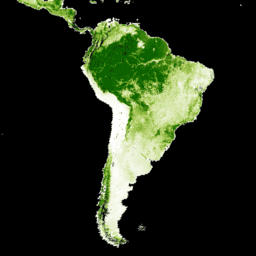
Primary Humid Tropical Forests](/earth-engine/datasets/catalog/UMD_GLAD_PRIMARY_HUMID_TROPICAL_FORESTS_v1) |\n | Primary humid tropical forests provide numerous global ecosystem services, but are under continuing threat of clearing from economic drivers. To facilitate national land use planning and balancing the goals of economic development and maintenance of ecosystem services, a primary humid tropical forest map was created ... |\n | [forest](/earth-engine/datasets/tags/forest) [forest-biomass](/earth-engine/datasets/tags/forest-biomass) [global](/earth-engine/datasets/tags/global) [landsat-derived](/earth-engine/datasets/tags/landsat-derived) [umd](/earth-engine/datasets/tags/umd) |\n\n-\n\n |---------------------------------------------------------------------------------------------------------------------------------------------------------------------------------------------------------------------------------------------------------------------------------------------------------------|\n | [### WHRC Pantropical National Level Carbon Stock Dataset](/earth-engine/datasets/catalog/WHRC_biomass_tropical) |\n | A national-level map of above-ground live woody biomass density for tropical countries at 500m. This dataset was assembled from a combination of co-located field measurements, LiDAR observations, and imagery recorded from the Moderate Resolution Imaging Spectroradiometer (MODIS). |\n | [aboveground](/earth-engine/datasets/tags/aboveground) [biomass](/earth-engine/datasets/tags/biomass) [carbon](/earth-engine/datasets/tags/carbon) [forest-biomass](/earth-engine/datasets/tags/forest-biomass) [geophysical](/earth-engine/datasets/tags/geophysical) [umd](/earth-engine/datasets/tags/umd) |"]]