-
Murray Global Intertidal Change Classification
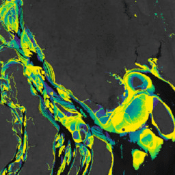
Murray Global Intertidal Change Dataset には、707,528 枚の Landsat アーカイブ画像の教師あり分類によって作成された干潟生態系の世界地図が含まれています。各ピクセルは、世界中に分散されたトレーニング データセットを参照して、干潟、常時水域、その他のいずれかに分類されています。カラーは、RGB 値とアルファ チャンネルで指定します。 沿岸 google 干潮帯 landsat 由来 murray 地表水 -
Murray Global Intertidal Change Data Mask
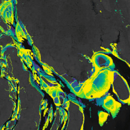
Murray Global Intertidal Change Dataset には、707,528 枚の Landsat アーカイブ画像の教師あり分類によって作成された干潟生態系の世界地図が含まれています。各ピクセルは、世界中に分散されたトレーニング データセットを参照して、干潟、常時水域、その他のいずれかに分類されています。カラーは、RGB 値とアルファ チャンネルで指定します。 沿岸 google 干潮帯 landsat 由来 murray 地表水 -
Murray Global Intertidal Change QA ピクセル数
Murray Global Intertidal Change Dataset には、707,528 枚の Landsat アーカイブ画像の教師あり分類によって作成された干潟生態系の世界地図が含まれています。各ピクセルは、世界中に分散されたトレーニング データセットを参照して、干潟、常時水域、その他のいずれかに分類されています。カラーは、RGB 値とアルファ チャンネルで指定します。 沿岸 google 干潮帯 landsat 由来 murray 地表水 -
Murray Global Tidal Wetland Change v1.0(1999 ~ 2019)
Murray Global Tidal Wetland Change Dataset には、干潟のグローバルな範囲とその変化の地図が含まれています。この地図は、(i)潮溜り湿地(潮溜り、干満、潮溜りのいずれかとして定義)の全世界の分布を推定するための 3 段階の分類から開発されました。 沿岸 生態系 干潟 landsat 由来 マングローブ murray
Datasets tagged murray in Earth Engine
[null,null,[],[[["\u003cp\u003eThe Murray datasets provide global maps of tidal wetlands and tidal flats, including their changes over time.\u003c/p\u003e\n"],["\u003cp\u003eThese datasets utilize a supervised classification of Landsat imagery to categorize areas into tidal flat, permanent water, or other land cover types.\u003c/p\u003e\n"],["\u003cp\u003eThe Global Tidal Wetland Change dataset specifically focuses on mapping tidal marshes and mangroves, along with their changes between 1999 and 2019.\u003c/p\u003e\n"],["\u003cp\u003eThe Global Intertidal Change dataset offers insights into tidal flat ecosystems based on a large-scale analysis of Landsat Archive images.\u003c/p\u003e\n"],["\u003cp\u003eQuality assessment information is also available through the Global Intertidal Change QA Pixel Count dataset.\u003c/p\u003e\n"]]],["The content describes the Murray Global datasets, which map tidal wetland and intertidal flat ecosystems. The Tidal Wetland Change Dataset estimates the global distribution of tidal marshes and other tidal ecosystems. The Intertidal Change datasets classify pixels from 707,528 Landsat images into tidal flat, permanent water, or other categories. These datasets use a globally distributed training data to classify and map the global extent of intertidal areas and track changes.\n"],null,["# Datasets tagged murray in Earth Engine\n\n-\n\n |---------------------------------------------------------------------------------------------------------------------------------------------------------------------------------------------------------------------------------------------------------------------------------------------------------------------------------------|\n | [### Murray Global Intertidal Change Classification](/earth-engine/datasets/catalog/UQ_murray_Intertidal_v1_1_global_intertidal) |\n | The Murray Global Intertidal Change Dataset contains global maps of tidal flat ecosystems produced via a supervised classification of 707,528 Landsat Archive images. Each pixel was classified into tidal flat, permanent water or other with reference to a globally distributed set of training data. The ... |\n | [coastal](/earth-engine/datasets/tags/coastal) [google](/earth-engine/datasets/tags/google) [intertidal](/earth-engine/datasets/tags/intertidal) [landsat-derived](/earth-engine/datasets/tags/landsat-derived) [murray](/earth-engine/datasets/tags/murray) [surface-ground-water](/earth-engine/datasets/tags/surface-ground-water) |\n\n-\n\n |---------------------------------------------------------------------------------------------------------------------------------------------------------------------------------------------------------------------------------------------------------------------------------------------------------------------------------------|\n | [### Murray Global Intertidal Change Data Mask](/earth-engine/datasets/catalog/UQ_murray_Intertidal_v1_1_data_mask) |\n | The Murray Global Intertidal Change Dataset contains global maps of tidal flat ecosystems produced via a supervised classification of 707,528 Landsat Archive images. Each pixel was classified into tidal flat, permanent water or other with reference to a globally distributed set of training data. The ... |\n | [coastal](/earth-engine/datasets/tags/coastal) [google](/earth-engine/datasets/tags/google) [intertidal](/earth-engine/datasets/tags/intertidal) [landsat-derived](/earth-engine/datasets/tags/landsat-derived) [murray](/earth-engine/datasets/tags/murray) [surface-ground-water](/earth-engine/datasets/tags/surface-ground-water) |\n\n-\n\n |---------------------------------------------------------------------------------------------------------------------------------------------------------------------------------------------------------------------------------------------------------------------------------------------------------------------------------------|\n | [### Murray Global Intertidal Change QA Pixel Count](/earth-engine/datasets/catalog/UQ_murray_Intertidal_v1_1_qa_pixel_count) |\n | The Murray Global Intertidal Change Dataset contains global maps of tidal flat ecosystems produced via a supervised classification of 707,528 Landsat Archive images. Each pixel was classified into tidal flat, permanent water or other with reference to a globally distributed set of training data. The ... |\n | [coastal](/earth-engine/datasets/tags/coastal) [google](/earth-engine/datasets/tags/google) [intertidal](/earth-engine/datasets/tags/intertidal) [landsat-derived](/earth-engine/datasets/tags/landsat-derived) [murray](/earth-engine/datasets/tags/murray) [surface-ground-water](/earth-engine/datasets/tags/surface-ground-water) |\n\n-\n\n |---------------------------------------------------------------------------------------------------------------------------------------------------------------------------------------------------------------------------------------------------------------------------------------------------------------------|\n | [### Murray Global Tidal Wetland Change v1.0 (1999-2019)](/earth-engine/datasets/catalog/JCU_Murray_GIC_global_tidal_wetland_change_2019) |\n | The Murray Global Tidal Wetland Change Dataset contains maps of the global extent of tidal wetlands and their change. The maps were developed from a three stage classification that sought to (i) estimate the global distribution of tidal wetlands (defined as either tidal marsh, tidal ... |\n | [coastal](/earth-engine/datasets/tags/coastal) [ecosystem](/earth-engine/datasets/tags/ecosystem) [intertidal](/earth-engine/datasets/tags/intertidal) [landsat-derived](/earth-engine/datasets/tags/landsat-derived) [mangrove](/earth-engine/datasets/tags/mangrove) [murray](/earth-engine/datasets/tags/murray) |"]]