-
ArcticDEM Mosaic phiên bản 4.1
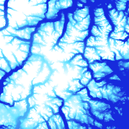
ArcticDEM là một sáng kiến công tư của Cơ quan Tình báo Địa không gian Quốc gia (NGA) và Quỹ Khoa học Quốc gia (NSF) nhằm tự động tạo ra một mô hình bề mặt kỹ thuật số (DSM) có độ phân giải cao và chất lượng cao của Bắc Cực bằng cách sử dụng hình ảnh lập thể quang học, điện toán hiệu suất cao và phần mềm đo đạc quang học nguồn mở. Nền tảng này bao gồm thảm thực vật, tán cây, các toà nhà và … arctic dem elevation-topography geophysical pgc umn -
Các dải dữ liệu ArcticDEM

ArcticDEM là một sáng kiến công tư của Cơ quan Tình báo Địa không gian Quốc gia (NGA) và Quỹ Khoa học Quốc gia (NSF) nhằm tự động tạo ra một mô hình bề mặt kỹ thuật số (DSM) có độ phân giải cao và chất lượng cao của Bắc Cực bằng cách sử dụng hình ảnh lập thể quang học, điện toán hiệu suất cao và phần mềm đo đạc quang học nguồn mở. Nền tảng này bao gồm thảm thực vật, tán cây, các toà nhà và … arctic dem elevation-topography geophysical pgc umn -
REMA Mosaic

Mô hình độ cao tham chiếu của Nam Cực (REMA) là một Mô hình bề mặt kỹ thuật số (DSM) có độ phân giải cao, được gắn dấu thời gian của Nam Cực ở độ phân giải không gian 2 mét và 8 mét. Các tệp DEM được ghép từ nhiều dải đã được đăng ký đồng thời, kết hợp và làm mờ để giảm các thành phần lạ trùng khớp cạnh. dem elevation-topography geophysical pgc rema umn -
REMA Strips 2m

Mô hình độ cao tham chiếu của Nam Cực (REMA) là một Mô hình bề mặt kỹ thuật số (DSM) có độ phân giải cao, được gắn dấu thời gian của Nam Cực ở độ phân giải không gian 2 mét và 8 mét. Các tệp DEM dải tương ứng với vùng chồng chéo của các dải cặp hình ảnh lập thể đầu vào khi chúng được thu thập bởi … của DigitalGlobe dem elevation-topography geophysical pgc rema umn -
REMA Strips 8m

Mô hình độ cao tham chiếu của Nam Cực (REMA) là một Mô hình bề mặt kỹ thuật số (DSM) có độ phân giải cao, được gắn dấu thời gian của Nam Cực ở độ phân giải không gian 2 mét và 8 mét. Các tệp DEM dải tương ứng với vùng chồng chéo của các dải cặp hình ảnh lập thể đầu vào khi chúng được thu thập bởi … của DigitalGlobe dem elevation-topography geophysical pgc rema umn
Datasets tagged pgc in Earth Engine
[null,null,[],[],[]]