-
OpenLandMap の砂の含有量
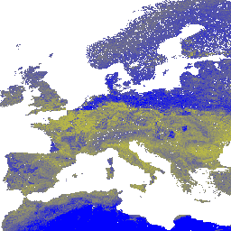
250 m の解像度で、6 つの標準深度(0、10、30、60、100、200 cm)における砂の含有量(kg / kg)。土壌プロファイルとサンプルのグローバル コンピレーションからの機械学習予測に基づいています。処理手順について詳しくは、こちらをご覧ください。南極は … envirometrix opengeohub openlandmap sand soil usda -
iSDAsoil の砂の含有量
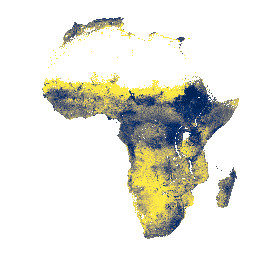
土壌深度 0 ~ 20 cm と 20 ~ 50 cm の砂の含有量、予測される平均値と標準偏差。密林地帯(一般的に中央アフリカ)では、モデルの精度が低いため、バンディング(ストライプ)などのアーティファクトが見られることがあります。土壌特性の予測は、Innovative … africa isda sand soil
Datasets tagged sand in Earth Engine
[null,null,[],[],[]]