সেন্টিনেল-১ থেকে গতিশীল ভূপৃষ্ঠের জলের বিস্তৃতি (DSWx-S1) V1 
এই ডেটাসেটটিতে সেন্টিনেল-১ (DSWX-S1) থেকে প্রাপ্ত লেভেল-৩ ডাইনামিক OPERA ভূপৃষ্ঠের জলসীমার তথ্য রয়েছে। DSWx-S1 মিলিটারি গ্রিড রেফারেন্স সিস্টেম (MGRS) গ্রিড সিস্টেমের উপর ৩০ মিটার স্থানিক রেজোলিউশনে ভূমির উপরিভাগের জলসীমার প্রায়-বৈশ্বিক ভৌগোলিক মানচিত্র প্রদান করে, যার একটি নির্দিষ্ট সময় অন্তর পুনরাগমন হার রয়েছে… ভূ-ভৌত নাসা অপেরা সেন্টিনেল১-উদ্ভূত পৃষ্ঠতল ভূপৃষ্ঠ-ভূগর্ভস্থ-জল ইএসএ ওয়ার্ল্ডসিরিয়াল ১০ মি ভি১০০ 
ইউরোপীয় মহাকাশ সংস্থা (ইএসএ)-এর ওয়ার্ল্ডসিরিয়াল ১০ মি ২০২১ প্রোডাক্ট স্যুটে বৈশ্বিক বার্ষিক ও মৌসুমী শস্যের মানচিত্র এবং সেগুলোর সংশ্লিষ্ট নির্ভরযোগ্যতা অন্তর্ভুক্ত রয়েছে। এগুলো ইএসএ-ওয়ার্ল্ডসিরিয়াল প্রকল্পের অংশ হিসেবে তৈরি করা হয়েছিল। এই প্রোডাক্টগুলোর বিষয়বস্তু এবং ব্যবহৃত পদ্ধতি সম্পর্কে আরও তথ্য… কৃষি কোপারনিকাস ফসল ইএসএ বৈশ্বিক ভূমি আচ্ছাদন ইএসএ ওয়ার্ল্ডসিরিয়াল সক্রিয় শস্যভূমি ১০ মি ভি১০০ 
ইউরোপীয় মহাকাশ সংস্থা (ESA)-এর ওয়ার্ল্ডসিরিয়াল অ্যাক্টিভ ক্রপল্যান্ড ১০ মি ২০২১ প্রোডাক্ট স্যুটে বৈশ্বিক পর্যায়ের মৌসুমী সক্রিয় ফসলি জমির মার্কার রয়েছে। এগুলো ESA-ওয়ার্ল্ডসিরিয়াল প্রকল্পের অংশ হিসেবে তৈরি করা হয়েছিল। সক্রিয় ফসলি জমির প্রোডাক্টগুলো নির্দেশ করে যে, অস্থায়ী ফসল হিসেবে চিহ্নিত কোনো পিক্সেল সক্রিয়ভাবে ব্যবহৃত হয়েছে কি না… কৃষি কোপারনিকাস ফসল ইএসএ বৈশ্বিক ভূমি আচ্ছাদন ইএসএ ওয়ার্ল্ডকভার ১০মি ভি১০০ 
ইউরোপীয় মহাকাশ সংস্থা (ESA)-এর ওয়ার্ল্ডকভার ১০ মি ২০২০ পণ্যটি সেন্টিনেল-১ এবং সেন্টিনেল-২ ডেটার উপর ভিত্তি করে ১০ মি রেজোলিউশনে ২০২০ সালের একটি বৈশ্বিক ভূমি আচ্ছাদন মানচিত্র প্রদান করে। ওয়ার্ল্ডকভার পণ্যটিতে ১১টি ভূমি আচ্ছাদন শ্রেণি রয়েছে এবং এটি …-এর কাঠামোর অধীনে তৈরি করা হয়েছে। ইএসএ ভূমি আচ্ছাদন ভূমি ব্যবহার ভূমি ব্যবহার-ভূমি আচ্ছাদন সেন্টিনেল১-উদ্ভূত সেন্টিনেল২-উদ্ভূত ইএসএ ওয়ার্ল্ডকভার ১০মি ভি২০০ 
ইউরোপীয় মহাকাশ সংস্থা (ESA)-এর ওয়ার্ল্ডকভার ১০ মি ২০২১ পণ্যটি সেন্টিনেল-১ এবং সেন্টিনেল-২ ডেটার উপর ভিত্তি করে ১০ মি রেজোলিউশনে ২০২১ সালের জন্য একটি বৈশ্বিক ভূমি আচ্ছাদন মানচিত্র প্রদান করে। ওয়ার্ল্ডকভার পণ্যটিতে ১১টি ভূমি আচ্ছাদন শ্রেণি রয়েছে এবং এটি …-এর কাঠামোর অধীনে তৈরি করা হয়েছে। ইএসএ ভূমি আচ্ছাদন ভূমি ব্যবহার ভূমি ব্যবহার-ভূমি আচ্ছাদন সেন্টিনেল১-উদ্ভূত সেন্টিনেল২-উদ্ভূত ইউক্রপম্যাপ 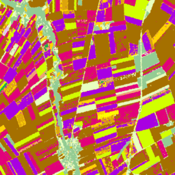
২০১৮ সালের জন্য সেন্টিনেল-১ এবং লুকাস কোপারনিকাস ২০১৮-এর ইন-সিটু পর্যবেক্ষণের উপর ভিত্তি করে ইউরোপীয় শস্যের প্রকারভেদের মানচিত্র, এবং ২০২২ সালের জন্য সেন্টিনেল-১, সেন্টিনেল-২, ও সহায়ক তথ্যের সাথে লুকাস কোপারনিকাস ২০২২-এর পর্যবেক্ষণের সমন্বয়। অনন্য লুকাস ২০১৮ কোপারনিকাস ইন-সিটু সমীক্ষার উপর ভিত্তি করে, এই ডেটাসেটটি প্রথম… কৃষি ফসল ইইউ জেআরসি লুকাস সেন্টিনেল১-উদ্ভূত গ্লোবাল সিজনাল সেন্টিনেল-১ ইন্টারফেরোমেট্রিক কোহেরেন্স এবং ব্যাকস্ক্যাটার ভি২০১৯ ব্যাকস্ক্যাটার 
এই ডেটা সেটটি হলো বহু-ঋতুভিত্তিক, বৈশ্বিক সি-ব্যান্ড সিন্থেটিক অ্যাপারচার রাডার (SAR) ইন্টারফেরোমেট্রিক রিপিট-পাস কোহেরেন্স এবং ব্যাকস্ক্যাটার সিগনেচারের সর্বপ্রথম স্থানিক উপস্থাপনা। এর আওতাভুক্ত এলাকা ৮২ ডিগ্রি উত্তর অক্ষাংশ থেকে ৭৯ ডিগ্রি দক্ষিণ অক্ষাংশ পর্যন্ত বিস্তৃত স্থলভাগ এবং বরফ চাদর। ডেটা সেটটি বহু-সাময়িক… ব্যাকস্ক্যাটার আর্থ-বিগ-ডেটা জেপিএল নাসা পোলারাইজেশন রাডার গ্লোবাল সিজনাল সেন্টিনেল-১ ইন্টারফেরোমেট্রিক কোহেরেন্স এবং ব্যাকস্ক্যাটার ভি২০১৯ কোহেরেন্স 
এই ডেটা সেটটি হলো বহু-ঋতুভিত্তিক, বৈশ্বিক সি-ব্যান্ড সিন্থেটিক অ্যাপারচার রাডার (SAR) ইন্টারফেরোমেট্রিক রিপিট-পাস কোহেরেন্স এবং ব্যাকস্ক্যাটার সিগনেচারের সর্বপ্রথম স্থানিক উপস্থাপনা। এর আওতাভুক্ত এলাকা ৮২ ডিগ্রি উত্তর অক্ষাংশ থেকে ৭৯ ডিগ্রি দক্ষিণ অক্ষাংশ পর্যন্ত বিস্তৃত স্থলভাগ এবং বরফ চাদর। ডেটা সেটটি বহু-সাময়িক… পৃথিবী-বিগ-ডেটা জেপিএল নাসা পোলারাইজেশন রাডার এসএআর গ্লোবাল সিজনাল সেন্টিনেল-১ ইন্টারফেরোমেট্রিক কোহেরেন্স এবং ব্যাকস্ক্যাটার ভি২০১৯ ডিক্যাই মডেল প্যারামিটার 
এই ডেটা সেটটি হলো বহু-ঋতুভিত্তিক, বৈশ্বিক সি-ব্যান্ড সিন্থেটিক অ্যাপারচার রাডার (SAR) ইন্টারফেরোমেট্রিক রিপিট-পাস কোহেরেন্স এবং ব্যাকস্ক্যাটার সিগনেচারের সর্বপ্রথম স্থানিক উপস্থাপনা। এর আওতাভুক্ত এলাকা ৮২ ডিগ্রি উত্তর অক্ষাংশ থেকে ৭৯ ডিগ্রি দক্ষিণ অক্ষাংশ পর্যন্ত বিস্তৃত স্থলভাগ এবং বরফ চাদর। ডেটা সেটটি বহু-সাময়িক… পৃথিবী-বিগ-ডেটা জেপিএল নাসা পোলারাইজেশন রাডার এসএআর গ্লোবাল সিজনাল সেন্টিনেল-১ ইন্টারফেরোমেট্রিক কোহেরেন্স এবং ব্যাকস্ক্যাটার ভি২০১৯ ইনসিডেন্স লেওভার শ্যাডো 
এই ডেটা সেটটি হলো বহু-ঋতুভিত্তিক, বৈশ্বিক সি-ব্যান্ড সিন্থেটিক অ্যাপারচার রাডার (SAR) ইন্টারফেরোমেট্রিক রিপিট-পাস কোহেরেন্স এবং ব্যাকস্ক্যাটার সিগনেচারের সর্বপ্রথম স্থানিক উপস্থাপনা। এর আওতাভুক্ত এলাকা ৮২ ডিগ্রি উত্তর অক্ষাংশ থেকে ৭৯ ডিগ্রি দক্ষিণ অক্ষাংশ পর্যন্ত বিস্তৃত স্থলভাগ এবং বরফ চাদর। ডেটা সেটটি বহু-সাময়িক… পৃথিবী-বিগ-ডেটা জেপিএল নাসা পোলারাইজেশন রাডার এসএআর OPERA রেডিওমেট্রিক টেরেইন-কারেক্টেড SAR ব্যাকস্ক্যাটার ফ্রম সেন্টিনেল-১ স্ট্যাটিক লেয়ারস V1.0 
এই পণ্যটিতে OPERA Radiometric Terrain Corrected SAR Backscatter from Sentinel-1 ডেটাসেটের সাথে সম্পর্কিত স্ট্যাটিক রাডার জ্যামিতি স্তরসমূহ রয়েছে। S1 মিশনের সংকীর্ণ কক্ষপথের কারণে, ইনসিডেন্স অ্যাঙ্গেল, লোকাল ইনসিডেন্স অ্যাঙ্গেল, নাম্বার অফ লুকস, এবং RTC এরিয়া নর্মালাইজেশন ফ্যাক্টর (ANF)-এর মতো রাডার-জ্যামিতি স্তরসমূহ… jpl nasa opera sar satellite-imagery sentinel1-derived OPERA রেডিওমেট্রিক টেরেইন-কারেক্টেড SAR ব্যাকস্ক্যাটার ফ্রম সেন্টিনেল-১ V1.0 
এই প্রোডাক্টটি ভূসংস্থানের সাপেক্ষে স্বাভাবিককৃত রাডার ব্যাকস্ক্যাটার নিয়ে গঠিত। এটি ভূমিতে বিক্ষিপ্তকারী বস্তুসমূহের ভৌত বৈশিষ্ট্য, যেমন ভূপৃষ্ঠের অমসৃণতা এবং মাটির আর্দ্রতা এবং/অথবা গাছপালা সম্পর্কিত সংকেতগুলোকে ম্যাপ করে। OPERA RTC-S1 প্রোডাক্টটি কোপারনিকাস সেন্টিনেল-১ ইন্টারফেরোমেট্রিক ওয়াইড (IW) থেকে উদ্ভূত… ব্যাকস্ক্যাটার জেপিএল নাসা অপেরা পোলারাইজেশন রাডার স্যাটেলাইট এমবেডিং ভি১ 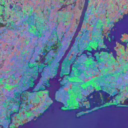
গুগল স্যাটেলাইট এমবেডিং ডেটাসেট হলো লার্নড জিওস্পেশিয়াল এমবেডিং-এর একটি বৈশ্বিক ও বিশ্লেষণের জন্য প্রস্তুত সংগ্রহ। এই ডেটাসেটের প্রতিটি ১০-মিটার পিক্সেল হলো একটি ৬৪-মাত্রিক উপস্থাপনা বা "এমবেডিং ভেক্টর", যা বিভিন্ন ভূ-পর্যবেক্ষণ কেন্দ্র দ্বারা পরিমাপকৃত সেই পিক্সেল এবং তার আশেপাশের ভূপৃষ্ঠের অবস্থার কালিক গতিপথকে এনকোড করে… বার্ষিক বৈশ্বিক গুগল ল্যান্ডস্যাট-থেকে-প্রাপ্ত স্যাটেলাইট-চিত্রাবলী সেন্টিনেল১-থেকে-প্রাপ্ত বিশ্ব বসতি পদচিহ্ন ২০১৫ 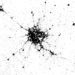
ওয়ার্ল্ড সেটেলমেন্ট ফুটপ্রিন্ট (ডব্লিউএসএফ) ২০১৫ হলো একটি ১০ মিটার রেজোলিউশনের বাইনারি মাস্ক, যা বিশ্বব্যাপী মানব বসতির বিস্তৃতিকে চিহ্নিত করে। এটি ২০১৪-২০১৫ সালের মাল্টিটেম্পোরাল ল্যান্ডস্যাট-৮ এবং সেন্টিনেল-১ চিত্রাবলীর মাধ্যমে উদ্ভাবিত হয়েছে (যার মধ্যে যথাক্রমে প্রায় ২,১৭,০০০ এবং প্রায় ১,০৭,০০০ দৃশ্য প্রক্রিয়াজাত করা হয়েছে)। মানব বসতির কালিক গতিশীলতা… ভূমি আচ্ছাদন ল্যান্ডস্যাট-থেকে প্রাপ্ত জনসংখ্যা সেন্টিনেল১-থেকে প্রাপ্ত বসতি শহুরে
Datasets tagged sentinel1-derived in Earth Engine
[null,null,[],[],[]]