-
GLCF: Landsat Global Inland Water
Küresel İç Su veri kümesi, tatlı ve tuzlu göller, nehirler ve barajlar dahil olmak üzere iç su yüzeyi kütlelerini gösterir. GLS 2000 döneminde, yaklaşık dörtte üçü Kuzey Amerika ve Asya'da olmak üzere 3.650.723 km2 iç su tespit edildi. Tayga ormanları ve tundra glcf landsat-derived nasa surface-ground-water umd water -
Küresel Orman Örtüsü Değişikliği (GFCC) Ağaç Örtüsü Çok Yıllık Küresel 30 m
Landsat Vegetation Continuous Fields (VCF) ağaç örtüsü katmanları, her 30 metrelik pikselde 5 metreden uzun odunsu bitki örtüsüyle kaplı yatay zemin yüzdesinin tahminlerini içerir. Veri kümesi, 2000, 2005, 2010 yılları merkezli dört dönem için kullanılabilir. orman orman-biyokütlesi glcf landsat-türevi nasa umd -
Hansen Global Forest Change v1.12 (2000-2024)
Dünyadaki ormanların kapsamını ve değişimini karakterize etmek için Landsat görüntülerinin zaman serisi analizinden elde edilen sonuçlar. "İlk" ve "son" bantlar, kırmızı, NIR, SWIR1 ve SWIR2'ye karşılık gelen Landsat spektral bantları için mevcut olan ilk ve son yıllardaki referans çok spektral görüntülerdir. Referans birleştirilmiş görüntüler şunu gösterir: orman orman-biyokütlesi jeofizik landsat kaynaklı umd -
Birincil Nemli Tropikal Ormanlar
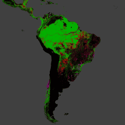
Birincil nemli tropikal ormanlar, dünya genelinde birçok ekosistem hizmeti sunsa da ekonomik nedenlerle sürekli olarak temizlenme tehdidi altındadır. Ulusal arazi kullanımı planlamasını kolaylaştırmak ve ekonomik kalkınma ile ekosistem hizmetlerinin sürdürülmesi hedeflerini dengelemek için birincil nemli tropikal orman haritası oluşturuldu. forest forest-biomass global landsat-derived umd -
WHRC Pantropical Ulusal Düzeyde Karbon Stok Veri Kümesi
Tropikal ülkeler için 500 m'de yerüstü canlı odunsu biyokütle yoğunluğunun ulusal düzeyde haritası. Bu veri kümesi, aynı yerde yapılan saha ölçümleri, LiDAR gözlemleri ve Orta Çözünürlüklü Görüntüleme Spektroradyometresi'nden (MODIS) kaydedilen görüntülerden oluşturulmuştur. aboveground biomass carbon forest-biomass geophysical umd
Datasets tagged umd in Earth Engine
[null,null,[],[[["\u003cp\u003eThis webpage provides access to various datasets related to global forest cover, tree cover, and biomass.\u003c/p\u003e\n"],["\u003cp\u003eDatasets offer insights into forest change, including deforestation and primary forest identification.\u003c/p\u003e\n"],["\u003cp\u003eInformation on global inland water bodies, such as lakes and rivers, is also available.\u003c/p\u003e\n"],["\u003cp\u003eData is derived from sources like Landsat and MODIS imagery, offering high-resolution observations.\u003c/p\u003e\n"],["\u003cp\u003eThese datasets support research on carbon stock, land use planning, and ecosystem services.\u003c/p\u003e\n"]]],[],null,["# Datasets tagged umd in Earth Engine\n\n-\n\n |-------------------------------------------------------------------------------------------------------------------------------------------------------------------------------------------------------------------------------------------------------------------------------------------------------------|\n | [### GLCF: Landsat Global Inland Water](/earth-engine/datasets/catalog/GLCF_GLS_WATER) |\n | The Global Inland Water dataset shows inland surface water bodies, including fresh and saline lakes, rivers, and reservoirs. From the GLS 2000 epoch, 3,650,723 km2 of inland water were identified, around three quarters of which were in North America and Asia. Boreal forests and tundra ... |\n | [glcf](/earth-engine/datasets/tags/glcf) [landsat-derived](/earth-engine/datasets/tags/landsat-derived) [nasa](/earth-engine/datasets/tags/nasa) [surface-ground-water](/earth-engine/datasets/tags/surface-ground-water) [umd](/earth-engine/datasets/tags/umd) [water](/earth-engine/datasets/tags/water) |\n\n-\n\n |---------------------------------------------------------------------------------------------------------------------------------------------------------------------------------------------------------------------------------------------------------------------------------------------------|\n | [### Global Forest Cover Change (GFCC) Tree Cover Multi-Year Global 30m](/earth-engine/datasets/catalog/NASA_MEASURES_GFCC_TC_v3) |\n | The Landsat Vegetation Continuous Fields (VCF) tree cover layers contain estimates of the percentage of horizontal ground in each 30-m pixel covered by woody vegetation greater than 5 meters in height. The dataset is available for four epochs centered on the years 2000, 2005, 2010 ... |\n | [forest](/earth-engine/datasets/tags/forest) [forest-biomass](/earth-engine/datasets/tags/forest-biomass) [glcf](/earth-engine/datasets/tags/glcf) [landsat-derived](/earth-engine/datasets/tags/landsat-derived) [nasa](/earth-engine/datasets/tags/nasa) [umd](/earth-engine/datasets/tags/umd) |\n\n-\n\n |------------------------------------------------------------------------------------------------------------------------------------------------------------------------------------------------------------------------------------------------------------------------------------------------------------------------------------|\n | [### Hansen Global Forest Change v1.12 (2000-2024)](/earth-engine/datasets/catalog/UMD_hansen_global_forest_change_2024_v1_12) |\n | Results from time-series analysis of Landsat images in characterizing global forest extent and change. The 'first' and 'last' bands are reference multispectral imagery from the first and last available years for Landsat spectral bands corresponding to red, NIR, SWIR1, and SWIR2. Reference composite imagery represents ... |\n | [forest](/earth-engine/datasets/tags/forest) [forest-biomass](/earth-engine/datasets/tags/forest-biomass) [geophysical](/earth-engine/datasets/tags/geophysical) [landsat-derived](/earth-engine/datasets/tags/landsat-derived) [umd](/earth-engine/datasets/tags/umd) |\n\n-\n\n |-----------------------------------------------------------------------------------------------------------------------------------------------------------------------------------------------------------------------------------------------------------------------------------------------------------------------------------|\n | [### Primary Humid Tropical Forests](/earth-engine/datasets/catalog/UMD_GLAD_PRIMARY_HUMID_TROPICAL_FORESTS_v1) |\n | Primary humid tropical forests provide numerous global ecosystem services, but are under continuing threat of clearing from economic drivers. To facilitate national land use planning and balancing the goals of economic development and maintenance of ecosystem services, a primary humid tropical forest map was created ... |\n | [forest](/earth-engine/datasets/tags/forest) [forest-biomass](/earth-engine/datasets/tags/forest-biomass) [global](/earth-engine/datasets/tags/global) [landsat-derived](/earth-engine/datasets/tags/landsat-derived) [umd](/earth-engine/datasets/tags/umd) |\n\n-\n\n |---------------------------------------------------------------------------------------------------------------------------------------------------------------------------------------------------------------------------------------------------------------------------------------------------------------|\n | [### WHRC Pantropical National Level Carbon Stock Dataset](/earth-engine/datasets/catalog/WHRC_biomass_tropical) |\n | A national-level map of above-ground live woody biomass density for tropical countries at 500m. This dataset was assembled from a combination of co-located field measurements, LiDAR observations, and imagery recorded from the Moderate Resolution Imaging Spectroradiometer (MODIS). |\n | [aboveground](/earth-engine/datasets/tags/aboveground) [biomass](/earth-engine/datasets/tags/biomass) [carbon](/earth-engine/datasets/tags/carbon) [forest-biomass](/earth-engine/datasets/tags/forest-biomass) [geophysical](/earth-engine/datasets/tags/geophysical) [umd](/earth-engine/datasets/tags/umd) |"]]