Dieses Dataset enthält Schätzungen der Wasserfläche (permanentes Eis und Wasser) innerhalb jedes Pixels und wurde zur Berechnung der Bevölkerungsdichte-Datasets von GPW v4.11 verwendet.
Die Gridded Population of the World Version 4 (GPWv4), Revision 11, modelliert die Verteilung der globalen Bevölkerung für die Jahre 2000, 2005, 2010, 2015 und 2020 in Rasterzellen mit einer Größe von 30 Bogensekunden (ca. 1 km). Die Bevölkerung wird auf Zellen verteilt, indem die Bevölkerung aus Volkszählungs- und Verwaltungseinheiten proportional zugewiesen wird. Die Bevölkerungsdaten werden mit der detailliertesten räumlichen Auflösung erfasst, die aus den Ergebnissen der Volkszählungen von 2010 (zwischen 2005 und 2014) verfügbar ist. Die Eingabedaten werden extrapoliert, um Bevölkerungsschätzungen für jedes modellierte Jahr zu erstellen.
Bänder
Pixelgröße 927,67 Meter
Bänder
Name
Min.
Max.
Pixelgröße
Beschreibung
water_area
0*
0,860558*
Meter
Schätzungen für die Wasserfläche in jedem Pixel mit 30 Bogensekunden.
Center for International Earth Science Information Network (CIESIN), Columbia University. 2018. Gridded Population of the World, Version 4 (GPWv4): Water Area, Revision 11.
Palisades, NY: NASA Socioeconomic Data and Applications Center
(SEDAC). https://doi.org/10.7927/H4Z60M4Z.
Zugriff am DAY. MONTH. YEAR.
Dieses Dataset enthält Schätzungen der Wasserfläche (permanentes Eis und Wasser) innerhalb jedes Pixels und wurde zur Berechnung der Bevölkerungsdichte-Datasets von GPW v4.11 verwendet. Allgemeine Dokumentation Die Gridded Population of World Version 4 (GPWv4), Revision 11 modelliert die Verteilung der globalen menschlichen Bevölkerung für die Jahre 2000, 2005, …
[null,null,[],[[["\u003cp\u003eThe GPWv411: Water Area dataset provides estimates of permanent ice and water area within each pixel at a 30 arc-second resolution (approximately 1km).\u003c/p\u003e\n"],["\u003cp\u003eThis dataset covers the period from 2000 to 2020 and was used to calculate population density for the Gridded Population of the World Version 4 (GPWv4) dataset.\u003c/p\u003e\n"],["\u003cp\u003eWater area is modeled using proportional allocation from census and administrative units and is available through the NASA Socioeconomic Data and Applications Center (SEDAC).\u003c/p\u003e\n"],["\u003cp\u003eThe dataset is freely accessible under the CC-BY-4.0 license and can be explored using Google Earth Engine.\u003c/p\u003e\n"],["\u003cp\u003eData is provided by NASA SEDAC at the Center for International Earth Science Information Network.\u003c/p\u003e\n"]]],[],null,["# GPWv411: Water Area (Gridded Population of the World Version 4.11)\n\nDataset Availability\n: 2000-01-01T00:00:00Z--2020-01-01T00:00:00Z\n\nDataset Provider\n:\n\n\n [NASA SEDAC at the Center for International Earth Science Information Network](https://doi.org/10.7927/H4Z60M4Z)\n\nTags\n:\n[ciesin](/earth-engine/datasets/tags/ciesin) [gpw](/earth-engine/datasets/tags/gpw) [nasa](/earth-engine/datasets/tags/nasa) [population](/earth-engine/datasets/tags/population) [surface-ground-water](/earth-engine/datasets/tags/surface-ground-water) \n\n#### Description\n\nThis dataset contains estimates of the water area (permanent ice and water)\nwithin each pixel, and was used to calculate the GPW v4.11 population density\ndatasets.\n\n[General Documentation](https://sedac.ciesin.columbia.edu/data/set/gpw-v4-land-water-area-rev11/docs)\n\nThe Gridded Population of World Version 4 (GPWv4), Revision 11 models the distribution\nof global human population for the years 2000, 2005, 2010, 2015, and 2020\non 30 arc-second (approximately 1 km) grid cells. Population is distributed\nto cells using proportional allocation of population from census and\nadministrative units. Population input data are collected at the most\ndetailed spatial resolution available from the results of the 2010 round of\ncensuses, which occurred between 2005 and 2014. The input data are\nextrapolated to produce population estimates for each modeled year.\n\n### Bands\n\n\n**Pixel Size**\n\n927.67 meters\n\n**Bands**\n\n| Name | Min | Max | Pixel Size | Description |\n|--------------|-----|------------|------------|-----------------------------------------------------------|\n| `water_area` | 0\\* | 0.860558\\* | meters | Estimates for water area within each 30-arc second pixel. |\n\n\\* estimated min or max value\n\n### Terms of Use\n\n**Terms of Use**\n\n[CC-BY-4.0](https://spdx.org/licenses/CC-BY-4.0.html)\n\n### Citations\n\nCitations:\n\n- Center for International Earth Science Information Network - CIESIN -\n Columbia University. 2018. Gridded Population of the World, Version 4\n (GPWv4): Water Area, Revision 11.\n Palisades, NY: NASA Socioeconomic Data and Applications Center\n (SEDAC). \u003chttps://doi.org/10.7927/H4Z60M4Z\u003e.\n Accessed DAY MONTH YEAR.\n\n### DOIs\n\n- \u003chttps://doi.org/10.7927/H4Z60M4Z\u003e\n\n### Explore with Earth Engine\n\n| **Important:** Earth Engine is a platform for petabyte-scale scientific analysis and visualization of geospatial datasets, both for public benefit and for business and government users. Earth Engine is free to use for research, education, and nonprofit use. To get started, please [register for Earth Engine access.](https://console.cloud.google.com/earth-engine)\n\n### Code Editor (JavaScript)\n\n```javascript\n
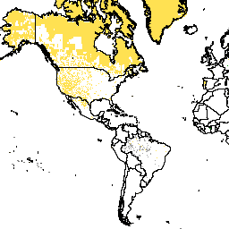
var dataset = ee.ImageCollection('CIESIN/GPWv411/GPW_Water_Area');\nvar raster = dataset.select('water_area');\nvar raster_vis = {\n 'min': 0.0,\n 'palette': [\n 'f5f6da',\n '180d02'\n ],\n 'max': 0.860558\n};\nMap.setCenter(79.1, 19.81, 3);\nMap.addLayer(raster, raster_vis, 'water_area');\n```\n[Open in Code Editor](https://code.earthengine.google.com/?scriptPath=Examples:Datasets/CIESIN/CIESIN_GPWv411_GPW_Water_Area) \n[GPWv411: Water Area (Gridded Population of the World Version 4.11)](/earth-engine/datasets/catalog/CIESIN_GPWv411_GPW_Water_Area) \nThis dataset contains estimates of the water area (permanent ice and water) within each pixel, and was used to calculate the GPW v4.11 population density datasets. General Documentation The Gridded Population of World Version 4 (GPWv4), Revision 11 models the distribution of global human population for the years 2000, 2005, ... \nCIESIN/GPWv411/GPW_Water_Area, ciesin,gpw,nasa,population,surface-ground-water \n2000-01-01T00:00:00Z/2020-01-01T00:00:00Z \n-90 -180 90 180 \nGoogle Earth Engine \nhttps://developers.google.com/earth-engine/datasets\n\n- [https://doi.org/10.7927/H4Z60M4Z](https://doi.org/https://doi.org/10.7927/H4Z60M4Z)\n- [https://doi.org/10.7927/H4Z60M4Z](https://doi.org/https://developers.google.com/earth-engine/datasets/catalog/CIESIN_GPWv411_GPW_Water_Area)"]]