-
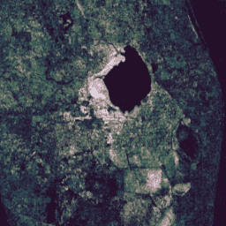
פלחי CCDC גלובליים של Google המבוססים על Landsat (1999-2019)
האוסף הזה מכיל תוצאות מחושבות מראש של הרצת האלגוריתם לזיהוי ולסיווג שינויים מתמשכים (CCDC) על נתוני ההחזרה של פני השטח של Landsat מ-20 שנה. CCDC הוא אלגוריתם לאיתור נקודות שבירה שמשתמש בהתאמה הרמונית עם סף RMSE דינמי כדי לזהות נקודות שבירה בנתוני סדרות זמנים. … change-detection google landcover landsat-derived landuse landuse-landcover -
שכבות של מיפוי מים גלובליים על פני השטח, גרסה 1.4
מערך הנתונים הזה מכיל מפות של המיקום וההפצה הזמנית של מים על פני השטח מ-1984 עד 2021, ומספק נתונים סטטיסטיים לגבי ההיקף והשינוי של פני המים האלה. מידע נוסף זמין במאמר בכתב העת המשויך: מיפוי ברזולוציה גבוהה של מים על פני השטח בעולם והשפעתם על … change-detection geophysical google jrc landsat-derived surface -
MCD64A1.061 MODIS Burned Area Monthly Global 500m
מוצר הנתונים המשולב של Terra ו-Aqua, MCD64A1 גרסה 6.1, הוא מוצר חודשי גלובלי ברשת של 500 מ' שמכיל מידע על שטח שרוף ואיכות לפי פיקסל. הגישה למיפוי אזורים שנשרפו לפי MCD64A1 מבוססת על תמונות של MODIS Surface Reflectance ברזולוציה של 500 מ' בשילוב עם תצפיות של שריפות פעילות ב-MODIS ברזולוציה של 1 ק"מ. האלגוריתם… burn change-detection fire geophysical global mcd64a1 -
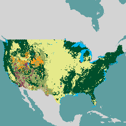
מערכת המעקב אחר שינויים בנוף של USFS גרסה 2024.10 (CONUS ו-OCONUS)
המוצר הזה הוא חלק מחבילת הנתונים של מערכת למעקב אחרי שינויים בנוף (LCMS). המפה מציגה שינויים לפי מודל LCMS, כיסוי קרקע ו/או סיווגים של שימוש בקרקע בכל שנה, והיא מכסה את שטחי ארצות הברית (CONUS) וגם אזורים מחוץ ל-CONUS (OCONUS), כולל אלסקה (AK), פוארטו ריקו … change-detection forest gtac landcover landuse landuse-landcover -
VNP64A1: רשת SIN גלובלית של 500 מ' ברזולוציית L4 לדיווח חודשי על שטחים שנשרפו
גרסת 1 של מוצר הנתונים היומי של Suomi National Polar-Orbiting Partnership (Suomi NPP) NASA Visible Infrared Imaging Radiometer Suite (VIIRS) Burned Area (VNP64A1) הוא מוצר חודשי גלובלי ברשת של 500 מ' שמכיל מידע על שטח שרוף ועל איכות לכל פיקסל. הגישה למיפוי אזורים שנשרפו ב-VNP64 מתבססת על נתוני VIIRS ברזולוציה של 750 מ' … burn change-detection fire land nasa noaa
Datasets tagged change-detection in Earth Engine
[null,null,[],[[["\u003cp\u003eThis webpage features curated datasets focused on land change detection using satellite imagery.\u003c/p\u003e\n"],["\u003cp\u003eDatasets provide insights into surface water changes, burned areas, and land cover/use transformations.\u003c/p\u003e\n"],["\u003cp\u003eData sources include Landsat, MODIS, VIIRS, and algorithms like CCDC for analyzing temporal patterns.\u003c/p\u003e\n"],["\u003cp\u003eGlobal and regional coverage is offered, with examples such as the USFS Landscape Change Monitoring System.\u003c/p\u003e\n"],["\u003cp\u003eThe collection spans multiple decades, enabling long-term change analysis and monitoring efforts.\u003c/p\u003e\n"]]],[],null,["# Datasets tagged change-detection in Earth Engine\n\n-\n\n |---------------------------------------------------------------------------------------------------------------------------------------------------------------------------------------------------------------------------------------------------------------------------------------------------------------------------------------------------|\n | [### Google Global Landsat-based CCDC Segments (1999-2019)](/earth-engine/datasets/catalog/GOOGLE_GLOBAL_CCDC_V1) |\n | This collection contains precomputed results from running the Continuous Change Detection and Classification (CCDC) algorithm on 20 years of Landsat surface reflectance data. CCDC is a break-point finding algorithm that uses harmonic fitting with a dynamic RMSE threshold to detect breakpoints in time-series data. The ... |\n | [change-detection](/earth-engine/datasets/tags/change-detection) [google](/earth-engine/datasets/tags/google) [landcover](/earth-engine/datasets/tags/landcover) [landsat-derived](/earth-engine/datasets/tags/landsat-derived) [landuse](/earth-engine/datasets/tags/landuse) [landuse-landcover](/earth-engine/datasets/tags/landuse-landcover) |\n\n-\n\n |---------------------------------------------------------------------------------------------------------------------------------------------------------------------------------------------------------------------------------------------------------------------------------------------------------------------------|\n | [### JRC Global Surface Water Mapping Layers, v1.4](/earth-engine/datasets/catalog/JRC_GSW1_4_GlobalSurfaceWater) |\n | This dataset contains maps of the location and temporal distribution of surface water from 1984 to 2021 and provides statistics on the extent and change of those water surfaces. For more information see the associated journal article: High-resolution mapping of global surface water and its ... |\n | [change-detection](/earth-engine/datasets/tags/change-detection) [geophysical](/earth-engine/datasets/tags/geophysical) [google](/earth-engine/datasets/tags/google) [jrc](/earth-engine/datasets/tags/jrc) [landsat-derived](/earth-engine/datasets/tags/landsat-derived) [surface](/earth-engine/datasets/tags/surface) |\n\n-\n\n |-----------------------------------------------------------------------------------------------------------------------------------------------------------------------------------------------------------------------------------------------------------------------------------------------------------------------------------------|\n | [### MCD64A1.061 MODIS Burned Area Monthly Global 500m](/earth-engine/datasets/catalog/MODIS_061_MCD64A1) |\n | The Terra and Aqua combined MCD64A1 Version 6.1 Burned Area data product is a monthly, global gridded 500m product containing per-pixel burned-area and quality information. The MCD64A1 burned-area mapping approach employs 500m MODIS Surface Reflectance imagery coupled with 1km MODIS active fire observations. The algorithm ... |\n | [burn](/earth-engine/datasets/tags/burn) [change-detection](/earth-engine/datasets/tags/change-detection) [fire](/earth-engine/datasets/tags/fire) [geophysical](/earth-engine/datasets/tags/geophysical) [global](/earth-engine/datasets/tags/global) [mcd64a1](/earth-engine/datasets/tags/mcd64a1) |\n\n-\n\n |-----------------------------------------------------------------------------------------------------------------------------------------------------------------------------------------------------------------------------------------------------------------------------------------------------------------------------|\n | [### USFS Landscape Change Monitoring System v2024.10 (CONUS and OCONUS)](/earth-engine/datasets/catalog/USFS_GTAC_LCMS_v2024-10) |\n | This product is part of the Landscape Change Monitoring System (LCMS) data suite. It shows LCMS-modeled change, land cover, and/or land use classes for each year and covers the Conterminous United States (CONUS) as well as areas outside the CONUS (OCONUS) including Alaska (AK), Puerto ... |\n | [change-detection](/earth-engine/datasets/tags/change-detection) [forest](/earth-engine/datasets/tags/forest) [gtac](/earth-engine/datasets/tags/gtac) [landcover](/earth-engine/datasets/tags/landcover) [landuse](/earth-engine/datasets/tags/landuse) [landuse-landcover](/earth-engine/datasets/tags/landuse-landcover) |\n\n-\n\n |---------------------------------------------------------------------------------------------------------------------------------------------------------------------------------------------------------------------------------------------------------------------------------------------------------------------------------------|\n | [### VNP64A1: Burned Area Monthly L4 Global 500m SIN Grid](/earth-engine/datasets/catalog/NOAA_VIIRS_001_VNP64A1) |\n | The daily Suomi National Polar-Orbiting Partnership (Suomi NPP) NASA Visible Infrared Imaging Radiometer Suite (VIIRS) Burned Area (VNP64A1) Version 1 data product is a monthly, global gridded 500m product containing per-pixel burned area and quality information. The VNP64 burned area mapping approach employs 750m VIIRS ... |\n | [burn](/earth-engine/datasets/tags/burn) [change-detection](/earth-engine/datasets/tags/change-detection) [fire](/earth-engine/datasets/tags/fire) [land](/earth-engine/datasets/tags/land) [nasa](/earth-engine/datasets/tags/nasa) [noaa](/earth-engine/datasets/tags/noaa) |"]]