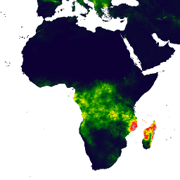
-
CHIRPS 日次: 気候危険センターの赤外線降水量(気象ステーション データを含む)(バージョン 2.0 最終版)
Climate Hazards Center InfraRed Precipitation with Station data(CHIRPS)は、30 年以上の準グローバルな降雨データセットです。CHIRPS は、0.05° 解像度の衛星画像と現地の観測所データを統合して、傾向分析と季節的な干ばつモニタリング用のグリッド状の降雨時系列を作成します。 chg 気候 地理物理学 降水量 ucsb 天気 -
CHIRPS Pentad: 気候危険センターの赤外線降水量(気象ステーションのデータを含む)(バージョン 2.0 最終版)
Climate Hazards Center InfraRed Precipitation with Station data(CHIRPS)は、30 年以上の準グローバルな降雨データセットです。CHIRPS は、0.05° 解像度の衛星画像と現地の観測所データを統合して、傾向分析と季節的な干ばつモニタリング用のグリッド状の降雨時系列を作成します。 chg 気候 地理物理学 降水量 ucsb 天気 -
CHIRTS-daily: 気候災害センターの赤外線温度と観測所の 1 日の気温データ プロダクト
Climate Hazards Center InfraRed Temperature with Stations の 1 日の気温データ プロダクト(CHIRTS-daily、Verdin et al. 2020)は、2 メートルの高解像度グリッド状データセット(0.05° × 0.05° 解像度、南緯 60°~北緯 70°)で、1 日の最低気温(Tmin)と最高気温(Tmax)のほか、4 つの派生変数(飽和水蒸気圧、気温の標準偏差、気温の標準偏差の標準偏差、気温の標準偏差の標準偏差の標準偏差)を提供します。 chg 気候 日次 era5 地理物理学 再分析
Datasets tagged chg in Earth Engine
[null,null,[],[[["\u003cp\u003eCHIRPS is a 30+ year quasi-global rainfall dataset incorporating satellite imagery and station data to create gridded rainfall time series.\u003c/p\u003e\n"],["\u003cp\u003eCHIRPS data is available in daily and pentad temporal resolutions for trend analysis and seasonal drought monitoring.\u003c/p\u003e\n"],["\u003cp\u003eCHIRTS-daily provides daily minimum and maximum 2-meter temperatures, along with four derived variables, at a 0.05° × 0.05° resolution.\u003c/p\u003e\n"]]],[],null,["# Datasets tagged chg in Earth Engine\n\n-\n\n |---------------------------------------------------------------------------------------------------------------------------------------------------------------------------------------------------------------------------------------------------------------------------------------------------|\n | [### CHIRPS Daily: Climate Hazards Center InfraRed Precipitation With Station Data (Version 2.0 Final)](/earth-engine/datasets/catalog/UCSB-CHG_CHIRPS_DAILY) |\n | Climate Hazards Center InfraRed Precipitation with Station data (CHIRPS) is a 30+ year quasi-global rainfall dataset. CHIRPS incorporates 0.05° resolution satellite imagery with in-situ station data to create gridded rainfall time series for trend analysis and seasonal drought monitoring. |\n | [chg](/earth-engine/datasets/tags/chg) [climate](/earth-engine/datasets/tags/climate) [geophysical](/earth-engine/datasets/tags/geophysical) [precipitation](/earth-engine/datasets/tags/precipitation) [ucsb](/earth-engine/datasets/tags/ucsb) [weather](/earth-engine/datasets/tags/weather) |\n\n-\n\n |---------------------------------------------------------------------------------------------------------------------------------------------------------------------------------------------------------------------------------------------------------------------------------------------------|\n | [### CHIRPS Pentad: Climate Hazards Center InfraRed Precipitation With Station Data (Version 2.0 Final)](/earth-engine/datasets/catalog/UCSB-CHG_CHIRPS_PENTAD) |\n | Climate Hazards Center InfraRed Precipitation with Station data (CHIRPS) is a 30+ year quasi-global rainfall dataset. CHIRPS incorporates 0.05° resolution satellite imagery with in-situ station data to create gridded rainfall time series for trend analysis and seasonal drought monitoring. |\n | [chg](/earth-engine/datasets/tags/chg) [climate](/earth-engine/datasets/tags/climate) [geophysical](/earth-engine/datasets/tags/geophysical) [precipitation](/earth-engine/datasets/tags/precipitation) [ucsb](/earth-engine/datasets/tags/ucsb) [weather](/earth-engine/datasets/tags/weather) |\n\n-\n\n |--------------------------------------------------------------------------------------------------------------------------------------------------------------------------------------------------------------------------------------------------------------------------------------------------------------------------------------------------------|\n | [### CHIRTS-daily: Climate Hazards Center InfraRed Temperature with Stations daily temperature data product](/earth-engine/datasets/catalog/UCSB-CHG_CHIRTS_DAILY) |\n | The Climate Hazards Center InfraRed Temperature with Stations daily temperature data product (CHIRTS-daily; Verdin et al. 2020) is a quasi global, high-resolution gridded dataset (0.05° × 0.05° resolution, 60°S - 70°N) that provides daily minimum (Tmin) and maximum 2-meter temperatures (Tmax) and four derived variables: saturation vapor ... |\n | [chg](/earth-engine/datasets/tags/chg) [climate](/earth-engine/datasets/tags/climate) [daily](/earth-engine/datasets/tags/daily) [era5](/earth-engine/datasets/tags/era5) [geophysical](/earth-engine/datasets/tags/geophysical) [reanalysis](/earth-engine/datasets/tags/reanalysis) |"]]