-
Bản đồ lớp phủ đất BNETD 2020 của Bờ Biển Ngà
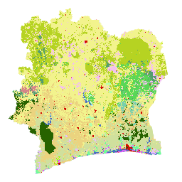
Bản đồ lớp phủ đất BNETD 2020 của Bờ Biển Ngà được Chính phủ Bờ Biển Ngà tạo ra thông qua một tổ chức quốc gia là Trung tâm thông tin địa lý và kỹ thuật số thuộc Văn phòng quốc gia về nghiên cứu và phát triển kỹ thuật (BNETD-CIGN), với sự hỗ trợ kỹ thuật và tài chính từ Liên minh Châu Âu. Phương pháp … classification deforestation forest landcover landuse-landcover -
Phân loại rừng toàn cầu năm 2020 cho các ước tính về sinh khối trên mặt đất cấp 1 của IPCC, Phiên bản 1

Tập dữ liệu này cung cấp các lớp rừng toàn cầu được phân định theo trạng thái/tình trạng vào năm 2020 ở độ phân giải khoảng 30 mét. Dữ liệu này hỗ trợ tạo các ước tính cấp 1 cho Mật độ sinh khối gỗ khô trên mặt đất (AGBD) trong các khu rừng tự nhiên trong Bản sửa đổi năm 2019 đối với Hướng dẫn năm 2006 của IPCC về Khí nhà kính quốc gia … aboveground biomass carbon classification forest forest-biomass -
Bản đồ rừng/không phải rừng 3 lớp toàn cầu PALSAR-2/PALSAR

Bạn có thể tìm thấy phiên bản mới hơn của tập dữ liệu này với 4 lớp cho giai đoạn 2017-2020 trong JAXA/ALOS/PALSAR/YEARLY/FNF4 Bản đồ rừng/không phải rừng (FNF) toàn cầu được tạo bằng cách phân loại hình ảnh SAR (hệ số tán xạ ngược) trong ảnh ghép SAR PALSAR-2/PALSAR toàn cầu có độ phân giải 25 mét để các pixel tán xạ ngược mạnh và yếu … alos alos2 classification eroc forest forest-biomass -
Bản đồ rừng/không phải rừng 4 lớp toàn cầu PALSAR-2/PALSAR

Bản đồ rừng/không phải rừng (FNF) toàn cầu được tạo bằng cách phân loại hình ảnh SAR (hệ số tán xạ ngược) trong ảnh ghép SAR PALSAR-2/PALSAR toàn cầu có độ phân giải 25 mét để các pixel tán xạ ngược mạnh và yếu được chỉ định là "rừng" và "không phải rừng". Ở đây, "rừng" được định nghĩa là rừng tự nhiên có … alos alos2 classification eroc forest forest-biomass
Datasets tagged classification in Earth Engine
[null,null,[],[],[]]