-
ALOS-2 PALSAR-2 StripMap 레벨 2.1
2024년 1월 1일 밤부터 일본 정부 부처 및 관련 기관의 요청에 따라 JAXA는 ALOS-2 PALSAR-2 긴급 관측을 시행했습니다. JAXA는 이러한 긴급 관측 데이터가 재해 관리에 매우 유용할 것으로 예상하므로 …에서 이 데이터를 공개하기로 결정했습니다. alos2 eroc jaxa palsar2 radar sar -
전역 3개 클래스 PALSAR-2/PALSAR 산림/비산림 지도
2017~2020년의 4개 클래스가 포함된 이 데이터 세트의 최신 버전은 JAXA/ALOS/PALSAR/YEARLY/FNF4에서 확인할 수 있습니다. 전역 산림/비산림 지도 (FNF)는 전역 25m 해상도 PALSAR-2/PALSAR SAR 모자이크에서 SAR 이미지 (후방 산란 계수)를 분류하여 강력한 후방 산란 픽셀과 낮은 후방 산란 픽셀을 … alos alos2 분류 eroc 산림 산림 바이오매스 -
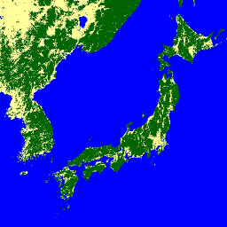
전역 4개 클래스 PALSAR-2/PALSAR 산림/비산림 지도
전역 산림/비산림 지도 (FNF)는 전역 25m 해상도 PALSAR-2/PALSAR SAR 모자이크에서 SAR 이미지 (후방 산란 계수)를 분류하여 강력한 후방 산란 픽셀과 낮은 후방 산란 픽셀을 각각 '산림' 및 '비산림'으로 할당하여 생성됩니다. 여기서 '산림'은 …이 있는 자연림으로 정의됩니다. alos alos2 분류 eroc 산림 산림 바이오매스 -
전역 PALSAR-2/PALSAR 연간 모자이크, 버전 1

2015~2021년의 데이터가 포함된 이 데이터 세트의 최신 버전은 JAXA/ALOS/PALSAR/YEARLY/SAR_EPOCH에서 확인할 수 있습니다. 전역 25m PALSAR/PALSAR-2 모자이크는 PALSAR/PALSAR-2의 SAR 이미지 스트립을 모자이크하여 만든 완벽한 전역 SAR 이미지입니다. 각 연도 및 위치에 대해 스트립 데이터가 선택되었습니다. alos alos2 eroc jaxa palsar palsar2 -
전역 PALSAR-2/PALSAR 연간 모자이크, 버전 2.5.0
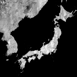
전역 25m PALSAR/PALSAR-2 모자이크는 PALSAR/PALSAR-2의 SAR 이미지 스트립을 모자이크하여 만든 완벽한 전역 SAR 이미지입니다. 각 연도 및 위치에 대해 해당 기간 동안 사용 가능한 찾아보기 모자이크를 시각적으로 검사하여 스트립 데이터를 선택했으며, 최소 …을 보여주는 데이터가 선택되었습니다. alos alos2 eroc jaxa palsar palsar2 -
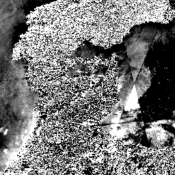
PALSAR-2 ScanSAR 레벨 2.2

25m PALSAR-2 ScanSAR는 관측 폭이 350km인 PALSAR-2 광역 관측 모드의 정규화된 후방 산란 데이터입니다. SAR 이미지는 ALOS World 3D - 30m (AW3D30) 디지털 지표면 모델을 사용하여 정사보정 및 경사 보정되었습니다. 편광 데이터는 …에 저장됩니다. alos2 eroc jaxa palsar2 radar sar
Datasets tagged palsar2 in Earth Engine
[null,null,[],[],[]]