-
ArcticDEM-Mosaik V4.1
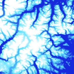
ArcticDEM ist eine öffentlich-private Initiative der National Geospatial-Intelligence Agency (NGA) und der National Science Foundation (NSF), um automatisch ein hochauflösendes, hochwertiges digitales Oberflächenmodell (DSM) der Arktis mithilfe von optischen Stereobildern, Hochleistungs-Computing und Open-Source-Photogrammetrie-Software zu erstellen. Dazu gehören Vegetation, Baumkronen, Gebäude und … arctic dem elevation-topography geophysical pgc umn -
ArcticDEM-Streifen

ArcticDEM ist eine öffentlich-private Initiative der National Geospatial-Intelligence Agency (NGA) und der National Science Foundation (NSF), um automatisch ein hochauflösendes, hochwertiges digitales Oberflächenmodell (DSM) der Arktis mithilfe von optischen Stereobildern, Hochleistungs-Computing und Open-Source-Photogrammetrie-Software zu erstellen. Dazu gehören Vegetation, Baumkronen, Gebäude und … arctic dem elevation-topography geophysical pgc umn -
REMA Mosaic

Das Reference Elevation Model of Antarctica (REMA) ist ein hochauflösendes, mit Zeitstempeln versehenes digitales Oberflächenmodell (Digital Surface Model, DSM) der Antarktis mit einer räumlichen Auflösung von 2 Metern und 8 Metern. Mosaik-DEM-Dateien werden aus mehreren Streifen zusammengestellt, die gemeinsam registriert, zusammengeführt und weichgezeichnet wurden, um Artefakte an den Kanten zu reduzieren. dem elevation-topography geophysical pgc rema umn -
REMA-Streifen 2 m

Das Reference Elevation Model of Antarctica (REMA) ist ein hochauflösendes, mit Zeitstempeln versehenes digitales Oberflächenmodell (Digital Surface Model, DSM) der Antarktis mit einer räumlichen Auflösung von 2 Metern und 8 Metern. Strip-DEM-Dateien entsprechen dem Überschneidungsbereich der Eingabe-Stereobildstreifen, die von … erfasst werden. dem elevation-topography geophysical pgc rema umn -
REMA-Streifen 8 m

Das Reference Elevation Model of Antarctica (REMA) ist ein hochauflösendes, mit Zeitstempeln versehenes digitales Oberflächenmodell (Digital Surface Model, DSM) der Antarktis mit einer räumlichen Auflösung von 2 Metern und 8 Metern. Strip-DEM-Dateien entsprechen dem Überschneidungsbereich der Eingabe-Stereobildstreifen, die von … erfasst werden. dem elevation-topography geophysical pgc rema umn
Datasets tagged pgc in Earth Engine
[null,null,[],[],[]]