-
Grönland-Mosaik von 2000 – Greenland Ice Mapping Project (GIMP)

Dieses Dataset enthält ein vollständiges Bildmosaik der Eisdecke Grönlands mit einer Auflösung von 15 m, das aus Landsat 7 ETM+- und RADARSAT-1 SAR-Bildern aus den Jahren 1999 bis 2002 abgeleitet wurde. Die Methoden umfassen eine Kombination aus Bild-Cloud-Maskierung, Pan-Sharpening, Bildsampling und ‑skalierung … arctic gimp greenland imagery nasa polar -
ArcticDEM-Mosaik, Version 4.1
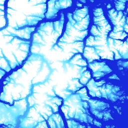
ArcticDEM ist eine öffentlich-private Initiative der National Geospatial-Intelligence Agency (NGA) und der National Science Foundation (NSF), um automatisch ein hochauflösendes, hochwertiges digitales Oberflächenmodell (DSM) der Arktis mithilfe von optischen Stereobildern, Hochleistungs-Computing und Open-Source-Photogrammetrie-Software zu erstellen. Es umfasst Vegetation, Baumkronen, Gebäude und … arctic dem elevation-topography geophysical pgc umn -
ArcticDEM-Streifen

ArcticDEM ist eine öffentlich-private Initiative der National Geospatial-Intelligence Agency (NGA) und der National Science Foundation (NSF), um automatisch ein hochauflösendes, hochwertiges digitales Oberflächenmodell (DSM) der Arktis mithilfe von optischen Stereobildern, Hochleistungs-Computing und Open-Source-Photogrammetrie-Software zu erstellen. Es umfasst Vegetation, Baumkronen, Gebäude und … arctic dem elevation-topography geophysical pgc umn -
Grönland-DEM – Greenland Mapping Project (GIMP)

Dieses digitale Höhenmodell (Digital Elevation Model, DEM) wurde aus einer Kombination von ASTER- und SPOT-5-DEMs für die Peripherie und den Rand der Eisdecke (d. h. unterhalb der Höhe der Gleichgewichtslinie) südlich von etwa 82,5° N und AVHRR-Photoklinometrie im Inneren der Eisdecke und im hohen Norden erstellt (Scambos und … arctic elevation-topography gimp greenland nasa polar -
Grönland-Eis- und Ozeanmaske – Greenland Mapping Project (GIMP)

Dieses Dataset enthält vollständige Klassifizierungsmasken für Landeis und Ozean mit einer Auflösung von 15 m für die Eisdecke Grönlands. Die Eisbedeckung wurde mithilfe einer Kombination aus orthorektifizierten panchromatischen Bildern (Band 8) des Landsat 7 Enhanced Thematic Mapper Plus (ETM+), die vom USGS vertrieben werden, und … arctic cryosphere gimp greenland ice nasa -
MEaSUREs Greenland Ice Velocity: Selected Glacier Site Velocity Maps from Optical Images, Version 2

Dieses Dataset ist Teil des NASA-Programms „Making Earth System Data Records for Use in Research Environments“ (MEaSUREs) und besteht aus durchschnittlichen monatlichen Geschwindigkeitskarten für ausgewählte Gletscherabflussgebiete. Die Karten werden erstellt, indem sichtbare Merkmale zwischen optischen Bildpaaren verfolgt werden, die vom Landsat … arctic cryosphere gimp greenland ice nasa
Datasets tagged arctic in Earth Engine
[null,null,[],[],["The content details datasets from the Greenland Ice Mapping Project (GIMP) and ArcticDEM initiatives. GIMP provides a 15m resolution ice/ocean classification mask and a 2000 image mosaic of Greenland derived from Landsat 7 and RADARSAT-1. It also includes a digital elevation model (DEM) and mean monthly glacier velocity maps. ArcticDEM, a joint NGA/NSF project, offers high-resolution digital surface models (DSMs) of the Arctic, encompassing features like vegetation and buildings.\n"]]