-
ALOS-2 PALSAR-2 StripMap Level 2.1

Ab der Nacht des 1. Januar 2024 hat die JAXA auf Anfrage japanischer Ministerien und verwandter Organisationen die Notfallbeobachtung mit ALOS-2 PALSAR-2 implementiert. Da die JAXA davon ausgeht, dass diese Notfallbeobachtungsdaten für das Katastrophenmanagement äußerst nützlich sein werden, hat sie beschlossen, diese Daten am … zu veröffentlichen. alos2 eroc jaxa palsar2 radar sar -
Copernicus Global In-situ Observations of Ocean Currents - Radar Radial

Das In-situ-TAC ist ein verteiltes Zentrum, das um sieben ozeanografische Regionen herum organisiert ist: den globalen Ozean und die sechs regionalen EUROGOOS-Allianzen. Es umfasst 14 Partner aus 11 Ländern in Europa. Es setzt kein Beobachtungssystem ein und stützt sich auf Daten, die ausschließlich von anderen … finanziert werden. copernicus currents insitu oceans radar -
Copernicus Global In-situ Observations of Ocean Currents - Radar Total

Das In-situ-TAC ist ein verteiltes Zentrum, das um sieben ozeanografische Regionen herum organisiert ist: den globalen Ozean und die sechs regionalen EUROGOOS-Allianzen. Es umfasst 14 Partner aus 11 Ländern in Europa. Es setzt kein Beobachtungssystem ein und stützt sich auf Daten, die ausschließlich von anderen … finanziert werden. copernicus currents insitu oceans radar -
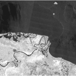
Global Seasonal Sentinel-1 Interferometric Coherence and Backscatter V2019 Backscatter

Dieses Dataset ist die erste räumliche Darstellung von mehrsaisonalen, globalen C-Band-SAR-Interferometrie-Kohärenz- und Rückstreusignaturen (Synthetic Aperture Radar). Die Abdeckung umfasst Landmassen und Eisschilde von 82 Grad nördlicher bis 79 Grad südlicher Breite. Das Dataset wird aus multitemporalen … abgeleitet. backscatter earth-big-data jpl nasa polarization radar -
Global Seasonal Sentinel-1 Interferometric Coherence and Backscatter V2019 Coherence

Dieses Dataset ist die erste räumliche Darstellung von mehrsaisonalen, globalen C-Band-SAR-Interferometrie-Kohärenz- und Rückstreusignaturen (Synthetic Aperture Radar). Die Abdeckung umfasst Landmassen und Eisschilde von 82 Grad nördlicher bis 79 Grad südlicher Breite. Das Dataset wird aus multitemporalen … abgeleitet. earth-big-data jpl nasa polarization radar sar -
Global Seasonal Sentinel-1 Interferometric Coherence and Backscatter V2019 Decay Model Parameters

Dieses Dataset ist die erste räumliche Darstellung von mehrsaisonalen, globalen C-Band-SAR-Interferometrie-Kohärenz- und Rückstreusignaturen (Synthetic Aperture Radar). Die Abdeckung umfasst Landmassen und Eisschilde von 82 Grad nördlicher bis 79 Grad südlicher Breite. Das Dataset wird aus multitemporalen … abgeleitet. earth-big-data jpl nasa polarization radar sar -
Global Seasonal Sentinel-1 Interferometric Coherence and Backscatter V2019 Incidence Layover Shadow

Dieses Dataset ist die erste räumliche Darstellung von mehrsaisonalen, globalen C-Band-SAR-Interferometrie-Kohärenz- und Rückstreusignaturen (Synthetic Aperture Radar). Die Abdeckung umfasst Landmassen und Eisschilde von 82 Grad nördlicher bis 79 Grad südlicher Breite. Das Dataset wird aus multitemporalen … abgeleitet. earth-big-data jpl nasa polarization radar sar -
OPERA Radiometric Terrain-Corrected SAR Backscatter from Sentinel-1 V1.0

Dieses Produkt besteht aus Radar-Rückstreuung, die in Bezug auf die Topografie normalisiert wurde. Es bildet Signale ab, die mit den physikalischen Eigenschaften von Bodenstreuungsobjekten zusammenhängen, z. B. Oberflächenrauheit und Bodenfeuchte und/oder Vegetation. Das OPERA RTC-S1-Produkt wird aus Copernicus Sentinel-1 Interferometric Wide (IW) … abgeleitet. backscatter jpl nasa opera polarization radar -
PALSAR-2 ScanSAR Level 2.2
Das 25-m-PALSAR-2-ScanSAR ist normalisiertes Rückstreudaten des PALSAR-2-Beobachtungsmodus für große Flächen mit einer Beobachtungsbreite von 350 km. Die SAR-Bilder wurden mithilfe des digitalen Oberflächenmodells ALOS World 3D – 30 m (AW3D30) orthorektifiziert und neigungskorrigiert. Polarisationsdaten werden … gespeichert. alos2 eroc jaxa palsar2 radar sar -
Sentinel-1 SAR GRD: C-Band-SAR-Bodenbereich erkannt, logarithmische Skalierung

Die Sentinel-1-Mission liefert Daten von einem C-Band-SAR-Instrument (Synthetic Aperture Radar) mit Dualpolarisation bei 5,405 GHz (C-Band). Diese Sammlung enthält die S1-GRD-Szenen (Ground Range Detected), die mit der Sentinel-1-Toolbox verarbeitet wurden, um ein kalibriertes, orthokorrigiertes Produkt zu erstellen. Die Sammlung wird täglich aktualisiert. Neu … backscatter copernicus esa eu polarization radar
Datasets tagged radar in Earth Engine
[null,null,[],[],[]]