-
SPL3SMP_E.005 SMAP L3 Radiometer Global Daily 9 km Soil Moisture
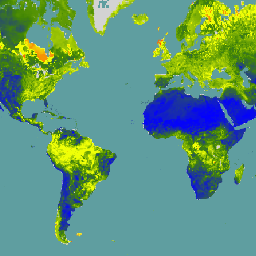
Daten ab dem 04.12.2023 sind in der Sammlung „NASA/SMAP/SPL3SMP_E/006“ verfügbar. Dieses Produkt zur Bodenfeuchte auf Stufe 3 (L3) bietet einen täglichen Composite der globalen Landoberflächenbedingungen, der vom SMAP-L-Band-Radiometer (Soil Moisture Active Passive) abgerufen wird. Die täglichen Daten hier wurden aus dem absteigenden (lokalen … drought nasa smap soil soil-moisture surface -
SPL3SMP_E.006 SMAP L3 Radiometer Global Daily 9 km Soil Moisture
Daten vor dem 04.12.2023 sind in der älteren Sammlung NASA/SMAP/SPL3SMP_E/005 verfügbar. Sie werden schließlich neu verarbeitet und dieser Sammlung hinzugefügt. Dieses Bodenfeuchteprodukt der Stufe 3 (L3) bietet einen täglichen Composite der globalen Landoberflächenbedingungen, die vom Soil Moisture Active Passive (SMAP) L-Band abgerufen werden. drought nasa smap soil soil-moisture surface -
SPL4SMGP.008 SMAP L4 Global 3-hourly 9-km Surface and Root Zone Soil Moisture
Das SMAP-Produkt (Soil Moisture Active Passive) der Stufe 4 (L4) umfasst die Bodenfeuchte an der Oberfläche (vertikaler Durchschnitt von 0–5 cm), die Bodenfeuchte in der Wurzelzone (vertikaler Durchschnitt von 0–100 cm) und zusätzliche Forschungsprodukte (nicht validiert), darunter meteorologische Variablen für die Oberfläche, Bodentemperatur, Evapotranspiration und Nettostrahlung. Dieses Dataset, das offiziell als … drought nasa smap soil soil-moisture surface
Datasets tagged smap in Earth Engine
[null,null,[],[[["\u003cp\u003eNASA's SMAP mission offers Level-3 (L3) daily composite soil moisture data, with SPL3SMP_E.005 covering data before December 4, 2023, and SPL3SMP_E.006 covering data from December 4, 2023, onwards.\u003c/p\u003e\n"],["\u003cp\u003eSMAP L3 data provides insights into global land surface conditions, specifically soil moisture, retrieved using the L-Band radiometer.\u003c/p\u003e\n"],["\u003cp\u003eThe SMAP Level-4 (L4) product (SPL4SMGP.007) offers 3-hourly, 9-km resolution data for surface and root zone soil moisture, along with supplementary research products like temperature, evapotranspiration, and net radiation.\u003c/p\u003e\n"]]],[],null,["# Datasets tagged smap in Earth Engine\n\n-\n\n |---------------------------------------------------------------------------------------------------------------------------------------------------------------------------------------------------------------------------------------------------------------------------------------------------------------------------------------|\n | [### SPL3SMP_E.005 SMAP L3 Radiometer Global Daily 9 km Soil Moisture](/earth-engine/datasets/catalog/NASA_SMAP_SPL3SMP_E_005) |\n | Data starting from 2023-12-04 are available in the NASA/SMAP/SPL3SMP_E/006 collection. This Level-3 (L3) soil moisture product provides a daily composite of global land surface conditions retrieved by the Soil Moisture Active Passive (SMAP) L-Band radiometer. The daily data here were collected from the descending (local ... |\n | [drought](/earth-engine/datasets/tags/drought) [nasa](/earth-engine/datasets/tags/nasa) [smap](/earth-engine/datasets/tags/smap) [soil](/earth-engine/datasets/tags/soil) [soil-moisture](/earth-engine/datasets/tags/soil-moisture) [surface](/earth-engine/datasets/tags/surface) |\n\n-\n\n |----------------------------------------------------------------------------------------------------------------------------------------------------------------------------------------------------------------------------------------------------------------------------------------------------------------------------------|\n | [### SPL3SMP_E.006 SMAP L3 Radiometer Global Daily 9 km Soil Moisture](/earth-engine/datasets/catalog/NASA_SMAP_SPL3SMP_E_006) |\n | Data prior from 2023-12-04 are available in the older NASA/SMAP/SPL3SMP_E/005 collection. They will eventually be reprocessed and added to this collection. This Level-3 (L3) soil moisture product provides a daily composite of global land surface conditions retrieved by the Soil Moisture Active Passive (SMAP) L-Band ... |\n | [drought](/earth-engine/datasets/tags/drought) [nasa](/earth-engine/datasets/tags/nasa) [smap](/earth-engine/datasets/tags/smap) [soil](/earth-engine/datasets/tags/soil) [soil-moisture](/earth-engine/datasets/tags/soil-moisture) [surface](/earth-engine/datasets/tags/surface) |\n\n-\n\n |-------------------------------------------------------------------------------------------------------------------------------------------------------------------------------------------------------------------------------------------------------------------------------------------------------------------------------------------------------------------|\n | [### SPL4SMGP.008 SMAP L4 Global 3-hourly 9-km Surface and Root Zone Soil Moisture](/earth-engine/datasets/catalog/NASA_SMAP_SPL4SMGP_008) |\n | The SMAP Level-4 (L4) Soil Moisture product includes surface soil moisture (0-5 cm vertical average), root-zone soil moisture (0-100 cm vertical average), and additional research products (not validated), including surface meteorological forcing variables, soil temperature, evapotranspiration, and net radiation. This dataset, formally known as the ... |\n | [drought](/earth-engine/datasets/tags/drought) [nasa](/earth-engine/datasets/tags/nasa) [smap](/earth-engine/datasets/tags/smap) [soil](/earth-engine/datasets/tags/soil) [soil-moisture](/earth-engine/datasets/tags/soil-moisture) [surface](/earth-engine/datasets/tags/surface) |"]]