Page Summary
-
The Global Inland Water dataset identifies inland surface water bodies and shows a significant concentration in North America and Asia.
-
The Global Forest Cover Change dataset provides estimates of tree cover percentage based on Landsat Vegetation Continuous Fields.
-
The Hansen Global Forest Change dataset characterizes global forest extent and change using time-series analysis of Landsat images.
-
Primary humid tropical forests are under threat but a map exists to aid in land use planning.
-
A dataset provides a national-level map of above-ground live woody biomass density for tropical countries using various data sources.
-
GLCF: Landsat Global Inland Water
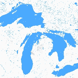
The Global Inland Water dataset shows inland surface water bodies, including fresh and saline lakes, rivers, and reservoirs. From the GLS 2000 epoch, 3,650,723 km2 of inland water were identified, around three quarters of which were in North America and Asia. Boreal forests and tundra … glcf landsat-derived nasa surface-ground-water umd water -
Global Forest Cover Change (GFCC) Tree Cover Multi-Year Global 30m
The Landsat Vegetation Continuous Fields (VCF) tree cover layers contain estimates of the percentage of horizontal ground in each 30-m pixel covered by woody vegetation greater than 5 meters in height. The dataset is available for four epochs centered on the years 2000, 2005, 2010 … forest forest-biomass glcf landsat-derived nasa umd -
Hansen Global Forest Change v1.13 (2000-2025)

Results from time-series analysis of Landsat images in characterizing global forest extent and change. The 'first' and 'last' bands are reference multispectral imagery from the first and last available years for Landsat spectral bands corresponding to red, NIR, SWIR1, and SWIR2. Reference composite imagery represents … forest forest-biomass geophysical landsat-derived umd -
Primary Humid Tropical Forests
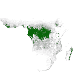
Primary humid tropical forests provide numerous global ecosystem services, but are under continuing threat of clearing from economic drivers. To facilitate national land use planning and balancing the goals of economic development and maintenance of ecosystem services, a primary humid tropical forest map was created … forest forest-biomass global landsat-derived umd -
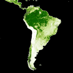
WHRC Pantropical National Level Carbon Stock Dataset

A national-level map of above-ground live woody biomass density for tropical countries at 500m. This dataset was assembled from a combination of co-located field measurements, LiDAR observations, and imagery recorded from the Moderate Resolution Imaging Spectroradiometer (MODIS). aboveground biomass carbon forest-biomass geophysical umd