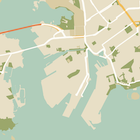
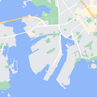
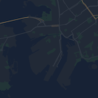
নতুন বেসম্যাপ স্টাইলিং শীঘ্রই গুগল ম্যাপ প্ল্যাটফর্মে আসছে। মানচিত্র স্টাইলিংয়ের এই আপডেটে একটি নতুন ডিফল্ট রঙ প্যালেট, আধুনিক পিন এবং মানচিত্রের অভিজ্ঞতা এবং ব্যবহারযোগ্যতার উন্নতি অন্তর্ভুক্ত রয়েছে। সমস্ত মানচিত্রের শৈলী মার্চ 2025-এ স্বয়ংক্রিয়ভাবে আপডেট হবে। প্রাপ্যতা এবং আগে কীভাবে নির্বাচন করবেন সে সম্পর্কে আরও তথ্যের জন্য,
Google Maps প্ল্যাটফর্মের জন্য নতুন মানচিত্রের শৈলী দেখুন।
স্টাইলিং সঙ্গে মানচিত্র বৈশিষ্ট্য লুকানো
মানচিত্রে বৈশিষ্ট্যগুলির শৈলী পরিবর্তন করার পাশাপাশি, আপনি সেগুলি সম্পূর্ণরূপে লুকিয়ে রাখতে পারেন৷ এই উদাহরণটি আপনাকে দেখায় কিভাবে আপনার মানচিত্রে ব্যবসায়িক আগ্রহের পয়েন্ট (POI) এবং পাবলিক ট্রানজিট আইকনগুলি লুকাতে হয়৷
স্টাইলিং শুধুমাত্র normal
মানচিত্রের প্রকারে কাজ করে। স্টাইলিং অভ্যন্তরীণ মানচিত্রগুলিকে প্রভাবিত করে না, তাই বৈশিষ্ট্যগুলি লুকানোর জন্য স্টাইলিং ব্যবহার করা অভ্যন্তরীণ মেঝে পরিকল্পনাগুলিকে মানচিত্রে উপস্থিত হতে বাধা দেয় না৷
আপনার মানচিত্রে একটি JSON শৈলী অবজেক্ট পাস করুন
আপনার মানচিত্রের স্টাইল করতে, GoogleMap.setMapStyle()
একটি MapStyleOptions
অবজেক্ট পাস করে কল করুন যাতে JSON ফর্ম্যাটে আপনার শৈলীর ঘোষণা রয়েছে। আপনি একটি কাঁচা সম্পদ বা একটি স্ট্রিং থেকে JSON লোড করতে পারেন, যেমনটি নিম্নলিখিত উদাহরণগুলিতে দেখানো হয়েছে:
কাঁচা সম্পদ
নিম্নলিখিত কোড নমুনা অনুমান করে যে আপনার প্রকল্পটিতে style_json
নামে একটি কাঁচা সংস্থান রয়েছে:
// Copyright 2020 Google LLC
//
// Licensed under the Apache License, Version 2.0 (the "License");
// you may not use this file except in compliance with the License.
// You may obtain a copy of the License at
//
// http://www.apache.org/licenses/LICENSE-2.0
//
// Unless required by applicable law or agreed to in writing, software
// distributed under the License is distributed on an "AS IS" BASIS,
// WITHOUT WARRANTIES OR CONDITIONS OF ANY KIND, either express or implied.
// See the License for the specific language governing permissions and
// limitations under the License.
package com.example.styledmap;
import android.content.res.Resources;
import android.os.Bundle;
import android.util.Log;
import androidx.appcompat.app.AppCompatActivity;
import com.google.android.gms.maps.CameraUpdateFactory;
import com.google.android.gms.maps.GoogleMap;
import com.google.android.gms.maps.OnMapReadyCallback;
import com.google.android.gms.maps.SupportMapFragment;
import com.google.android.gms.maps.model.LatLng;
import com.google.android.gms.maps.model.MapStyleOptions;
/**
* A styled map using JSON styles from a raw resource.
*/
public class MapsActivityRaw extends AppCompatActivity
implements OnMapReadyCallback {
private static final String TAG = MapsActivityRaw.class.getSimpleName();
@Override
protected void onCreate(Bundle savedInstanceState) {
super.onCreate(savedInstanceState);
// Retrieve the content view that renders the map.
setContentView(R.layout.activity_maps_raw);
// Get the SupportMapFragment and register for the callback
// when the map is ready for use.
SupportMapFragment mapFragment =
(SupportMapFragment) getSupportFragmentManager()
.findFragmentById(R.id.map);
mapFragment.getMapAsync(this);
}
/**
* Manipulates the map when it's available.
* The API invokes this callback when the map is ready for use.
*/
@Override
public void onMapReady(GoogleMap googleMap) {
try {
// Customise the styling of the base map using a JSON object defined
// in a raw resource file.
boolean success = googleMap.setMapStyle(
MapStyleOptions.loadRawResourceStyle(
this, R.raw.style_json));
if (!success) {
Log.e(TAG, "Style parsing failed.");
}
} catch (Resources.NotFoundException e) {
Log.e(TAG, "Can't find style. Error: ", e);
}
// Position the map's camera near Sydney, Australia.
googleMap.moveCamera(CameraUpdateFactory.newLatLng(new LatLng(-34, 151)));
}
}
/res/raw/style_json.json
এ একটি কাঁচা সংস্থান সংজ্ঞায়িত করুন, যার মধ্যে ব্যবসার আগ্রহের পয়েন্ট (POIs) লুকানোর জন্য নিম্নলিখিত JSON শৈলী ঘোষণা রয়েছে:
JSON দেখান/লুকান।
[
{
"featureType": "poi.business",
"elementType": "all",
"stylers": [
{
"visibility": "off"
}
]
}
]
নিম্নলিখিত শৈলী ঘোষণা ব্যবসায়িক আগ্রহের পয়েন্ট (POIs) এবং পাবলিক ট্রানজিট আইকনগুলিকে লুকিয়ে রাখে:
JSON দেখান/লুকান।
[
{
"featureType": "poi.business",
"elementType": "all",
"stylers": [
{
"visibility": "off"
}
]
},
{
"featureType": "transit",
"elementType": "labels.icon",
"stylers": [
{
"visibility": "off"
}
]
}
]
লেআউটটি ( activity_maps.xml
) এইরকম দেখাচ্ছে:
লেআউট ফাইল দেখান/লুকান।
<fragment xmlns:android="http://schemas.android.com/apk/res/android"
xmlns:map="http://schemas.android.com/apk/res-auto"
xmlns:tools="http://schemas.android.com/tools"
android:id="@+id/map"
android:name="com.google.android.gms.maps.SupportMapFragment"
android:layout_width="match_parent"
android:layout_height="match_parent"
tools:context="com.example.mapstyles.MapsActivityRaw"
map:cameraZoom="13" />
স্ট্রিং রিসোর্স
নিম্নলিখিত কোড নমুনা অনুমান করে যে আপনার প্রকল্পটিতে style_json
নামে একটি স্ট্রিং সংস্থান রয়েছে:
package com.example.styledmap;
import android.os.Bundle;
import android.support.v7.app.AppCompatActivity;
import android.util.Log;
import com.google.android.gms.maps.CameraUpdateFactory;
import com.google.android.gms.maps.GoogleMap;
import com.google.android.gms.maps.OnMapReadyCallback;
import com.google.android.gms.maps.SupportMapFragment;
import com.google.android.gms.maps.model.LatLng;
import com.google.android.gms.maps.model.MapStyleOptions;
/**
* A styled map using JSON styles from a string resource.
*/
public class MapsActivityString extends AppCompatActivity
implements OnMapReadyCallback {
private static final String TAG = MapsActivityString.class.getSimpleName();
@Override
protected void onCreate(Bundle savedInstanceState) {
super.onCreate(savedInstanceState);
// Retrieve the content view that renders the map.
setContentView(R.layout.activity_maps_string);
// Get the SupportMapFragment and register for the callback
// when the map is ready for use.
SupportMapFragment mapFragment =
(SupportMapFragment) getSupportFragmentManager()
.findFragmentById(R.id.map);
mapFragment.getMapAsync(this);
}
/**
* Manipulates the map when it's available.
* The API invokes this callback when the map is ready for use.
*/
@Override
public void onMapReady(GoogleMap googleMap) {
// Customise the styling of the base map using a JSON object defined
// in a string resource file. First create a MapStyleOptions object
// from the JSON styles string, then pass this to the setMapStyle
// method of the GoogleMap object.
boolean success = googleMap.setMapStyle(new MapStyleOptions(getResources()
.getString(R.string.style_json)));
if (!success) {
Log.e(TAG, "Style parsing failed.");
}
// Position the map's camera near Sydney, Australia.
googleMap.moveCamera(CameraUpdateFactory.newLatLng(new LatLng(-34, 151)));
}
}
/res/values/style_strings.xml
এ একটি স্ট্রিং রিসোর্স সংজ্ঞায়িত করুন, যাতে ব্যবসায়িক আগ্রহের পয়েন্ট (POIs) লুকানোর জন্য নিম্নলিখিত JSON শৈলী ঘোষণা রয়েছে। এই ফাইলে আপনাকে উদ্ধৃতি চিহ্নগুলি এড়াতে একটি ব্যাকস্ল্যাশ ব্যবহার করতে হবে:
JSON দেখান/লুকান।
<resources>
<string name="style_json">
[
{
\"featureType\": \"poi.business\",
\"elementType\": \"all\",
\"stylers\": [
{
\"visibility\": \"off\"
}
]
}
]
</string>
</resources>
নিম্নলিখিত শৈলী ঘোষণা ব্যবসায়িক আগ্রহের পয়েন্ট (POIs) এবং পাবলিক ট্রানজিট আইকনগুলিকে লুকিয়ে রাখে:
JSON দেখান/লুকান।
<resources>
<string name="style_json">
[
{
\"featureType\": \"poi.business\",
\"elementType\": \"all\",
\"stylers\": [
{
\"visibility\": \"off\"
}
]
},
{
\"featureType\": \"transit\",
\"elementType\": \"labels.icon\",
\"stylers\": [
{
\"visibility\": \"off\"
}
]
}
]
</string>
</resources>
লেআউটটি ( activity_maps.xml
) এইরকম দেখাচ্ছে:
লেআউট ফাইল দেখান/লুকান।
<fragment xmlns:android="http://schemas.android.com/apk/res/android"
xmlns:map="http://schemas.android.com/apk/res-auto"
xmlns:tools="http://schemas.android.com/tools"
android:id="@+id/map"
android:name="com.google.android.gms.maps.SupportMapFragment"
android:layout_width="match_parent"
android:layout_height="match_parent"
tools:context="com.example.mapstyles.MapsActivityString"
map:cameraZoom="13" />
JSON শৈলী ঘোষণা
স্টাইল করা মানচিত্র একটি মানচিত্রে রং এবং অন্যান্য শৈলী পরিবর্তন প্রয়োগ করতে দুটি ধারণা ব্যবহার করে:
- নির্বাচকরা ভৌগলিক উপাদানগুলি নির্দিষ্ট করে যা আপনি মানচিত্রে স্টাইল করতে পারেন৷ এর মধ্যে রয়েছে রাস্তা, পার্ক, জলাশয় এবং আরও অনেক কিছু, সেইসাথে তাদের লেবেল। নির্বাচকদের মধ্যে বৈশিষ্ট্য এবং উপাদানগুলি অন্তর্ভুক্ত রয়েছে, যা
featureType
এবং elementType
বৈশিষ্ট্য হিসাবে নির্দিষ্ট করা হয়েছে। - স্টাইলারগুলি হল রঙ এবং দৃশ্যমানতার বৈশিষ্ট্য যা আপনি মানচিত্রের উপাদানগুলিতে প্রয়োগ করতে পারেন। তারা রঙ, রঙ এবং হালকা/গামা মানগুলির সংমিশ্রণের মাধ্যমে প্রদর্শিত রঙকে সংজ্ঞায়িত করে।
JSON স্টাইলিং বিকল্পগুলির বিশদ বিবরণের জন্য স্টাইল রেফারেন্স দেখুন।
একটি JSON স্টাইলিং অবজেক্ট তৈরি করার দ্রুত উপায় হিসাবে মানচিত্র প্ল্যাটফর্ম স্টাইলিং উইজার্ড ব্যবহার করুন৷ অ্যান্ড্রয়েডের জন্য মানচিত্র SDK মানচিত্র জাভাস্ক্রিপ্ট API হিসাবে একই শৈলী ঘোষণা সমর্থন করে৷
সম্পূর্ণ কোড নমুনা
GitHub-এ ApiDemos সংগ্রহস্থলে এমন নমুনা রয়েছে যা স্টাইলিং ব্যবহার প্রদর্শন করে।
, মানচিত্রে বৈশিষ্ট্যগুলির শৈলী পরিবর্তন করার পাশাপাশি, আপনি সেগুলি সম্পূর্ণরূপে লুকিয়ে রাখতে পারেন৷ এই উদাহরণটি আপনাকে দেখায় কিভাবে আপনার মানচিত্রে ব্যবসায়িক আগ্রহের পয়েন্ট (POI) এবং পাবলিক ট্রানজিট আইকনগুলি লুকাতে হয়৷
স্টাইলিং শুধুমাত্র normal
মানচিত্রের প্রকারে কাজ করে। স্টাইলিং অভ্যন্তরীণ মানচিত্রগুলিকে প্রভাবিত করে না, তাই বৈশিষ্ট্যগুলি লুকানোর জন্য স্টাইলিং ব্যবহার করা অভ্যন্তরীণ মেঝে পরিকল্পনাগুলিকে মানচিত্রে উপস্থিত হতে বাধা দেয় না৷
আপনার মানচিত্রে একটি JSON শৈলী অবজেক্ট পাস করুন
আপনার মানচিত্রের স্টাইল করতে, GoogleMap.setMapStyle()
একটি MapStyleOptions
অবজেক্ট পাস করে কল করুন যাতে JSON ফর্ম্যাটে আপনার শৈলীর ঘোষণা রয়েছে। আপনি একটি কাঁচা সম্পদ বা একটি স্ট্রিং থেকে JSON লোড করতে পারেন, যেমনটি নিম্নলিখিত উদাহরণগুলিতে দেখানো হয়েছে:
কাঁচা সম্পদ
নিম্নলিখিত কোড নমুনা অনুমান করে যে আপনার প্রকল্পটিতে style_json
নামে একটি কাঁচা সংস্থান রয়েছে:
// Copyright 2020 Google LLC
//
// Licensed under the Apache License, Version 2.0 (the "License");
// you may not use this file except in compliance with the License.
// You may obtain a copy of the License at
//
// http://www.apache.org/licenses/LICENSE-2.0
//
// Unless required by applicable law or agreed to in writing, software
// distributed under the License is distributed on an "AS IS" BASIS,
// WITHOUT WARRANTIES OR CONDITIONS OF ANY KIND, either express or implied.
// See the License for the specific language governing permissions and
// limitations under the License.
package com.example.styledmap;
import android.content.res.Resources;
import android.os.Bundle;
import android.util.Log;
import androidx.appcompat.app.AppCompatActivity;
import com.google.android.gms.maps.CameraUpdateFactory;
import com.google.android.gms.maps.GoogleMap;
import com.google.android.gms.maps.OnMapReadyCallback;
import com.google.android.gms.maps.SupportMapFragment;
import com.google.android.gms.maps.model.LatLng;
import com.google.android.gms.maps.model.MapStyleOptions;
/**
* A styled map using JSON styles from a raw resource.
*/
public class MapsActivityRaw extends AppCompatActivity
implements OnMapReadyCallback {
private static final String TAG = MapsActivityRaw.class.getSimpleName();
@Override
protected void onCreate(Bundle savedInstanceState) {
super.onCreate(savedInstanceState);
// Retrieve the content view that renders the map.
setContentView(R.layout.activity_maps_raw);
// Get the SupportMapFragment and register for the callback
// when the map is ready for use.
SupportMapFragment mapFragment =
(SupportMapFragment) getSupportFragmentManager()
.findFragmentById(R.id.map);
mapFragment.getMapAsync(this);
}
/**
* Manipulates the map when it's available.
* The API invokes this callback when the map is ready for use.
*/
@Override
public void onMapReady(GoogleMap googleMap) {
try {
// Customise the styling of the base map using a JSON object defined
// in a raw resource file.
boolean success = googleMap.setMapStyle(
MapStyleOptions.loadRawResourceStyle(
this, R.raw.style_json));
if (!success) {
Log.e(TAG, "Style parsing failed.");
}
} catch (Resources.NotFoundException e) {
Log.e(TAG, "Can't find style. Error: ", e);
}
// Position the map's camera near Sydney, Australia.
googleMap.moveCamera(CameraUpdateFactory.newLatLng(new LatLng(-34, 151)));
}
}
/res/raw/style_json.json
এ একটি কাঁচা সংস্থান সংজ্ঞায়িত করুন, যার মধ্যে ব্যবসার আগ্রহের পয়েন্ট (POIs) লুকানোর জন্য নিম্নলিখিত JSON শৈলী ঘোষণা রয়েছে:
JSON দেখান/লুকান।
[
{
"featureType": "poi.business",
"elementType": "all",
"stylers": [
{
"visibility": "off"
}
]
}
]
নিম্নলিখিত শৈলী ঘোষণা ব্যবসায়িক আগ্রহের পয়েন্ট (POIs) এবং পাবলিক ট্রানজিট আইকনগুলিকে লুকিয়ে রাখে:
JSON দেখান/লুকান।
[
{
"featureType": "poi.business",
"elementType": "all",
"stylers": [
{
"visibility": "off"
}
]
},
{
"featureType": "transit",
"elementType": "labels.icon",
"stylers": [
{
"visibility": "off"
}
]
}
]
লেআউটটি ( activity_maps.xml
) এইরকম দেখাচ্ছে:
লেআউট ফাইল দেখান/লুকান।
<fragment xmlns:android="http://schemas.android.com/apk/res/android"
xmlns:map="http://schemas.android.com/apk/res-auto"
xmlns:tools="http://schemas.android.com/tools"
android:id="@+id/map"
android:name="com.google.android.gms.maps.SupportMapFragment"
android:layout_width="match_parent"
android:layout_height="match_parent"
tools:context="com.example.mapstyles.MapsActivityRaw"
map:cameraZoom="13" />
স্ট্রিং রিসোর্স
নিম্নলিখিত কোড নমুনা অনুমান করে যে আপনার প্রকল্পটিতে style_json
নামে একটি স্ট্রিং সংস্থান রয়েছে:
package com.example.styledmap;
import android.os.Bundle;
import android.support.v7.app.AppCompatActivity;
import android.util.Log;
import com.google.android.gms.maps.CameraUpdateFactory;
import com.google.android.gms.maps.GoogleMap;
import com.google.android.gms.maps.OnMapReadyCallback;
import com.google.android.gms.maps.SupportMapFragment;
import com.google.android.gms.maps.model.LatLng;
import com.google.android.gms.maps.model.MapStyleOptions;
/**
* A styled map using JSON styles from a string resource.
*/
public class MapsActivityString extends AppCompatActivity
implements OnMapReadyCallback {
private static final String TAG = MapsActivityString.class.getSimpleName();
@Override
protected void onCreate(Bundle savedInstanceState) {
super.onCreate(savedInstanceState);
// Retrieve the content view that renders the map.
setContentView(R.layout.activity_maps_string);
// Get the SupportMapFragment and register for the callback
// when the map is ready for use.
SupportMapFragment mapFragment =
(SupportMapFragment) getSupportFragmentManager()
.findFragmentById(R.id.map);
mapFragment.getMapAsync(this);
}
/**
* Manipulates the map when it's available.
* The API invokes this callback when the map is ready for use.
*/
@Override
public void onMapReady(GoogleMap googleMap) {
// Customise the styling of the base map using a JSON object defined
// in a string resource file. First create a MapStyleOptions object
// from the JSON styles string, then pass this to the setMapStyle
// method of the GoogleMap object.
boolean success = googleMap.setMapStyle(new MapStyleOptions(getResources()
.getString(R.string.style_json)));
if (!success) {
Log.e(TAG, "Style parsing failed.");
}
// Position the map's camera near Sydney, Australia.
googleMap.moveCamera(CameraUpdateFactory.newLatLng(new LatLng(-34, 151)));
}
}
/res/values/style_strings.xml
এ একটি স্ট্রিং রিসোর্স সংজ্ঞায়িত করুন, যাতে ব্যবসায়িক আগ্রহের পয়েন্ট (POIs) লুকানোর জন্য নিম্নলিখিত JSON শৈলী ঘোষণা রয়েছে। এই ফাইলে আপনাকে উদ্ধৃতি চিহ্নগুলি এড়াতে একটি ব্যাকস্ল্যাশ ব্যবহার করতে হবে:
JSON দেখান/লুকান।
<resources>
<string name="style_json">
[
{
\"featureType\": \"poi.business\",
\"elementType\": \"all\",
\"stylers\": [
{
\"visibility\": \"off\"
}
]
}
]
</string>
</resources>
নিম্নলিখিত শৈলী ঘোষণা ব্যবসায়িক আগ্রহের পয়েন্ট (POIs) এবং পাবলিক ট্রানজিট আইকনগুলিকে লুকিয়ে রাখে:
JSON দেখান/লুকান।
<resources>
<string name="style_json">
[
{
\"featureType\": \"poi.business\",
\"elementType\": \"all\",
\"stylers\": [
{
\"visibility\": \"off\"
}
]
},
{
\"featureType\": \"transit\",
\"elementType\": \"labels.icon\",
\"stylers\": [
{
\"visibility\": \"off\"
}
]
}
]
</string>
</resources>
লেআউটটি ( activity_maps.xml
) এইরকম দেখাচ্ছে:
লেআউট ফাইল দেখান/লুকান।
<fragment xmlns:android="http://schemas.android.com/apk/res/android"
xmlns:map="http://schemas.android.com/apk/res-auto"
xmlns:tools="http://schemas.android.com/tools"
android:id="@+id/map"
android:name="com.google.android.gms.maps.SupportMapFragment"
android:layout_width="match_parent"
android:layout_height="match_parent"
tools:context="com.example.mapstyles.MapsActivityString"
map:cameraZoom="13" />
JSON শৈলী ঘোষণা
স্টাইল করা মানচিত্র একটি মানচিত্রে রং এবং অন্যান্য শৈলী পরিবর্তন প্রয়োগ করতে দুটি ধারণা ব্যবহার করে:
- নির্বাচকরা ভৌগলিক উপাদানগুলি নির্দিষ্ট করে যা আপনি মানচিত্রে স্টাইল করতে পারেন৷ এর মধ্যে রয়েছে রাস্তা, পার্ক, জলাশয় এবং আরও অনেক কিছু, সেইসাথে তাদের লেবেল। নির্বাচকদের মধ্যে বৈশিষ্ট্য এবং উপাদানগুলি অন্তর্ভুক্ত রয়েছে, যা
featureType
এবং elementType
বৈশিষ্ট্য হিসাবে নির্দিষ্ট করা হয়েছে। - স্টাইলারগুলি হল রঙ এবং দৃশ্যমানতার বৈশিষ্ট্য যা আপনি মানচিত্রের উপাদানগুলিতে প্রয়োগ করতে পারেন। তারা রঙ, রঙ এবং হালকা/গামা মানগুলির সংমিশ্রণের মাধ্যমে প্রদর্শিত রঙকে সংজ্ঞায়িত করে।
JSON স্টাইলিং বিকল্পগুলির বিশদ বিবরণের জন্য স্টাইল রেফারেন্স দেখুন।
একটি JSON স্টাইলিং অবজেক্ট তৈরি করার দ্রুত উপায় হিসাবে মানচিত্র প্ল্যাটফর্ম স্টাইলিং উইজার্ড ব্যবহার করুন৷ অ্যান্ড্রয়েডের জন্য মানচিত্র SDK মানচিত্র জাভাস্ক্রিপ্ট API হিসাবে একই শৈলী ঘোষণা সমর্থন করে৷
সম্পূর্ণ কোড নমুনা
GitHub-এ ApiDemos সংগ্রহস্থলে এমন নমুনা রয়েছে যা স্টাইলিং ব্যবহার প্রদর্শন করে।
অন্য কিছু উল্লেখ না করা থাকলে, এই পৃষ্ঠার কন্টেন্ট Creative Commons Attribution 4.0 License-এর অধীনে এবং কোডের নমুনাগুলি Apache 2.0 License-এর অধীনে লাইসেন্স প্রাপ্ত। আরও জানতে, Google Developers সাইট নীতি দেখুন। Java হল Oracle এবং/অথবা তার অ্যাফিলিয়েট সংস্থার রেজিস্টার্ড ট্রেডমার্ক।
2024-09-28 UTC-তে শেষবার আপডেট করা হয়েছে।