-
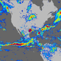
GPM: 全球降水観測(GPM)リリース 07

全球降水観測(GPM)は、世界中の雨と雪の次世代観測を 3 時間ごとに提供する国際衛星ミッションです。GPM の統合型マルチ衛星降水推定(IMERG)は、GPM のすべてのパッシブ マイクロ波機器のデータを組み合わせて降水量を推定する統合アルゴリズムです。 気候 地球物理学 GPM IMERG JAXA NASA -
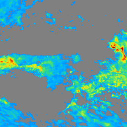
GPM: 月単位の全球降水観測(GPM)v6
IMERG-Final バージョン「06」の生成は 2021 年 9 月に終了しました。バージョン「07」は 2022 年 9 月にリリースされる予定です。全球降水観測(GPM)は、世界中の雨と雪の次世代観測を 3 時間ごとに提供する国際衛星ミッションです。GPM の統合型マルチ衛星降水推定(IMERG)は、GPM のすべてのパッシブ マイクロ波機器のデータを組み合わせて降水量を推定する統合アルゴリズムです。 気候 地球物理学 GPM IMERG JAXA 月単位 -
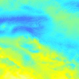
GPM: 月単位の全球降水観測(GPM)v リリース 07
全球降水観測(GPM)は、世界中の雨と雪の次世代観測を 3 時間ごとに提供する国際衛星ミッションです。GPM の統合型マルチ衛星降水推定(IMERG)は、GPM のすべてのパッシブ マイクロ波機器のデータを組み合わせて降水量を推定する統合アルゴリズムです。 気候 地球物理学 GPM IMERG JAXA 月単位 -
OpenLandMap 月単位の降水量
SM2RAIN-ASCAT 2007 ~ 2018、IMERG、CHELSA Climate、WorldClim に基づく、1 km 解像度の月単位の降水量(mm)。gdalwarp(三次スプライン)と WorldClim、CHELSA Climate、IMERG の月単位のプロダクトの平均値(「3B-MO-L.GIS.IMERG.20180601.V05B.tif」など)を使用して、1 km 解像度にダウンスケールしました。3 倍の重みが与えられます。 envirometrix IMERG 月単位 opengeohub OpenLandMap 降水量
Datasets tagged imerg in Earth Engine
[null,null,[],[],["The Global Precipitation Measurement (GPM) mission uses satellites to observe global rain and snow every three hours. The Integrated Multi-satellitE Retrievals for GPM (IMERG) algorithm estimates rainfall by combining data from various passive-microwave instruments. Version 06 of IMERG-Final production stopped in September 2021. OpenLandMap offers monthly precipitation data at 1 km resolution using SM2RAIN-ASCAT, IMERG, CHELSA Climate, and WorldClim.\n"]]