-
GHSL: 도시화 정도 1975~2030 V2-0 (P2023A)
이 래스터 데이터 세트는 GHSL 프로젝트에서 1975~2030년의 5년 간격으로 생성한 전 세계 그리드 인구 및 빌드업 표면 데이터를 기반으로 유엔 통계 위원회에서 권장하는 '도시화 정도' 1단계 방법론을 적용하여 전 세계의 시시각각 변하는 농촌-도시 분류를 나타냅니다. 학위 … ghsl jrc 인구 sdg 정착촌 -
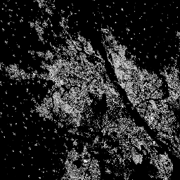
GHSL: 전 세계 인공 표면 10m (P2023A)
이 래스터 데이터 세트는 S2 이미지 데이터에서 관찰된 2018년의 10m 그리드 셀당 평방미터로 표시된 인공 표면의 분포를 보여줍니다. 데이터 세트는 a) 총 건물 면적, b) 격자 셀에 할당된 건물 면적을 측정합니다. built built-environment builtup copernicus ghsl jrc -
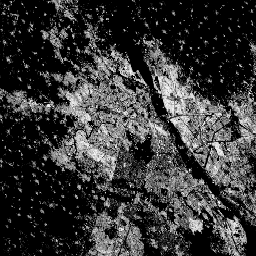
GHSL: 전 세계 1975~2030년 인공 표면 (P2023A)
이 래스터 데이터 세트는 100m 그리드 셀당 평방미터로 표시된 인공 표면의 분포를 보여줍니다. 이 데이터 세트는 a) 총 건축물 면적과 b) 주로 비주거용 (NRES) 용도의 그리드 셀에 할당된 건축물 면적을 측정합니다. 데이터가 공간적으로 보간되거나 … built built-environment builtup copernicus ghsl jrc -
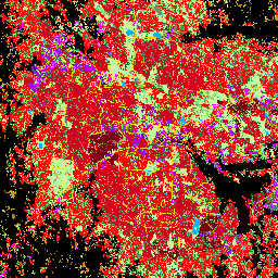
GHSL: 전 세계 결제 특성 (10m) 2018 (P2023A)
이 공간 래스터 데이터 세트는 10m 해상도로 인구 거주 지역을 표시하고, 인공 환경의 기능 및 높이 관련 구성요소 측면에서 내부 특성을 설명합니다. GHSL 데이터 제품에 대한 자세한 내용은 GHSL 데이터 패키지 2023 보고서에서 확인할 수 있습니다. 건물 건축됨 건물 코페르니쿠스 ghsl 높이 -
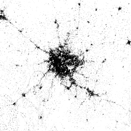
2015년 전 세계 정착촌 면적
2015년 세계 인구 거주 지역 (WSF)은 2014~2015년 다중 시점 Landsat-8 및 Sentinel-1 이미지 (이 중 각각 약 217,000개와 107,000개의 장면이 처리됨)를 통해 전 세계 인구 거주 지역의 범위를 윤곽선으로 나타낸 10m 해상도의 바이너리 마스크입니다. 인간 정착촌의 시간적 역학 … landcover landsat-derived population sentinel1-derived settlement urban
Datasets tagged settlement in Earth Engine
[null,null,[],[[["\u003cp\u003eThe World Settlement Footprint 2015 dataset provides a global, 10m resolution binary mask showing the extent of human settlements using 2014-2015 Landsat-8 and Sentinel-1 imagery.\u003c/p\u003e\n"],["\u003cp\u003eThe GHSL datasets offer various perspectives on global built-up areas, including settlement characteristics, built-up surface extent over time, and degree of urbanization.\u003c/p\u003e\n"],["\u003cp\u003eGHSL data is available at different resolutions (10m and 100m) and provides insights into built-up surface area and functional characteristics like building height and residential/non-residential use.\u003c/p\u003e\n"],["\u003cp\u003eThe Degree of Urbanization dataset from GHSL classifies areas globally as rural or urban using a multitemporal approach and gridded population and built-up surface data.\u003c/p\u003e\n"],["\u003cp\u003eThese datasets are derived from various satellite imagery sources including Landsat-8, Sentinel-1, and Sentinel-2 and cover different time periods from 1975 to 2030.\u003c/p\u003e\n"]]],[],null,["# Datasets tagged settlement in Earth Engine\n\n-\n\n |------------------------------------------------------------------------------------------------------------------------------------------------------------------------------------------------------------------------------------------------------------------------------------------------------------------------------------------------|\n | [### GHSL: Degree of Urbanization 1975-2030 V2-0 (P2023A)](/earth-engine/datasets/catalog/JRC_GHSL_P2023A_GHS_SMOD_V2-0) |\n | This raster dataset represents a global, multitemporal rural-urban classification, applying the \"Degree of Urbanisation\" stage I methodology recommended by UN Statistical Commission, based on global gridded population and built-up surface data generated by the GHSL project for the epochs 1975-2030 in 5-year intervals. The Degree ... |\n | [ghsl](/earth-engine/datasets/tags/ghsl) [jrc](/earth-engine/datasets/tags/jrc) [population](/earth-engine/datasets/tags/population) [sdg](/earth-engine/datasets/tags/sdg) [settlement](/earth-engine/datasets/tags/settlement) |\n\n-\n\n |---------------------------------------------------------------------------------------------------------------------------------------------------------------------------------------------------------------------------------------------------------------------------------------------------|\n | [### GHSL: Global built-up surface 10m (P2023A)](/earth-engine/datasets/catalog/JRC_GHSL_P2023A_GHS_BUILT_S_10m) |\n | This raster dataset depicts the distribution of built-up surfaces, expressed in square metres per 10 m grid cell, for 2018 as observed from the S2 image data. The datasets measure: a) the total built-up surface, and b) the built-up surface allocated to grid cells of ... |\n | [built](/earth-engine/datasets/tags/built) [built-environment](/earth-engine/datasets/tags/built-environment) [builtup](/earth-engine/datasets/tags/builtup) [copernicus](/earth-engine/datasets/tags/copernicus) [ghsl](/earth-engine/datasets/tags/ghsl) [jrc](/earth-engine/datasets/tags/jrc) |\n\n-\n\n |--------------------------------------------------------------------------------------------------------------------------------------------------------------------------------------------------------------------------------------------------------------------------------------------------------------------------|\n | [### GHSL: Global built-up surface 1975-2030 (P2023A)](/earth-engine/datasets/catalog/JRC_GHSL_P2023A_GHS_BUILT_S) |\n | This raster dataset depicts the distribution of built-up surfaces, expressed in square metres per 100 m grid cell. The dataset measures: a) the total built-up surface, and b) the built-up surface allocated to grid cells of predominant non-residential (NRES) use. Data are spatially-temporally interpolated or ... |\n | [built](/earth-engine/datasets/tags/built) [built-environment](/earth-engine/datasets/tags/built-environment) [builtup](/earth-engine/datasets/tags/builtup) [copernicus](/earth-engine/datasets/tags/copernicus) [ghsl](/earth-engine/datasets/tags/ghsl) [jrc](/earth-engine/datasets/tags/jrc) |\n\n-\n\n |---------------------------------------------------------------------------------------------------------------------------------------------------------------------------------------------------------------------------------------------------------------------------------------------------------------|\n | [### GHSL: Global settlement characteristics (10 m) 2018 (P2023A)](/earth-engine/datasets/catalog/JRC_GHSL_P2023A_GHS_BUILT_C) |\n | This spatial raster dataset delineates human settlements at 10 m resolution, and describes their inner characteristics in terms of the functional and height-related components of the built environment. More information about the GHSL data products can be found in the GHSL Data Package 2023 report ... |\n | [building](/earth-engine/datasets/tags/building) [built](/earth-engine/datasets/tags/built) [builtup](/earth-engine/datasets/tags/builtup) [copernicus](/earth-engine/datasets/tags/copernicus) [ghsl](/earth-engine/datasets/tags/ghsl) [height](/earth-engine/datasets/tags/height) |\n\n-\n\n |-------------------------------------------------------------------------------------------------------------------------------------------------------------------------------------------------------------------------------------------------------------------------------------------------------------------------------------------|\n | [### World Settlement Footprint 2015](/earth-engine/datasets/catalog/DLR_WSF_WSF2015_v1) |\n | The World Settlement Footprint (WSF) 2015 is a 10m resolution binary mask outlining the extent of human settlements globally derived by means of 2014-2015 multitemporal Landsat-8 and Sentinel-1 imagery (of which \\~217,000 and \\~107,000 scenes have been processed, respectively). The temporal dynamics of human settlements ... |\n | [landcover](/earth-engine/datasets/tags/landcover) [landsat-derived](/earth-engine/datasets/tags/landsat-derived) [population](/earth-engine/datasets/tags/population) [sentinel1-derived](/earth-engine/datasets/tags/sentinel1-derived) [settlement](/earth-engine/datasets/tags/settlement) [urban](/earth-engine/datasets/tags/urban) |"]]