-
CFSR:气候预测系统再分析

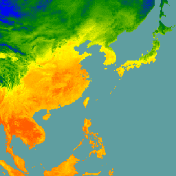
美国国家环境预测中心 (NCEP) 气候预测系统再分析 (CFSR) 旨在作为全球高分辨率耦合大气-海洋-陆地表面-海冰系统来设计和执行,以便提供对这些耦合域在 32 年记录期(从 1 月开始)内的状态的最佳估计。 气候 日光通量 预测 地球物理 ncep -
CFSV2:NCEP 气候预测系统第 2 版,6 小时产品已协调

美国国家环境预测中心 (NCEP) 气候预测系统 (CFS) 是一个完全耦合的模型,用于表示地球大气、海洋、陆地和海冰之间的相互作用。CFS 是在 NCEP 的环境建模中心 (EMC) 开发的。运营 CFS 已升级到 … 气候 日光通量 预测 地球物理 ncep -
Daymet V4:每日地面天气和气候摘要

Daymet V4 提供北美大陆、夏威夷和波多黎各的每日天气参数的网格估计值(波多黎各的数据从 1950 年开始提供)。它源自选定的气象站数据和各种支持数据源。与之前的版本相比,Daymet … 气候 每日 日光通量 通量 地球物理 nasa -
ECMWF 近实时 IFS 大气预测
此数据集包含 ECMWF 综合预报系统 (IFS) 生成的 15 天大气模型变量预测数据,分辨率为 0.25 度。我们将这些数据称为近实时 (NRT) 数据,因为在 ECMWF 实时预测数据发布后,每天会发布两次新产品,作为其… 气候 ecmwf 预测 全球 湿度 -
ERA5-Land 每日汇总 - ECMWF 气候再分析

ERA5-Land 是一个再分析数据集,与 ERA5 相比,它以更高的分辨率提供对陆地变量在过去几十年内的演变的统一视图。ERA5-Land 是通过重放 ECMWF ERA5 气候再分析的陆地组件生成的。再分析将模型数据与… cds 气候 copernicus ecmwf era5-land 蒸发 -
ERA5-Land 每小时 - ECMWF 气候再分析

ERA5-Land 是一个再分析数据集,与 ERA5 相比,它以更高的分辨率提供对陆地变量在过去几十年内的演变的统一视图。ERA5-Land 是通过重放 ECMWF ERA5 气候再分析的陆地组件生成的。再分析将模型数据与… cds 气候 copernicus ecmwf era5-land 蒸发 -
ERA5-Land 每月汇总 - ECMWF 气候再分析

ERA5-Land 是一个再分析数据集,与 ERA5 相比,它以更高的分辨率提供对陆地变量在过去几十年内的演变的统一视图。ERA5-Land 是通过重放 ECMWF ERA5 气候再分析的陆地组件生成的。再分析将模型数据与… cds 气候 copernicus ecmwf era5-land 蒸发 -
ERA5-Land 按一天中的小时数每月平均 - ECMWF 气候再分析

ERA5-Land 是一个再分析数据集,与 ERA5 相比,它以更高的分辨率提供对陆地变量在过去几十年内的演变的统一视图。ERA5-Land 是通过重放 ECMWF ERA5 气候再分析的陆地组件生成的。再分析将模型数据与… cds 气候 copernicus ecmwf era5-land 蒸发 -
FLDAS:饥荒预警系统网络 (FEWS NET) 陆地数据同化系统

FLDAS 数据集(McNally 等人,2017 年)旨在帮助在数据稀疏的发展中国家/地区进行粮食安全评估。它包含许多与气候相关的变量的信息,包括水分含量、湿度、蒸散量、平均土壤温度、总降水率等。有多个不同的 FLDAS 数据集;… 气候 冰冻圈 蒸散量 湿度 ldas 每月 -
GLIMS 2023:来自太空的全球陆地冰测量
来自太空的全球陆地冰测量 (GLIMS) 是一项国际计划,旨在重复调查全球估计的 20 万个冰川。该项目旨在创建全球全面的陆地冰清单,包括冰川面积、几何形状、表面速度和雪线测量… 冰冻圈 冰川 glims 冰 土地覆盖 nasa -
GLIMS 当前:来自太空的全球陆地冰测量

来自太空的全球陆地冰测量 (GLIMS) 是一项国际计划,旨在重复调查全球估计的 20 万个冰川。该项目旨在创建全球全面的陆地冰清单,包括冰川面积、几何形状、表面速度和雪线测量… 冰冻圈 冰川 glims 冰 土地覆盖 nasa -
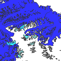
MOD10A1.061 Terra 雪盖每日全球 500 米

MOD10A1 V6.1 雪盖每日全球 500 米产品包含雪盖、雪反照率、雪盖分数和质量评估 (QA) 数据。雪盖数据基于雪盖映射算法,该算法采用归一化差异雪盖指数 (NDSI) 和其他标准测试。一般… 反照率 冰冻圈 每日 地球物理 全球 modis -
MOD10A2.061 Terra 雪盖 8 天 L3 全球 500 米

MOD10A2 是来自 Terra 卫星上的 MODIS 的雪盖数据集。该数据集报告了 8 天内最大雪盖范围,分辨率为 500 米。之所以选择 8 天的合成周期,是因为这是确切的地面轨迹重复… 冰冻圈 每日 地球物理 全球 modis nasa -
MYD10A1.061 Aqua 雪盖每日全球 500 米

MYD10A1 V6 雪盖每日全球 500 米产品包含雪盖、雪反照率、雪盖分数和质量评估 (QA) 数据。雪盖数据基于雪盖映射算法,该算法采用归一化差异雪盖指数 (NDSI) 和其他标准测试。一般… albedo aqua 冰冻圈 每日 地球物理 全球
Datasets tagged snow in Earth Engine
[null,null,[],[],["The content describes various climate and land datasets. ERA5-Land provides land variable evolution data, enhanced from ERA5, in daily, hourly, and monthly aggregations. GLIMS offers a global inventory of glacier measurements. MODIS datasets track daily and 8-day snow cover data. FLDAS includes climate variables for food security. Daymet provides daily weather estimates, and CFSR/CFSV2 offers climate forecasts, including data on coupled atmosphere-ocean-land interactions.\n"]]