-
GLCF: Landsat Global Inland Water (Globalne wody śródlądowe Landsat)
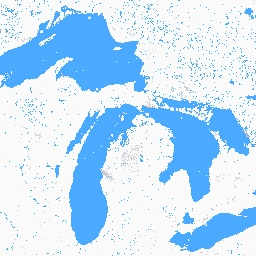
Zbiór danych Global Inland Water (Globalne wody śródlądowe) przedstawia śródlądowe zbiorniki wód powierzchniowych, w tym jeziora słodkie i słone, rzeki i zbiorniki. W epoce GLS 2000 zidentyfikowano 3 650 723 km2 wód śródlądowych, z czego około trzy czwarte znajdowało się w Ameryce Północnej i Azji. Tajga i tundra… glcf landsat-derived nasa surface-ground-water umd water -
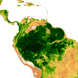
Global Forest Cover Change (GFCC) Tree Cover Multi-Year Global 30m (Globalne zmiany pokrycia lasami (GFCC) – pokrycie drzewami – wieloletnie dane globalne w rozdzielczości 30 m)
Warstwy zagęszczenia drzew w zbiorze danych Landsat Vegetation Continuous Fields (VCF) zawierają szacunki procentowego pokrycia terenu przez roślinność drzewiastą o wysokości ponad 5 metrów w każdym pikselu o wymiarach 30 m. Zbiór danych jest dostępny dla 4 epok, których środki przypadają na lata 2000, 2005, 2010… forest forest-biomass glcf landsat-derived nasa umd -
Hansen Global Forest Change v1.13 (2000–2025) (Globalne zmiany pokrycia lasami Hansena w wersji 1.13 (2000–2025))

Wyniki analizy szeregów czasowych zdjęć Landsat, które charakteryzują globalny zasięg lasów i jego zmiany. Pasmo „first” (pierwsze) i „last” (ostatnie) to referencyjne obrazy wielospektralne z pierwszego i ostatniego dostępnego roku dla pasm spektralnych Landsat odpowiadających pasmom czerwonym, NIR, SWIR1 i SWIR2. Referencyjne obrazy złożone reprezentują… forest forest-biomass geophysical landsat-derived umd -
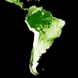
Primary Humid Tropical Forests (Pierwotne wilgotne lasy tropikalne)
Pierwotne wilgotne lasy tropikalne zapewniają wiele globalnych usług ekosystemowych, ale są stale zagrożone wycinką z powodów ekonomicznych. Aby ułatwić krajowe planowanie użytkowania gruntów i zrównoważyć cele rozwoju gospodarczego oraz utrzymania usług ekosystemowych, utworzono mapę pierwotnych wilgotnych lasów tropikalnych… forest forest-biomass global landsat-derived umd -
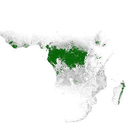
WHRC Pantropical National Level Carbon Stock Dataset (Zbiór danych WHRC dotyczący zasobów węgla na poziomie krajowym w strefie międzyzwrotnikowej)
Mapa gęstości biomasy drzewnej nadziemnej na poziomie krajowym dla krajów tropikalnych w rozdzielczości 500 m. Ten zbiór danych został utworzony na podstawie pomiarów terenowych, obserwacji LiDAR i zdjęć zarejestrowanych przez spektrometr MODIS. aboveground biomass carbon forest-biomass geophysical umd
Datasets tagged umd in Earth Engine
[null,null,[],[],[]]