-
MTBS 불에 탄 지역 경계
Monitoring Trends in Burn Severity (MTBS) 소실 지역 경계 데이터 세트에는 미국 본토, 알래스카, 하와이, 푸에르토리코에서 현재 완료된 모든 MTBS 화재의 소실 지역 범위 다각형이 포함되어 있습니다. NBR은 '정규화된 연소 비율'을 나타내고 dNBR은 … eros fire gtac mtbs table usda -
번 심각도 추세 모니터링 (MTBS) 번 심각도 이미지
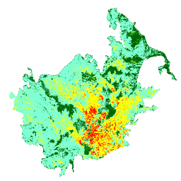
연소 심각도 모자이크는 미국 본토, 알래스카, 하와이, 푸에르토리코에서 현재 완료된 모든 MTBS 화재에 대한 MTBS 연소 심각도 등급의 주제별 래스터 이미지로 구성됩니다. 모자이크 처리된 화상 심각도 이미지는 미국 주별로 매년 컴파일되며 … eros fire forest gtac landcover landsat-derived -
USFS Landscape Change Monitoring System v2024.10 (미국 본토 및 미국 외 지역)
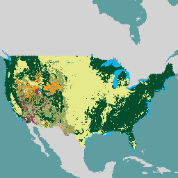
이 제품은 Landscape Change Monitoring System (LCMS) 데이터 모음의 일부입니다. 매년 LCMS 모델링된 변화, 토지 피복, 토지 이용 클래스를 보여주며 미국 본토 (CONUS)와 알래스카 (AK), 푸에르토리코 등 미국 본토 외 지역 (OCONUS)을 포함합니다. change-detection forest gtac landcover landuse landuse-landcover -
USFS 트리 캐노피 범위 v2023-5 (미국 본토 및 미국 외 지역)
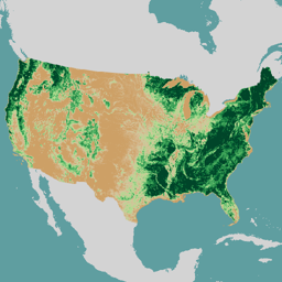
이 제품은 수관 밀도 (TCC) 데이터 제품군의 일부입니다. 여기에는 각 연도의 모델링된 TCC, 표준 오차 (SE), 국토 피복 데이터베이스 (NLCD)의 TCC 데이터가 포함됩니다. 미국 농무부 산림청 (USFS)에서 생성한 TCC 데이터는 … forest gtac landuse-landcover redcastle-resources usda usfs -
USFS TreeMap v2016 (미국 본토)
이 제품은 TreeMap 데이터 제품군의 일부입니다. 2016년 미국 본토의 전체 산림 범위에 걸쳐 살아 있는 나무와 죽은 나무의 수, 바이오매스, 탄소 등 산림 특성에 관한 자세한 공간 정보를 제공합니다. TreeMap v2016에는 이미지 하나가 포함되어 있습니다. biomass carbon climate-change conus forest forest-biomass -
USFS TreeMap v2020
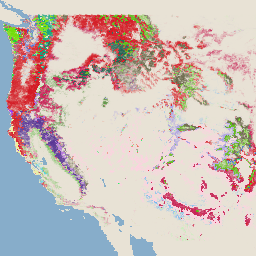
이 제품은 TreeMap 데이터 제품군의 일부입니다. 2020년 미국 전체 산림 지역의 생존 및 고사 나무 수, 바이오매스, 탄소 등 산림 특성에 관한 자세한 공간 정보를 제공합니다. TreeMap v2020에는 22개 밴드, 30x30m … aboveground biomass carbon climate-change conus forest -
USFS TreeMap v2022
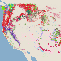
이 제품은 TreeMap 데이터 제품군의 일부입니다. 2022년 미국 전체 산림 범위에 걸쳐 살아 있는 나무와 죽은 나무의 수, 바이오매스, 탄소 등 산림 특성에 관한 자세한 공간 정보를 제공합니다. TreeMap v2022에는 22개 밴드 30x30m … aboveground biomass carbon climate-change conus forest
Datasets tagged usfs in Earth Engine
[null,null,[],[[["\u003cp\u003eThe USFS Landscape Change Monitoring System (LCMS) tracks land cover and use changes across the Conterminous US (CONUS) and other areas like Southeastern Alaska and Puerto Rico.\u003c/p\u003e\n"],["\u003cp\u003eMonitoring Trends in Burn Severity (MTBS) provides annual burn severity mosaics and boundaries for fires across the US, including Alaska, Hawaii, and Puerto Rico.\u003c/p\u003e\n"],["\u003cp\u003eThe USFS TreeMap dataset offers detailed forest characteristic information for the continental US, encompassing tree counts, biomass, and carbon estimates for 2016.\u003c/p\u003e\n"],["\u003cp\u003eThe USFS Tree Canopy Cover dataset provides modeled tree canopy cover, standard error, and NLCD tree canopy cover data for CONUS and OCONUS regions.\u003c/p\u003e\n"]]],[],null,["# Datasets tagged usfs in Earth Engine\n\n-\n\n |-------------------------------------------------------------------------------------------------------------------------------------------------------------------------------------------------------------------------------------------------------------------------------------------------------------|\n | [### MTBS Burned Area Boundaries](/earth-engine/datasets/catalog/USFS_GTAC_MTBS_burned_area_boundaries_v1) |\n | The Monitoring Trends in Burn Severity (MTBS) burned area boundaries dataset contains the extent polygons of the burned areas of all currently completed MTBS fires for the continental United States, Alaska, Hawaii, and Puerto Rico. Below NBR stands for \"Normalized Burn Ratio\", while dNBR stands ... |\n | [eros](/earth-engine/datasets/tags/eros) [fire](/earth-engine/datasets/tags/fire) [gtac](/earth-engine/datasets/tags/gtac) [mtbs](/earth-engine/datasets/tags/mtbs) [table](/earth-engine/datasets/tags/table) [usda](/earth-engine/datasets/tags/usda) |\n\n-\n\n |------------------------------------------------------------------------------------------------------------------------------------------------------------------------------------------------------------------------------------------------------------------------------------------------|\n | [### Monitoring Trends in Burn Severity (MTBS) Burn Severity Images](/earth-engine/datasets/catalog/USFS_GTAC_MTBS_annual_burn_severity_mosaics_v1) |\n | The burn severity mosaics consist of thematic raster images of MTBS burn severity classes for all currently completed MTBS fires for the continental United States, Alaska, Hawaii and Puerto Rico. Mosaicked burn severity images are compiled annually for each year by US State and the ... |\n | [eros](/earth-engine/datasets/tags/eros) [fire](/earth-engine/datasets/tags/fire) [forest](/earth-engine/datasets/tags/forest) [gtac](/earth-engine/datasets/tags/gtac) [landcover](/earth-engine/datasets/tags/landcover) [landsat-derived](/earth-engine/datasets/tags/landsat-derived) |\n\n-\n\n |-----------------------------------------------------------------------------------------------------------------------------------------------------------------------------------------------------------------------------------------------------------------------------------------------------------------------------|\n | [### USFS Landscape Change Monitoring System v2024.10 (CONUS and OCONUS)](/earth-engine/datasets/catalog/USFS_GTAC_LCMS_v2024-10) |\n | This product is part of the Landscape Change Monitoring System (LCMS) data suite. It shows LCMS-modeled change, land cover, and/or land use classes for each year and covers the Conterminous United States (CONUS) as well as areas outside the CONUS (OCONUS) including Alaska (AK), Puerto ... |\n | [change-detection](/earth-engine/datasets/tags/change-detection) [forest](/earth-engine/datasets/tags/forest) [gtac](/earth-engine/datasets/tags/gtac) [landcover](/earth-engine/datasets/tags/landcover) [landuse](/earth-engine/datasets/tags/landuse) [landuse-landcover](/earth-engine/datasets/tags/landuse-landcover) |\n\n-\n\n |-------------------------------------------------------------------------------------------------------------------------------------------------------------------------------------------------------------------------------------------------------------------------------------------------------------------|\n | [### USFS Tree Canopy Cover v2023-5 (CONUS and OCONUS)](/earth-engine/datasets/catalog/USGS_NLCD_RELEASES_2023_REL_TCC_v2023-5) |\n | This product is part of the Tree Canopy Cover (TCC) data suite. It includes modeled TCC, standard error (SE), and National Land Cover Database's (NLCD) TCC data for each year. TCC data produced by the the United States Department of Agriculture, Forest Service (USFS) are ... |\n | [forest](/earth-engine/datasets/tags/forest) [gtac](/earth-engine/datasets/tags/gtac) [landuse-landcover](/earth-engine/datasets/tags/landuse-landcover) [redcastle-resources](/earth-engine/datasets/tags/redcastle-resources) [usda](/earth-engine/datasets/tags/usda) [usfs](/earth-engine/datasets/tags/usfs) |\n\n-\n\n |---------------------------------------------------------------------------------------------------------------------------------------------------------------------------------------------------------------------------------------------------------------------------------------------------------------|\n | [### USFS TreeMap v2016 (Conterminous United States)](/earth-engine/datasets/catalog/USFS_GTAC_TreeMap_v2016) |\n | This product is part of the TreeMap data suite. It provides detailed spatial information on forest characteristics including number of live and dead trees, biomass, and carbon across the entire forested extent of the continental United States in 2016. TreeMap v2016 contains one image, a ... |\n | [biomass](/earth-engine/datasets/tags/biomass) [carbon](/earth-engine/datasets/tags/carbon) [climate-change](/earth-engine/datasets/tags/climate-change) [conus](/earth-engine/datasets/tags/conus) [forest](/earth-engine/datasets/tags/forest) [forest-biomass](/earth-engine/datasets/tags/forest-biomass) |\n\n-\n\n |---------------------------------------------------------------------------------------------------------------------------------------------------------------------------------------------------------------------------------------------------------------------------------------------------------|\n | [### USFS TreeMap v2020](/earth-engine/datasets/catalog/USFS_GTAC_TreeMap_v2020) |\n | This product is part of the TreeMap data suite. It provides detailed spatial information on forest characteristics including number of live and dead trees, biomass, and carbon across the entire forested extent of the United States in 2020. TreeMap v2020 contains 22-band 30 x 30m ... |\n | [aboveground](/earth-engine/datasets/tags/aboveground) [biomass](/earth-engine/datasets/tags/biomass) [carbon](/earth-engine/datasets/tags/carbon) [climate-change](/earth-engine/datasets/tags/climate-change) [conus](/earth-engine/datasets/tags/conus) [forest](/earth-engine/datasets/tags/forest) |\n\n-\n\n |---------------------------------------------------------------------------------------------------------------------------------------------------------------------------------------------------------------------------------------------------------------------------------------------------------|\n | [### USFS TreeMap v2022](/earth-engine/datasets/catalog/USFS_GTAC_TreeMap_v2022) |\n | This product is part of the TreeMap data suite. It provides detailed spatial information on forest characteristics including number of live and dead trees, biomass, and carbon across the entire forested extent of the United States in 2022. TreeMap v2022 contains 22-band 30 x 30m ... |\n | [aboveground](/earth-engine/datasets/tags/aboveground) [biomass](/earth-engine/datasets/tags/biomass) [carbon](/earth-engine/datasets/tags/carbon) [climate-change](/earth-engine/datasets/tags/climate-change) [conus](/earth-engine/datasets/tags/conus) [forest](/earth-engine/datasets/tags/forest) |"]]