Configurare l'altitudine degli indicatori
Mantieni tutto organizzato con le raccolte
Salva e classifica i contenuti in base alle tue preferenze.
Seleziona piattaforma:
Android
iOS
Puoi personalizzare l'altitudine dei marcatori che aggiungi a una mappa 3D.
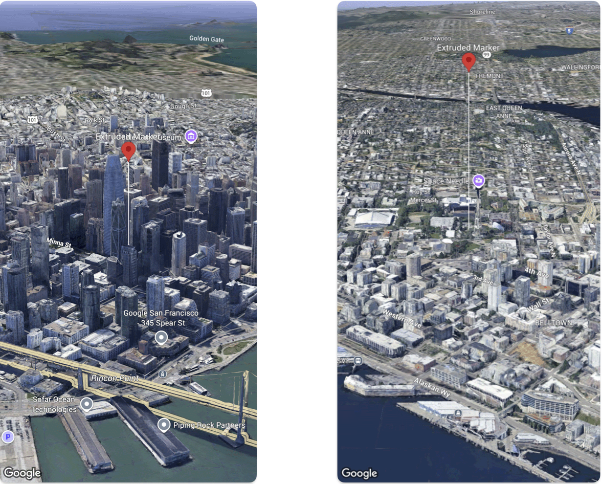
Il seguente esempio di codice mostra come utilizzare la struct Marker
per configurare l'altitudine e la modalità di altitudine di un indicatore per estruderlo e impostarne l'altitudine.
Swift
@State var extrudedMarker: Marker = .init(
position: .init(
latitude: 37.78980534,
longitude: -122.3969349,
altitude: 50.0),
altitudeMode: .relativeToGround,
collisionBehavior: .required,
extruded: true,
drawsWhenOccluded: true,
sizePreserved: true,
zIndex: 0,
label: "Extruded marker"
)
Salvo quando diversamente specificato, i contenuti di questa pagina sono concessi in base alla licenza Creative Commons Attribution 4.0, mentre gli esempi di codice sono concessi in base alla licenza Apache 2.0. Per ulteriori dettagli, consulta le norme del sito di Google Developers. Java è un marchio registrato di Oracle e/o delle sue consociate.
Ultimo aggiornamento 2025-08-31 UTC.
[null,null,["Ultimo aggiornamento 2025-08-31 UTC."],[],[],null,["# Configure marker altitude\n\nSelect platform: [Android](/maps/documentation/maps-3d/android-sdk/configure-marker-altitude \"View this page for the Android platform docs.\") [iOS](/maps/documentation/maps-3d/ios-sdk/configure-marker-altitude \"View this page for the iOS platform docs.\")\n\n\u003cbr /\u003e\n\n| This product or feature is Experimental (pre-GA). Pre-GA products and features might have limited support, and changes to pre-GA products and features might not be compatible with other pre-GA versions. Pre-GA Offerings are covered by the [Google\n| Maps Platform Service Specific Terms](https://cloud.google.com/maps-platform/terms/maps-service-terms). For more information, see the [launch stage descriptions](/maps/launch-stages).\n\n\nYou can customize the altitude of markers that you add to a 3D map.\n\n\nThe following code sample demonstrates how use the [`Marker` struct](/maps/documentation/maps-3d/ios-sdk/reference/Structs/Marker) configure the altitude and altitude mode of a marker to extrude it and set its altitude. \n\n### Swift\n\n```swift\n@State var extrudedMarker: Marker = .init(\n position: .init(\n latitude: 37.78980534,\n longitude: -122.3969349,\n altitude: 50.0),\n altitudeMode: .relativeToGround,\n collisionBehavior: .required,\n extruded: true,\n drawsWhenOccluded: true,\n sizePreserved: true,\n zIndex: 0,\n label: \"Extruded marker\"\n)\n\n \n```"]]