Page Summary
-
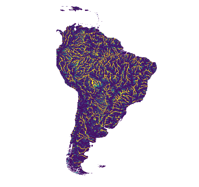
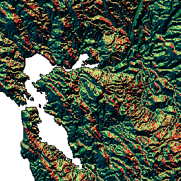
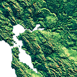
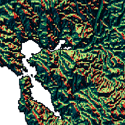
MERIT Hydro provides global flow direction maps at 3 arc-second resolution derived from MERIT DEM and water body datasets.
-
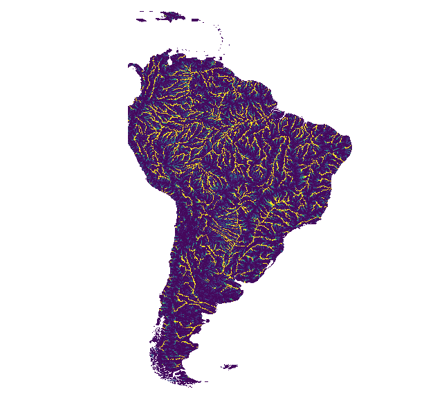
Supplementary visualization layers are available for MERIT Hydro.
-
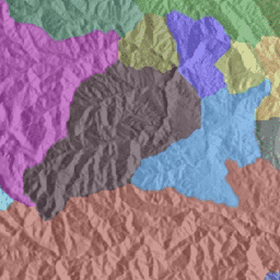
BasinATLAS, part of the HydroATLAS database, offers a standardized collection of hydro-environmental attributes for global watersheds at high spatial resolution, with data for 56 variables across 281 attributes available at various basin levels.
-
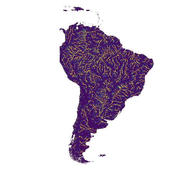
HydroSHEDS is a mapping product offering consistent hydrographic information including river networks, watershed boundaries, drainage directions, and flow accumulations at different scales, based on SRTM data.
-
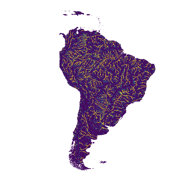
HydroSHEDS includes drainage direction and flow accumulation datasets at 3, 15, and 30 arc-second resolutions.
-
The HydroSHEDS product suite also contains a Free Flowing Rivers Network dataset.
-
Hydrologically conditioned and void-filled DEMs are available within the HydroSHEDS product suite at different resolutions.
-
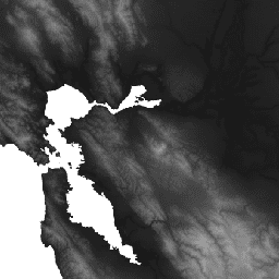
MERIT Hydro: Global Hydrography Datasets
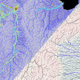
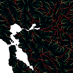
MERIT Hydro is a new global flow direction map at 3 arc-second resolution (~90 m at the equator) derived from the version 1.0.3 of the MERIT DEM elevation data and water body datasets (G1WBM, GSWO and OpenStreetMap). MERIT Hydro contains the output of a new … dem elevation hydrography hydrosheds merit river-width -
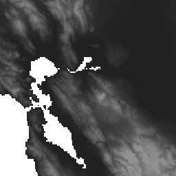
MERIT Hydro: Supplementary Visualization Layers
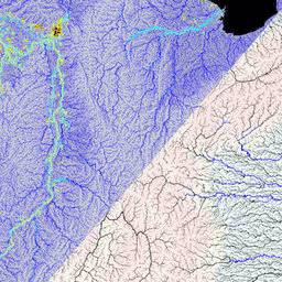
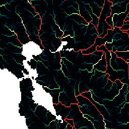
Supplementary visualization layers for MERIT Hydro hydrography hydrosheds merit river-width surface-ground-water upstream-drainage-area -
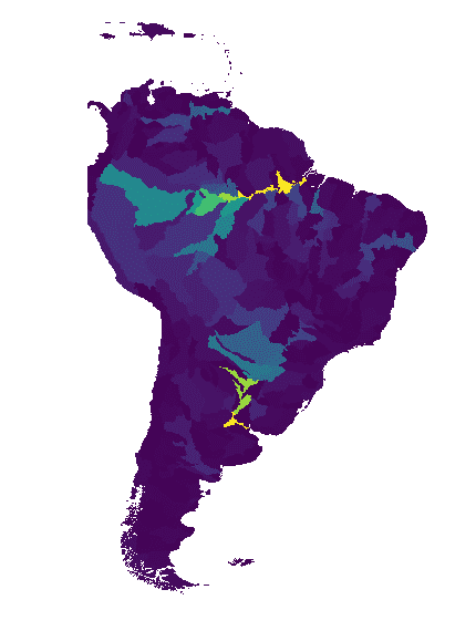
WWF HydroATLAS Basins Level 03
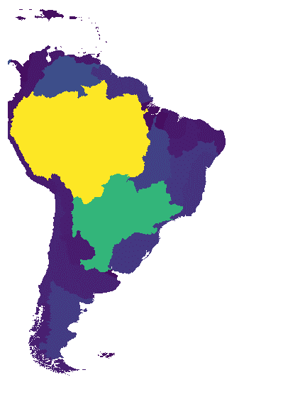
BasinATLAS is a component of the HydroATLAS database, which is a component of HydroSHEDS. BasinATLAS provides a standardized compendium of hydro-environmental attribute information for all watersheds of the world at high spatial resolution. This dataset includes data for 56 variables, partitioned into 281 attributes and … geophysical hydroatlas hydrography hydrology hydrosheds srtm -
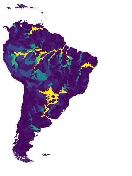
WWF HydroATLAS Basins Level 04
BasinATLAS is a component of the HydroATLAS database, which is a component of HydroSHEDS. BasinATLAS provides a standardized compendium of hydro-environmental attribute information for all watersheds of the world at high spatial resolution. This dataset includes data for 56 variables, partitioned into 281 attributes and … geophysical hydroatlas hydrography hydrology hydrosheds srtm -
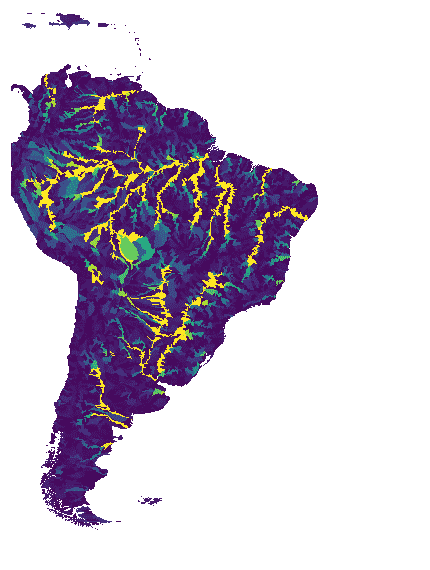
WWF HydroATLAS Basins Level 05
BasinATLAS is a component of the HydroATLAS database, which is a component of HydroSHEDS. BasinATLAS provides a standardized compendium of hydro-environmental attribute information for all watersheds of the world at high spatial resolution. This dataset includes data for 56 variables, partitioned into 281 attributes and … geophysical hydroatlas hydrography hydrology hydrosheds srtm -
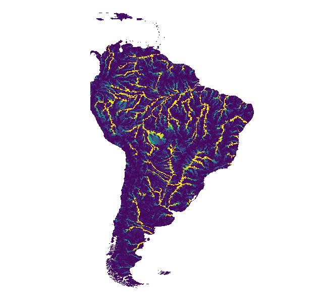
WWF HydroATLAS Basins Level 06
BasinATLAS is a component of the HydroATLAS database, which is a component of HydroSHEDS. BasinATLAS provides a standardized compendium of hydro-environmental attribute information for all watersheds of the world at high spatial resolution. This dataset includes data for 56 variables, partitioned into 281 attributes and … geophysical hydroatlas hydrography hydrology hydrosheds srtm -
WWF HydroATLAS Basins Level 07
BasinATLAS is a component of the HydroATLAS database, which is a component of HydroSHEDS. BasinATLAS provides a standardized compendium of hydro-environmental attribute information for all watersheds of the world at high spatial resolution. This dataset includes data for 56 variables, partitioned into 281 attributes and … geophysical hydroatlas hydrography hydrology hydrosheds srtm -
WWF HydroATLAS Basins Level 08
BasinATLAS is a component of the HydroATLAS database, which is a component of HydroSHEDS. BasinATLAS provides a standardized compendium of hydro-environmental attribute information for all watersheds of the world at high spatial resolution. This dataset includes data for 56 variables, partitioned into 281 attributes and … geophysical hydroatlas hydrography hydrology hydrosheds srtm -
WWF HydroATLAS Basins Level 09
BasinATLAS is a component of the HydroATLAS database, which is a component of HydroSHEDS. BasinATLAS provides a standardized compendium of hydro-environmental attribute information for all watersheds of the world at high spatial resolution. This dataset includes data for 56 variables, partitioned into 281 attributes and … geophysical hydroatlas hydrography hydrology hydrosheds srtm -
WWF HydroATLAS Basins Level 10
BasinATLAS is a component of the HydroATLAS database, which is a component of HydroSHEDS. BasinATLAS provides a standardized compendium of hydro-environmental attribute information for all watersheds of the world at high spatial resolution. This dataset includes data for 56 variables, partitioned into 281 attributes and … geophysical hydroatlas hydrography hydrology hydrosheds srtm -
WWF HydroATLAS Basins Level 11
BasinATLAS is a component of the HydroATLAS database, which is a component of HydroSHEDS. BasinATLAS provides a standardized compendium of hydro-environmental attribute information for all watersheds of the world at high spatial resolution. This dataset includes data for 56 variables, partitioned into 281 attributes and … geophysical hydroatlas hydrography hydrology hydrosheds srtm -
WWF HydroATLAS Basins Level 12
BasinATLAS is a component of the HydroATLAS database, which is a component of HydroSHEDS. BasinATLAS provides a standardized compendium of hydro-environmental attribute information for all watersheds of the world at high spatial resolution. This dataset includes data for 56 variables, partitioned into 281 attributes and … geophysical hydroatlas hydrography hydrology hydrosheds srtm -
WWF HydroSHEDS Basins Level 1

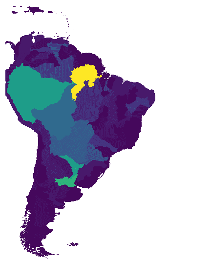
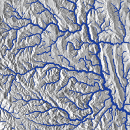
HydroSHEDS is a mapping product that provides hydrographic information for regional and global-scale applications in a consistent format. It offers a suite of geo-referenced datasets (vector and raster) at various scales, including river networks, watershed boundaries, drainage directions, and flow accumulations. HydroSHEDS is based on … geophysical hydrography hydrology hydrosheds srtm surface-ground-water -
WWF HydroSHEDS Basins Level 10

HydroSHEDS is a mapping product that provides hydrographic information for regional and global-scale applications in a consistent format. It offers a suite of geo-referenced datasets (vector and raster) at various scales, including river networks, watershed boundaries, drainage directions, and flow accumulations. HydroSHEDS is based on … geophysical hydrography hydrology hydrosheds srtm surface-ground-water -
WWF HydroSHEDS Basins Level 11

HydroSHEDS is a mapping product that provides hydrographic information for regional and global-scale applications in a consistent format. It offers a suite of geo-referenced datasets (vector and raster) at various scales, including river networks, watershed boundaries, drainage directions, and flow accumulations. HydroSHEDS is based on … geophysical hydrography hydrology hydrosheds srtm surface-ground-water -
WWF HydroSHEDS Basins Level 12

HydroSHEDS is a mapping product that provides hydrographic information for regional and global-scale applications in a consistent format. It offers a suite of geo-referenced datasets (vector and raster) at various scales, including river networks, watershed boundaries, drainage directions, and flow accumulations. HydroSHEDS is based on … geophysical hydrography hydrology hydrosheds srtm surface-ground-water -
WWF HydroSHEDS Basins Level 2

HydroSHEDS is a mapping product that provides hydrographic information for regional and global-scale applications in a consistent format. It offers a suite of geo-referenced datasets (vector and raster) at various scales, including river networks, watershed boundaries, drainage directions, and flow accumulations. HydroSHEDS is based on … geophysical hydrography hydrology hydrosheds srtm surface-ground-water -
WWF HydroSHEDS Basins Level 3

HydroSHEDS is a mapping product that provides hydrographic information for regional and global-scale applications in a consistent format. It offers a suite of geo-referenced datasets (vector and raster) at various scales, including river networks, watershed boundaries, drainage directions, and flow accumulations. HydroSHEDS is based on … geophysical hydrography hydrology hydrosheds srtm surface-ground-water -
WWF HydroSHEDS Basins Level 4

HydroSHEDS is a mapping product that provides hydrographic information for regional and global-scale applications in a consistent format. It offers a suite of geo-referenced datasets (vector and raster) at various scales, including river networks, watershed boundaries, drainage directions, and flow accumulations. HydroSHEDS is based on … geophysical hydrography hydrology hydrosheds srtm surface-ground-water -
WWF HydroSHEDS Basins Level 5

HydroSHEDS is a mapping product that provides hydrographic information for regional and global-scale applications in a consistent format. It offers a suite of geo-referenced datasets (vector and raster) at various scales, including river networks, watershed boundaries, drainage directions, and flow accumulations. HydroSHEDS is based on … geophysical hydrography hydrology hydrosheds srtm surface-ground-water -
WWF HydroSHEDS Basins Level 6

HydroSHEDS is a mapping product that provides hydrographic information for regional and global-scale applications in a consistent format. It offers a suite of geo-referenced datasets (vector and raster) at various scales, including river networks, watershed boundaries, drainage directions, and flow accumulations. HydroSHEDS is based on … geophysical hydrography hydrology hydrosheds srtm surface-ground-water -
WWF HydroSHEDS Basins Level 7
HydroSHEDS is a mapping product that provides hydrographic information for regional and global-scale applications in a consistent format. It offers a suite of geo-referenced datasets (vector and raster) at various scales, including river networks, watershed boundaries, drainage directions, and flow accumulations. HydroSHEDS is based on … geophysical hydrography hydrology hydrosheds srtm surface-ground-water -
WWF HydroSHEDS Basins Level 8

HydroSHEDS is a mapping product that provides hydrographic information for regional and global-scale applications in a consistent format. It offers a suite of geo-referenced datasets (vector and raster) at various scales, including river networks, watershed boundaries, drainage directions, and flow accumulations. HydroSHEDS is based on … geophysical hydrography hydrology hydrosheds srtm surface-ground-water -
WWF HydroSHEDS Basins Level 9

HydroSHEDS is a mapping product that provides hydrographic information for regional and global-scale applications in a consistent format. It offers a suite of geo-referenced datasets (vector and raster) at various scales, including river networks, watershed boundaries, drainage directions, and flow accumulations. HydroSHEDS is based on … geophysical hydrography hydrology hydrosheds srtm surface-ground-water -
WWF HydroSHEDS Drainage Direction, 15 Arc-Seconds
HydroSHEDS is a mapping product that provides hydrographic information for regional and global-scale applications in a consistent format. It offers a suite of geo-referenced datasets (vector and raster) at various scales, including river networks, watershed boundaries, drainage directions, and flow accumulations. HydroSHEDS is based on … direction drainage flow geophysical hydrography hydrology -
WWF HydroSHEDS Drainage Direction, 3 Arc-Seconds
HydroSHEDS is a mapping product that provides hydrographic information for regional and global-scale applications in a consistent format. It offers a suite of geo-referenced datasets (vector and raster) at various scales, including river networks, watershed boundaries, drainage directions, and flow accumulations. HydroSHEDS is based on … direction drainage flow geophysical hydrography hydrology -
WWF HydroSHEDS Drainage Direction, 30 Arc-Seconds
HydroSHEDS is a mapping product that provides hydrographic information for regional and global-scale applications in a consistent format. It offers a suite of geo-referenced datasets (vector and raster) at various scales, including river networks, watershed boundaries, drainage directions, and flow accumulations. HydroSHEDS is based on … direction drainage flow geophysical hydrography hydrology -
WWF HydroSHEDS Flow Accumulation, 15 Arc-Seconds
HydroSHEDS is a mapping product that provides hydrographic information for regional and global-scale applications in a consistent format. It offers a suite of geo-referenced datasets (vector and raster) at various scales, including river networks, watershed boundaries, drainage directions, and flow accumulations. HydroSHEDS is based on … accumulation drainage flow geophysical hydrography hydrology -
WWF HydroSHEDS Flow Accumulation, 30 Arc-Seconds
HydroSHEDS is a mapping product that provides hydrographic information for regional and global-scale applications in a consistent format. It offers a suite of geo-referenced datasets (vector and raster) at various scales, including river networks, watershed boundaries, drainage directions, and flow accumulations. HydroSHEDS is based on … accumulation drainage flow geophysical hydrography hydrology -
WWF HydroSHEDS Free Flowing Rivers Network v1
HydroSHEDS is a mapping product that provides hydrographic information for regional and global-scale applications in a consistent format. It offers a suite of geo-referenced datasets (vector and raster) at various scales, including river networks, watershed boundaries, drainage directions, and flow accumulations. HydroSHEDS is based on … geophysical hydrography hydrology hydrosheds srtm surface-ground-water -
WWF HydroSHEDS Hydrologically Conditioned DEM, 15 Arc-Seconds
HydroSHEDS is a mapping product that provides hydrographic information for regional and global-scale applications in a consistent format. It offers a suite of geo-referenced datasets (vector and raster) at various scales, including river networks, watershed boundaries, drainage directions, and flow accumulations. HydroSHEDS is based on … conditioned dem elevation geophysical hydrography hydrology -
WWF HydroSHEDS Hydrologically Conditioned DEM, 3 Arc-Seconds
HydroSHEDS is a mapping product that provides hydrographic information for regional and global-scale applications in a consistent format. It offers a suite of geo-referenced datasets (vector and raster) at various scales, including river networks, watershed boundaries, drainage directions, and flow accumulations. HydroSHEDS is based on … conditioned dem elevation geophysical hydrography hydrology -
WWF HydroSHEDS Hydrologically Conditioned DEM, 30 Arc-Seconds
HydroSHEDS is a mapping product that provides hydrographic information for regional and global-scale applications in a consistent format. It offers a suite of geo-referenced datasets (vector and raster) at various scales, including river networks, watershed boundaries, drainage directions, and flow accumulations. HydroSHEDS is based on … conditioned dem elevation geophysical hydrography hydrology -
WWF HydroSHEDS Void-Filled DEM, 3 Arc-Seconds
HydroSHEDS is a mapping product that provides hydrographic information for regional and global-scale applications in a consistent format. It offers a suite of geo-referenced datasets (vector and raster) at various scales, including river networks, watershed boundaries, drainage directions, and flow accumulations. HydroSHEDS is based on … dem elevation geophysical hydrography hydrology hydrosheds