Page Summary
-
OpenLandMap provides global data on various environmental factors, including soil properties, land surface temperature, potential vegetation, and precipitation.
-
Soil data available includes clay and sand content, bulk density, organic carbon content, texture class, water content, and pH, all at 250m resolution for multiple depths.
-
Land Surface Temperature data includes daytime monthly median and standard deviation from 2000-2017, as well as monthly day-night differences, all at 1 km resolution.
-
Additional datasets cover potential natural vegetation biomes and FAPAR, and monthly precipitation at 1 km resolution based on multiple sources.
-
Most datasets exclude Antarctica and are derived using machine learning or specific data processing techniques mentioned in the descriptions.
-
OpenLandMap Clay Content
Clay content in % (kg / kg) at 6 standard depths (0, 10, 30, 60, 100 and 200 cm) at 250 m resolution Based on machine learning predictions from global compilation of soil profiles and samples. Processing steps are described in detail here. Antarctica is … clay envirometrix opengeohub openlandmap soil usda -
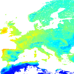
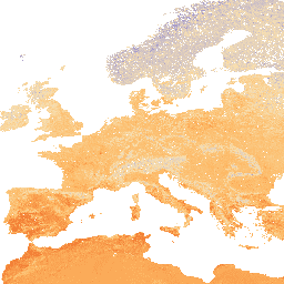
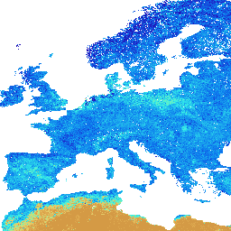
OpenLandMap Long-term Land Surface Temperature Daytime Monthly Median
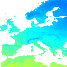
Land Surface Temperature daytime monthly mean value 2000-2017. Derived using the data.table package and quantile function in R. For more info about the MODIS LST product see this page. Antarctica is not included. To access and visualize maps outside of Earth Engine, use this page. … climate envirometrix lst mod11a2 modis monthly -
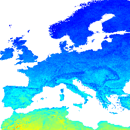
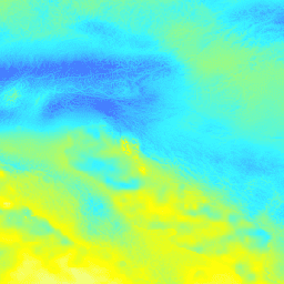
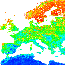
OpenLandMap Long-term Land Surface Temperature Daytime Monthly Standard Deviation
Long-term MODIS LST day-time and night-time temperatures standard deviation at 1 km based on the 2000-2017 time series. Derived using the data.table package and quantile function in R. For more info about the MODIS LST product see this page. Antarctica is not included. To access … climate envirometrix lst mod11a2 modis monthly -
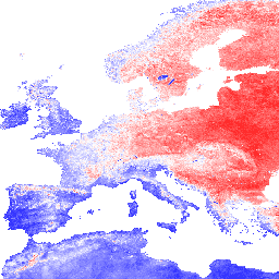
OpenLandMap Long-term Land Surface Temperature Monthly Day-Night Difference
Long-term MODIS LST day-time and night-time differences at 1 km based on the 2000-2017 time series Derived using the data.table package and quantile function in R. For more info about the MODIS LST product see this page. Antarctica is not included. To access and visualize … climate day envirometrix lst mod11a2 modis -
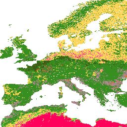
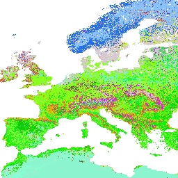
OpenLandMap Potential Distribution of Biomes
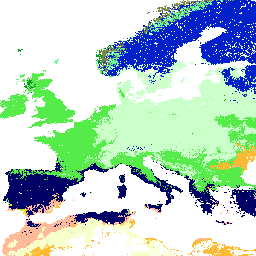
Potential Natural Vegetation biomes global predictions of classes (based on predictions using the BIOMES 6000 dataset's 'current biomes' category.) Potential Natural Vegetation (PNV) is the vegetation cover in equilibrium with climate that would exist at a given location non-impacted by human activities. PNV is useful … ecosystems envirometrix opengeohub openlandmap potential -
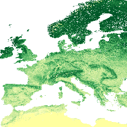
OpenLandMap Potential FAPAR Monthly
Potential Natural Vegetation FAPAR predicted monthly median (based on PROB-V FAPAR 2014-2017). Description. To access and visualize maps outside of Earth Engine, use this page. If you discover a bug, artifact or inconsistency in the LandGIS maps or if you have a question please use … envirometrix fapar monthly opengeohub openlandmap plant-productivity -
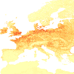
OpenLandMap Precipitation Monthly
Monthly precipitation in mm at 1 km resolution based on SM2RAIN-ASCAT 2007-2018, IMERG, CHELSA Climate, and WorldClim. Downscaled to 1 km resolution using gdalwarp (cubic splines) and an average between WorldClim, CHELSA Climate, and IMERG monthly product (see, e.g, "3B-MO-L.GIS.IMERG.20180601.V05B.tif"). 3x higher weight is given … envirometrix imerg monthly opengeohub openlandmap precipitation -
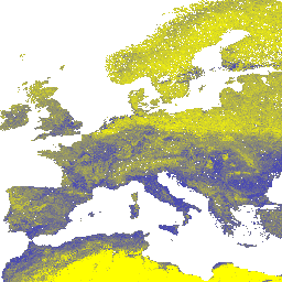
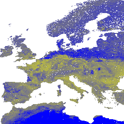
OpenLandMap Predicted Hapludalfs Probability
Predicted USDA soil great groups at 250 m (probabilities). Distribution of the USDA soil great groups based on machine learning predictions from global compilation of soil profiles. To learn more about soil great groups please refer to the Illustrated Guide to Soil Taxonomy - NRCS … envirometrix opengeohub openlandmap soil -
OpenLandMap Sand Content
Sand content in % (kg / kg) at 6 standard depths (0, 10, 30, 60, 100 and 200 cm) at 250 m resolution Based on machine learning predictions from global compilation of soil profiles and samples. Processing steps are described in detail here. Antarctica is … envirometrix opengeohub openlandmap sand soil usda -
OpenLandMap Soil Bulk Density
Soil bulk density (fine earth) 10 x kg / m3 at 6 standard depths (0, 10, 30, 60, 100 and 200 cm) at 250 m resolution. Processing steps are described in detail here. Antarctica is not included. To access and visualize maps outside of Earth … density envirometrix opengeohub openlandmap soil -
OpenLandMap Soil Organic Carbon Content
Soil organic carbon content in x 5 g / kg at 6 standard depths (0, 10, 30, 60, 100 and 200 cm) at 250 m resolution Predicted from a global compilation of soil points. Processing steps are described in detail here. Antarctica is not included. … carbon envirometrix opengeohub openlandmap soil -
OpenLandMap Soil Texture Class (USDA System)
Soil texture classes (USDA system) for 6 soil depths (0, 10, 30, 60, 100 and 200 cm) at 250 m Derived from predicted soil texture fractions using the soiltexture package in R. Processing steps are described in detail here. Antarctica is not included. To access … envirometrix opengeohub openlandmap soil usda -
OpenLandMap Soil Water Content at 33kPa (Field Capacity)
Soil water content (volumetric %) for 33kPa and 1500kPa suctions predicted at 6 standard depths (0, 10, 30, 60, 100 and 200 cm) at 250 m resolution Training points are based on a global compilation of soil profiles: USDA NCSS AfSPDB ISRIC WISE EGRPR SPADE … envirometrix opengeohub openlandmap soil -
OpenLandMap Soil pH in H2O
Soil pH in H2O at 6 standard depths (0, 10, 30, 60, 100 and 200 cm) at 250 m resolution Processing steps are described in detail here. Antarctica is not included. To access and visualize maps outside of Earth Engine, use this page. If you … envirometrix opengeohub openlandmap ph soil -
OpenLandMap USDA Soil Taxonomy Great Groups
Predicted USDA soil great group probabilities at 250m. Distribution of the USDA soil great groups based on machine learning predictions from global compilation of soil profiles. To learn more about soil great groups please refer to the Illustrated Guide to Soil Taxonomy - NRCS - … envirometrix opengeohub openlandmap soil usda