-
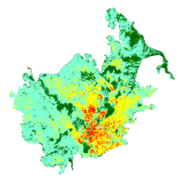
Yanma Önem Düzeyi (MTBS) Yanma Önem Düzeyi Resimlerindeki Trendleri İzleme
Yanma şiddeti mozaiklerinde, kıtasal ABD, Alaska, Hawaii ve Porto Riko'da şu anda tamamlanmış tüm MTBS yangınları için MTBS yanma şiddeti sınıflarının tematik raster görüntüleri yer alır. Mozaiklenmiş yanık şiddeti görüntüleri, ABD Eyaleti ve … eros fire forest gtac landcover landsat-derived -
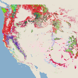
USFS Landscape Change Monitoring System v2024.10 (CONUS ve OCONUS)
Bu ürün, Peyzaj Değişikliği İzleme Sistemi (LCMS) veri paketinin bir parçasıdır. Her yıl için LCMS tarafından modellenmiş değişimi, arazi örtüsünü ve/veya arazi kullanımı sınıflarını gösterir. Kıta Amerika Birleşik Devletleri'nin (CONUS) yanı sıra Alaska (AK), Porto Riko (PR), Hawaii (HI) ve Virgin Adaları (VI) dahil olmak üzere CONUS dışındaki alanları kapsar. change-detection forest gtac landcover landuse landuse-landcover -
USFS Tree Canopy Cover v2023-5 (CONUS ve OCONUS)
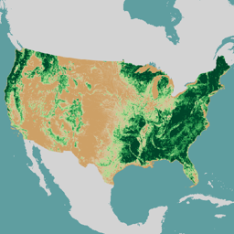
Bu ürün, Ağaç Örtüsü (TCC) veri paketinin bir parçasıdır. Bu dosya, modellenmiş TCC, standart hata (SE) ve her yıl için Ulusal Arazi Örtüsü Veritabanı'nın (NLCD) TCC verilerini içerir. Amerika Birleşik Devletleri Tarım Bakanlığı, Orman Hizmeti (USFS) tarafından üretilen TCC verileri … forest gtac landuse-landcover redcastle-resources usda usfs -
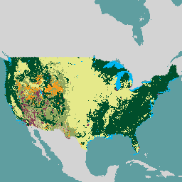
USFS TreeMap v2016 (ABD'nin karasal kısmı)
Bu ürün, TreeMap veri paketinin bir parçasıdır. Bu veri kümesi, 2016'da kıta ABD'sinin ormanlık alanının tamamında canlı ve ölü ağaç sayısı, biyokütle ve karbon dahil olmak üzere orman özellikleri hakkında ayrıntılı mekansal bilgiler sağlar. TreeMap v2016, bir resim, bir … biyokütle karbon iklim-değişikliği conus orman orman-biyokütlesi
Datasets tagged redcastle-resources in Earth Engine
[null,null,[],[[["\u003cp\u003eThe MTBS dataset provides annual burn severity mosaics for fires across the US, including Alaska, Hawaii, and Puerto Rico.\u003c/p\u003e\n"],["\u003cp\u003eThe USFS TreeMap v2016 dataset offers detailed forest characteristic information for the continental United States, including tree counts, biomass, and carbon estimates.\u003c/p\u003e\n"],["\u003cp\u003eThe USFS Tree Canopy Cover v2021-4 dataset includes modeled and NLCD tree canopy cover data, along with standard error, for the continental US and other US territories.\u003c/p\u003e\n"]]],[],null,["# Datasets tagged redcastle-resources in Earth Engine\n\n-\n\n |------------------------------------------------------------------------------------------------------------------------------------------------------------------------------------------------------------------------------------------------------------------------------------------------|\n | [### Monitoring Trends in Burn Severity (MTBS) Burn Severity Images](/earth-engine/datasets/catalog/USFS_GTAC_MTBS_annual_burn_severity_mosaics_v1) |\n | The burn severity mosaics consist of thematic raster images of MTBS burn severity classes for all currently completed MTBS fires for the continental United States, Alaska, Hawaii and Puerto Rico. Mosaicked burn severity images are compiled annually for each year by US State and the ... |\n | [eros](/earth-engine/datasets/tags/eros) [fire](/earth-engine/datasets/tags/fire) [forest](/earth-engine/datasets/tags/forest) [gtac](/earth-engine/datasets/tags/gtac) [landcover](/earth-engine/datasets/tags/landcover) [landsat-derived](/earth-engine/datasets/tags/landsat-derived) |\n\n-\n\n |-----------------------------------------------------------------------------------------------------------------------------------------------------------------------------------------------------------------------------------------------------------------------------------------------------------------------------|\n | [### USFS Landscape Change Monitoring System v2024.10 (CONUS and OCONUS)](/earth-engine/datasets/catalog/USFS_GTAC_LCMS_v2024-10) |\n | This product is part of the Landscape Change Monitoring System (LCMS) data suite. It shows LCMS-modeled change, land cover, and/or land use classes for each year and covers the Conterminous United States (CONUS) as well as areas outside the CONUS (OCONUS) including Alaska (AK), Puerto ... |\n | [change-detection](/earth-engine/datasets/tags/change-detection) [forest](/earth-engine/datasets/tags/forest) [gtac](/earth-engine/datasets/tags/gtac) [landcover](/earth-engine/datasets/tags/landcover) [landuse](/earth-engine/datasets/tags/landuse) [landuse-landcover](/earth-engine/datasets/tags/landuse-landcover) |\n\n-\n\n |-------------------------------------------------------------------------------------------------------------------------------------------------------------------------------------------------------------------------------------------------------------------------------------------------------------------|\n | [### USFS Tree Canopy Cover v2023-5 (CONUS and OCONUS)](/earth-engine/datasets/catalog/USGS_NLCD_RELEASES_2023_REL_TCC_v2023-5) |\n | This product is part of the Tree Canopy Cover (TCC) data suite. It includes modeled TCC, standard error (SE), and National Land Cover Database's (NLCD) TCC data for each year. TCC data produced by the the United States Department of Agriculture, Forest Service (USFS) are ... |\n | [forest](/earth-engine/datasets/tags/forest) [gtac](/earth-engine/datasets/tags/gtac) [landuse-landcover](/earth-engine/datasets/tags/landuse-landcover) [redcastle-resources](/earth-engine/datasets/tags/redcastle-resources) [usda](/earth-engine/datasets/tags/usda) [usfs](/earth-engine/datasets/tags/usfs) |\n\n-\n\n |---------------------------------------------------------------------------------------------------------------------------------------------------------------------------------------------------------------------------------------------------------------------------------------------------------------|\n | [### USFS TreeMap v2016 (Conterminous United States)](/earth-engine/datasets/catalog/USFS_GTAC_TreeMap_v2016) |\n | This product is part of the TreeMap data suite. It provides detailed spatial information on forest characteristics including number of live and dead trees, biomass, and carbon across the entire forested extent of the continental United States in 2016. TreeMap v2016 contains one image, a ... |\n | [biomass](/earth-engine/datasets/tags/biomass) [carbon](/earth-engine/datasets/tags/carbon) [climate-change](/earth-engine/datasets/tags/climate-change) [conus](/earth-engine/datasets/tags/conus) [forest](/earth-engine/datasets/tags/forest) [forest-biomass](/earth-engine/datasets/tags/forest-biomass) |\n\n-\n\n |---------------------------------------------------------------------------------------------------------------------------------------------------------------------------------------------------------------------------------------------------------------------------------------------------------|\n | [### USFS TreeMap v2020](/earth-engine/datasets/catalog/USFS_GTAC_TreeMap_v2020) |\n | This product is part of the TreeMap data suite. It provides detailed spatial information on forest characteristics including number of live and dead trees, biomass, and carbon across the entire forested extent of the United States in 2020. TreeMap v2020 contains 22-band 30 x 30m ... |\n | [aboveground](/earth-engine/datasets/tags/aboveground) [biomass](/earth-engine/datasets/tags/biomass) [carbon](/earth-engine/datasets/tags/carbon) [climate-change](/earth-engine/datasets/tags/climate-change) [conus](/earth-engine/datasets/tags/conus) [forest](/earth-engine/datasets/tags/forest) |\n\n-\n\n |---------------------------------------------------------------------------------------------------------------------------------------------------------------------------------------------------------------------------------------------------------------------------------------------------------|\n | [### USFS TreeMap v2022](/earth-engine/datasets/catalog/USFS_GTAC_TreeMap_v2022) |\n | This product is part of the TreeMap data suite. It provides detailed spatial information on forest characteristics including number of live and dead trees, biomass, and carbon across the entire forested extent of the United States in 2022. TreeMap v2022 contains 22-band 30 x 30m ... |\n | [aboveground](/earth-engine/datasets/tags/aboveground) [biomass](/earth-engine/datasets/tags/biomass) [carbon](/earth-engine/datasets/tags/carbon) [climate-change](/earth-engine/datasets/tags/climate-change) [conus](/earth-engine/datasets/tags/conus) [forest](/earth-engine/datasets/tags/forest) |"]]