-
Phạm vi nước mặt động từ Sentinel-1 (DSWx-S1) Phiên bản 1

Tập dữ liệu này chứa phạm vi nước mặt động cấp 3 OPERA từ Sentinel-1 (DSWX-S1). DSWx-S1 cung cấp bản đồ địa lý gần như toàn cầu về phạm vi nước mặt trên đất liền ở độ phân giải không gian là 30 mét trên hệ thống lưới Hệ thống tham chiếu lưới quân sự (MGRS), với tần suất xem lại theo thời gian là giữa … geophysical nasa opera sentinel1-derived surface surface-ground-water -
ESA WorldCereal 10 m phiên bản 100

Bộ sản phẩm WorldCereal 10 m 2021 của Cơ quan Vũ trụ Châu Âu (ESA) bao gồm các bản đồ cây trồng hằng năm và theo mùa trên quy mô toàn cầu cùng với độ tin cậy liên quan. Các bản đồ này được tạo trong khuôn khổ dự án ESA-WorldCereal. Thông tin khác về nội dung của các sản phẩm này và phương pháp được dùng để … agriculture copernicus crop esa global landcover -
ESA WorldCereal Active Cropland 10 m phiên bản 100
Bộ sản phẩm ESA WorldCereal Active Cropland 10 m 2021 chứa các điểm đánh dấu đất trồng trọt đang hoạt động theo mùa trên quy mô toàn cầu. Các bản đồ này được tạo trong khuôn khổ dự án ESA-WorldCereal. Các sản phẩm đất trồng trọt đang hoạt động cho biết liệu một điểm ảnh được xác định là cây trồng tạm thời có đang hoạt động hay không … agriculture copernicus crop esa global landcover -
ESA WorldCover 10m phiên bản 100

Sản phẩm ESA WorldCover 10 m 2020 cung cấp bản đồ lớp phủ mặt đất toàn cầu cho năm 2020 ở độ phân giải 10 m dựa trên dữ liệu của Sentinel-1 và Sentinel-2. Sản phẩm WorldCover có 11 lớp phủ mặt đất và được tạo trong khuôn khổ … esa landcover landuse landuse-landcover sentinel1-derived sentinel2-derived -
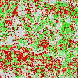
ESA WorldCover 10m phiên bản 200

Sản phẩm ESA WorldCover 10 m 2021 cung cấp bản đồ lớp phủ mặt đất toàn cầu cho năm 2021 ở độ phân giải 10 m dựa trên dữ liệu của Sentinel-1 và Sentinel-2. Sản phẩm WorldCover có 11 lớp phủ mặt đất và được tạo trong khuôn khổ … esa landcover landuse landuse-landcover sentinel1-derived sentinel2-derived -
EUCROPMAP

Bản đồ loại cây trồng ở Châu Âu dựa trên các quan sát tại chỗ của Sentinel-1 và LUCAS Copernicus 2018 cho năm 2018, cũng như sự kết hợp giữa Sentinel-1, Sentinel-2 và dữ liệu phụ trợ với các quan sát của LUCAS Copernicus 2022 cho năm 2022. Dựa trên cuộc khảo sát tại chỗ độc đáo của LUCAS 2018 Copernicus, tập dữ liệu này đại diện cho … agriculture crop eu jrc lucas sentinel1-derived -
Độ phản xạ ngược và độ kết hợp giao thoa kế theo mùa toàn cầu của Sentinel-1 Phiên bản 2019 Độ phản xạ ngược

Tập dữ liệu này là bản trình bày không gian đầu tiên thuộc loại này về độ kết hợp giao thoa kế và các dấu hiệu phản xạ ngược của Radar khẩu độ tổng hợp (SAR) dải tần C trên toàn cầu, nhiều mùa và lặp lại. Phạm vi bao gồm các khối đất và các lớp băng từ 82 độ vĩ độ Bắc đến 79 độ vĩ độ Nam. Tập dữ liệu này được lấy từ … backscatter earth-big-data jpl nasa polarization radar -
Độ phản xạ ngược và độ kết hợp giao thoa kế theo mùa toàn cầu của Sentinel-1 Phiên bản 2019 Độ kết hợp

Tập dữ liệu này là bản trình bày không gian đầu tiên thuộc loại này về độ kết hợp giao thoa kế và các dấu hiệu phản xạ ngược của Radar khẩu độ tổng hợp (SAR) dải tần C trên toàn cầu, nhiều mùa và lặp lại. Phạm vi bao gồm các khối đất và các lớp băng từ 82 độ vĩ độ Bắc đến 79 độ vĩ độ Nam. Tập dữ liệu này được lấy từ … earth-big-data jpl nasa polarization radar sar -
Độ phản xạ ngược và độ kết hợp giao thoa kế theo mùa toàn cầu của Sentinel-1 Phiên bản 2019 Tham số mô hình phân rã

Tập dữ liệu này là bản trình bày không gian đầu tiên thuộc loại này về độ kết hợp giao thoa kế và các dấu hiệu phản xạ ngược của Radar khẩu độ tổng hợp (SAR) dải tần C trên toàn cầu, nhiều mùa và lặp lại. Phạm vi bao gồm các khối đất và các lớp băng từ 82 độ vĩ độ Bắc đến 79 độ vĩ độ Nam. Tập dữ liệu này được lấy từ … earth-big-data jpl nasa polarization radar sar -
Độ phản xạ ngược và độ kết hợp giao thoa kế theo mùa toàn cầu của Sentinel-1 Phiên bản 2019 Bóng đổ chồng lên nhau do góc tới

Tập dữ liệu này là bản trình bày không gian đầu tiên thuộc loại này về độ kết hợp giao thoa kế và các dấu hiệu phản xạ ngược của Radar khẩu độ tổng hợp (SAR) dải tần C trên toàn cầu, nhiều mùa và lặp lại. Phạm vi bao gồm các khối đất và các lớp băng từ 82 độ vĩ độ Bắc đến 79 độ vĩ độ Nam. Tập dữ liệu này được lấy từ … earth-big-data jpl nasa polarization radar sar -
Độ phản xạ ngược SAR được hiệu chỉnh theo địa hình bằng phép đo bức xạ của OPERA từ các lớp tĩnh của Sentinel-1 Phiên bản 1.0

Sản phẩm này chứa các lớp hình học radar tĩnh liên kết với tập dữ liệu Độ phản xạ ngược SAR được hiệu chỉnh theo địa hình bằng phép đo bức xạ của OPERA từ Sentinel-1. Do ống quỹ đạo hẹp của nhiệm vụ S1, các lớp hình học radar như góc tới, góc tới cục bộ, số lần quan sát và Hệ số chuẩn hoá diện tích RTC (ANF) … jpl nasa opera sar satellite-imagery sentinel1-derived -
Độ phản xạ ngược SAR được hiệu chỉnh theo địa hình bằng phép đo bức xạ của OPERA từ Sentinel-1 Phiên bản 1.0

Sản phẩm này bao gồm độ phản xạ ngược radar được chuẩn hoá theo địa hình. Sản phẩm này lập bản đồ các tín hiệu liên quan đến các thuộc tính vật lý của các đối tượng tán xạ trên mặt đất, chẳng hạn như độ nhám bề mặt và độ ẩm của đất và/hoặc thảm thực vật. Sản phẩm OPERA RTC-S1 được lấy từ Copernicus Sentinel-1 Interferometric Wide (IW) … backscatter jpl nasa opera polarization radar -
Vệ tinh nhúng Phiên bản 1
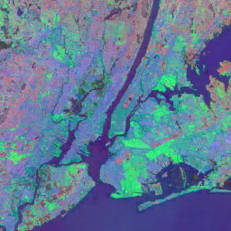
Tập dữ liệu Vệ tinh nhúng của Google là một tập hợp toàn cầu, sẵn sàng cho việc phân tích các dữ liệu nhúng không gian địa lý đã học. Mỗi điểm ảnh 10 mét trong tập dữ liệu này là một bản trình bày 64 chiều, hay "vectơ nhúng", mã hoá các quỹ đạo thời gian của điều kiện bề mặt tại và xung quanh điểm ảnh đó theo phép đo của nhiều hoạt động quan sát Trái đất … annual global google landsat-derived satellite-imagery sentinel1-derived -
Dấu chân khu dân cư trên toàn cầu năm 2015

Dấu chân khu dân cư trên toàn cầu (WSF) năm 2015 là một mặt nạ nhị phân có độ phân giải 10 m,phác thảo phạm vi của các khu dân cư trên toàn cầu,được lấy từ hình ảnh đa thời gian của Landsat-8 và Sentinel-1 từ năm 2014 đến năm 2015 (trong đó, lần lượt có khoảng 217.000 và 107.000 cảnh đã được xử lý). Tính linh động theo thời gian của các khu dân cư … landcover landsat-derived population sentinel1-derived settlement urban
Datasets tagged sentinel1-derived in Earth Engine
[null,null,[],[],[]]