-
GPW – Jährliche dominante Klasse von Grasland – Version 1
Dieses Dataset enthält globale jährliche Karten der dominanten Klasse von Grünland (kultiviert und natürlich/naturnah) für den Zeitraum von 2000 bis 2022 mit einer räumlichen Auflösung von 30 m. Die von der Initiative „Land & Carbon Lab Global Pasture Watch“ erstellte Karte der Graslandfläche umfasst alle Landbedeckungstypen, die mindestens 30% … global global-pasture-watch land landcover landuse landuse-landcover -
GPW – Jährliche Wahrscheinlichkeiten von Anbauflächen für Grasland, Version 1
Dieses Dataset enthält globale jährliche Wahrscheinlichkeitskarten von kultiviertem Grünland für den Zeitraum von 2000 bis 2022 mit einer räumlichen Auflösung von 30 m. Die von der Initiative „Land & Carbon Lab Global Pasture Watch“ erstellte Karte der Graslandfläche umfasst alle Arten der Landbedeckung, die mindestens 30% trockenes oder … global global-pasture-watch land landcover landuse landuse-landcover -
GPW – Jährliche Wahrscheinlichkeiten von natürlichen/naturnahen Grasflächen, Version 1
Dieses Dataset enthält globale jährliche Wahrscheinlichkeitskarten von natürlichen/naturnahen Grasflächen für den Zeitraum 2000 bis 2022 mit einer räumlichen Auflösung von 30 m. Die von der Initiative „Land & Carbon Lab Global Pasture Watch“ erstellte Karte der Graslandfläche umfasst alle Arten der Landbedeckung, die mindestens 30% trockenes oder … global global-pasture-watch land landcover landuse landuse-landcover -
GPW Annual uncalibrated Gross Primary Productivity (uGPP) v1
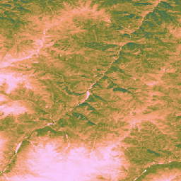
Dieser Datensatz enthält globale, nicht kalibrierte, EO-basierte Daten zur Brutto-Primärproduktion ab dem Jahr 2000 mit einer räumlichen Auflösung von 30 m. Das aktuelle Dataset wurde von der Initiative „Land & Carbon Lab Global Pasture Watch“ erstellt und enthält Werte für die Bruttoprimärproduktion (Gross Primary Productivity, GPP) weltweit mit einer räumlichen Auflösung von 30 m ab dem Jahr 2000. GPP-Werte sind … global global-pasture-watch land landcover landuse plant-productivity
Datasets tagged global-pasture-watch in Earth Engine
[null,null,[],[[["\u003cp\u003eThe Global Pasture Watch (GPW) initiative provides annual global maps of grassland types at 30-meter resolution from 2000 to 2022.\u003c/p\u003e\n"],["\u003cp\u003eThe datasets include probabilities of cultivated, natural/semi-natural, and dominant class of grasslands.\u003c/p\u003e\n"],["\u003cp\u003eGrassland extent is defined as any land cover with at least 30% dry or photosynthetic vegetation.\u003c/p\u003e\n"],["\u003cp\u003eThese datasets are produced by the Land & Carbon Lab and are available for global analysis.\u003c/p\u003e\n"]]],[],null,["# Datasets tagged global-pasture-watch in Earth Engine\n\n-\n\n |-------------------------------------------------------------------------------------------------------------------------------------------------------------------------------------------------------------------------------------------------------------------------------------------------------------------------------------|\n | [### GPW Annual Dominant Class of Grasslands v1](/earth-engine/datasets/catalog/projects_global-pasture-watch_assets_ggc-30m_v1_grassland_c) |\n | This dataset provides global annual dominant class maps of grasslands (cultivated and natural/semi-natural) from 2000 to 2022 at 30-m spatial resolution. Produced by Land \\& Carbon Lab Global Pasture Watch initiative, the mapped grassland extent includes any land cover type, which contains at least 30% ... |\n | [global](/earth-engine/datasets/tags/global) [global-pasture-watch](/earth-engine/datasets/tags/global-pasture-watch) [land](/earth-engine/datasets/tags/land) [landcover](/earth-engine/datasets/tags/landcover) [landuse](/earth-engine/datasets/tags/landuse) [landuse-landcover](/earth-engine/datasets/tags/landuse-landcover) |\n\n-\n\n |-------------------------------------------------------------------------------------------------------------------------------------------------------------------------------------------------------------------------------------------------------------------------------------------------------------------------------------|\n | [### GPW Annual Probabilities of Cultivated Grasslands v1](/earth-engine/datasets/catalog/projects_global-pasture-watch_assets_ggc-30m_v1_cultiv-grassland_p) |\n | This dataset provides global annual probability maps of cultivated grassland from 2000 to 2022 at 30-m spatial resolution. Produced by Land \\& Carbon Lab Global Pasture Watch initiative, the mapped grassland extent includes any land cover type, which contains at least 30% of dry or ... |\n | [global](/earth-engine/datasets/tags/global) [global-pasture-watch](/earth-engine/datasets/tags/global-pasture-watch) [land](/earth-engine/datasets/tags/land) [landcover](/earth-engine/datasets/tags/landcover) [landuse](/earth-engine/datasets/tags/landuse) [landuse-landcover](/earth-engine/datasets/tags/landuse-landcover) |\n\n-\n\n |-------------------------------------------------------------------------------------------------------------------------------------------------------------------------------------------------------------------------------------------------------------------------------------------------------------------------------------|\n | [### GPW Annual Probabilities of Natural/Semi-natural Grasslands v1](/earth-engine/datasets/catalog/projects_global-pasture-watch_assets_ggc-30m_v1_nat-semi-grassland_p) |\n | This dataset provides global annual probability maps of natural/semi-natural grassland from 2000 to 2022 at 30-m spatial resolution. Produced by Land \\& Carbon Lab Global Pasture Watch initiative, the mapped grassland extent includes any land cover type, which contains at least 30% of dry or ... |\n | [global](/earth-engine/datasets/tags/global) [global-pasture-watch](/earth-engine/datasets/tags/global-pasture-watch) [land](/earth-engine/datasets/tags/land) [landcover](/earth-engine/datasets/tags/landcover) [landuse](/earth-engine/datasets/tags/landuse) [landuse-landcover](/earth-engine/datasets/tags/landuse-landcover) |\n\n-\n\n |---------------------------------------------------------------------------------------------------------------------------------------------------------------------------------------------------------------------------------------------------------------------------------------------------------------------------------------|\n | [### GPW Annual uncalibrated Gross Primary Productivity (uGPP) v1](/earth-engine/datasets/catalog/projects_global-pasture-watch_assets_ggpp-30m_v1_ugpp_m) |\n | This dataset provides global uncalibrated EO-based Gross Primary Productivity from 2000 at 30-m spatial resolution. Produced by Land \\& Carbon Lab Global Pasture Watch initiative, the current dataset provides Gross Primary Productivity (GPP) values globally at 30-m spatial resolution from 2000 onwards. GPP values are ... |\n | [global](/earth-engine/datasets/tags/global) [global-pasture-watch](/earth-engine/datasets/tags/global-pasture-watch) [land](/earth-engine/datasets/tags/land) [landcover](/earth-engine/datasets/tags/landcover) [landuse](/earth-engine/datasets/tags/landuse) [plant-productivity](/earth-engine/datasets/tags/plant-productivity) |"]]