-
Google Global Landsat-basierte CCDC-Segmente (1999–2019)
Diese Sammlung enthält vorab berechnete Ergebnisse aus der Ausführung des Algorithmus „Continuous Change Detection and Classification“ (CCDC) auf 20 Jahre Landsat-Daten zur Oberflächenreflexion. CCDC ist ein Algorithmus zum Finden von Wendepunkten, der die harmonische Anpassung mit einem dynamischen RMSE-Grenzwert verwendet, um Wendepunkte in Zeitreihendaten zu erkennen. Die… change-detection google landcover landsat-derived landuse landuse-landcover -
JRC Global Surface Water Mapping Layers, Version 1.4
Dieser Datensatz enthält Karten der Lage und zeitlichen Verteilung von Oberflächenwasser von 1984 bis 2021 sowie Statistiken zur Ausdehnung und Veränderung dieser Wasserflächen. Weitere Informationen finden Sie im zugehörigen Zeitschriftenartikel: High-resolution mapping of global surface water and its … change-detection geophysical google jrc landsat-derived surface -
MCD64A1.061 MODIS-Daten zu verbrannten Flächen – Monatlich – Global – 500 m
Das kombinierte Terra- und Aqua-Datenprodukt „MCD64A1 Version 6.1“ für verbrannte Flächen ist ein globales, monatliches, gegrilltes Produkt mit einer Auflösung von 500 m, das Informationen zu verbrannten Flächen und zur Qualität pro Pixel enthält. Bei der Kartierung von Brandflächen mit MCD64A1 werden MODIS-Bilder der Oberflächenreflexion mit einer Auflösung von 500 m mit MODIS-Beobachtungen aktiver Brände mit einer Auflösung von 1 km kombiniert. Der Algorithmus… burn change-detection fire geophysical global mcd64a1 -
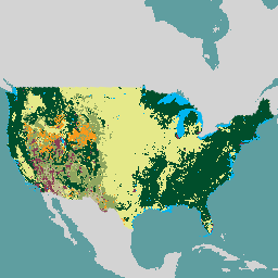
USFS Landscape Change Monitoring System, Version 2024.10 (CONUS und OCONUS)
Dieses Produkt ist Teil der LCMS-Datensuite (Landscape Change Monitoring System). Die Karte zeigt die LCMS-Modellierung von Veränderungen, Bodenbedeckung und/oder Bodennutzungsklassen für jedes Jahr. Sie deckt die kontinentalen USA (CONUS) sowie Gebiete außerhalb der CONUS (OCONUS) ab, einschließlich Alaska (AK), Puerto Rico (PR), … change-detection forest gtac landcover landuse landuse-landcover -
VNP64A1: Monatliche L4-Daten zum verbrannten Gebiet im globalen SIN-Raster mit 500 m
Das tägliche Datenprodukt „Verbrannte Fläche“ (VNP64A1) der Suomi National Polar-Orbiting Partnership (Suomi NPP) der NASA Visible Infrared Imaging Radiometer Suite (VIIRS) Version 1 ist ein globales, monatliches, gegrilltes Produkt mit 500 m Rasterabstand, das Informationen zur verbrannten Fläche und zur Qualität pro Pixel enthält. Der VNP64-Ansatz zur Kartierung von Brandflächen verwendet VIIRS-Daten mit einer Auflösung von 750 m… burn change-detection fire land nasa noaa
Datasets tagged change-detection in Earth Engine
[null,null,[],[[["\u003cp\u003eThis webpage features curated datasets focused on land change detection using satellite imagery.\u003c/p\u003e\n"],["\u003cp\u003eDatasets provide insights into surface water changes, burned areas, and land cover/use transformations.\u003c/p\u003e\n"],["\u003cp\u003eData sources include Landsat, MODIS, VIIRS, and algorithms like CCDC for analyzing temporal patterns.\u003c/p\u003e\n"],["\u003cp\u003eGlobal and regional coverage is offered, with examples such as the USFS Landscape Change Monitoring System.\u003c/p\u003e\n"],["\u003cp\u003eThe collection spans multiple decades, enabling long-term change analysis and monitoring efforts.\u003c/p\u003e\n"]]],[],null,["# Datasets tagged change-detection in Earth Engine\n\n-\n\n |---------------------------------------------------------------------------------------------------------------------------------------------------------------------------------------------------------------------------------------------------------------------------------------------------------------------------------------------------|\n | [### Google Global Landsat-based CCDC Segments (1999-2019)](/earth-engine/datasets/catalog/GOOGLE_GLOBAL_CCDC_V1) |\n | This collection contains precomputed results from running the Continuous Change Detection and Classification (CCDC) algorithm on 20 years of Landsat surface reflectance data. CCDC is a break-point finding algorithm that uses harmonic fitting with a dynamic RMSE threshold to detect breakpoints in time-series data. The ... |\n | [change-detection](/earth-engine/datasets/tags/change-detection) [google](/earth-engine/datasets/tags/google) [landcover](/earth-engine/datasets/tags/landcover) [landsat-derived](/earth-engine/datasets/tags/landsat-derived) [landuse](/earth-engine/datasets/tags/landuse) [landuse-landcover](/earth-engine/datasets/tags/landuse-landcover) |\n\n-\n\n |---------------------------------------------------------------------------------------------------------------------------------------------------------------------------------------------------------------------------------------------------------------------------------------------------------------------------|\n | [### JRC Global Surface Water Mapping Layers, v1.4](/earth-engine/datasets/catalog/JRC_GSW1_4_GlobalSurfaceWater) |\n | This dataset contains maps of the location and temporal distribution of surface water from 1984 to 2021 and provides statistics on the extent and change of those water surfaces. For more information see the associated journal article: High-resolution mapping of global surface water and its ... |\n | [change-detection](/earth-engine/datasets/tags/change-detection) [geophysical](/earth-engine/datasets/tags/geophysical) [google](/earth-engine/datasets/tags/google) [jrc](/earth-engine/datasets/tags/jrc) [landsat-derived](/earth-engine/datasets/tags/landsat-derived) [surface](/earth-engine/datasets/tags/surface) |\n\n-\n\n |-----------------------------------------------------------------------------------------------------------------------------------------------------------------------------------------------------------------------------------------------------------------------------------------------------------------------------------------|\n | [### MCD64A1.061 MODIS Burned Area Monthly Global 500m](/earth-engine/datasets/catalog/MODIS_061_MCD64A1) |\n | The Terra and Aqua combined MCD64A1 Version 6.1 Burned Area data product is a monthly, global gridded 500m product containing per-pixel burned-area and quality information. The MCD64A1 burned-area mapping approach employs 500m MODIS Surface Reflectance imagery coupled with 1km MODIS active fire observations. The algorithm ... |\n | [burn](/earth-engine/datasets/tags/burn) [change-detection](/earth-engine/datasets/tags/change-detection) [fire](/earth-engine/datasets/tags/fire) [geophysical](/earth-engine/datasets/tags/geophysical) [global](/earth-engine/datasets/tags/global) [mcd64a1](/earth-engine/datasets/tags/mcd64a1) |\n\n-\n\n |-----------------------------------------------------------------------------------------------------------------------------------------------------------------------------------------------------------------------------------------------------------------------------------------------------------------------------|\n | [### USFS Landscape Change Monitoring System v2024.10 (CONUS and OCONUS)](/earth-engine/datasets/catalog/USFS_GTAC_LCMS_v2024-10) |\n | This product is part of the Landscape Change Monitoring System (LCMS) data suite. It shows LCMS-modeled change, land cover, and/or land use classes for each year and covers the Conterminous United States (CONUS) as well as areas outside the CONUS (OCONUS) including Alaska (AK), Puerto ... |\n | [change-detection](/earth-engine/datasets/tags/change-detection) [forest](/earth-engine/datasets/tags/forest) [gtac](/earth-engine/datasets/tags/gtac) [landcover](/earth-engine/datasets/tags/landcover) [landuse](/earth-engine/datasets/tags/landuse) [landuse-landcover](/earth-engine/datasets/tags/landuse-landcover) |\n\n-\n\n |---------------------------------------------------------------------------------------------------------------------------------------------------------------------------------------------------------------------------------------------------------------------------------------------------------------------------------------|\n | [### VNP64A1: Burned Area Monthly L4 Global 500m SIN Grid](/earth-engine/datasets/catalog/NOAA_VIIRS_001_VNP64A1) |\n | The daily Suomi National Polar-Orbiting Partnership (Suomi NPP) NASA Visible Infrared Imaging Radiometer Suite (VIIRS) Burned Area (VNP64A1) Version 1 data product is a monthly, global gridded 500m product containing per-pixel burned area and quality information. The VNP64 burned area mapping approach employs 750m VIIRS ... |\n | [burn](/earth-engine/datasets/tags/burn) [change-detection](/earth-engine/datasets/tags/change-detection) [fire](/earth-engine/datasets/tags/fire) [land](/earth-engine/datasets/tags/land) [nasa](/earth-engine/datasets/tags/nasa) [noaa](/earth-engine/datasets/tags/noaa) |"]]