Định cấu hình độ cao của điểm đánh dấu
Sử dụng bộ sưu tập để sắp xếp ngăn nắp các trang
Lưu và phân loại nội dung dựa trên lựa chọn ưu tiên của bạn.
Chọn nền tảng:
Android
iOS
Bạn có thể tuỳ chỉnh độ cao của các điểm đánh dấu mà bạn thêm vào bản đồ 3D.
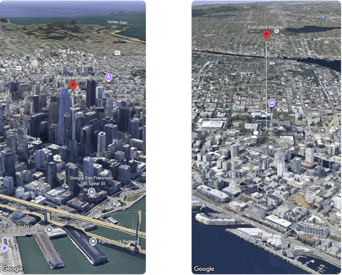
Mã mẫu sau đây minh hoạ cách đặt độ cao và chế độ độ cao
của Marker.
@State var extrudedMarker: Marker3D = .init(
  position: .init(
      latitude: 37.78980534,
      longitude:  -122.3969349,
      altitude: 50.0),
  altitudeMode: .relativeToGround,
  collisionBehavior: .required,
  extruded: true,
  drawsWhenOccluded: true,
  sizePreserved: true,
  zIndex: 0,
  label: "Extruded marker"
)
Trừ phi có lưu ý khác, nội dung của trang này được cấp phép theo Giấy phép ghi nhận tác giả 4.0 của Creative Commons và các mẫu mã lập trình được cấp phép theo Giấy phép Apache 2.0. Để biết thông tin chi tiết, vui lòng tham khảo Chính sách trang web của Google Developers. Java là nhãn hiệu đã đăng ký của Oracle và/hoặc các đơn vị liên kết với Oracle.
Cập nhật lần gần đây nhất: 2026-04-29 UTC.
[null,null,["Cập nhật lần gần đây nhất: 2026-04-29 UTC."],[],[]]
