Page Summary
-
The webpage features datasets from JAXA, including global digital surface models, radar imagery, orthorectified optical imagery, and various Level 3 products from GCOM-C/SGLI.
-
Datasets available cover diverse environmental parameters such as elevation, chlorophyll-a concentration, land surface temperature, leaf area index, and sea surface temperature.
-
Precipitation data from the Global Precipitation Measurement (GPM) mission, including hourly and monthly estimates, are also presented.
-
The ALOS and PALSAR datasets include global forest/non-forest maps and yearly SAR mosaics.
-
Some datasets have multiple versions available, and some, like the TRMM 3B43 monthly precipitation, are no longer being updated, with newer options suggested.
-
ALOS DSM: Global 30m v4.1

ALOS World 3D - 30m (AW3D30) is a global digital surface model (DSM) dataset with a horizontal resolution of approximately 30 meters (1 arcsec mesh). The dataset is based on the DSM dataset (5-meter mesh version) of the World 3D Topographic Data. More details are … alos dem elevation elevation-topography geophysical jaxa -
ALOS-2 PALSAR-2 StripMap Level 2.1
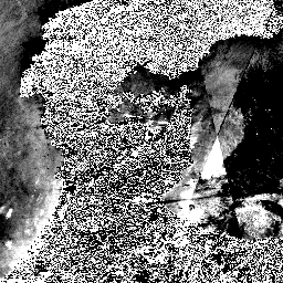
Starting from the night of January 1st, 2024, based on the request from Japanese ministries and related organization, JAXA implemented ALOS-2 PALSAR-2 emergency observation. Since JAXA expects these emergency observation data to be extremely useful for disaster management, JAXA decided to open these data on … alos2 eroc jaxa palsar2 radar sar -
ALOS/AVNIR-2 ORI
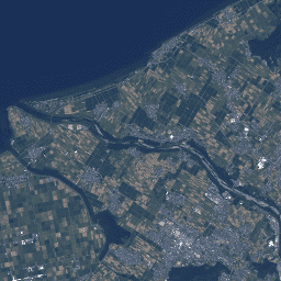
This dataset is contains orthorectified imagery from the Advanced Visible and Near Infrared Radiometer type 2 (AVNIR-2) sensor on-board the Advanced Land Observing Satellite (ALOS) "DAICHI". The AVNIR-2 ORI product was created from AVNIR-2 1B1 data after stereo matching with reference to ALOS's Panchromatic Remote-sensing … alos jaxa orthophoto satellite-imagery visible -
GCOM-C/SGLI L3 Chlorophyll-a Concentration (V1)

This product is the concentration of the photosynthetic pigment (chlorophyll-a) in phytoplankton in the sea surface layer. A newer version JAXA/GCOM-C/L3/OCEAN/CHLA/V3 is also available for this dataset which uses this algorithm for processing. GCOM-C conducts long-term and continuous global observation and data collection to elucidate … chla chlorophyll-a g-portal gcom gcom-c jaxa -
GCOM-C/SGLI L3 Chlorophyll-a Concentration (V2)
This product is the concentration of the photosynthetic pigment (chlorophyll-a) in phytoplankton in the sea surface layer. For data after 2021-11-28, see the V3 dataset. GCOM-C conducts long-term and continuous global observation and data collection to elucidate the mechanism behind fluctuations in radiation budget and … chla chlorophyll-a g-portal gcom gcom-c jaxa -
GCOM-C/SGLI L3 Chlorophyll-a Concentration (V3)

This product is the concentration of the photosynthetic pigment (chlorophyll-a) in phytoplankton in the sea surface layer. This is an ongoing dataset with a latency of 3-4 days. GCOM-C conducts long-term and continuous global observation and data collection to elucidate the mechanism behind fluctuations in … chla chlorophyll-a g-portal gcom gcom-c jaxa -
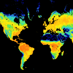
GCOM-C/SGLI L3 Land Surface Temperature (V1)
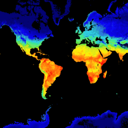
This product is the temperature of terrestrial land surface. A newer version JAXA/GCOM-C/L3/LAND/LST/V3 is also available for this dataset which uses this algorithm for processing. GCOM-C conducts long-term and continuous global observation and data collection to elucidate the mechanism behind fluctuations in radiation budget and … climate g-portal gcom gcom-c jaxa land -
GCOM-C/SGLI L3 Land Surface Temperature (V2)

This product is the temperature of terrestrial land surface. For data after 2021-11-28, see the V3 dataset. GCOM-C conducts long-term and continuous global observation and data collection to elucidate the mechanism behind fluctuations in radiation budget and carbon cycle needed to make accurate projections regarding … climate g-portal gcom gcom-c jaxa land -
GCOM-C/SGLI L3 Land Surface Temperature (V3)

This product is the temperature of terrestrial land surface. This is an ongoing dataset with a latency of 3-4 days. GCOM-C conducts long-term and continuous global observation and data collection to elucidate the mechanism behind fluctuations in radiation budget and carbon cycle needed to make … climate g-portal gcom gcom-c jaxa land -
GCOM-C/SGLI L3 Leaf Area Index (V1)

This product is the sum of the one-sided green leaf area per unit ground area. A newer version JAXA/GCOM-C/L3/LAND/LAI/V3 is also available for this dataset which uses this algorithm for processing. GCOM-C conducts long-term and continuous global observation and data collection to elucidate the mechanism … g-portal gcom gcom-c jaxa lai land -
GCOM-C/SGLI L3 Leaf Area Index (V2)
This product is the sum of the one-sided green leaf area per unit ground area. For data after 2021-11-28, see the V3 dataset. GCOM-C conducts long-term and continuous global observation and data collection to elucidate the mechanism behind fluctuations in radiation budget and carbon cycle … g-portal gcom gcom-c jaxa lai land -
GCOM-C/SGLI L3 Leaf Area Index (V3)

This product is the sum of the one-sided green leaf area per unit ground area. This is an ongoing dataset with a latency of 3-4 days. GCOM-C conducts long-term and continuous global observation and data collection to elucidate the mechanism behind fluctuations in radiation budget … g-portal gcom gcom-c jaxa lai land -
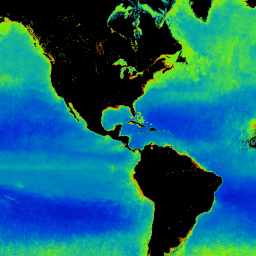
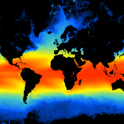
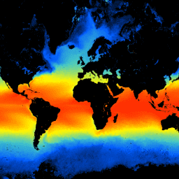
GCOM-C/SGLI L3 Sea Surface Temperature (V1)

This product is the temperature of sea surface. A newer version JAXA/GCOM-C/L3/OCEAN/SST/V3 is also available for this dataset which uses this algorithm for processing. GCOM-C conducts long-term and continuous global observation and data collection to elucidate the mechanism behind fluctuations in radiation budget and carbon … climate g-portal gcom gcom-c jaxa oceans -
GCOM-C/SGLI L3 Sea Surface Temperature (V2)
This product is the temperature of sea surface. For data after 2021-11-28, see the V3 dataset. GCOM-C conducts long-term and continuous global observation and data collection to elucidate the mechanism behind fluctuations in radiation budget and carbon cycle needed to make accurate projections regarding future … climate g-portal gcom gcom-c jaxa oceans -
GCOM-C/SGLI L3 Sea Surface Temperature (V3)
This product is the temperature of sea surface. This is an ongoing dataset with a latency of 3-4 days. GCOM-C conducts long-term and continuous global observation and data collection to elucidate the mechanism behind fluctuations in radiation budget and carbon cycle needed to make accurate … climate g-portal gcom gcom-c jaxa oceans -
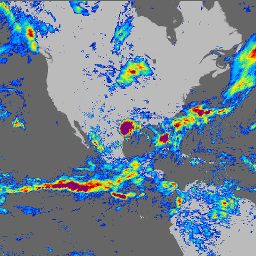
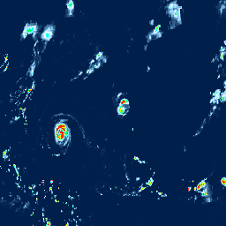
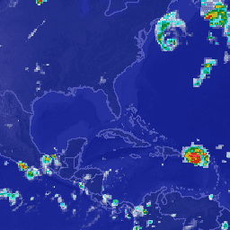
GPM: Global Precipitation Measurement (GPM) Release 07
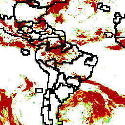
Global Precipitation Measurement (GPM) is an international satellite mission to provide next-generation observations of rain and snow worldwide every three hours. The Integrated Multi-satellitE Retrievals for GPM (IMERG) is the unified algorithm that provides rainfall estimates combining data from all passive-microwave instruments in the GPM … climate geophysical gpm imerg jaxa nasa -
GPM: Monthly Global Precipitation Measurement (GPM) v6
IMERG-Final version "06" stopped being produced in September, 2021. Version "07" is expected to be released in September 2022 Global Precipitation Measurement (GPM) is an international satellite mission to provide next-generation observations of rain and snow worldwide every three hours. The Integrated Multi-satellitE Retrievals for … climate geophysical gpm imerg jaxa monthly -
GPM: Monthly Global Precipitation Measurement (GPM) vRelease 07
Global Precipitation Measurement (GPM) is an international satellite mission to provide next-generation observations of rain and snow worldwide every three hours. The Integrated Multi-satellitE Retrievals for GPM (IMERG) is the unified algorithm that provides rainfall estimates combining data from all passive-microwave instruments in the GPM … climate geophysical gpm imerg jaxa monthly -
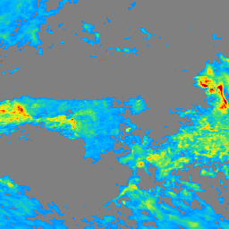
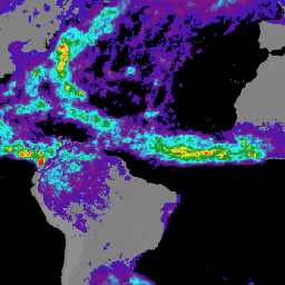
GSMaP Operational: Global Satellite Mapping of Precipitation - V6
Global Satellite Mapping of Precipitation (GSMaP) provides a global hourly rain rate with a 0.1 x 0.1 degree resolution. GSMaP is a product of the Global Precipitation Measurement (GPM) mission, which provides global precipitation observations at three hour intervals. Values are estimated using multi-band passive … climate geophysical gpm hourly jaxa precipitation -
GSMaP Operational: Global Satellite Mapping of Precipitation - V7
Global Satellite Mapping of Precipitation (GSMaP) provides a global hourly rain rate with a 0.1 x 0.1 degree resolution. GSMaP is a product of the Global Precipitation Measurement (GPM) mission, which provides global precipitation observations at three hour intervals. Values are estimated using multi-band passive … climate geophysical gpm hourly jaxa precipitation -
GSMaP Operational: Global Satellite Mapping of Precipitation - V8
Global Satellite Mapping of Precipitation (GSMaP) provides a global hourly rain rate with a 0.1 x 0.1 degree resolution. GSMaP is a product of the Global Precipitation Measurement (GPM) mission, which provides global precipitation observations at three hour intervals. Values are estimated using multi-band passive … climate geophysical gpm hourly jaxa precipitation -
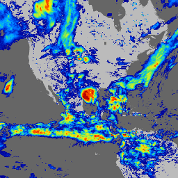
GSMaP Reanalysis: Global Satellite Mapping of Precipitation

Global Satellite Mapping of Precipitation (GSMaP) provides a global hourly rain rate with a 0.1 x 0.1 degree resolution. GSMaP is a product of the Global Precipitation Measurement (GPM) mission, which provides global precipitation observations at three hour intervals. Values are estimated using multi-band passive … climate geophysical gpm hourly jaxa precipitation -
Global 3-class PALSAR-2/PALSAR Forest/Non-Forest Map
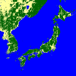
A newer version of this dataset with 4 classes for 2017-2020 can be found in JAXA/ALOS/PALSAR/YEARLY/FNF4 The global forest/non-forest map (FNF) is generated by classifying the SAR image (backscattering coefficient) in the global 25m resolution PALSAR-2/PALSAR SAR mosaic so that strong and low backscatter pixels … alos alos2 classification eroc forest forest-biomass -
Global 4-class PALSAR-2/PALSAR Forest/Non-Forest Map

The global forest/non-forest map (FNF) is generated by classifying the SAR image (backscattering coefficient) in the global 25m resolution PALSAR-2/PALSAR SAR mosaic so that strong and low backscatter pixels are assigned as "forest" and "non-forest", respectively. Here, "forest" is defined as the natural forest with … alos alos2 classification eroc forest forest-biomass -
Global PALSAR-2/PALSAR Yearly Mosaic, version 1

A newer version of this dataset with data for 2015-2021 can be found in JAXA/ALOS/PALSAR/YEARLY/SAR_EPOCH The global 25m PALSAR/PALSAR-2 mosaic is a seamless global SAR image created by mosaicking strips of SAR imagery from PALSAR/PALSAR-2. For each year and location, the strip data were selected … alos alos2 eroc jaxa palsar palsar2 -
Global PALSAR-2/PALSAR Yearly Mosaic, version 2.5.0
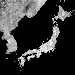
The global 25m PALSAR/PALSAR-2 mosaic is a seamless global SAR image created by mosaicking strips of SAR imagery from PALSAR/PALSAR-2. For each year and location, the strip data were selected through visual inspection of the browse mosaics available over the period, with those showing minimum … alos alos2 eroc jaxa palsar palsar2 -
PALSAR-2 ScanSAR Level 2.2
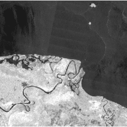
The 25 m PALSAR-2 ScanSAR is normalized backscatter data of PALSAR-2 broad area observation mode with observation width of 350 km. The SAR imagery was ortho-rectificatied and slope corrected using the ALOS World 3D - 30 m (AW3D30) Digital Surface Model. Polarization data are stored … alos2 eroc jaxa palsar2 radar sar -
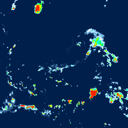
TRMM 3B42: 3-Hourly Precipitation Estimates
The Tropical Rainfall Measuring Mission (TRMM) is a joint mission between NASA and the Japan Aerospace Exploration Agency (JAXA) designed to monitor and study tropical rainfall. The 34B2 product contains a gridded, TRMM-adjusted, merged infrared precipitation (mm/hr) and RMS precipitation-error estimate, with a 3-hour temporal … 3-hourly climate geophysical jaxa nasa precipitation -
TRMM 3B43: Monthly Precipitation Estimates
This collection is no longer being updated. See IMERG monthly This dataset algorithmically merges microwave data from multiple satellites, including SSMI, SSMIS, MHS, AMSU-B and AMSR-E, each inter-calibrated to the TRMM Combined Instrument. Algorithm 3B43 is executed once per calendar month to produce the single, … climate geophysical jaxa nasa precipitation rainfall