-
GHSL: Degree of Urbanization 1975-2030 V2-0 (P2023A)
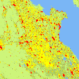
Ten rastrowy zbiór danych przedstawia globalną, wieloczasową klasyfikację obszarów wiejskich i miejskich z zastosowaniem metodologii „Stopień urbanizacji” etapu I zalecanej przez Komisję Statystyczną ONZ na podstawie globalnych danych o populacji i powierzchni zabudowanej w siatce, które zostały wygenerowane przez projekt GHSL dla okresów 1975–2030 w 5-letnich odstępach czasu. Stopień … ghsl jrc population sdg settlement -
GHSL: Global building height 2018 (P2023A)
Ten przestrzenny zbiór danych rastrowych przedstawia globalny rozkład wysokości budynków w rozdzielczości 100 m w odniesieniu do 2018 r. Dane wejściowe używane do przewidywania wysokości budynków to ALOS Global Digital Surface Model (30 m), NASA Shuttle Radar Topographic Mission… alos building built built-environment builtup copernicus -
GHSL: Global building volume 1975-2030 (P2023A)
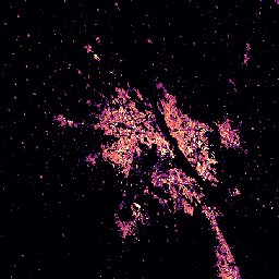
Ten zbiór danych rastrowych przedstawia globalne rozmieszczenie objętości budynków wyrażonej w metrach sześciennych na komórkę siatki o boku 100 m. Zbiór danych zawiera pomiary całkowitej kubatury budynku oraz kubatury budynku przypisanej do komórek siatki o przeważającym zastosowaniu niemieszkalnym (NRES). Prognozy są oparte na … alos building built-environment copernicus dem ghsl -
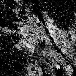
GHSL: Global built-up surface 10m (P2023A)
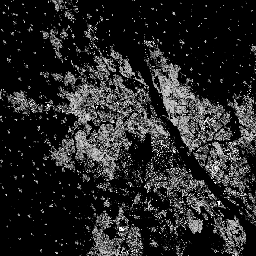
Ten rastrowy zbiór danych przedstawia rozmieszczenie powierzchni zabudowanych w 2018 roku, wyrażone w metrach kwadratowych na komórkę siatki o wymiarach 10 m × 10 m, na podstawie danych obrazów S2. Zbiory danych mierzą: a) łączną powierzchnię zabudowaną i b) powierzchnię zabudowaną przypisaną do komórek siatki o rozmiarach… built built-environment builtup copernicus ghsl jrc -
GHSL: Global built-up surface 1975-2030 (P2023A)
Ten rastrowy zbiór danych przedstawia rozkład powierzchni zabudowanych wyrażony w metrach kwadratowych na komórkę siatki o wymiarach 100 m × 100 m. Zbiór danych zawiera pomiary: a) całkowitej powierzchni zabudowanej i b) powierzchni zabudowanej przypisanej do komórek siatki o przeważającym zastosowaniu niemieszkalnym (NRES). Dane są interpolowane przestrzennie i czasowo lub… built built-environment builtup copernicus ghsl jrc -
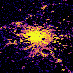
GHSL: Global population surfaces 1975-2030 (P2023A)

Ten rastrowy zbiór danych przedstawia przestrzenny rozkład populacji mieszkalnej wyrażony jako bezwzględna liczba mieszkańców komórki. Szacunki dotyczące populacji w latach 1975–2020 w 5-letnich odstępach oraz prognozy na lata 2025 i 2030 pochodzące z CIESIN GPWv4.11 zostały rozdzielone na podstawie danych ze spisu ludności lub… ghsl jrc population sdg -
GHSL: Global settlement characteristics (10 m) 2018 (P2023A)
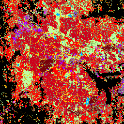
Ten przestrzenny zbiór danych rastrowych wyznacza obszary zamieszkane przez ludzi w rozdzielczości 10 m i opisuje ich wewnętrzne cechy pod względem funkcjonalnych i związanych z wysokością elementów środowiska zabudowanego. Więcej informacji o produktach danych GHSL znajdziesz w raporcie GHSL Data Package 2023… building built builtup copernicus ghsl height
Datasets tagged sdg in Earth Engine
[null,null,[],[],[]]