Page Summary
-
The Consistent and Corrected Nighttime Lights (CCNL) dataset is a reprocessed version of the DMSP OLS Version 4, improved to mitigate inconsistencies and effects like saturation.
-
The DMSP OLS Global Radiance-Calibrated Nighttime Lights Version 4 collection provides global nighttime lights images without sensor saturation.
-
The DMSP OLS Nighttime Lights Time Series Version 4 contains cloud-free composites of nighttime lights data.
-
The JRC Yearly Water Classification History dataset maps the location and temporal distribution of surface water from 1984 to 2021.
-
The Landsat and MODIS Net Primary Production (NPP) CONUS datasets estimate NPP using Landsat and MODIS surface reflectance respectively.
-
The MCD12C1.061 and MCD12Q1.061 MODIS Land Cover Type products provide yearly global land cover types.
-
The MCD12Q2.006 MODIS Land Cover Dynamics product provides global land surface phenology metrics yearly.
-
The MOD17A3HGF.061 and MYD17A3HGF.061 products provide annual Gross and Net Primary Productivity (GPP and NPP) at 500m resolution.
-
CCNL: Consistent and Corrected Nighttime Light Dataset from DMSP-OLS (1992-2013) v1
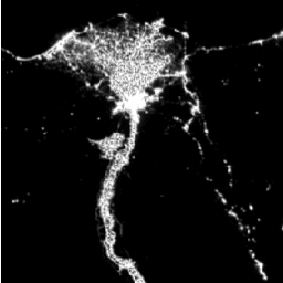
The Consistent and Corrected Nighttime Lights (CCNL) dataset is a reprocessed version of the Defense Meteorological Program (DMSP) Operational Line-Scan System (OLS) Version 4. A series of methods was used to mitigate the impact of inter-annual inconsistency, saturation, and blooming effects and to improve data … dmsp eog imagery lights nighttime ols -
DMSP OLS: Global Radiance-Calibrated Nighttime Lights Version 4, Defense Meteorological Program Operational Linescan System
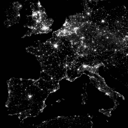
The Defense Meteorological Program (DMSP) Operational Line-Scan System (OLS) has a unique capability to detect visible and near-infrared (VNIR) emission sources at night. This collection contains global nighttime lights images with no sensor saturation. The sensor is typically operated at a high-gain setting to enable … dmsp eog imagery lights nighttime ols -
DMSP OLS: Nighttime Lights Time Series Version 4, Defense Meteorological Program Operational Linescan System

The Defense Meteorological Program (DMSP) Operational Line-Scan System (OLS) has a unique capability to detect visible and near-infrared (VNIR) emission sources at night. Version 4 of the DMSP-OLS Nighttime Lights Time Series consists of cloud-free composites made using all the available archived DMSP-OLS smooth resolution … dmsp eog imagery lights nighttime ols -
JRC Yearly Water Classification History, v1.4
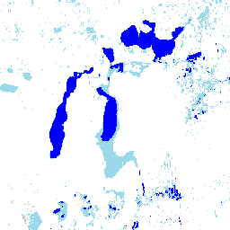
This dataset contains maps of the location and temporal distribution of surface water from 1984 to 2021 and provides statistics on the extent and change of those water surfaces. For more information see the associated journal article: High-resolution mapping of global surface water and its … annual geophysical google history jrc landsat-derived -
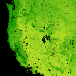
Landsat Net Primary Production CONUS
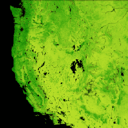
The Landsat Net Primary Production (NPP) CONUS dataset estimates NPP using Landsat Surface Reflectance for CONUS. NPP is the amount of carbon captured by plants in an ecosystem, after accounting for losses due to respiration. NPP is calculated using the MOD17 algorithm (see MOD17 User … conus gridmet-derived landsat mod17 nlcd-derived npp -
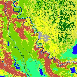
MCD12C1.061 MODIS Land Cover Type Yearly Global 0.05 Deg CMG
The Terra and Aqua combined Moderate Resolution Imaging Spectroradiometer (MODIS) Land Cover Climate Modeling Grid (CMG) (MCD12C1) Version 6.1 data product provides a spatially aggregated and reprojected version of the tiled MCD12Q1 Version 6.1 data product. Maps of the International Geosphere-Biosphere Programme (IGBP), University of … landcover landuse-landcover modis nasa usgs yearly -
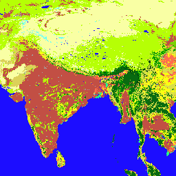
MCD12Q1.061 MODIS Land Cover Type Yearly Global 500m
The Terra and Aqua combined Moderate Resolution Imaging Spectroradiometer (MODIS) Land Cover Type (MCD12Q1) Version 6.1 data product provides global land cover types at yearly intervals. The MCD12Q1 Version 6.1 data product is derived using supervised classifications of MODIS Terra and Aqua reflectance data. Land … landcover landuse-landcover modis nasa usgs yearly -
MCD12Q2.006 Land Cover Dynamics Yearly Global 500m
The Terra and Aqua combined Moderate Resolution Imaging Spectroradiometer (MODIS) Land Cover Dynamics (MCD12Q2) Version 6.1 data product provides global land surface phenology metrics at yearly intervals. The MCD12Q2 Version 6.1 data product is derived from time series of the 2-band Enhanced Vegetation Index (EVI2) … evi global landuse-landcover modis onset-greenness phenology -
MOD17A3HGF.061: Terra Net Primary Production Gap-Filled Yearly Global 500m

The MOD17A3HGF V6.1 product provides information about annual Gross and Net Primary Productivity (GPP and NPP) at 500m pixel resolution. Annual NPP is derived from the sum of all 8-day Net Photosynthesis(PSN) products (MOD17A2H) from the given year. The PSN value is the difference of … global gpp nasa npp photosynthesis plant-productivity -
MODIS Net Primary Production CONUS
The MODIS Net Primary Production (NPP) CONUS dataset estimates NPP using MODIS Surface Reflectance for CONUS. NPP is the amount of carbon captured by plants in an ecosystem, after accounting for losses due to respiration. NPP is calculated using the MOD17 algorithm (see MOD17 User … conus gridmet-derived mod09q1 mod17 modis nlcd-derived -
MYD17A3HGF.061: Aqua Net Primary Production Gap-Filled Yearly Global 500m

The MYD17A3HGF V6.1 product provides information about annual Gross and Net Primary Productivity (GPP and NPP) at 500m pixel resolution. Annual NPP is derived from the sum of all 8-day Net Photosynthesis(PSN) products (MYD17A2H) from the given year. The PSN value is the difference of … aqua global gpp nasa npp photosynthesis