Page Summary
-
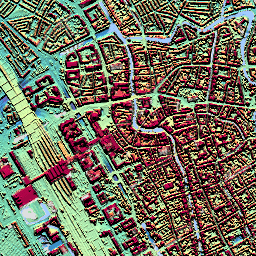
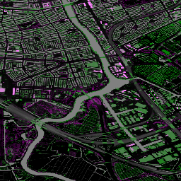
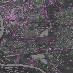
AHN Netherlands provides 0.5m DEMs of the Netherlands derived from LIDAR data, with versions showing ground level only or including above-ground features.
-
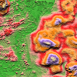
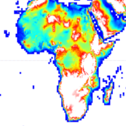
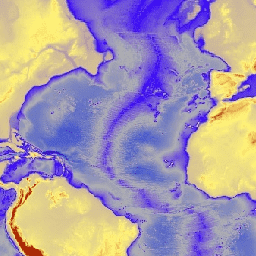
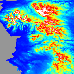
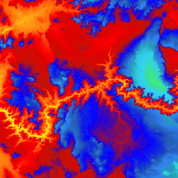
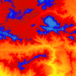
Various global DEM datasets are available, including ALOS DSM (30m), Copernicus DEM GLO-30 (30m), ETOPO1 (1 arc-minute), GMTED2010 (7.5 arc-seconds), GTOPO30 (30 arc-seconds), MERIT DEM (3 arc seconds), and NASA SRTM (30m), some with improved void reduction and accuracy.
-
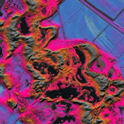
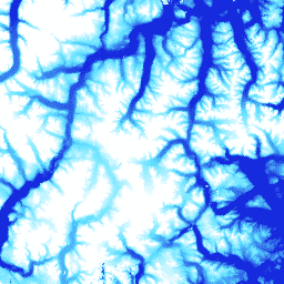
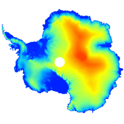
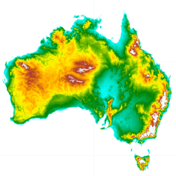
Regional and national DEMs with high resolution are available for specific areas like the Arctic, Australia, Canada, England, France, and Antarctica.
-
Specialized datasets provide building height and volume information globally at 100m resolution.
-
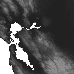
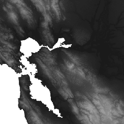
Hydrologically conditioned and void-filled DEMs are available for hydrological applications, like the WWF HydroSHEDS datasets.
-
AHN Netherlands 0.5m DEM, Interpolated
The AHN DEM is a 0.5m DEM covering the Netherlands. It was generated from LIDAR data taken in the spring between 2007 and 2012. It contains ground level samples with all other items above ground (such as buildings, bridges, trees etc.) removed. This version is … ahn dem elevation elevation-topography geophysical lidar -
AHN Netherlands 0.5m DEM, Non-Interpolated
The AHN DEM is a 0.5m DEM covering the Netherlands. It was generated from LIDAR data taken in the spring between 2007 and 2012. It contains ground level samples with all other items above ground (such as buildings, bridges, trees etc.) removed. This version is … ahn dem elevation elevation-topography geophysical lidar -
AHN Netherlands 0.5m DEM, Raw Samples
The AHN DEM is a 0.5m DEM covering the Netherlands. It was generated from LIDAR data taken in the spring between 2007 and 2012. This version contains both ground level samples and items above ground level (such as buildings, bridges, trees etc). The point cloud … ahn dem elevation elevation-topography geophysical lidar -
AHN3: Netherlands AHN 0.5m
The Actueel Hoogtebestand Nederland (AHN) is a dataset with detailed and precise elevation data for the whole of the Netherlands. Elevation information was collected from helicopters and aircraft using laser technology with vertical accuracy of 5 cm. AHN3 Dataset contains the Netherlands AHN 0.5m DSM … ahn dem elevation elevation-topography geophysical lidar -
AHN4: Netherlands AHN 0.5m
The Actueel Hoogtebestand Nederland (AHN) is a dataset with detailed and precise elevation data for the whole of the Netherlands. Elevation information was collected from helicopters and aircraft using laser technology with vertical accuracy of 5 cm. AHN4 Dataset contains the Netherlands AHN 0.5m DSM … ahn dem elevation elevation-topography geophysical lidar -
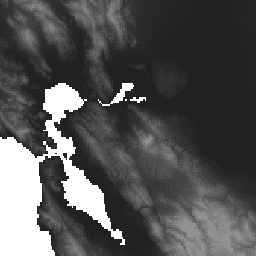
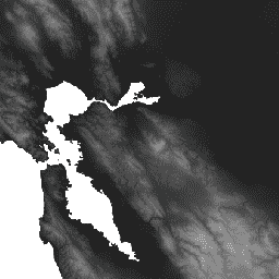
ALOS DSM: Global 30m v4.1

ALOS World 3D - 30m (AW3D30) is a global digital surface model (DSM) dataset with a horizontal resolution of approximately 30 meters (1 arcsec mesh). The dataset is based on the DSM dataset (5-meter mesh version) of the World 3D Topographic Data. More details are … alos dem elevation elevation-topography geophysical jaxa -
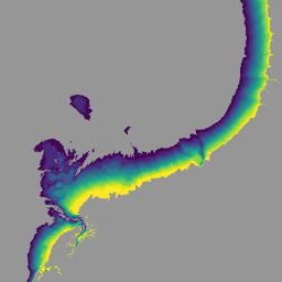
ArcticDEM Mosaic V4.1

ArcticDEM is a National Geospatial-Intelligence Agency (NGA) and National Science Foundation (NSF) public-private initiative to automatically produce a high-resolution, high-quality digital surface model (DSM) of the Arctic using optical stereo imagery, high-performance computing, and open source photogrammetry software. It includes vegetation, tree canopy, buildings, and … arctic dem elevation-topography geophysical pgc umn -
ArcticDEM Strips
ArcticDEM is a National Geospatial-Intelligence Agency (NGA) and National Science Foundation (NSF) public-private initiative to automatically produce a high-resolution, high-quality digital surface model (DSM) of the Arctic using optical stereo imagery, high-performance computing, and open source photogrammetry software. It includes vegetation, tree canopy, buildings, and … arctic dem elevation-topography geophysical pgc umn -
Australian 5M DEM
The Digital Elevation Model (DEM) 5 meter Grid of Australia derived from LiDAR model represents a National 5 meter (bare earth) DEM which has been derived from some 236 individual LiDAR surveys between 2001 and 2015 covering an area in excess of 245,000 square kilometers. … australia dem elevation elevation-topography ga geophysical -
Canadian Digital Elevation Model
The Canadian Digital Elevation Model (CDEM) is part of Natural Resources Canada's (NRCan) altimetry system and stems from the existing Canadian Digital Elevation Data (CDED). In these data, elevations can be either ground or reflective surface elevations. The CDEM is comprised of multiple DEMs with … canada dem elevation elevation-topography geophysical topography -
Copernicus DEM GLO-30: Global 30m Digital Elevation Model
The Copernicus DEM is a Digital Surface Model (DSM) which represents the surface of the Earth including buildings, infrastructure and vegetation. This DEM is derived from an edited DSM named WorldDEM™, i.e., flattening of water bodies and consistent flow of rivers has been included. Editing … copernicus dem elevation elevation-topography geophysical -
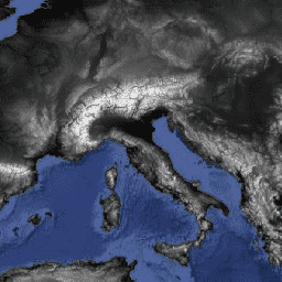
CryoSat-2 Antarctica 1km DEM
This dataset is a digital elevation model (DEM) of the Antarctic ice sheet and ice shelves based on observations recorded by the CryoSat-2 satellite radar altimeter between July 2010 and July 2016. The DEM is formed from spatio-temporal fits to elevation measurements accumulated within 1, … antarctica dem elevation elevation-topography polar -
DEM-H: Australian SRTM Hydrologically Enforced Digital Elevation Model
The Hydrologically Enforced Digital Elevation Model (DEM-H) was derived from the SRTM data acquired by NASA in February 2000. The model has been hydrologically conditioned and drainage enforced. The DEM-H captures flow paths based on SRTM elevations and mapped stream lines, and supports delineation of … australia dem elevation elevation-topography ga geophysical -
DEM-S: Australian Smoothed Digital Elevation Model

The Smoothed Digital Elevation Model (DEM-S) was derived from the SRTM data acquired by NASA in February 2000. DEM-S represents ground surface topography (excluding vegetation features) and has been smoothed to reduce noise and improve the representation of surface shape. An adaptive process applied more … australia dem elevation elevation-topography ga geophysical -
ETOPO1: Global 1 Arc-Minute Elevation
ETOPO1 is a 1 arc-minute global relief model of Earth''s surface that integrates land topography and ocean bathymetry. It was built from numerous global and regional data sets. It contains two elevation bands: ice_surface and bedrock. bedrock dem elevation elevation-topography geophysical ice -
England 1m Composite DTM/DSM (Environment Agency)
The LIDAR Composite DTM/DSM is a raster terrain model covering ~99% of England at 1m spatial resolution, produced by the UK Environment Agency in 2022. The model contains 3 bands of terrain data: a Digital Terrain Model (DTM), a first return Digital Surface Model (DSM), … dem elevation elevation-topography lidar -
GHSL: Global building height 2018 (P2023A)
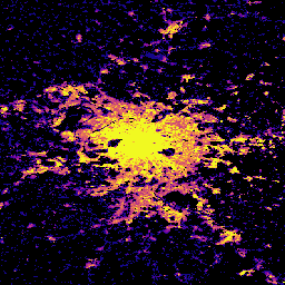
This spatial raster dataset depicts the global distribution of building heights at a resolution of 100 m, referred to the year 2018. The input data used to predict building heights are the ALOS Global Digital Surface Model (30 m), the NASA Shuttle Radar Topographic Mission … alos building built built-environment builtup copernicus -
GHSL: Global building volume 1975-2030 (P2023A)
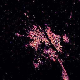
This raster dataset depicts the global distribution of building volume, expressed in cubic metres per 100 m grid cell. The dataset measures the total building volume and the building volume allocated to grid cells of predominant non-residential (NRES) use. Estimates are based on the built-up … alos building built-environment copernicus dem ghsl -
GMTED2010: Global Multi-resolution Terrain Elevation Data 2010
The Global Multi-resolution Terrain Elevation Data 2010 (GMTED2010) dataset contains elevation data for the globe collected from various sources at 7.5 arc-seconds resolution. More details are available in the dataset report. The primary source dataset for GMTED2010 is NGA''s SRTM Digital Terrain Elevation Data (DTED®, … dem elevation elevation-topography geophysical srtm topography -
GTOPO30: Global 30 Arc-Second Elevation
GTOPO30 is a global digital elevation model (DEM) with a horizontal grid spacing of 30 arc seconds (approximately 1 kilometer). The DEM was derived from several raster and vector sources of topographic information. Completed in late 1996, GTOPO30 was developed over a three-year period through … dem elevation elevation-topography geophysical nasa topography -
MERIT DEM: Multi-Error-Removed Improved-Terrain DEM
MERIT DEM a high accuracy global DEM at 3 arc second resolution (~90 m at the equator) produced by eliminating major error components from existing DEMs (NASA SRTM3 DEM, JAXA AW3D DEM, Viewfinder Panoramas DEM). MERIT DEM separates absolute bias, stripe noise, speckle noise and … dem elevation elevation-topography merit topography -
MERIT Hydro: Global Hydrography Datasets
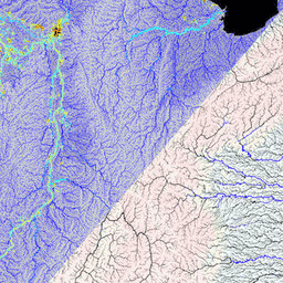
MERIT Hydro is a new global flow direction map at 3 arc-second resolution (~90 m at the equator) derived from the version 1.0.3 of the MERIT DEM elevation data and water body datasets (G1WBM, GSWO and OpenStreetMap). MERIT Hydro contains the output of a new … dem elevation hydrography hydrosheds merit river-width -
NASA SRTM Digital Elevation 30m

The Shuttle Radar Topography Mission (SRTM, see Farr et al. 2007) digital elevation data is an international research effort that obtained digital elevation models on a near-global scale. This SRTM V3 product (SRTM Plus) is provided by NASA JPL at a resolution of 1 arc-second … dem elevation elevation-topography geophysical nasa srtm -
NASADEM: NASA 30m Digital Elevation Model
NASADEM is a reprocessing of SRTM data, with improved accuracy by incorporating auxiliary data from ASTER GDEM, ICESat GLAS, and PRISM datasets. The most significant processing improvements involve void reduction through improved phase unwrapping and using ICESat GLAS data for control. Documentation: User's Guide dem elevation elevation-topography geophysical nasa srtm -
NEON Digital Elevation Model (DEM)
Digital models of the surface (DSM) and terrain (DTM) derived from NEON LiDAR data. DSM: Surface features (topographic information with vegetation and man-made structures present). DTM: Bare earth elevation (topographic information with vegetation and man-made structures removed). Images are given in meters above mean sea … airborne dem elevation-topography forest highres lidar -
Preview National Intertidal Digital Elevation Model 25m 1.0.0
The National Intertidal Digital Elevation Model (NIDEM; Bishop-Taylor et al. 2018, 2019) is a continental-scale elevation dataset for Australia's exposed intertidal zone. NIDEM provides the first three-dimensional representation of Australia's intertidal sandy beaches and shores, tidal flats and rocky shores and reefs at 25 m … australia dem elevation-topography ga -
REMA Mosaic

The Reference Elevation Model of Antarctica (REMA) is a high resolution, time-stamped Digital Surface Model (DSM) of Antarctica at 2-meter and 8-meter spatial resolutions. Mosaicked DEM files are compiled from multiple strips that have been co-registered, blended, and feathered to reduce edge-matching artifacts. dem elevation-topography geophysical pgc rema umn -
REMA Strips 2m

The Reference Elevation Model of Antarctica (REMA) is a high resolution, time-stamped Digital Surface Model (DSM) of Antarctica at 2-meter and 8-meter spatial resolutions. Strip DEM files correspond to the overlapping area of the input stereoscopic imagery pair strips as they are collected by DigitalGlobe's … dem elevation-topography geophysical pgc rema umn -
REMA Strips 8m

The Reference Elevation Model of Antarctica (REMA) is a high resolution, time-stamped Digital Surface Model (DSM) of Antarctica at 2-meter and 8-meter spatial resolutions. Strip DEM files correspond to the overlapping area of the input stereoscopic imagery pair strips as they are collected by DigitalGlobe's … dem elevation-topography geophysical pgc rema umn -
RGE ALTI: IGN RGE ALTI Digital Elevation 1m
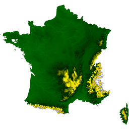
The RGE ALTI dataset describes the digital elevation model (DEM) of France with the pixel size of 1m. It was created from surveys obtained by airborne lidar or by correlation of aerial images. Lidar was deployed for flood-prone, coastal, and large forest areas. The vertical … dem elevation elevation-topography geophysical -
SRTM Digital Elevation Data Version 4
The Shuttle Radar Topography Mission (SRTM) digital elevation dataset was originally produced to provide consistent, high-quality elevation data at near global scope. This version of the SRTM digital elevation data has been processed to fill data voids, and to facilitate its ease of use. dem elevation elevation-topography geophysical srtm topography -
USGS 3DEP 10m National Map Seamless (1/3 Arc-Second)
This is the seamless 3DEP DEM dataset for the U.S. with full coverage of the 48 conterminous states, Hawaii, and U.S. territories. Alaska coverage is partially available now and is being expanded to statewide coverage as part of the Alaska Mapping Initiative. Ground spacing is … 3dep dem elevation elevation-topography geophysical topography -
USGS 3DEP 1m National Map
This is a tiled collection of images with 1m pixel size from the 3D Elevation Program (3DEP). The 3DEP data holdings serve as the elevation layer of The National Map and provide foundational elevation information for earth science studies and mapping applications in the United … 3dep dem elevation elevation-topography geophysical topography -
WWF HydroSHEDS Hydrologically Conditioned DEM, 15 Arc-Seconds
HydroSHEDS is a mapping product that provides hydrographic information for regional and global-scale applications in a consistent format. It offers a suite of geo-referenced datasets (vector and raster) at various scales, including river networks, watershed boundaries, drainage directions, and flow accumulations. HydroSHEDS is based on … conditioned dem elevation geophysical hydrography hydrology -
WWF HydroSHEDS Hydrologically Conditioned DEM, 3 Arc-Seconds
HydroSHEDS is a mapping product that provides hydrographic information for regional and global-scale applications in a consistent format. It offers a suite of geo-referenced datasets (vector and raster) at various scales, including river networks, watershed boundaries, drainage directions, and flow accumulations. HydroSHEDS is based on … conditioned dem elevation geophysical hydrography hydrology -
WWF HydroSHEDS Hydrologically Conditioned DEM, 30 Arc-Seconds
HydroSHEDS is a mapping product that provides hydrographic information for regional and global-scale applications in a consistent format. It offers a suite of geo-referenced datasets (vector and raster) at various scales, including river networks, watershed boundaries, drainage directions, and flow accumulations. HydroSHEDS is based on … conditioned dem elevation geophysical hydrography hydrology -
WWF HydroSHEDS Void-Filled DEM, 3 Arc-Seconds
HydroSHEDS is a mapping product that provides hydrographic information for regional and global-scale applications in a consistent format. It offers a suite of geo-referenced datasets (vector and raster) at various scales, including river networks, watershed boundaries, drainage directions, and flow accumulations. HydroSHEDS is based on … dem elevation geophysical hydrography hydrology hydrosheds