-
GPW – Jährliche dominante Klasse von Grasland – Version 1
Dieses Dataset enthält globale jährliche Karten der dominanten Klasse von Grünland (kultiviert und natürlich/naturnah) für den Zeitraum von 2000 bis 2022 mit einer räumlichen Auflösung von 30 m. Die von der Initiative „Land & Carbon Lab Global Pasture Watch“ erstellte Karte der Graslandfläche umfasst alle Landbedeckungstypen, die mindestens 30% … global global-pasture-watch land landcover landuse landuse-landcover -
GPW – Jährliche Wahrscheinlichkeiten von Anbauflächen für Grasland, Version 1
Dieses Dataset enthält globale jährliche Wahrscheinlichkeitskarten von kultiviertem Grünland für den Zeitraum von 2000 bis 2022 mit einer räumlichen Auflösung von 30 m. Die von der Initiative „Land & Carbon Lab Global Pasture Watch“ erstellte Karte der Graslandfläche umfasst alle Arten der Landbedeckung, die mindestens 30% trockenes oder … global global-pasture-watch land landcover landuse landuse-landcover -
GPW – Jährliche Wahrscheinlichkeiten von natürlichen/naturnahen Grasflächen, Version 1
Dieses Dataset enthält globale jährliche Wahrscheinlichkeitskarten von natürlichen/naturnahen Grasflächen für den Zeitraum 2000 bis 2022 mit einer räumlichen Auflösung von 30 m. Die von der Initiative „Land & Carbon Lab Global Pasture Watch“ erstellte Karte der Graslandfläche umfasst alle Arten der Landbedeckung, die mindestens 30% trockenes oder … global global-pasture-watch land landcover landuse landuse-landcover -
RCMAP Rangeland Component Timeseries (1985-2023), v06
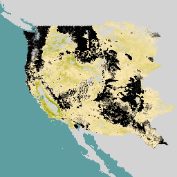
'Der RCMAP-Datensatz (Rangeland Condition Monitoring Assessment and Projection) quantifiziert die prozentuale Abdeckung von Weidelandkomponenten in West-Nordamerika anhand von Landsat-Bildern aus dem Zeitraum 1985 bis 2023. Die RCMAP-Produktfamilie besteht aus zehn Komponenten: jährliche krautige Pflanzen, unbewachsener Boden, krautige Pflanzen, Streu, Nicht-Beifuß-Sträucher, mehrjährige krautige Pflanzen, Beifuß, … climate-change disturbance landsat-derived landuse-landcover nlcd rangeland -
RCMAP Rangeland Trends Year for Component Timeseries (1985-2023), v06
Diese Sammlung umfasst jährliche RCMAP-Produkte von 1985 bis 2023. Im RCMAP-Dataset (Rangeland Condition Monitoring Assessment and Projection) wird der prozentuale Anteil der Rangeland-Komponenten in West-Nordamerika anhand von Landsat-Bildern aus dem Zeitraum 1985 bis 2023 quantifiziert. Die RCMAP-Produktreihe besteht aus zehn fraktionierten Komponenten: jährlich … climate-change disturbance landsat-derived landuse-landcover nlcd rangeland -
RCMAP Rangeland Trends for Component Timeseries (1985-2023), v06
Im RCMAP-Dataset (Rangeland Condition Monitoring Assessment and Projection) wird der prozentuale Anteil der Rangeland-Komponenten in West-Nordamerika anhand von Landsat-Bildern aus dem Zeitraum 1985 bis 2023 quantifiziert. Die RCMAP-Produktfamilie besteht aus zehn Komponenten: jährliche krautige Pflanzen, unbewachsener Boden, krautige Pflanzen, Streu, Nicht-Beifuß-Sträucher, mehrjährige krautige Pflanzen, Beifuß, … climate-change disturbance landsat-derived landuse-landcover nlcd rangeland
Datasets tagged rangeland in Earth Engine
[null,null,[],[[["\u003cp\u003eThe RCMAP dataset uses Landsat imagery to quantify the percent cover of ten rangeland components across western North America from 1985-2023, including annual herbaceous, bare ground, and sagebrush.\u003c/p\u003e\n"],["\u003cp\u003eRCMAP products provide insights into rangeland condition, trends, and disturbances, offering valuable information for land management and climate change studies.\u003c/p\u003e\n"],["\u003cp\u003eYearly RCMAP products are available from 1985 through 2023, allowing for the analysis of long-term changes in rangeland ecosystems.\u003c/p\u003e\n"]]],[],null,["# Datasets tagged rangeland in Earth Engine\n\n-\n\n |-------------------------------------------------------------------------------------------------------------------------------------------------------------------------------------------------------------------------------------------------------------------------------------------------------------------------------------|\n | [### GPW Annual Dominant Class of Grasslands v1](/earth-engine/datasets/catalog/projects_global-pasture-watch_assets_ggc-30m_v1_grassland_c) |\n | This dataset provides global annual dominant class maps of grasslands (cultivated and natural/semi-natural) from 2000 to 2022 at 30-m spatial resolution. Produced by Land \\& Carbon Lab Global Pasture Watch initiative, the mapped grassland extent includes any land cover type, which contains at least 30% ... |\n | [global](/earth-engine/datasets/tags/global) [global-pasture-watch](/earth-engine/datasets/tags/global-pasture-watch) [land](/earth-engine/datasets/tags/land) [landcover](/earth-engine/datasets/tags/landcover) [landuse](/earth-engine/datasets/tags/landuse) [landuse-landcover](/earth-engine/datasets/tags/landuse-landcover) |\n\n-\n\n |-------------------------------------------------------------------------------------------------------------------------------------------------------------------------------------------------------------------------------------------------------------------------------------------------------------------------------------|\n | [### GPW Annual Probabilities of Cultivated Grasslands v1](/earth-engine/datasets/catalog/projects_global-pasture-watch_assets_ggc-30m_v1_cultiv-grassland_p) |\n | This dataset provides global annual probability maps of cultivated grassland from 2000 to 2022 at 30-m spatial resolution. Produced by Land \\& Carbon Lab Global Pasture Watch initiative, the mapped grassland extent includes any land cover type, which contains at least 30% of dry or ... |\n | [global](/earth-engine/datasets/tags/global) [global-pasture-watch](/earth-engine/datasets/tags/global-pasture-watch) [land](/earth-engine/datasets/tags/land) [landcover](/earth-engine/datasets/tags/landcover) [landuse](/earth-engine/datasets/tags/landuse) [landuse-landcover](/earth-engine/datasets/tags/landuse-landcover) |\n\n-\n\n |-------------------------------------------------------------------------------------------------------------------------------------------------------------------------------------------------------------------------------------------------------------------------------------------------------------------------------------|\n | [### GPW Annual Probabilities of Natural/Semi-natural Grasslands v1](/earth-engine/datasets/catalog/projects_global-pasture-watch_assets_ggc-30m_v1_nat-semi-grassland_p) |\n | This dataset provides global annual probability maps of natural/semi-natural grassland from 2000 to 2022 at 30-m spatial resolution. Produced by Land \\& Carbon Lab Global Pasture Watch initiative, the mapped grassland extent includes any land cover type, which contains at least 30% of dry or ... |\n | [global](/earth-engine/datasets/tags/global) [global-pasture-watch](/earth-engine/datasets/tags/global-pasture-watch) [land](/earth-engine/datasets/tags/land) [landcover](/earth-engine/datasets/tags/landcover) [landuse](/earth-engine/datasets/tags/landuse) [landuse-landcover](/earth-engine/datasets/tags/landuse-landcover) |\n\n-\n\n |------------------------------------------------------------------------------------------------------------------------------------------------------------------------------------------------------------------------------------------------------------------------------------------------------------------------------------------------------------------------------------|\n | [### RCMAP Rangeland Component Timeseries (1985-2023), v06](/earth-engine/datasets/catalog/USGS_NLCD_RELEASES_2023_REL_RCMAP_V6_COVER) |\n | 'The RCMAP (Rangeland Condition Monitoring Assessment and Projection) dataset quantifies the percent cover of rangeland components across western North America using Landsat imagery from 1985-2023. The RCMAP product suite consists of ten fractional components: annual herbaceous, bare ground, herbaceous, litter, non-sagebrush shrub, perennial herbaceous, sagebrush, ... |\n | [climate-change](/earth-engine/datasets/tags/climate-change) [disturbance](/earth-engine/datasets/tags/disturbance) [landsat-derived](/earth-engine/datasets/tags/landsat-derived) [landuse-landcover](/earth-engine/datasets/tags/landuse-landcover) [nlcd](/earth-engine/datasets/tags/nlcd) [rangeland](/earth-engine/datasets/tags/rangeland) |\n\n-\n\n |-------------------------------------------------------------------------------------------------------------------------------------------------------------------------------------------------------------------------------------------------------------------------------------------------------------------------------------------------------|\n | [### RCMAP Rangeland Trends Year for Component Timeseries (1985-2023), v06](/earth-engine/datasets/catalog/USGS_NLCD_RELEASES_2023_REL_RCMAP_V6_TRENDS_YEAR) |\n | This collection includes RCMAP yearly products from 1985 through 2023. The RCMAP (Rangeland Condition Monitoring Assessment and Projection) dataset quantifies the percent cover of rangeland components across western North America using Landsat imagery from 1985-2023. The RCMAP product suite consists of ten fractional components: annual ... |\n | [climate-change](/earth-engine/datasets/tags/climate-change) [disturbance](/earth-engine/datasets/tags/disturbance) [landsat-derived](/earth-engine/datasets/tags/landsat-derived) [landuse-landcover](/earth-engine/datasets/tags/landuse-landcover) [nlcd](/earth-engine/datasets/tags/nlcd) [rangeland](/earth-engine/datasets/tags/rangeland) |\n\n-\n\n |-----------------------------------------------------------------------------------------------------------------------------------------------------------------------------------------------------------------------------------------------------------------------------------------------------------------------------------------------------------------------------------|\n | [### RCMAP Rangeland Trends for Component Timeseries (1985-2023), v06](/earth-engine/datasets/catalog/USGS_NLCD_RELEASES_2023_REL_RCMAP_V6_TRENDS) |\n | The RCMAP (Rangeland Condition Monitoring Assessment and Projection) dataset quantifies the percent cover of rangeland components across western North America using Landsat imagery from 1985-2023. The RCMAP product suite consists of ten fractional components: annual herbaceous, bare ground, herbaceous, litter, non-sagebrush shrub, perennial herbaceous, sagebrush, ... |\n | [climate-change](/earth-engine/datasets/tags/climate-change) [disturbance](/earth-engine/datasets/tags/disturbance) [landsat-derived](/earth-engine/datasets/tags/landsat-derived) [landuse-landcover](/earth-engine/datasets/tags/landuse-landcover) [nlcd](/earth-engine/datasets/tags/nlcd) [rangeland](/earth-engine/datasets/tags/rangeland) |"]]