-
Globale jährliche Mangrovenausdehnung (1984–2023)

Das Dataset CGMD-Extent30 (Continuous Global Mangrove Dynamics – jährliche Mangrovenausdehnung mit einer Auflösung von 30 m) enthält Daten zur globalen jährlichen Mangrovenausdehnung von 1984 bis 2023. Das Dataset wird als einzelne Earth Engine-FeatureCollection verteilt, wobei jedes Feature ein kartiertes Mangrovenpolygon für ein bestimmtes Jahr darstellt. Das Dataset … annual coastal forest-biomass global landsat-derived landuse-landcover -
Globale jährliche Mangroven-Kronendeckung (1984–2023)

Dieses Dataset enthält Daten zur globalen jährlichen Mangroven-Kronendeckung (Fractional Canopy Cover, FCC) mit einer räumlichen Auflösung von 30 m für den Zeitraum von 1984 bis 2023. Es soll groß angelegte Analysen der langfristigen Mangrovendynamik unterstützen, einschließlich des Abbaus und der Erholung der Kronendeckung, der Bewertung von Blue Carbon und des Monitorings von Küstenökosystemen. Die FCC quantifiziert den Anteil jedes Landsat-… annual coastal forest-biomass global landsat-derived mangrove -
Globale Verteilung von Mangrovenwäldern, Version 1 (2000)

Die Datenbank wurde anhand von Landsat-Satellitendaten aus dem Jahr 2000 erstellt. Mehr als 1.000 Landsat-Szenen, die vom USGS Earth Resources Observation and Science Center (EROS) stammen, wurden mithilfe von hybriden überwachten und nicht überwachten digitalen Bildklassifizierungstechniken klassifiziert. Diese Datenbank ist die erste und … annual ciesin forest-biomass global landsat-derived mangrove -
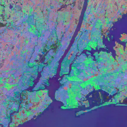
JRC Yearly Water Classification History, Version 1.4

Dieser Datensatz enthält Karten der Standort- und zeitlichen Verteilung von Oberflächenwasser von 1984 bis 2021 sowie Statistiken zur Ausdehnung und Veränderung dieser Wasseroberflächen. Weitere Informationen finden Sie im zugehörigen Zeitschriftenartikel: High-resolution mapping of global surface water and its … annual geophysical google history jrc landsat-derived -
MOD44B.061 Terra Vegetation Continuous Fields Yearly Global 250m

Das Terra MODIS Vegetation Continuous Fields (VCF)-Produkt ist eine Darstellung von Schätzungen der Oberflächenvegetationsbedeckung auf Subpixel-Ebene weltweit. Es wurde entwickelt, um die terrestrische Oberfläche der Erde kontinuierlich als Anteil der grundlegenden Vegetationseigenschaften darzustellen. Es bietet eine Abstufung von drei Oberflächenbedeckungskomponenten: prozentualer Baumbestand, prozentuale … annual geophysical global landuse-landcover modis nasa -
Open Buildings Temporal V1

Das Open Buildings 2.5D Temporal Dataset enthält Daten zur Gebäudeanwesenheit, zu anteiligen Gebäudezahlen und zu Gebäudehöhen mit einer effektiven räumlichen Auflösung von 4 m (Raster werden mit einer Auflösung von 0, 5 m bereitgestellt) in jährlichen Abständen von 2016 bis 2023. Es wird aus Open-Source-Bildern mit niedriger Auflösung aus dem … africa annual asia built-up height open-buildings -
Satellite Embedding V1
Das Google Satellite Embedding Dataset ist eine globale, analysereife Sammlung von gelernten raumbezogenen Einbettungen. Jedes 10-Meter-Pixel in diesem Dataset ist eine 64-dimensionale Darstellung oder ein „Einbettungsvektor“, der zeitliche Verläufe der Oberflächenbedingungen an und um dieses Pixel herum codiert, wie sie von verschiedenen … annual global google landsat-derived satellite-imagery sentinel1-derived -
VIIRS Nighttime Day/Night Annual Band Composites V2.1

Das jährliche globale VIIRS-Dataset für Nachtlichter ist eine Zeitreihe, die aus monatlichen wolkenfreien durchschnittlichen Strahlungsrastern für den Zeitraum von 2013 bis 2021 erstellt wurde. Daten für 2022 sind im Dataset NOAA/VIIRS/DNB/ANNUAL_V22 verfügbar. In einem ersten Filterschritt wurden sonnenbeschienene, mondbeschienene und bewölkte Pixel entfernt, was zu groben Composites führte, die … annual dnb eog lights nighttime noaa -
VIIRS Nighttime Day/Night Annual Band Composites V2.2

Das jährliche globale VIIRS-Dataset für Nachtlichter ist eine Zeitreihe, die aus monatlichen wolkenfreien durchschnittlichen Strahlungsrastern für 2022 erstellt wurde. Daten für frühere Jahre sind im Dataset NOAA/VIIRS/DNB/ANNUAL_V21 verfügbar. In einem ersten Filterschritt wurden sonnenbeschienene, mondbeschienene und bewölkte Pixel entfernt, was zu groben Composites führte, die … annual dnb eog lights nighttime noaa
Datasets tagged annual in Earth Engine
[null,null,[],[],["The datasets provide annual global information on various Earth features. The Open Buildings dataset offers building presence, counts, and heights from 2016-2023. JRC data maps surface water distribution and changes from 1984-2021. Another dataset, based on data from 2000, details mangrove forest distribution. MODIS data provides continuous vegetation cover estimates, including tree cover percentages. Lastly, VIIRS data sets map annual nighttime light composites from 2013-2022, based on cloud-free average radiance grids.\n"]]