Page Summary
-
Harmonized Sentinel-2 MSI data has been adjusted to ensure consistency in value ranges across newer and older scenes.
-
The Landsat Image Mosaic of Antarctica (LIMA) offers seamless, cloudless mosaics of processed Landsat 7 ETM+ scenes, including 16-bit and pan-sharpened versions.
-
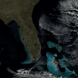
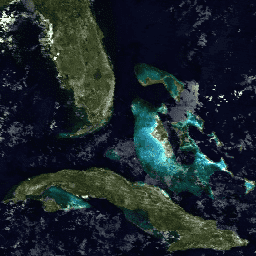
MODIS Surface Reflectance products from both Terra and Aqua satellites provide atmospheric corrected spectral reflectance estimates at various resolutions and temporal frequencies.
-
The NICFI Satellite Data Program Basemaps offer high-resolution satellite data for tropical forest monitoring across Africa, the Americas, and Asia.
-
NOAA provides Climate Data Records including AVHRR Surface Reflectance and GRIDSAT-B1 Geostationary IR Channel Brightness Temperature.
-
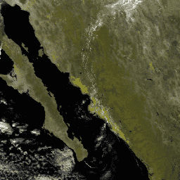
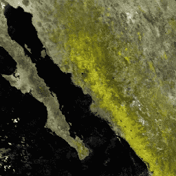
USGS Landsat Level 2 Collection 2 data from Landsat 4, 5, 7, 8, and 9 satellites provide atmospherically corrected surface reflectance and land surface temperature.
-
VIIRS Surface Reflectance products from the Suomi NPP satellite offer daily and 8-day composite estimates of land surface reflectance.
-
Harmonized Sentinel-2 MSI: MultiSpectral Instrument, Level-2A (SR)
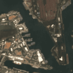
After 2022-01-25, Sentinel-2 scenes with PROCESSING_BASELINE '04.00' or above have their DN (value) range shifted by 1000. The HARMONIZED collection shifts data in newer scenes to be in the same range as in older scenes. Sentinel-2 is a wide-swath, high-resolution, multi-spectral imaging mission supporting Copernicus … copernicus esa eu msi reflectance satellite-imagery -
Landsat Collection 2 Tier 1 Level 2 32-Day Composite

These Landsat Collection 2 Tier 1 Level 2 composites are made from Tier 1 Level 2 orthorectified scenes, and include the SR bands: blue, green, red, nir, swir1, swir2, and thermal. These composites are created from all the scenes in each 32-day period beginning from … landsat landsat-composite satellite-imagery sr usgs -
Landsat Collection 2 Tier 1 Level 2 8-Day Composite
These Landsat Collection 2 Tier 1 Level 2 composites are made from Tier 1 Level 2 orthorectified scenes, and include the SR bands: blue, green, red, nir, swir1, swir2, and thermal. These composites are created from all the scenes in each 8-day period beginning from … landsat landsat-composite satellite-imagery sr usgs -
Landsat Collection 2 Tier 1 Level 2 Annual Composite

These Landsat Collection 2 Tier 1 Level 2 composites are made from Tier 1 Level 2 orthorectified scenes, and include the SR bands: blue, green, red, nir, swir1, swir2, and thermal. These composites are created from all the scenes in each annual period beginning from … landsat landsat-composite satellite-imagery sr usgs -
Landsat Image Mosaic of Antarctica (LIMA) - Processed Landsat Scenes (16 bit)
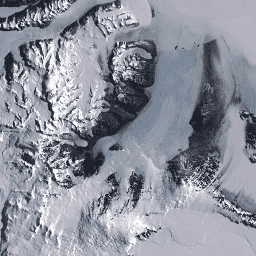
The Landsat Image Mosaic of Antarctica (LIMA) is a seamless and virtually cloudless mosaic created from processed Landsat 7 ETM+ scenes. Processed Landsat Scenes (16 bit) are Level 1Gt NLAPS scenes converted to 16 bit, processed with sun-angle correction, and converted to reflectance values (Bindschadler … antarctica ice landsat-derived lima mosaic satellite-imagery -
Landsat Image Mosaic of Antarctica (LIMA) - Processed Landsat Scenes (16 bit) Metadata
The Landsat Image Mosaic of Antarctica (LIMA) is a seamless and virtually cloudless mosaic created from processed Landsat 7 ETM+ scenes. Processed Landsat Scenes (16 bit) are Level 1Gt NLAPS scenes converted to 16 bit, processed with sun-angle correction, and converted to reflectance values (Bindschadler … antarctica ice landsat-derived lima mosaic satellite-imagery -
Landsat Image Mosaic of Antarctica (LIMA) 16-Bit Pan-Sharpened Mosaic

The Landsat Image Mosaic of Antarctica (LIMA) is a seamless and virtually cloudless mosaic created from processed Landsat 7 ETM+ scenes. This LIMA dataset is the 16-bit Intermediate LIMA. The mosaic consists of pan-sharpened normalized surface reflectance scenes (Landsat ETM+ bands 1, 2, 3, and … antarctica ice landsat-derived lima mosaic satellite-imagery -
MOD09A1.061 Terra Surface Reflectance 8-Day Global 500m

The MOD09A1 V6.1 product provides an estimate of the surface spectral reflectance of Terra MODIS bands 1-7 at 500m resolution and corrected for atmospheric conditions such as gasses, aerosols, and Rayleigh scattering. Along with the seven reflectance bands is a quality layer and four observation … 8-day global modis nasa satellite-imagery sr -
MOD09GA.061 Terra Surface Reflectance Daily Global 1km and 500m
The MODIS Surface Reflectance products provide an estimate of the surface spectral reflectance as it would be measured at ground level in the absence of atmospheric scattering or absorption. Low-level data are corrected for atmospheric gases and aerosols. MOD09GA version 6.1 provides bands 1-7 in … daily global modis nasa satellite-imagery sr -
MOD09GQ.061 Terra Surface Reflectance Daily Global 250m
The MODIS Surface Reflectance products provide an estimate of the surface spectral reflectance as it would be measured at ground level in the absence of atmospheric scattering or absorption. Low-level data are corrected for atmospheric gases and aerosols. MOD09GQ version 6.1 provides bands 1 and … daily global modis nasa satellite-imagery sr -
MOD09Q1.061 Terra Surface Reflectance 8-Day Global 250m
The MOD09Q1 product provides an estimate of the surface spectral reflectance of bands 1 and 2 at 250m resolution and corrected for atmospheric conditions such as gasses, aerosols, and Rayleigh scattering. Along with the two reflectance bands, a quality layer is also included. For each … 8-day global mod09q1 modis nasa satellite-imagery -
MODOCGA.006 Terra Ocean Reflectance Daily Global 1km

The MODOCGA V6 ocean reflectance product consists of 1 kilometer reflectance data from Terra MODIS bands 8-16. The product is referred to as ocean reflectance, because bands 8-16 are used primarily to produce ocean products, but this is not an ocean product as the tiles … daily global modis nasa ocean reflectance -
MYD09A1.061 Aqua Surface Reflectance 8-Day Global 500m
The MYD09A1 V6.1 product provides an estimate of the surface spectral reflectance of Aqua MODIS bands 1-7 at 500m resolution and corrected for atmospheric conditions such as gasses, aerosols, and Rayleigh scattering. Along with the seven reflectance bands is a quality layer and four observation … 8-day aqua global modis nasa satellite-imagery -
MYD09GA.061 Aqua Surface Reflectance Daily Global 1km and 500m

The MODIS Surface Reflectance products provide an estimate of the surface spectral reflectance as it would be measured at ground level in the absence of atmospheric scattering or absorption. Low-level data are corrected for atmospheric gases and aerosols. MYD09GA version 6.1 provides bands 1-7 in … aqua daily global modis nasa satellite-imagery -
MYD09GQ.061 Aqua Surface Reflectance Daily Global 250m

The MODIS Surface Reflectance products provide an estimate of the surface spectral reflectance as it would be measured at ground level in the absence of atmospheric scattering or absorption. Low-level data are corrected for atmospheric gases and aerosols. MYD09GQ version 6.1 provides bands 1 and … aqua daily global modis nasa satellite-imagery -
MYD09Q1.061 Aqua Surface Reflectance 8-Day Global 250m

The MYD09Q1 product provides an estimate of the surface spectral reflectance of bands 1 and 2 at 250m resolution and corrected for atmospheric conditions such as gasses, aerosols, and Rayleigh scattering. Along with the two reflectance bands, a quality layer is also included. For each … 8-day aqua global modis nasa satellite-imagery -
MYDOCGA.006 Aqua Ocean Reflectance Daily Global 1km
The MYDOCGA V6 ocean reflectance product consists of 1 kilometer reflectance data from Aqua MODIS bands 8-16. The product is referred to as ocean reflectance, because bands 8-16 are used primarily to produce ocean products, but this is not an ocean product as the tiles … aqua daily global modis nasa ocean -
NICFI Satellite Data Program Basemaps for Tropical Forest Monitoring - Africa
This image collection provides access to high-resolution satellite monitoring of the tropics for the primary purpose of reducing and reversing the loss of tropical forests, contributing to combating climate change, conserving biodiversity, contributing to forest regrowth, restoration and enhancement, and facilitating sustainable development, all of … basemaps forest nicfi planet planet-nicfi publisher-dataset -
NICFI Satellite Data Program Basemaps for Tropical Forest Monitoring - Americas
This image collection provides access to high-resolution satellite monitoring of the tropics for the primary purpose of reducing and reversing the loss of tropical forests, contributing to combating climate change, conserving biodiversity, contributing to forest regrowth, restoration and enhancement, and facilitating sustainable development, all of … basemaps forest nicfi planet planet-nicfi publisher-dataset -
NICFI Satellite Data Program Basemaps for Tropical Forest Monitoring - Asia
This image collection provides access to high-resolution satellite monitoring of the tropics for the primary purpose of reducing and reversing the loss of tropical forests, contributing to combating climate change, conserving biodiversity, contributing to forest regrowth, restoration and enhancement, and facilitating sustainable development, all of … basemaps forest nicfi planet planet-nicfi publisher-dataset -
NOAA CDR AVHRR: Surface Reflectance, Version 5
The NOAA Climate Data Record (CDR) of AVHRR Surface Reflectance contains gridded daily surface reflectance and brightness temperatures derived from the Advanced Very High Resolution Radiometer (AVHRR) sensors onboard seven NOAA polar orbiting satellites. The data are gridded at a resolution of 0.05° and computed … avhrr cdr daily land noaa reflectance -
NOAA CDR GRIDSAT-B1: Geostationary IR Channel Brightness Temperature
Note: This dataset has not been updated by the provider since 2024-03-31 due to ongoing infrastructure updates. There is no current timeline for when dataset updates will resume. This dataset provides a high quality Climate Data Record (CDR) of global infrared measurements from geostationary satellites. … brightness cdr climate infrared noaa reflectance -
USGS Landsat 4 Level 2, Collection 2, Tier 1

This dataset contains atmospherically corrected surface reflectance and land surface temperature derived from the data produced by the Landsat TM sensor. These images contain 4 visible and near-infrared (VNIR) bands and 2 short-wave infrared (SWIR) bands processed to orthorectified surface reflectance, and one thermal infrared … cfmask cloud fmask global landsat lasrc -
USGS Landsat 4 Level 2, Collection 2, Tier 2

This dataset contains atmospherically corrected surface reflectance and land surface temperature derived from the data produced by the Landsat TM sensor. These images contain 4 visible and near-infrared (VNIR) bands and 2 short-wave infrared (SWIR) bands processed to orthorectified surface reflectance, and one thermal infrared … cfmask cloud fmask global landsat lasrc -
USGS Landsat 5 Level 2, Collection 2, Tier 1

This dataset contains atmospherically corrected surface reflectance and land surface temperature derived from the data produced by the Landsat TM sensor. These images contain 4 visible and near-infrared (VNIR) bands and 2 short-wave infrared (SWIR) bands processed to orthorectified surface reflectance, and one thermal infrared … cfmask cloud fmask global landsat lasrc -
USGS Landsat 5 Level 2, Collection 2, Tier 2

This dataset contains atmospherically corrected surface reflectance and land surface temperature derived from the data produced by the Landsat TM sensor. These images contain 4 visible and near-infrared (VNIR) bands and 2 short-wave infrared (SWIR) bands processed to orthorectified surface reflectance, and one thermal infrared … cfmask cloud fmask global landsat lasrc -
USGS Landsat 7 Level 2, Collection 2, Tier 1

This dataset contains atmospherically corrected surface reflectance and land surface temperature derived from the data produced by the Landsat 7 ETM+ sensor. These images contain 4 visible and near-infrared (VNIR) bands and 2 short-wave infrared (SWIR) bands processed to orthorectified surface reflectance, and one thermal … cfmask cloud etm fmask global landsat -
USGS Landsat 7 Level 2, Collection 2, Tier 2
This dataset contains atmospherically corrected surface reflectance and land surface temperature derived from the data produced by the Landsat 7 ETM+ sensor. These images contain 4 visible and near-infrared (VNIR) bands and 2 short-wave infrared (SWIR) bands processed to orthorectified surface reflectance, and one thermal … cfmask cloud etm fmask global landsat -
USGS Landsat 8 Level 2, Collection 2, Tier 1

This dataset contains atmospherically corrected surface reflectance and land surface temperature derived from the data produced by the Landsat 8 OLI/TIRS sensors. These images contain 5 visible and near-infrared (VNIR) bands and 2 short-wave infrared (SWIR) bands processed to orthorectified surface reflectance, and one thermal … cfmask cloud fmask global l8sr landsat -
USGS Landsat 8 Level 2, Collection 2, Tier 2

This dataset contains atmospherically corrected surface reflectance and land surface temperature derived from the data produced by the Landsat 8 OLI/TIRS sensors. These images contain 5 visible and near-infrared (VNIR) bands and 2 short-wave infrared (SWIR) bands processed to orthorectified surface reflectance, and one thermal … cfmask cloud fmask global l8sr landsat -
USGS Landsat 9 Level 2, Collection 2, Tier 1

This dataset contains atmospherically corrected surface reflectance and land surface temperature derived from the data produced by the Landsat 9 OLI/TIRS sensors. These images contain 5 visible and near-infrared (VNIR) bands and 2 short-wave infrared (SWIR) bands processed to orthorectified surface reflectance, and one thermal … cfmask cloud fmask global l9sr landsat -
USGS Landsat 9 Level 2, Collection 2, Tier 2

This dataset contains atmospherically corrected surface reflectance and land surface temperature derived from the data produced by the Landsat 9 OLI/TIRS sensors. These images contain 5 visible and near-infrared (VNIR) bands and 2 short-wave infrared (SWIR) bands processed to orthorectified surface reflectance, and one thermal … cfmask cloud fmask global l9sr landsat -
VNP09GA: VIIRS Surface Reflectance Daily 500m and 1km
The Visible Infrared Imaging Radiometer Suite (VIIRS) daily surface reflectance (VNP09GA) product provides an estimate of land surface reflectance from the Suomi National Polar-Orbiting Partnership (S-NPP) VIIRS sensor. Data are provided for three imagery bands (I1, I2, I3) at nominal 500 meter resolution (~463 meter) … daily nasa noaa npp reflectance satellite-imagery -
VNP09H1: VIIRS Surface Reflectance 8-Day L3 Global 500m
The 8-day Visible Infrared Imaging Radiometer Suite (VIIRS) Surface Reflectance (VNP09H1) Version 1 composite product provides an estimate of land surface reflectance from the Suomi National Polar-orbiting Partnership (Suomi NPP) VIIRS sensor for three imagery bands (I1, I2, I3) at nominal 500m resolution (~463m). The … daily nasa noaa npp reflectance satellite-imagery