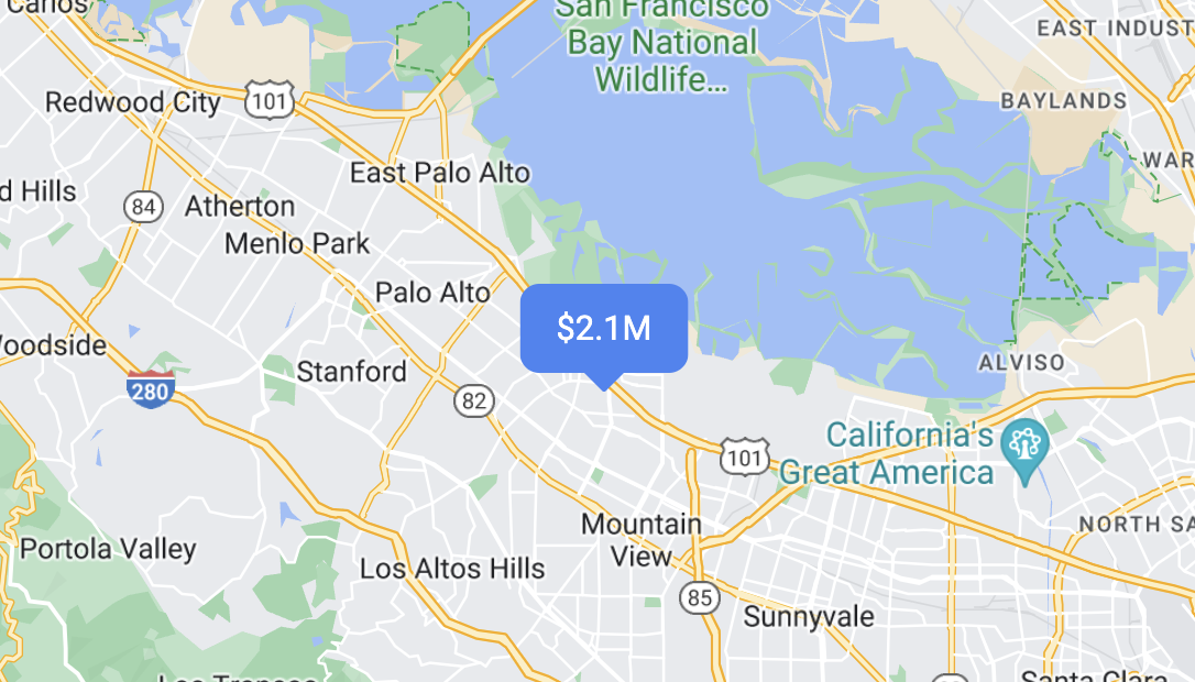
ภาพรวมเครื่องหมาย
จัดทุกอย่างให้เป็นระเบียบอยู่เสมอด้วยคอลเล็กชัน
บันทึกและจัดหมวดหมู่เนื้อหาตามค่ากำหนดของคุณ
ใช้เครื่องหมายเพื่อแสดงสถานที่เดียวบนแผนที่ คู่มือนี้แสดงวิธี
ใช้เครื่องหมายขั้นสูง เครื่องหมายขั้นสูงช่วยให้คุณสร้างและปรับแต่งเครื่องหมายที่มีประสิทธิภาพสูง รวมถึงสร้างเครื่องหมายที่เข้าถึงได้ซึ่งตอบสนองต่อเหตุการณ์คลิก DOM และอินพุตจากแป้นพิมพ์ เครื่องหมายขั้นสูงรองรับการใช้ HTML และ CSS ที่กำหนดเอง
รวมถึงความสามารถในการสร้างเครื่องหมายที่กำหนดเองทั้งหมด
เพื่อการปรับแต่งที่ละเอียดยิ่งขึ้น สำหรับแอปพลิเคชัน 3 มิติ
คุณสามารถควบคุมระดับความสูงที่เครื่องหมายปรากฏได้
เครื่องหมายขั้นสูงใช้ได้ทั้งในแผนที่แบบแรสเตอร์และแบบเวกเตอร์ (แม้ว่าฟีเจอร์บางอย่างจะใช้ไม่ได้ในแผนที่แบบแรสเตอร์)
ต้องมีรหัสแผนที่จึงจะใช้เครื่องหมายขั้นสูงได้ (ใช้ DEMO_MAP_ID
ได้)
เริ่มต้นใช้งานเครื่องหมายขั้นสูง
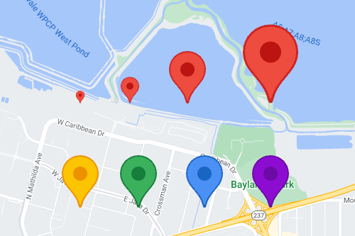
ปรับแต่งสี ขนาด และรูปภาพไอคอน
ปรับแต่งพื้นหลัง กลีฟ และสีเส้นขอบของเครื่องหมายเริ่มต้น
รวมถึงปรับขนาดเครื่องหมาย
แทนที่ไอคอนเครื่องหมายเริ่มต้นด้วยรูปภาพ SVG หรือ PNG ที่กำหนดเอง
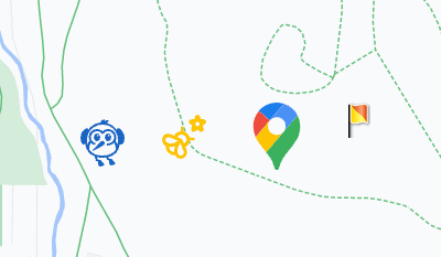
สร้างเครื่องหมาย HTML ที่กำหนดเอง
ใช้ HTML และ CSS ที่กำหนดเองเพื่อสร้างเครื่องหมายแบบอินเทอร์แอกทีฟที่โดดเด่น
และสร้างภาพเคลื่อนไหว
ทำให้เครื่องหมายตอบสนองต่อเหตุการณ์การคลิกและแป้นพิมพ์
ทำให้เครื่องหมายตอบสนองต่อการคลิกและเหตุการณ์ของแป้นพิมพ์โดยการเพิ่ม
click
Event Listener
function initMap() {
const map = new google.maps.Map(document.getElementById('map'), {
center: {lat: 37.4239163, lng: -122.0947209},
zoom: 17,
mapId: 'DEMO_MAP_ID',
});
const marker = new google.maps.marker.AdvancedMarkerElement({
map,
position: {lat: 37.4239163, lng: -122.0947209},
});
marker.addListener('click', ({domEvent, latLng}) => {
const {target} = domEvent;
// Handle the click event.
// ...
});
}
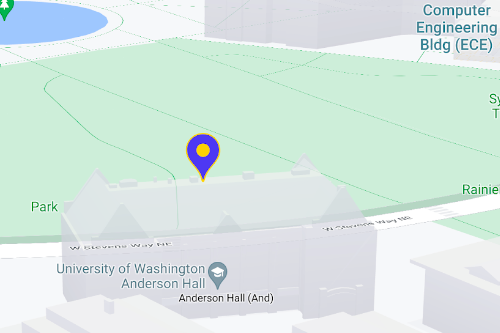
กำหนดระดับความสูงของเครื่องหมายและลักษณะการชน
กำหนดระดับความสูงของเครื่องหมายเพื่อให้ปรากฏอย่างถูกต้องพร้อมกับองค์ประกอบแผนที่ 3 มิติ และระบุลักษณะการทำงานของเครื่องหมายเมื่อชนกับเครื่องหมายอื่นหรือป้ายกำกับแผนที่ รองรับความสูงของเครื่องหมายในแผนที่เวกเตอร์เท่านั้น
ขั้นตอนถัดไป
เนื้อหาของหน้าเว็บนี้ได้รับอนุญาตภายใต้ใบอนุญาตที่ต้องระบุที่มาของครีเอทีฟคอมมอนส์ 4.0 และตัวอย่างโค้ดได้รับอนุญาตภายใต้ใบอนุญาต Apache 2.0 เว้นแต่จะระบุไว้เป็นอย่างอื่น โปรดดูรายละเอียดที่นโยบายเว็บไซต์ Google Developers Java เป็นเครื่องหมายการค้าจดทะเบียนของ Oracle และ/หรือบริษัทในเครือ
อัปเดตล่าสุด 2025-08-17 UTC
[null,null,["อัปเดตล่าสุด 2025-08-17 UTC"],[[["\u003cp\u003eAdvanced markers offer highly performant and customizable options for displaying single locations on Google Maps, including custom HTML and CSS for unique designs.\u003c/p\u003e\n"],["\u003cp\u003eThey are accessible, responding to DOM click events and keyboard input for enhanced user interaction.\u003c/p\u003e\n"],["\u003cp\u003eCustomization options include changing color, scale, icon image, and creating custom HTML markers with interactive elements and animations.\u003c/p\u003e\n"],["\u003cp\u003eAltitude control is available for 3D applications, enabling precise marker placement in three-dimensional spaces, although this feature is limited to vector maps.\u003c/p\u003e\n"],["\u003cp\u003eAdvanced markers are compatible with both raster and vector maps, requiring a map ID for implementation, and offer improved performance compared to legacy markers.\u003c/p\u003e\n"]]],["Advanced markers allow customization of map markers, including color, scale, and icons (SVG/PNG). Users can employ custom HTML and CSS for unique designs and animations. Markers can be made interactive via `click` event listeners, handling user clicks and keyboard input. Altitude and collision behavior can be defined for 3D maps. A map ID, like `DEMO_MAP_ID`, is needed, and these advanced markers are available on Android, iOS, and JavaScript platforms, supporting both raster and vector maps.\n"],null,["Select platform: [Android](/maps/documentation/android-sdk/advanced-markers/overview \"View this page for the Android platform docs.\") [iOS](/maps/documentation/ios-sdk/advanced-markers/overview \"View this page for the iOS platform docs.\") [JavaScript](/maps/documentation/javascript/advanced-markers/overview \"View this page for the JavaScript platform docs.\")\n\n\u003cbr /\u003e\n\nUse markers to display single locations on a map. This guide shows you how to\nuse advanced markers. With\nadvanced markers you can create and customize highly\nperformant markers, and make accessible markers that respond to DOM click events\nand keyboard input. For even deeper customization,\nadvanced markers supports the use of custom HTML and CSS,\nincluding the ability to create completely custom markers. For 3D applications\nyou can control the altitude at which a marker appears.\nAdvanced markers are supported on both raster and vector maps (though some features are not available on raster maps).\nA map ID is required to use Advanced Markers (the `DEMO_MAP_ID` can be used).\n| **Tip:** If your map uses [legacy markers](/maps/documentation/javascript/markers), consider [migrating to advanced markers](/maps/documentation/javascript/advanced-markers/migration).\n\n[Get started with advanced markers](/maps/documentation/javascript/advanced-markers/start)\n\nCustomize color, scale, and icon image\n\nCustomize the default marker's background, glyph, and border\ncolor, and adjust marker size.\n\nReplace the default marker icon with a custom SVG or PNG image.\n\nCreate custom HTML markers\n\nUse custom HTML and CSS to create visually distinctive\ninteractive markers, and create animations.\n\nMake markers respond to click and keyboard events\n\nMake a marker respond to clicks and keyboard events by adding a\n`click` event listener. \n\n```javascript\nfunction initMap() {\n const map = new google.maps.Map(document.getElementById('map'), {\n center: {lat: 37.4239163, lng: -122.0947209},\n zoom: 17,\n mapId: 'DEMO_MAP_ID',\n });\n\n const marker = new google.maps.marker.AdvancedMarkerElement({\n map,\n position: {lat: 37.4239163, lng: -122.0947209},\n });\n\n marker.addListener('click', ({domEvent, latLng}) =\u003e {\n const {target} = domEvent;\n // Handle the click event.\n // ...\n });\n}\n```\n\nSet marker altitude and collision behavior\n\nSet the altitude for a marker to make it appear correctly with\n3D map elements, and specify how a marker should behave when it collides with\nanother marker or map label. Marker altitude is only supported on vector maps.\n\nNext step\n\n- [Get started with advanced markers](/maps/documentation/javascript/advanced-markers/start)"]]