
FeatureStyleFunction, bir veri kümesindeki özellikleri seçerek stil uygulamak için mantık tanımladığınız yerdir. Bu mantığa göre FeatureStyleOptions döndürür. Stil oluşturma mantığı gerekmiyorsa stilleri doğrudan ayarlamak için FeatureStyleOptions
kullanabilirsiniz. Bu sayfada, haritaya veri kümesi ekleme ve stil uygulama işlemleri açıklanmaktadır.
Ön koşullar
Devam etmeden önce bir harita kimliğiniz, harita stiliniz ve veri kümesi kimliğiniz olmalıdır.
Veri kümesi kimliğini harita stiliyle ilişkilendirme
Veri kümenizi kullandığınız harita stiliyle ilişkilendirmek için aşağıdaki adımları uygulayın:
- Google Cloud Console'da Veri kümeleri sayfasına gidin.
- Veri kümesinin adını tıklayın. Veri kümesi ayrıntıları sayfası gösterilir.
- Önizleme sekmesini tıklayın.
- HARİTA STİLİ EKLE'ye kaydırıp tıklayın.
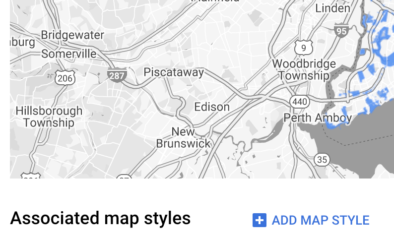
- İlişkilendirilecek harita stillerinin onay kutularını işaretleyin ve KAYDET'i tıklayın.
Basit stil kuralları kullanma
Özellikleri stilize etmenin en basit yolu, renk, opaklık ve çizgi kalınlığı gibi stil özelliklerini tanımlamak için FeatureStyleOptions iletmektir. Özellik stili seçeneklerini doğrudan bir veri kümesi özellik katmanına uygulayın veya bunları FeatureStyleFunction ile birlikte kullanın.
TypeScript
const styleOptions = { strokeColor: 'green', strokeWeight: 2, strokeOpacity: 1, fillColor: 'green', fillOpacity: 0.3, };
JavaScript
const styleOptions = { strokeColor: 'green', strokeWeight: 2, strokeOpacity: 1, fillColor: 'green', fillOpacity: 0.3, };
Bildirimsel stil kurallarını kullanma
Stil kurallarını bildirimsel olarak ayarlamak ve bunları veri kümenizin tamamına uygulamak için FeatureStyleFunction kullanın. Veri kümesi özellik değerlerine göre bir özelliğe FeatureStyleOptions uygulayın. Örneğin, özelliklerin bir alt kümesinin görünmez kalmasını istiyorsanız özellik stilinizdeki işlevden null değerini de döndürebilirsiniz. Bu örnekte, bir dizi noktayı veri özelliklerine göre renklendiren bir stil işlevi gösterilmektedir:
TypeScript
function setStyle(params: { feature: google.maps.Feature }) { // Get the dataset feature, so we can work with all of its attributes. const datasetFeature = params.feature as google.maps.DatasetFeature; // Get all of the needed dataset attributes. const furColors = datasetFeature.datasetAttributes.CombinationofPrimaryandHighlightColor; // Apply styles. Fill is primary fur color, stroke is secondary fur color. switch (furColors) { case 'Black+': return { fillColor: 'black', pointRadius: 8, }; break; case 'Cinnamon+': return { fillColor: '#8b0000', pointRadius: 8, }; break; case 'Cinnamon+Gray': return { fillColor: '#8b0000', strokeColor: 'gray', pointRadius: 6, }; break; case 'Cinnamon+White': return { fillColor: '#8b0000', strokeColor: 'white', pointRadius: 6, }; break; case 'Gray+': return { fillColor: 'gray', pointRadius: 8, }; break; case 'Gray+Cinnamon': return { fillColor: 'gray', strokeColor: '#8b0000', pointRadius: 6, }; break; case 'Gray+Cinnamon, White': return { fillColor: 'silver', strokeColor: '#8b0000', pointRadius: 6, }; break; case 'Gray+White': return { fillColor: 'gray', strokeColor: 'white', pointRadius: 6, }; break; default: // Color not defined. return { fillColor: 'yellow', pointRadius: 8, }; break; } }
JavaScript
function setStyle(params) { // Get the dataset feature, so we can work with all of its attributes. const datasetFeature = params.feature; // Get all of the needed dataset attributes. const furColors = datasetFeature.datasetAttributes.CombinationofPrimaryandHighlightColor; // Apply styles. Fill is primary fur color, stroke is secondary fur color. switch (furColors) { case 'Black+': return { fillColor: 'black', pointRadius: 8, }; break; case 'Cinnamon+': return { fillColor: '#8b0000', pointRadius: 8, }; break; case 'Cinnamon+Gray': return { fillColor: '#8b0000', strokeColor: 'gray', pointRadius: 6, }; break; case 'Cinnamon+White': return { fillColor: '#8b0000', strokeColor: 'white', pointRadius: 6, }; break; case 'Gray+': return { fillColor: 'gray', pointRadius: 8, }; break; case 'Gray+Cinnamon': return { fillColor: 'gray', strokeColor: '#8b0000', pointRadius: 6, }; break; case 'Gray+Cinnamon, White': return { fillColor: 'silver', strokeColor: '#8b0000', pointRadius: 6, }; break; case 'Gray+White': return { fillColor: 'gray', strokeColor: 'white', pointRadius: 6, }; break; default: // Color not defined. return { fillColor: 'yellow', pointRadius: 8, }; break; } }
Veri kümesi özellik katmanına stil uygulama
Özellik stili işlevindeki stilleri uygulamak için:
- Veri kümesi kimliğini ileterek
map.getDatasetFeatureLayer()işlevini çağırarak veri kümesi özellik katmanını alın. - Veri kümesi katmanında özellik stili seçeneklerini (ör.
styleOptions) veya işlevini (ör.setStyle) ayarlayarak stili uygulayın.
TypeScript
// Dataset ID for NYC park data. const datasetId = 'a75dd002-ad20-4fe6-af60-27cd2ed636b4'; const datasetLayer = innerMap.getDatasetFeatureLayer(datasetId); datasetLayer.style = styleOptions;
JavaScript
// Dataset ID for NYC park data. const datasetId = 'a75dd002-ad20-4fe6-af60-27cd2ed636b4'; const datasetLayer = innerMap.getDatasetFeatureLayer(datasetId); datasetLayer.style = styleOptions;
Katmandan stil kaldırma
Bir katmandan stili kaldırmak için style değerini null olarak ayarlayın:
featureLayer.style = null;
Örneğin, özelliklerin bir alt kümesinin görünmez kalmasını istiyorsanız özellik stili işlevinizden null da döndürebilirsiniz.
Atıf metni ekleme
Yüklenen veri kümeleri Google Haritalar'da gösterilirken haritanızda gerekli tüm ilişkilendirmeler gösterilmelidir. Atıf metni, Google logosunu kapatmamalı veya Google logosuyla etkileşime girmemelidir.
Atıf metni eklemenin bir yolu, haritada standart konumlara rastgele HTML yerleştirmek için özel kontroller kullanmaktır. Aşağıdaki kod snippet'lerinde, bu örnekteki atıflar için kullanılan HTML ve CSS gösterilmektedir:
<gmp-map
center="40.757815, -73.933123"
zoom="11"
map-id="5cd2c9ca1cf05670"
map-type-control="false">
<div id="attribution" slot="control-block-end-inline-start">
Data source: NYC Open Data
</div>
</gmp-map>
#attribution { background-color: rgba(255, 255, 255, 0.7); font-family: 'Roboto', 'Arial', sans-serif; font-size: 10px; padding: 2px; margin: 2px; }