公告:Google 地圖平台即將推出新版基本地圖樣式。新版地圖樣式內建全新的預設調色盤、現代化的圖釘,並且提升地圖體驗、改善服務的可用性。所有地圖樣式都將於 2025 年 3 月自動更新。請參閱「
Google 地圖平台新版地圖樣式」一文,進一步瞭解適用範圍及如何提早啟用。
標記總覽
您可以使用標記在地圖上顯示單一位置。本指南將說明如何使用進階標記。您可以運用進階標記,建立及自訂效能卓越的標記,並製作可回應 DOM 點擊事件和鍵盤輸入的標記。如果需要進一步自訂,進階標記支援使用自訂 HTML 和 CSS,包括建立完全自訂的標記。您可以在 3D 應用程式中利用進階標記,設定顯示標記的海拔高度。光柵地圖和向量地圖都支援進階標記 (但光柵地圖無法使用部分功能)。使用進階標記時,必須提供地圖 ID (可使用 DEMO_MAP_ID
)。
開始使用進階標記
自訂顏色、縮放和圖示圖片
自訂預設標記的背景、字符和邊框顏色,以及調整標記大小。
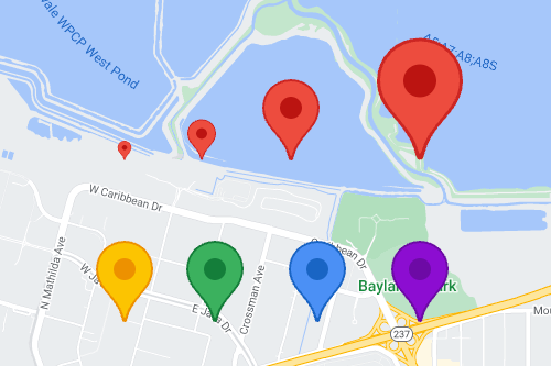
將預設標記圖示換成自訂的 SVG 或 PNG 圖片。
建立自訂 HTML 標記
使用自訂 HTML 和 CSS 建立搶眼的互動式標記,並製作動畫。
讓標記回應點擊和鍵盤事件
如要讓標記回應點擊和鍵盤事件,請加入 click
事件監聽器。
function initMap() {
const map = new google.maps.Map(document.getElementById('map'), {
center: {lat: 37.4239163, lng: -122.0947209},
zoom: 17,
mapId: 'DEMO_MAP_ID',
});
const marker = new google.maps.marker.AdvancedMarkerElement({
map,
position: {lat: 37.4239163, lng: -122.0947209},
});
marker.addListener('click', ({domEvent, latLng}) => {
const {target} = domEvent;
// Handle the click event.
// ...
});
}
設定標記高度和衝突行為
設定標記的高度,讓標記能與 3D 地圖元素一併正確顯示,並指定標記與其他標記或地圖標籤衝突時應呈現的行為。標記高度僅適用於向量地圖。
後續步驟
除非另有註明,否則本頁面中的內容是採用創用 CC 姓名標示 4.0 授權,程式碼範例則為阿帕契 2.0 授權。詳情請參閱《Google Developers 網站政策》。Java 是 Oracle 和/或其關聯企業的註冊商標。
上次更新時間:2025-01-14 (世界標準時間)。
[null,null,["上次更新時間:2025-01-14 (世界標準時間)。"],[[["Advanced markers offer highly performant and customizable options for displaying single locations on Google Maps, including custom HTML and CSS for unique designs."],["They are accessible, responding to DOM click events and keyboard input for enhanced user interaction."],["Customization options include changing color, scale, icon image, and creating custom HTML markers with interactive elements and animations."],["Altitude control is available for 3D applications, enabling precise marker placement in three-dimensional spaces, although this feature is limited to vector maps."],["Advanced markers are compatible with both raster and vector maps, requiring a map ID for implementation, and offer improved performance compared to legacy markers."]]],[]]