رادیانس ASTER L1T 
توجه: به دلیل مشکلات فنی دستگاه ASTER، بین ۲۸ نوامبر ۲۰۲۴ و ۱۶ ژانویه ۲۰۲۵، فاصلهای در جمعآوری دادهها وجود دارد. برای اطلاعات بیشتر به اطلاعیه USGS مراجعه کنید. رادیومتر پیشرفته فضابرد انتشار و بازتاب حرارتی (ASTER) یک تصویرگر چندطیفی است که... تصاویر آستر، تصاویر ماهوارهای ناسا نیر رادیانس نامگذاری: USGS GAP PAD-US نسخه ۲.۰ 
PAD-US فهرست ملی رسمی آمریکا از مناطق حفاظتشده زمینی و دریایی ایالات متحده است که به حفظ تنوع زیستی و سایر کاربردهای طبیعی، تفریحی و فرهنگی اختصاص داده شده و از طریق روشهای قانونی یا سایر روشهای مؤثر برای این اهداف مدیریت میشوند. این پایگاه داده به بخشهای ... تفکیک شده است. حق ارتفاق حفاظتی، تعیین حدود زیرساختها، مدیریت مالکیت، مناطق حفاظتشده تصویرگر فراطیفی EO-1 هایپریون 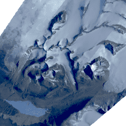
هایپریون یک تصویربردار فراطیفی با وضوح بالا است که ۲۲۰ کانال طیفی منحصر به فرد از ۰.۳۵۷ تا ۲.۵۷۶ میکرومتر با پهنای باند ۱۰ نانومتر تولید میکند. این ابزار به روش جاروب فشاری، با وضوح مکانی ۳۰ متر برای همه باندها و عرض صحنه استاندارد ... عمل میکند. تصاویر ماهوارهای فراطیفی USGS حق ارتفاق: USGS GAP PAD-US v2.0 
PAD-US فهرست ملی رسمی آمریکا از مناطق حفاظتشده زمینی و دریایی ایالات متحده است که به حفظ تنوع زیستی و سایر کاربردهای طبیعی، تفریحی و فرهنگی اختصاص داده شده و از طریق روشهای قانونی یا سایر روشهای مؤثر برای این اهداف مدیریت میشوند. این پایگاه داده به بخشهای ... تفکیک شده است. حق ارتفاق حفاظتی، تعیین حدود زیرساختها، مدیریت مالکیت، مناطق حفاظتشده هزینه: USGS GAP PAD-US v2.0 
PAD-US فهرست ملی رسمی آمریکا از مناطق حفاظتشده زمینی و دریایی ایالات متحده است که به حفظ تنوع زیستی و سایر کاربردهای طبیعی، تفریحی و فرهنگی اختصاص داده شده و از طریق روشهای قانونی یا سایر روشهای مؤثر برای این اهداف مدیریت میشوند. این پایگاه داده به بخشهای ... تفکیک شده است. حق ارتفاق حفاظتی، تعیین حدود زیرساختها، مدیریت مالکیت، مناطق حفاظتشده ارتفاع بالای سایبان رستری GEDI L2A (نسخه ۲) 
محصول معیارهای ارتفاع و ارتفاع جغرافیایی سطح 2A GEDI (GEDI02_A) در درجه اول از 100 معیار ارتفاع نسبی (RH) تشکیل شده است که در مجموع شکل موج جمعآوری شده توسط GEDI را توصیف میکنند. محصول اصلی GEDI02_A یک جدول نقطهای با وضوح مکانی (میانگین ردپا) 25 متر است. ... زیست توده جنگلی مرتفع ، پوشش درختی گدی لارس ناسا ارتفاع بالای سایبان برداری GEDI L2A (نسخه ۲) 
محصول معیارهای ارتفاع و ارتفاع جغرافیایی سطح 2A GEDI (GEDI02_A) در درجه اول از 100 معیار ارتفاع نسبی (RH) تشکیل شده است که در مجموع شکل موج جمعآوری شده توسط GEDI را توصیف میکنند. محصول اصلی GEDI02_A یک جدول نقطهای با وضوح مکانی (میانگین ردپا) 25 متر است. ... زیست توده جنگلی مرتفع ، پوشش درختی گدی لارس ناسا فهرست جدول GEDI L2A 
این یک مجموعه ویژگی است که از هندسه جداول L2A در LARSE/GEDI/GEDI02_A_002 ایجاد شده است. هر ویژگی، ردپای چندضلعی از یک جدول منبع به همراه شناسه دارایی و مهرهای زمانی شروع/پایان آن است. لطفاً برای اطلاعات بیشتر به راهنمای کاربر مراجعه کنید. ماموریت GEDI بررسی دینامیک اکوسیستم جهانی ... میز ناسا ، زیست توده جنگلی مرتفع معیارهای پروفیل عمودی پوشش سایبان رستری GEDI L2B (نسخه 2) 
محصول معیارهای پوشش تاجی و پروفیل عمودی سطح 2B از GEDI (GEDI02_B) معیارهای بیوفیزیکی را از هر شکل موج GEDI استخراج میکند. این معیارها بر اساس پروفیل احتمال شکاف جهتدار مشتق شده از شکل موج L1B هستند. گام عمودی بین اندازهگیریهای پروفیل شاخ و برگ (که در GEDI با dZ شناخته میشود...) زیست توده جنگلی مرتفع ، پوشش درختی گدی لارس ناسا معیارهای پروفیل عمودی پوشش سایبان برداری GEDI L2B (نسخه 2) 
محصول معیارهای پوشش تاجی و پروفیل عمودی سطح 2B از GEDI (GEDI02_B) معیارهای بیوفیزیکی را از هر شکل موج GEDI استخراج میکند. این معیارها بر اساس پروفیل احتمال شکاف جهتدار مشتق شده از شکل موج L1B هستند. گام عمودی بین اندازهگیریهای پروفیل شاخ و برگ (که در GEDI با dZ شناخته میشود...) زیست توده جنگلی مرتفع ، پوشش درختی گدی لارس ناسا فهرست جدول GEDI L2B 
این یک مجموعه ویژگی است که از هندسه جداول L2B در LARSE/GEDI/GEDI02_B_002 ایجاد شده است. هر ویژگی، یک ردپای چندضلعی از یک جدول منبع به همراه شناسه دارایی و مهرهای زمانی شروع/پایان آن است. لطفاً برای اطلاعات بیشتر به راهنمای کاربر مراجعه کنید. ماموریت GEDI بررسی دینامیک اکوسیستم جهانی ... میز ناسا ، زیست توده جنگلی مرتفع تراکم زیست توده روی زمین GEDI L4A، نسخه ۲.۱ 
این مجموعه دادهها شامل پیشبینیهای نسخه ۲ سطح ۴A (L4A) از بررسی دینامیک اکوسیستم جهانی (GEDI) از تراکم زیستتوده روی زمین (AGBD؛ بر حسب Mg/ha) و تخمین خطای استاندارد پیشبینی در هر ردپای لیزری جغرافیایی نمونهبرداری شده است. در این نسخه، گرانولها در زیرمدارها قرار دارند. معیارهای ارتفاع ... زیست توده جنگلی مرتفع ، پوشش درختی گدی لارس ناسا چگالی زیست توده روی زمین رستری GEDI L4A، نسخه ۲.۱ 
این مجموعه دادهها شامل پیشبینیهای نسخه ۲ سطح ۴A (L4A) از بررسی دینامیک اکوسیستم جهانی (GEDI) از تراکم زیستتوده روی زمین (AGBD؛ بر حسب Mg/ha) و تخمین خطای استاندارد پیشبینی در هر ردپای لیزری جغرافیایی نمونهبرداری شده است. در این نسخه، گرانولها در زیرمدارها قرار دارند. معیارهای ارتفاع ... زیست توده جنگلی مرتفع ، پوشش درختی گدی لارس ناسا فهرست جدول GEDI L4A 
این یک مجموعه ویژگی است که از هندسه جداول L4A در LARSE/GEDI/GEDI04_A_002 ایجاد شده است. هر ویژگی، ردپای چندضلعی از یک جدول منبع به همراه شناسه دارایی و مهرهای زمانی شروع/پایان آن است. لطفاً برای اطلاعات بیشتر به راهنمای کاربر مراجعه کنید. ماموریت GEDI بررسی دینامیک اکوسیستم جهانی ... میز ناسا ، زیست توده جنگلی مرتفع چگالی زیست توده روی زمین شبکه بندی شده GEDI L4B (نسخه 2) 
این محصول L4B از پروژه بررسی دینامیک اکوسیستم جهانی (GEDI) تخمینهایی به ابعاد ۱ کیلومتر در ۱ کیلومتر از میانگین تراکم زیستتوده روی زمین (AGBD) را بر اساس مشاهدات از هفته ۱۹ ماموریت که از تاریخ ۲۰۱۹-۰۴-۱۸ آغاز شده تا هفته ۱۳۸ ماموریت که در تاریخ ۲۰۲۱-۰۸-۰۴ به پایان میرسد، ارائه میدهد. محصول ردپای زیستتوده GEDI L4A ... زیست توده جنگلی مرتفع ، پوشش درختی گدی لارس ناسا GFSAD1000: پوشش گیاهی چند مطالعهای به وسعت ۱ کیلومتر مربع، دادههای تحلیل حمایت غذایی جهانی 
GFSAD یک پروژه با بودجه ناسا است که دادههای جهانی با وضوح بالا از زمینهای کشاورزی و میزان مصرف آب آنها را ارائه میدهد که به امنیت غذایی جهانی در قرن بیست و یکم کمک میکند. محصولات GFSAD از طریق دادههای سنجش از دور چند حسگری (مانند Landsat، MODIS، AVHRR)، دادههای ثانویه و دادههای نقشههای میدانی استخراج میشوند... پوشش زمین کشاورزی محصول USGS GMTED2010: دادههای ارتفاعی چند رزولوشنی جهانی زمین در سال ۲۰۱۰ 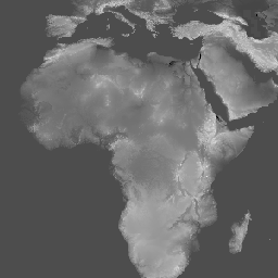
مجموعه دادههای ارتفاعی زمین با وضوح چندگانه جهانی ۲۰۱۰ (GMTED2010) شامل دادههای ارتفاعی برای کره زمین است که از منابع مختلف با وضوح ۷.۵ ثانیه قوسی جمعآوری شدهاند. جزئیات بیشتر در گزارش مجموعه دادهها موجود است. مجموعه دادههای منبع اصلی برای GMTED2010، دادههای ارتفاعی زمین دیجیتال SRTM (DTED®) NGA است... ارتفاع dem ، ارتفاع-توپوگرافی، ژئوفیزیک، توپوگرافی srtm GTOPO30: ارتفاع جهانی 30 ثانیه قوسی 
GTOPO30 یک مدل ارتفاعی رقومی جهانی (DEM) با فاصله شبکه افقی 30 ثانیه قوسی (تقریباً 1 کیلومتر) است. این DEM از چندین منبع رستری و برداری اطلاعات توپوگرافی استخراج شده است. GTOPO30 که در اواخر سال 1996 تکمیل شد، طی یک دوره سه ساله از طریق ... توسعه داده شد. ارتفاع dem ، ارتفاع-توپوگرافی، ژئوفیزیک، توپوگرافی ناسا توزیع جهانی جنگلهای حرا، نسخه ۱ (۲۰۰۰) 
این پایگاه داده با استفاده از دادههای ماهواره لندست از سال ۲۰۰۰ تهیه شده است. بیش از ۱۰۰۰ صحنه لندست که از مرکز رصد و علوم منابع زمین (EROS) سازمان زمینشناسی ایالات متحده (USGS) به دست آمده است، با استفاده از تکنیکهای طبقهبندی تصاویر دیجیتال ترکیبی نظارتشده و نظارتنشده طبقهبندی شدهاند. این پایگاه داده اولین و پرکاربردترین ... تغییرات سالانه در زیست توده جنگلی، جنگل حرا مشتق شده از لندست جهانی HLSL30: بازتاب سطحی و روشنایی TOA تصویرگر عملیاتی زمین HLS-2 لندست، روزانه جهانی 30 متر 
پروژه هماهنگشده لندست سنتینل-۲ (HLS) دادههای بازتاب سطحی (SR) و روشنایی بالای جو (TOA) ثابتی را از یک مجموعه مجازی از حسگرهای ماهوارهای ارائه میدهد. تصویربردار عملیاتی زمین (OLI) بر روی ماهوارههای مشترک ناسا/USGS لندست ۸ و لندست ۹ قرار دارد، در حالی که تصویربردار چندطیفی... تصاویر ماهوارهای لندست ناسا ، نگهبان USGS HLSS30: ابزار چند طیفی HLS Sentinel-2، بازتاب سطحی روزانه جهانی 30 متر 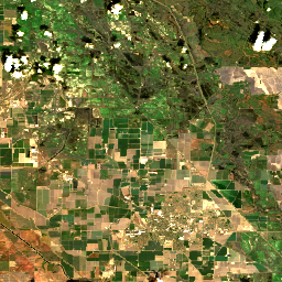
پروژه هماهنگشده لندست سنتینل-۲ (HLS) دادههای بازتاب سطحی ثابتی را از تصویرگر عملیاتی زمین (OLI) در ماهواره مشترک ناسا/USGS لندست ۸ و ابزار چندطیفی (MSI) در ماهوارههای کوپرنیک سنتینل-۲A اروپا ارائه میدهد. اندازهگیری ترکیبی، مشاهدات جهانی از زمین را هر ۲-۳ ... تصاویر ماهوارهای لندست ناسا ، نگهبان USGS HUC02: مجموعه دادههای مرز حوزه آبخیز USGS از مناطق 
مجموعه دادههای مرز حوضه آبخیز (WBD) مجموعهای جامع و تجمیعشده از دادههای واحد هیدرولوژیکی (HU) است که با معیارهای ملی برای تعیین و تفکیکپذیری مطابقت دارد. این مجموعه، وسعت منطقهای زهکشی آبهای سطحی را تا یک نقطه مشخص، به جز در مناطق ساحلی یا کنار دریاچه که ... هیدرولوژی، سفره آب سطحی-زیرزمینی، آبخیزداری ایالات متحده HUC04: مجموعه دادههای مرز حوزه آبخیز USGS از زیرمنطقهها 
مجموعه دادههای مرز حوضه آبخیز (WBD) مجموعهای جامع و تجمیعشده از دادههای واحد هیدرولوژیکی (HU) است که با معیارهای ملی برای تعیین و تفکیکپذیری مطابقت دارد. این مجموعه، وسعت منطقهای زهکشی آبهای سطحی را تا یک نقطه مشخص، به جز در مناطق ساحلی یا کنار دریاچه که ... هیدرولوژی، سفره آب سطحی-زیرزمینی، آبخیزداری ایالات متحده HUC06: مجموعه دادههای مرز حوضههای آبخیز USGS 
مجموعه دادههای مرز حوضه آبخیز (WBD) مجموعهای جامع و تجمیعشده از دادههای واحد هیدرولوژیکی (HU) است که با معیارهای ملی برای تعیین و تفکیکپذیری مطابقت دارد. این مجموعه، وسعت منطقهای زهکشی آبهای سطحی را تا یک نقطه مشخص، به جز در مناطق ساحلی یا کنار دریاچه که ... هیدرولوژی، سفره آب سطحی-زیرزمینی، آبخیزداری ایالات متحده HUC08: مجموعه دادههای مرز حوضه آبخیز USGS از زیرحوضهها 
مجموعه دادههای مرز حوضه آبخیز (WBD) مجموعهای جامع و تجمیعشده از دادههای واحد هیدرولوژیکی (HU) است که با معیارهای ملی برای تعیین و تفکیکپذیری مطابقت دارد. این مجموعه، وسعت منطقهای زهکشی آبهای سطحی را تا یک نقطه مشخص، به جز در مناطق ساحلی یا کنار دریاچه که ... هیدرولوژی، سفره آب سطحی-زیرزمینی، آبخیزداری ایالات متحده HUC10: مجموعه دادههای مرز حوزههای آبخیز سازمان زمینشناسی آمریکا (USGS) 
مجموعه دادههای مرز حوضه آبخیز (WBD) مجموعهای جامع و تجمیعشده از دادههای واحد هیدرولوژیکی (HU) است که با معیارهای ملی برای تعیین و تفکیکپذیری مطابقت دارد. این مجموعه، وسعت منطقهای زهکشی آبهای سطحی را تا یک نقطه مشخص، به جز در مناطق ساحلی یا کنار دریاچه که ... هیدرولوژی، سفره آب سطحی-زیرزمینی، آبخیزداری ایالات متحده HUC12: مجموعه دادههای مرز حوزه آبخیز USGS از زیرحوزههای آبخیز 
مجموعه دادههای مرز حوضه آبخیز (WBD) مجموعهای جامع و تجمیعشده از دادههای واحد هیدرولوژیکی (HU) است که با معیارهای ملی برای تعیین و تفکیکپذیری مطابقت دارد. این مجموعه، وسعت منطقهای زهکشی آبهای سطحی را تا یک نقطه مشخص، به جز در مناطق ساحلی یا کنار دریاچه که ... هیدرولوژی، سفره آب سطحی-زیرزمینی، آبخیزداری ایالات متحده تنظیمات بیوفیزیکی LANDFIRE BPS نسخه ۱.۴.۰ 
LANDFIRE (LF)، ابزارهای برنامهریزی آتشسوزی چشمانداز و مدیریت منابع، یک برنامه مشترک بین برنامههای مدیریت آتشسوزی در مناطق وحشی خدمات جنگلداری وزارت کشاورزی ایالات متحده، سازمان زمینشناسی وزارت کشور ایالات متحده و سازمان حفاظت از طبیعت است. لایههای LANDFIRE (LF) با استفاده از پیشبینی ... ایجاد میشوند. آتشسوزی جنگل-زیستتوده، آتشسوزی زمین ، حفاظت از طبیعت، وزارت کشاورزی ایالات متحده پتانسیل سایت محیطی (LANDFIRE ESP AK) نسخه ۱.۲.۰ 
LANDFIRE (LF)، ابزارهای برنامهریزی آتشسوزی چشمانداز و مدیریت منابع، یک برنامه مشترک بین برنامههای مدیریت آتشسوزی در مناطق وحشی خدمات جنگلداری وزارت کشاورزی ایالات متحده، سازمان زمینشناسی وزارت کشور ایالات متحده و سازمان حفاظت از طبیعت است. لایههای LANDFIRE (LF) با استفاده از پیشبینی ... ایجاد میشوند. آتشسوزی جنگل-زیستتوده، آتشسوزی زمین ، حفاظت از طبیعت، وزارت کشاورزی ایالات متحده پتانسیل سایت محیطی (LANDFIRE ESP CONUS) نسخه ۱.۲.۰ 
LANDFIRE (LF)، ابزارهای برنامهریزی آتشسوزی چشمانداز و مدیریت منابع، یک برنامه مشترک بین برنامههای مدیریت آتشسوزی در مناطق وحشی خدمات جنگلداری وزارت کشاورزی ایالات متحده، سازمان زمینشناسی وزارت کشور ایالات متحده و سازمان حفاظت از طبیعت است. لایههای LANDFIRE (LF) با استفاده از پیشبینی ... ایجاد میشوند. آتشسوزی جنگل-زیستتوده، آتشسوزی زمین ، حفاظت از طبیعت، وزارت کشاورزی ایالات متحده پتانسیل سایت محیطی (LANDFIRE ESP HI) نسخه ۱.۲.۰ 
LANDFIRE (LF)، ابزارهای برنامهریزی آتشسوزی چشمانداز و مدیریت منابع، یک برنامه مشترک بین برنامههای مدیریت آتشسوزی در مناطق وحشی خدمات جنگلداری وزارت کشاورزی ایالات متحده، سازمان زمینشناسی وزارت کشور ایالات متحده و سازمان حفاظت از طبیعت است. لایههای LANDFIRE (LF) با استفاده از پیشبینی ... ایجاد میشوند. آتشسوزی جنگل-زیستتوده، آتشسوزی زمین ، حفاظت از طبیعت، وزارت کشاورزی ایالات متحده LANDFIRE EVC (پوشش گیاهی موجود) نسخه ۱.۴.۰ 
LANDFIRE (LF)، ابزارهای برنامهریزی آتشسوزی چشمانداز و مدیریت منابع، یک برنامه مشترک بین برنامههای مدیریت آتشسوزی در مناطق وحشی خدمات جنگلداری وزارت کشاورزی ایالات متحده، سازمان زمینشناسی وزارت کشور ایالات متحده و سازمان حفاظت از طبیعت است. لایههای LANDFIRE (LF) با استفاده از پیشبینی ... ایجاد میشوند. آتشسوزی جنگل-زیستتوده، آتشسوزی زمین ، حفاظت از طبیعت، وزارت کشاورزی ایالات متحده LANDFIRE EVH (ارتفاع پوشش گیاهی موجود) نسخه ۱.۴.۰ 
LANDFIRE (LF)، ابزارهای برنامهریزی آتشسوزی چشمانداز و مدیریت منابع، یک برنامه مشترک بین برنامههای مدیریت آتشسوزی در مناطق وحشی خدمات جنگلداری وزارت کشاورزی ایالات متحده، سازمان زمینشناسی وزارت کشور ایالات متحده و سازمان حفاظت از طبیعت است. لایههای LANDFIRE (LF) با استفاده از پیشبینی ... ایجاد میشوند. آتشسوزی جنگل-زیستتوده، آتشسوزی زمین ، حفاظت از طبیعت، وزارت کشاورزی ایالات متحده LANDFIRE EVT (نوع پوشش گیاهی موجود) نسخه ۱.۴.۰ 
LANDFIRE (LF)، ابزارهای برنامهریزی آتشسوزی چشمانداز و مدیریت منابع، یک برنامه مشترک بین برنامههای مدیریت آتشسوزی در مناطق وحشی خدمات جنگلداری وزارت کشاورزی ایالات متحده، سازمان زمینشناسی وزارت کشور ایالات متحده و سازمان حفاظت از طبیعت است. لایههای LANDFIRE (LF) با استفاده از پیشبینی ... ایجاد میشوند. آتشسوزی جنگل-زیستتوده، آتشسوزی زمین ، حفاظت از طبیعت، وزارت کشاورزی ایالات متحده LANDFIRE FRG (گروههای آتشنشانی) نسخه ۱.۲.۰ 
آتشسوزی زمین (LF)، ابزارهای برنامهریزی آتشسوزی چشمانداز و مدیریت منابع، یک برنامه مشترک بین برنامههای مدیریت آتشسوزی در مناطق بکر خدمات جنگلداری وزارت کشاورزی ایالات متحده، سازمان زمینشناسی وزارت کشور ایالات متحده و سازمان حفاظت از طبیعت است. آتشسوزی زمین (LF) رژیمهای آتشسوزی تاریخی، فواصل زمانی و ... آتش سوزی زمینی، وزارت کشاورزی ایالات متحده ، حفاظت از طبیعت ، USGS LANDFIRE MFRI (میانگین فاصله بازگشت آتش) نسخه ۱.۲.۰ 
آتشسوزی زمین (LF)، ابزارهای برنامهریزی آتشسوزی چشمانداز و مدیریت منابع، یک برنامه مشترک بین برنامههای مدیریت آتشسوزی در مناطق بکر خدمات جنگلداری وزارت کشاورزی ایالات متحده، سازمان زمینشناسی وزارت کشور ایالات متحده و سازمان حفاظت از طبیعت است. آتشسوزی زمین (LF) رژیمهای آتشسوزی تاریخی، فواصل زمانی و ... آتش سوزی زمینی، وزارت کشاورزی ایالات متحده ، حفاظت از طبیعت ، USGS LANDFIRE PLS (درصد آتشسوزی با شدت کم) نسخه ۱.۲.۰ 
آتشسوزی زمین (LF)، ابزارهای برنامهریزی آتشسوزی چشمانداز و مدیریت منابع، یک برنامه مشترک بین برنامههای مدیریت آتشسوزی در مناطق بکر خدمات جنگلداری وزارت کشاورزی ایالات متحده، سازمان زمینشناسی وزارت کشور ایالات متحده و سازمان حفاظت از طبیعت است. آتشسوزی زمین (LF) رژیمهای آتشسوزی تاریخی، فواصل زمانی و ... آتش سوزی زمینی، وزارت کشاورزی ایالات متحده ، حفاظت از طبیعت ، USGS PMS آتشسوزی زمینی (درصد آتشسوزی با شدت مختلط) نسخه ۱.۲.۰ 
آتشسوزی زمین (LF)، ابزارهای برنامهریزی آتشسوزی چشمانداز و مدیریت منابع، یک برنامه مشترک بین برنامههای مدیریت آتشسوزی در مناطق بکر خدمات جنگلداری وزارت کشاورزی ایالات متحده، سازمان زمینشناسی وزارت کشور ایالات متحده و سازمان حفاظت از طبیعت است. آتشسوزی زمین (LF) رژیمهای آتشسوزی تاریخی، فواصل زمانی و ... آتش سوزی زمینی، وزارت کشاورزی ایالات متحده ، حفاظت از طبیعت ، USGS LANDFIRE PRS (درصد آتشسوزی با شدت جایگزینی) نسخه ۱.۲.۰ 
آتشسوزی زمین (LF)، ابزارهای برنامهریزی آتشسوزی چشمانداز و مدیریت منابع، یک برنامه مشترک بین برنامههای مدیریت آتشسوزی در مناطق بکر خدمات جنگلداری وزارت کشاورزی ایالات متحده، سازمان زمینشناسی وزارت کشور ایالات متحده و سازمان حفاظت از طبیعت است. آتشسوزی زمین (LF) رژیمهای آتشسوزی تاریخی، فواصل زمانی و ... آتش سوزی زمینی، وزارت کشاورزی ایالات متحده ، حفاظت از طبیعت ، USGS LANDFIRE SClass (کلاسهای جانشینی) نسخه ۱.۴.۰ 
آتشسوزی زمین (LF)، ابزارهای برنامهریزی آتشسوزی چشمانداز و مدیریت منابع، یک برنامه مشترک بین برنامههای مدیریت آتشسوزی در مناطق بکر خدمات جنگلداری وزارت کشاورزی ایالات متحده، سازمان زمینشناسی وزارت کشور ایالات متحده و سازمان حفاظت از طبیعت است. آتشسوزی زمین (LF) رژیمهای آتشسوزی تاریخی، فواصل زمانی و ... آتش سوزی زمینی، وزارت کشاورزی ایالات متحده ، حفاظت از طبیعت ، USGS LANDFIRE VCC (کلاس وضعیت پوشش گیاهی) نسخه ۱.۴.۰ 
آتشسوزی زمین (LF)، ابزارهای برنامهریزی آتشسوزی چشمانداز و مدیریت منابع، یک برنامه مشترک بین برنامههای مدیریت آتشسوزی در مناطق بکر خدمات جنگلداری وزارت کشاورزی ایالات متحده، سازمان زمینشناسی وزارت کشور ایالات متحده و سازمان حفاظت از طبیعت است. آتشسوزی زمین (LF) رژیمهای آتشسوزی تاریخی، فواصل زمانی و ... آتش سوزی زمینی، وزارت کشاورزی ایالات متحده ، حفاظت از طبیعت ، USGS LANDFIRE VDep (خروج پوشش گیاهی) نسخه ۱.۴.۰ 
آتشسوزی زمین (LF)، ابزارهای برنامهریزی آتشسوزی چشمانداز و مدیریت منابع، یک برنامه مشترک بین برنامههای مدیریت آتشسوزی در مناطق بکر خدمات جنگلداری وزارت کشاورزی ایالات متحده، سازمان زمینشناسی وزارت کشور ایالات متحده و سازمان حفاظت از طبیعت است. آتشسوزی زمین (LF) رژیمهای آتشسوزی تاریخی، فواصل زمانی و ... آتش سوزی زمینی، وزارت کشاورزی ایالات متحده ، حفاظت از طبیعت ، USGS مجموعه لندست ۲، ردیف ۱، سطح ۲، ترکیب ۳۲ روزه BAI 
این تصاویر ترکیبی لندست کالکشن ۲ رده ۱ سطح ۲ از صحنههای تصحیحشده قائم رده ۱ سطح ۲ ساخته شدهاند. شاخص مساحت سوختگی (BAI) از باندهای قرمز و فروسرخ نزدیک تولید میشود و فاصله طیفی هر پیکسل را از یک نقطه طیفی مرجع (...) اندازهگیری میکند. شاخصهای پوشش گیاهی ماهواره لندست، آتشسوزی بای ، شاخصهای پوشش گیاهی ماهواره لندست ترکیبی USGS مجموعه لندست ۲، ردیف ۱، سطح ۲، ترکیب ۳۲ روزه 
این تصاویر ترکیبی لندست کالکشن ۲ رده ۱ سطح ۲ از صحنههای تصحیحشده قائم رده ۱ سطح ۲ ساخته شدهاند و شامل باندهای SR: آبی، سبز، قرمز، nir، swir1، swir2 و حرارتی هستند. این تصاویر ترکیبی از تمام صحنهها در هر دوره ۳۲ روزه با شروع از ... ایجاد شدهاند. تصاویر ماهوارهای ترکیبی لندست ، لندست، sr، usgs مجموعه لندست ۲، ردیف ۱، سطح ۲، ترکیب ۳۲ روزه NBR 
این تصاویر ترکیبی لندست کالکشن ۲ رده ۱ سطح ۲ از صحنههای تصحیحشده قائم رده ۱ سطح ۲ ساخته شدهاند. شاخص نسبت سوختگی نرمالشده حرارتی (NBRT) از باندهای Near-IR، Mid-IR (۲۲۱۵ نانومتر) و Thermal تولید میشود و دامنهای از ۱.۰- تا ۱.۰ دارد. ببینید ... آتش لندست، لندست-کامپوزیت ، nbrt، usgs، شاخصهای پوشش گیاهی مجموعه لندست ۲، ردیف ۱، سطح ۲، ترکیب ۳۲ روزه NDVI 
این تصاویر ترکیبی لندست کالکشن ۲ رده ۱ سطح ۲ از صحنههای تصحیحشده ارتو در رده ۱ سطح ۲ ساخته شدهاند. شاخص پوشش گیاهی تفاضلی نرمالشده از باندهای فروسرخ نزدیک و قرمز هر صحنه به صورت (NIR - قرمز) / (NIR + قرمز) تولید میشود و در محدوده ... قرار دارد. لندست ، ماهواره ترکیبی لندست ، ndvi ، ماهواره USGS ، پوشش گیاهی ، شاخصهای پوشش گیاهی مجموعه لندست ۲، ردیف ۱، سطح ۲، ترکیب ۳۲ روزه NDWI 
این تصاویر ترکیبی لندست کالکشن ۲ رده ۱ سطح ۲ از صحنههای تصحیحشده قائم رده ۱ سطح ۲ ساخته شدهاند. شاخص نرمالشده تفاضلی آب (NDWI) برای مشخص کردن ویژگیهای آبهای آزاد و افزایش حضور آنها در تصاویر و در عین حال حذف ویژگیهای خاک و پوشش گیاهی زمینی طراحی شده است. این ... لندست ، لندست-کامپوزیت، ndwi، آبهای سطحی-زیرزمینی ، USGS مجموعه لندست ۲، ردیف ۱، سطح ۲، ترکیب ۸ روزه BAI 
این تصاویر ترکیبی لندست کالکشن ۲ رده ۱ سطح ۲ از صحنههای تصحیحشده قائم رده ۱ سطح ۲ ساخته شدهاند. شاخص مساحت سوختگی (BAI) از باندهای قرمز و فروسرخ نزدیک تولید میشود و فاصله طیفی هر پیکسل را از یک نقطه طیفی مرجع (...) اندازهگیری میکند. شاخصهای پوشش گیاهی ماهواره لندست، آتشسوزی بای ، شاخصهای پوشش گیاهی ماهواره لندست ترکیبی USGS مجموعه لندست ۲، سطح ۱، سطح ۲، ترکیب ۸ روزه 
این تصاویر ترکیبی لندست کالکشن ۲ رده ۱ سطح ۲ از صحنههای تصحیحشده قائم رده ۱ سطح ۲ ساخته شدهاند و شامل باندهای SR: آبی، سبز، قرمز، nir، swir1، swir2 و حرارتی هستند. این تصاویر ترکیبی از تمام صحنهها در هر دوره ۸ روزه با شروع از ... ایجاد شدهاند. تصاویر ماهوارهای ترکیبی لندست ، لندست، sr، usgs مجموعه لندست ۲، سطح ۱، سطح ۲، ترکیب ۸ روزه EVI 
این تصاویر ترکیبی لندست کالکشن ۲ رده ۱ سطح ۲ از صحنههای تصحیحشده قائم رده ۱ سطح ۲ ساخته شدهاند. شاخص پوشش گیاهی بهبودیافته (EVI) از باندهای فروسرخ نزدیک، قرمز و آبی هر صحنه تولید میشود و مقدار آن از ۱.۰- تا ۱.۰ متغیر است. به Huete مراجعه کنید… ماهواره لندست اوی ، ماهواره لندست ترکیبی، پوشش گیاهی ایالات متحده ، شاخصهای پوشش گیاهی مجموعه لندست ۲، ردیف ۱، سطح ۲، کامپوزیت NBR هشت روزه 
این تصاویر ترکیبی لندست کالکشن ۲ رده ۱ سطح ۲ از صحنههای تصحیحشده قائم رده ۱ سطح ۲ ساخته شدهاند. شاخص نسبت سوختگی نرمالشده حرارتی (NBRT) از باندهای Near-IR، Mid-IR (۲۲۱۵ نانومتر) و Thermal تولید میشود و دامنهای از ۱.۰- تا ۱.۰ دارد. ببینید ... آتش لندست، لندست-کامپوزیت ، nbrt، usgs، شاخصهای پوشش گیاهی مجموعه لندست ۲، ردیف ۱، سطح ۲، ترکیب ۸ روزه NDVI 
این تصاویر ترکیبی لندست کالکشن ۲ رده ۱ سطح ۲ از صحنههای تصحیحشده ارتو در رده ۱ سطح ۲ ساخته شدهاند. شاخص پوشش گیاهی تفاضلی نرمالشده از باندهای فروسرخ نزدیک و قرمز هر صحنه به صورت (NIR - قرمز) / (NIR + قرمز) تولید میشود و در محدوده ... قرار دارد. لندست ، ماهواره ترکیبی لندست ، ndvi ، ماهواره USGS ، پوشش گیاهی ، شاخصهای پوشش گیاهی مجموعه لندست ۲، ردیف ۱، سطح ۲، ترکیب ۸ روزه NDWI 
این تصاویر ترکیبی لندست کالکشن ۲ رده ۱ سطح ۲ از صحنههای تصحیحشده قائم رده ۱ سطح ۲ ساخته شدهاند. شاخص نرمالشده تفاضلی آب (NDWI) برای مشخص کردن ویژگیهای آبهای آزاد و افزایش حضور آنها در تصاویر و در عین حال حذف ویژگیهای خاک و پوشش گیاهی زمینی طراحی شده است. این ... لندست ، لندست-کامپوزیت، ndwi، آبهای سطحی-زیرزمینی ، USGS مجموعه لندست ۲، رده ۱، سطح ۲، ترکیب سالانه BAI 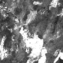
این تصاویر ترکیبی لندست کالکشن ۲ رده ۱ سطح ۲ از صحنههای تصحیحشده قائم رده ۱ سطح ۲ ساخته شدهاند. شاخص مساحت سوختگی (BAI) از باندهای قرمز و فروسرخ نزدیک تولید میشود و فاصله طیفی هر پیکسل را از یک نقطه طیفی مرجع (...) اندازهگیری میکند. شاخصهای پوشش گیاهی ماهواره لندست، آتشسوزی بای ، شاخصهای پوشش گیاهی ماهواره لندست ترکیبی USGS مجموعه لندست ۲، سطح ۱، سطح ۲، ترکیب سالانه 
این تصاویر ترکیبی لندست کالکشن ۲ رده ۱ سطح ۲ از صحنههای تصحیحشده قائم رده ۱ سطح ۲ ساخته شدهاند و شامل باندهای SR: آبی، سبز، قرمز، nir، swir1، swir2 و حرارتی هستند. این تصاویر ترکیبی از تمام صحنهها در هر دوره سالانه با شروع از ... ایجاد شدهاند. تصاویر ماهوارهای ترکیبی لندست ، لندست، sr، usgs مجموعه لندست ۲، سطح ۱، سطح ۲، گزارش ترکیبی سالانه EVI 
این تصاویر ترکیبی لندست کالکشن ۲ رده ۱ سطح ۲ از صحنههای تصحیحشده قائم رده ۱ سطح ۲ ساخته شدهاند. شاخص پوشش گیاهی بهبودیافته (EVI) از باندهای فروسرخ نزدیک، قرمز و آبی هر صحنه تولید میشود و مقدار آن از ۱.۰- تا ۱.۰ متغیر است. به Huete مراجعه کنید… ماهواره لندست اوی ، ماهواره لندست ترکیبی، پوشش گیاهی ایالات متحده ، شاخصهای پوشش گیاهی مجموعه لندست ۲، ردیف ۱، سطح ۲، گزارش ترکیبی سالانه NBR 
این تصاویر ترکیبی لندست کالکشن ۲ رده ۱ سطح ۲ از صحنههای تصحیحشده قائم رده ۱ سطح ۲ ساخته شدهاند. شاخص نسبت سوختگی نرمالشده حرارتی (NBRT) از باندهای Near-IR، Mid-IR (۲۲۱۵ نانومتر) و Thermal تولید میشود و دامنهای از ۱.۰- تا ۱.۰ دارد. ببینید ... آتش لندست، لندست-کامپوزیت ، nbrt، usgs، شاخصهای پوشش گیاهی مجموعه لندست ۲، رده ۱، سطح ۲، ترکیب سالانه NDVI 
این تصاویر ترکیبی لندست کالکشن ۲ رده ۱ سطح ۲ از صحنههای تصحیحشده ارتو در رده ۱ سطح ۲ ساخته شدهاند. شاخص پوشش گیاهی تفاضلی نرمالشده از باندهای فروسرخ نزدیک و قرمز هر صحنه به صورت (NIR - قرمز) / (NIR + قرمز) تولید میشود و در محدوده ... قرار دارد. لندست ، ماهواره ترکیبی لندست ، ndvi ، ماهواره USGS ، پوشش گیاهی ، شاخصهای پوشش گیاهی مجموعه لندست ۲، سطح ۱، سطح ۲، ترکیب سالانه NDWI 
این تصاویر ترکیبی لندست کالکشن ۲ رده ۱ سطح ۲ از صحنههای تصحیحشده قائم رده ۱ سطح ۲ ساخته شدهاند. شاخص نرمالشده تفاضلی آب (NDWI) برای مشخص کردن ویژگیهای آبهای آزاد و افزایش حضور آنها در تصاویر و در عین حال حذف ویژگیهای خاک و پوشش گیاهی زمینی طراحی شده است. این ... لندست ، لندست-کامپوزیت، ndwi، آبهای سطحی-زیرزمینی ، USGS نقشهبرداری جهانی زمین لندست ۱۹۷۵ 
نقشهبرداری جهانی زمین (GLS) 1975 مجموعهای جهانی از تصاویر اسکنر چندطیفی لندست (MSS) است. اکثر صحنهها توسط لندست 1-3 در سالهای 1972-1983 گرفته شدهاند. چند جای خالی در دادههای لندست 1-3 با صحنههای گرفته شده توسط لندست 4-5 در طول ... پر شده است. تصاویر ماهوارهای لندست رادیانس جهانی gls ، USGS نقشهبرداری جهانی زمین لندست ۲۰۰۵، صحنههایی از لندست ۵ 
مجموعه دادههای GLS2005 مجموعهای از ۹۵۰۰ تصویر ماهوارهای با وضوح متوسط و تصحیحشده قائم است که بین سالهای ۲۰۰۴ تا ۲۰۰۷ جمعآوری شده و خشکیهای زمین را پوشش میدهد. GLS2005 عمدتاً از دادههای لندست ۵ و دادههای لندست ۷ که جای خالی دارند، به همراه دادههای EO-1 ALI و Terra ASTER که هر جای خالی را پر میکنند، استفاده میکند... تصاویر ماهوارهای ETM GLS L5 لندست رادیانس نقشهبرداری جهانی زمین لندست ۲۰۰۵، صحنههای لندست ۵+۷ 
مجموعه دادههای GLS2005 مجموعهای از ۹۵۰۰ تصویر ماهوارهای با وضوح متوسط و تصحیحشده قائم است که بین سالهای ۲۰۰۴ تا ۲۰۰۷ جمعآوری شده و خشکیهای زمین را پوشش میدهد. GLS2005 عمدتاً از دادههای لندست ۵ و دادههای لندست ۷ که جای خالی دارند، به همراه دادههای EO-1 ALI و Terra ASTER که هر جای خالی را پر میکنند، استفاده میکند... تصاویر ماهوارهای GLS لندست رادیانس ، متعلق به USGS نقشهبرداری جهانی زمین لندست ۲۰۰۵، صحنههایی از لندست ۷ 
مجموعه دادههای GLS2005 مجموعهای از ۹۵۰۰ تصویر ماهوارهای با وضوح متوسط و تصحیحشده قائم است که بین سالهای ۲۰۰۴ تا ۲۰۰۷ جمعآوری شده و خشکیهای زمین را پوشش میدهد. GLS2005 عمدتاً از دادههای لندست ۵ و دادههای لندست ۷ که جای خالی دارند، به همراه دادههای EO-1 ALI و Terra ASTER که هر جای خالی را پر میکنند، استفاده میکند... تصاویر ماهوارهای ETM GLS L7 لندست رادیانس موزاییک تصویر لندست از قطب جنوب (LIMA) - صحنههای پردازششده لندست (۱۶ بیتی) 
تصویر موزاییکی لندست از قطب جنوب (LIMA) یک تصویر موزاییکی یکپارچه و تقریباً بدون ابر است که از صحنههای پردازششدهی لندست ۷ ETM+ ایجاد شده است. صحنههای پردازششدهی لندست (۱۶ بیتی) صحنههای NLAPS سطح ۱Gt هستند که به ۱۶ بیتی تبدیل شدهاند، با تصحیح زاویه خورشید پردازش شدهاند و به مقادیر بازتاب (Bindschadler ...) تبدیل شدهاند. تصاویر ماهوارهای موزاییکی لیما برگرفته از لندست، یخهای قطب جنوب تصویر موزاییکی لندست از قطب جنوب (LIMA) - صحنههای پردازششده لندست (۱۶ بیتی) فراداده 
تصویر موزاییکی لندست از قطب جنوب (LIMA) یک تصویر موزاییکی یکپارچه و تقریباً بدون ابر است که از صحنههای پردازششدهی لندست ۷ ETM+ ایجاد شده است. صحنههای پردازششدهی لندست (۱۶ بیتی) صحنههای NLAPS سطح ۱Gt هستند که به ۱۶ بیتی تبدیل شدهاند، با تصحیح زاویه خورشید پردازش شدهاند و به مقادیر بازتاب (Bindschadler ...) تبدیل شدهاند. تصاویر ماهوارهای موزاییکی لیما برگرفته از لندست، یخهای قطب جنوب تصویر موزاییکی لندست از قطب جنوب (LIMA) موزاییک ۱۶ بیتی با وضوح بالا 
تصویر موزاییکی لندست از قطب جنوب (LIMA) یک تصویر موزاییکی یکپارچه و تقریباً بدون ابر است که از صحنههای پردازششدهی لندست ۷ ETM+ ایجاد شده است. این مجموعه دادهی LIMA، LIMA میانی ۱۶ بیتی است. این موزاییک شامل صحنههای بازتاب سطحی نرمالشدهی تیز شده (باندهای ۱، ۲، ۳ و ... لندست ETM+) است. تصاویر ماهوارهای موزاییکی لیما برگرفته از لندست، یخهای قطب جنوب MCD12C1.061 MODIS نوع پوشش اراضی سالانه جهانی 0.05 درجه سانتیگراد 
محصول دادههای ترکیبی Terra و Aqua با استفاده از طیفسنج تصویربرداری با وضوح متوسط (MODIS) و شبکه مدلسازی آب و هوای پوشش زمین (CMG) (MCD12C1) نسخه 6.1، یک نسخه تجمیعشده مکانی و بازتصویر شده از محصول دادههای کاشیکاری شده MCD12Q1 نسخه 6.1 را ارائه میدهد. نقشههای برنامه بینالمللی ژئوسفر-زیستکره (IGBP)، دانشگاه ... landcover landuse-landcover modis nasa usgs سالانه MCD12Q1.061 MODIS نوع پوشش اراضی سالانه جهانی ۵۰۰ متر 
محصول دادههای ترکیبی طیفسنجی تصویربرداری با وضوح متوسط (MODIS) و نوع پوشش زمین (MCD12Q1) نسخه 6.1 از سنجندههای Terra و Aqua، انواع پوشش زمین جهانی را در فواصل سالانه ارائه میدهد. محصول دادههای MCD12Q1 نسخه 6.1 با استفاده از طبقهبندیهای نظارتشده دادههای بازتاب MODIS از سنجندههای Terra و Aqua استخراج شده است. Land… landcover landuse-landcover modis nasa usgs سالانه MCD12Q2.006 دینامیک پوشش زمین سالانه جهانی ۵۰۰ میلیون 
محصول دادههای ترکیبی طیفسنج تصویربرداری با وضوح متوسط (MODIS) و دینامیک پوشش زمین (MCD12Q2) نسخه 6.1 از سنجندههای Terra و Aqua، معیارهای فنولوژی سطح زمین را در فواصل سالانه ارائه میدهد. محصول دادههای MCD12Q2 نسخه 6.1 از سری زمانی شاخص پوشش گیاهی بهبود یافته 2 باندی (EVI2) مشتق شده است... evi، کاربری-پوشش زمین جهانی ، مودیس، شروع-سبزی، فنولوژی MCD15A3H.061 شاخص سطح برگ MODIS/FPAR 4 روزه جهانی 500 متر 
محصول MCD15A3H نسخه 6.1 طیفسنج تصویربرداری با وضوح متوسط (MODIS) سطح 4، کسر ترکیبی تابش فعال فتوسنتزی (FPAR) و شاخص سطح برگ (LAI) یک مجموعه داده ترکیبی 4 روزه با اندازه پیکسل 500 متر است. این الگوریتم بهترین پیکسل موجود را از بین تمام ... انتخاب میکند. بهرهوری گیاهی ناسا ، افپار گلوبال لای مودیس MCD19A1.061: سطح زمین BRF روزانه L2G جهانی ۵۰۰ متر و ۱ کیلومتر 
محصول داده MCD19A1 نسخه 6.1 یک محصول شبکهبندی شده سطح 2 با استفاده از طیفسنج تصویربرداری با وضوح متوسط (MODIS) از دادههای ترکیبی Terra و Aqua با ضریب بازتاب دوجهته سطح زمین (BRF) است که روزانه با وضوح 500 متر و 1 کیلومتر تولید میشود. برای اطلاعات بیشتر به راهنمای کاربر MAIAC مراجعه کنید. آئروسل AOD آکوا دیلی گلوبال مایاک MCD19A2.061: عمق نوری آئروسل زمینی Terra & Aqua MAIAC روزانه ۱ کیلومتر 
محصول داده MCD19A2 V6.1 ترکیبی از MODIS Terra و Aqua با پیادهسازی چند زاویهای تصحیح جوی (MAIAC) و عمق نوری آئروسل زمین (AOD) با شبکهبندی سطح 2 است که روزانه با وضوح 1 کیلومتر تولید میشود. برای اطلاعات بیشتر به راهنمای کاربر MAIAC مراجعه کنید. توجه: این محصول دارای ... آئروسل AOD آکوا اتمسفر روزانه جهانی پارامترهای مدل MODIS BRDF-Albedo با استفاده از MCD43A1.061، روزانه ۵۰۰ متر 
مجموعه دادههای پارامترهای مدل تابع توزیع بازتاب دوطرفه و آلبدو (BRDF/Albedo) مدل MCD43A1 V6.1، یک حاصلضرب ۱۶ روزه روزانه ۵۰۰ متری است. تاریخ جولیان نشان دهنده نهمین روز از دوره بازیابی ۱۶ روزه است و در نتیجه مشاهدات برای تخمین BRDF/Albedo برای آن روز وزندهی میشوند. … آلبدو، brdf، روزانه جهانی، مودیس ، ناسا MCD43A2.061 MODIS BRDF- کیفیت آلبدو روزانه ۵۰۰ متر 
مجموعه دادههای کیفیت تابع توزیع بازتاب دوطرفه و آلبدو (BRDF/Albedo) مدل MCD43A2 V6.1، یک محصول ۱۶ روزه با دامنه ۵۰۰ متر است. این مجموعه شامل تمام اطلاعات کیفی برای محصولات ۱۶ روزه متناظر MCD43A3 Albedo و MCD43A4 Nadir-BRDF (NBAR) است. MCD43A2 شامل کیفیت باندهای جداگانه و دادههای مشاهدهای است... آلبدو، brdf، روزانه جهانی، مودیس ، ناسا MCD43A3.061 MODIS آلبدو روزانه ۵۰۰ متر 
مجموعه داده مدل آلبدو MCD43A3 V6.1 یک محصول روزانه ۱۶ روزه است. این مجموعه، هم بازتاب نیمکره جهتدار (آلبدو آسمان سیاه) و هم بازتاب دو نیمکرهای (آلبدو آسمان سفید) را برای هر یک از باندهای بازتاب سطحی MODIS (باند ۱ تا باند ۷) و همچنین ۳ طیف گسترده ... ارائه میدهد. آلبدو، آسمان سیاه، روزانه جهانی، مودیس ، ناسا بازتاب تعدیلشده BRDF با استفاده از MODIS Nadir، MCD43A4.061، روزانه ۵۰۰ متر 
محصول MCD43A4 V6.1 با تابع توزیع بازتاب دو جهته نادیر (NBAR) دادههای بازتاب ۵۰۰ متری از باندهای ۱ تا ۷ "خشکی" MODIS را ارائه میدهد. این دادهها با استفاده از یک تابع توزیع بازتاب دو جهته تنظیم میشوند تا مقادیر را طوری مدلسازی کنند که گویی از نمای نادیر جمعآوری شدهاند. ... آلبدو، brdf، روزانه جهانی، مودیس ، ناسا MCD43C3.061 BRDF/Albedo روزانه L3 0.05 Deg CMG 
مجموعه دادههای آلبدو و تابع توزیع بازتاب دوطرفه (BRDF/Albedo) مربوط به MCD43C3 نسخه 6.1، روزانه با استفاده از دادههای 16 روزه Terra و Aqua MODIS در یک شبکه مدلسازی اقلیمی (CMG) با زاویه 0.05 درجه (5600 متر در خط استوا) تولید میشوند. دادهها به صورت زمانی تا نهم وزندهی میشوند... آلبدو بلک اسکای بر اساس اطلاعات روزانه گلوبال مودیس MCD64A1.061 MODIS منطقه سوخته ماهانه جهانی ۵۰۰ میلیون 
محصول دادههای ترکیبی MCD64A1 نسخه 6.1 از دادههای مناطق سوخته Terra و Aqua، یک محصول ماهانه، سراسری و شبکهبندی شده 500 متری است که شامل اطلاعات مربوط به مساحت سوخته شده در هر پیکسل و اطلاعات کیفی است. رویکرد نقشهبرداری از مناطق سوخته MCD64A1 از تصاویر بازتاب سطحی 500 متری MODIS به همراه مشاهدات آتشسوزی فعال 1 کیلومتری MODIS استفاده میکند. الگوریتم ... تشخیص تغییر سوختگی ، ژئوفیزیک آتشسوزی جهانی mcd64a1 MOD08_M3.061 محصول جهانی ماهانه Terra Atmosphere 
MOD08_M3 V6.1 یک محصول جهانی جو است که شامل مقادیر میانگین شبکهای ماهانه 1 در 1 درجه از پارامترهای جوی است. این پارامترها مربوط به خواص ذرات آئروسل جوی، بار کل ازن، بخار آب جوی، خواص نوری و فیزیکی ابر و شاخصهای پایداری جوی هستند. ... جو، آب و هوا، ژئوفیزیک، جهانی ، ماهنامه مودیز MOD09A1.061 بازتاب سطحی Terra، 8 روز جهانی، 500 متر 
محصول MOD09A1 V6.1 تخمینی از بازتاب طیفی سطحی باندهای 1 تا 7 سنجنده Terra MODIS با وضوح 500 متر و اصلاح شده برای شرایط جوی مانند گازها، آئروسلها و پراکندگی ریلی ارائه میدهد. در کنار هفت باند بازتاب، یک لایه کیفی و چهار لایه مشاهدهای وجود دارد... تصاویر ماهوارهای ۸ روزه جهانی مودیس ناسا sr MOD09GA.061 بازتاب سطحی Terra روزانه جهانی ۱ کیلومتر و ۵۰۰ متر 
محصولات بازتاب سطحی MODIS تخمینی از بازتاب طیفی سطح ارائه میدهند، همانطور که در سطح زمین و در غیاب پراکندگی یا جذب جوی اندازهگیری میشود. دادههای سطح پایین برای گازهای جوی و آئروسلها اصلاح میشوند. MOD09GA نسخه 6.1 باندهای 1 تا 7 را در ... ارائه میدهد. تصاویر ماهوارهای روزانه جهانی مودیس ناسا sr MOD09GQ.061 بازتاب سطحی Terra روزانه جهانی 250 متر 
محصولات بازتاب سطحی MODIS تخمینی از بازتاب طیفی سطح ارائه میدهند، همانطور که در سطح زمین و در غیاب پراکندگی یا جذب جوی اندازهگیری میشود. دادههای سطح پایین برای گازهای جوی و آئروسلها تصحیح میشوند. MOD09GQ نسخه 6.1 باندهای 1 و ... را ارائه میدهد. تصاویر ماهوارهای روزانه جهانی مودیس ناسا sr MOD09Q1.061 بازتاب سطحی Terra، 8 روزه جهانی، 250 متر 
محصول MOD09Q1 تخمینی از بازتاب طیفی سطحی باندهای 1 و 2 را با وضوح 250 متر و با اصلاح شرایط جوی مانند گازها، آئروسلها و پراکندگی ریلی ارائه میدهد. همراه با دو باند بازتاب، یک لایه کیفیت نیز گنجانده شده است. برای هر ... تصاویر ماهوارهای ۸ روزه جهانی mod09q1 از ناسا، modis MOD11A1.061 دمای سطح زمین و ضریب انتشار روزانه جهانی 1 کیلومتر 
محصول MOD11A1 V6.1 مقادیر روزانه دمای سطح زمین (LST) و ضریب گسیلندگی را در یک شبکه 1200 در 1200 کیلومتری ارائه میدهد. مقدار دما از محصول نوار MOD11_L2 مشتق شده است. در عرضهای جغرافیایی بالاتر از 30 درجه، برخی از پیکسلها ممکن است چندین مشاهده داشته باشند که در آنها معیارهای آسمان صاف ... آب و هوا، ضریب انتشار روزانه، جهانی ، LST، MODIS MOD11A2.061 دمای سطح زمین و ضریب انتشار 8 روزه جهانی 1 کیلومتر 
محصول MOD11A2 V6.1 میانگین دمای سطح زمین (LST) 8 روزه را در یک شبکه 1200 در 1200 کیلومتری ارائه میدهد. مقدار هر پیکسل در MOD11A2 میانگین سادهای از تمام پیکسلهای LST مربوط به MOD11A1 است که در آن دوره 8 روزه جمعآوری شدهاند. MOD11A2 ... ضریب انتشار آب و هوای ۸ روزه ، LST جهانی ، mod11a2 شاخصهای پوشش گیاهی زمین MOD13A1.061، دادههای جهانی 16 روزه 500 متر 
محصول MOD13A1 V6.1 مقدار شاخص پوشش گیاهی (VI) را بر اساس هر پیکسل ارائه میدهد. دو لایه پوشش گیاهی اصلی وجود دارد. اولین لایه، شاخص پوشش گیاهی نرمال شده (NDVI) است که به عنوان شاخص پیوستگی برای دادههای ملی اقیانوسی و جوی موجود شناخته میشود... برنامه ۱۶ روزه evi global modis ناسا ndvi MOD13A2.061 شاخصهای پوشش گیاهی زمین، دادههای جهانی ۱۶ روزه، از ۱ کیلومتر 
محصول MOD13A2 V6.1 دو شاخص پوشش گیاهی (VI) ارائه میدهد: شاخص پوشش گیاهی تفاضلی نرمالشده (NDVI) و شاخص پوشش گیاهی بهبودیافته (EVI). NDVI به عنوان شاخص پیوستگی NDVI مشتقشده از اداره ملی اقیانوسی و جوی (NOAA-AVHRR) موجود شناخته میشود. ... برنامه ۱۶ روزه evi global modis ناسا ndvi MOD13A3.061 شاخصهای پوشش گیاهی ماهانه L3 جهانی 1 کیلومتر شبکه SIN 
دادههای محصول MOD13A3 V6.1 به صورت ماهانه با وضوح مکانی ۱ کیلومتر (km) ارائه میشوند. در تولید این محصول ماهانه، الگوریتم تمام محصولات MOD13A2 را که در طول ماه همپوشانی دارند، در نظر میگیرد و از یک میانگین زمانی وزنی استفاده میکند. شاخصهای پوشش گیاهی برای پایش جهانی پوشش گیاهی استفاده میشوند… اوی گلوبال مودیس ماهانه ناسا اندوی MOD13C1.061: شاخصهای پوشش گیاهی زمین، شبکه مدلسازی آب و هوای جهانی 0.05 درجهای 16 روزه L3 
محصول طیفسنج تصویربرداری با وضوح متوسط ترا (MODIS) نسخه ۶.۱، مقدار شاخص پوشش گیاهی (VI) را بر اساس هر پیکسل ارائه میدهد. دو لایه پوشش گیاهی اصلی وجود دارد. اولین لایه، شاخص پوشش گیاهی نرمال شده (NDVI) است که پیوستگی با ... را حفظ میکند. پوشش گیاهی ۱۶ روزه جهانی ناسا و USGS شاخصهای پوشش گیاهی زمین MOD13Q1.061، دادههای جهانی ۱۶ روزه ۲۵۰ متر 
محصول MOD13Q1 V6.1 مقدار شاخص پوشش گیاهی (VI) را بر اساس هر پیکسل ارائه میدهد. دو لایه پوشش گیاهی اصلی وجود دارد. اولین لایه، شاخص پوشش گیاهی نرمال شده (NDVI) است که به عنوان شاخص پیوستگی موجود در دادههای ملی اقیانوسی و جوی ... شناخته میشود. برنامه ۱۶ روزه evi global modis ناسا ndvi MOD14A1.061: ناهنجاریهای حرارتی و آتشسوزیهای روزانه جهانی ۱ کیلومتر 
مجموعه داده MOD14A1 V6.1، کامپوزیتهای ماسک آتش روزانه را با وضوح ۱ کیلومتر ارائه میدهد که از تابشهای ۴ و ۱۱ میکرومتری MODIS گرفته شدهاند. استراتژی تشخیص آتشسوزی بر اساس تشخیص مطلق آتشسوزی (زمانی که قدرت آتش برای تشخیص کافی است) و تشخیص نسبت به ... آتش سوزی روزانه جهانی مودیس ناسا ترا MOD14A2.061: ناهنجاریهای حرارتی و آتشسوزیهای ۸ روزه جهانی ۱ کیلومتر 
مجموعه داده MOD14A2 V6.1، کامپوزیتهای ماسک آتشنشانی ۸ روزه را با وضوح ۱ کیلومتر ارائه میدهد. این مجموعه شامل حداکثر مقدار کلاسهای پیکسل منفرد در طول دوره ترکیب است. همراه با ماسک آتشنشانی، یک لایه اطلاعات کیفی مرتبط نیز ارائه شده است. مستندات: راهنمای کاربر، مبانی نظری الگوریتم ... آتشسوزی ۸ روزه جهانی مودیس ناسا ترا MOD15A2H.061: شاخص سطح برگ Terra/FPAR 8 روزه جهانی 500 متر 
محصول ترکیبی شاخص سطح برگ (LAI) و کسر تابش فعال فتوسنتزی (FPAR) سنجنده MOD15A2H V6.1 MODIS، یک مجموعه داده ترکیبی 8 روزه با وضوح 500 متر است. این الگوریتم "بهترین" پیکسل موجود از تمام دادههای دریافتی حسگر Terra را در طول دوره 8 روزه انتخاب میکند. ... 8 روز fpar جهانی lai modis nasa MOD17A2H.061: بهرهوری اولیه ناخالص Terra، 8 روزه جهانی، 500 میلیون 
محصول MOD17A2H V6.1 مربوط به بهرهوری اولیه ناخالص (GPP) یک ترکیب تجمعی ۸ روزه با اندازه پیکسل ۵۰۰ متر است. این محصول بر اساس مفهوم بهرهوری مصرف تابش ساخته شده است و میتواند به عنوان ورودی مدلهای داده برای محاسبه انرژی زمینی، کربن، فرآیندهای چرخه آب و ... مورد استفاده قرار گیرد. فتوسنتز جهانی ۸ روزه مودیس ناسا MOD17A2HGF.061: بهرهوری ناخالص اولیه Terra، 8 روزه جهانی، 500 میلیون 
محصول MOD17A2HGF نسخه 6.1 از بهرهوری ناخالص اولیه (GPP) یک ترکیب تجمعی 8 روزه از مقادیر با اندازه پیکسل 500 متر (m) بر اساس مفهوم بهرهوری مصرف تابش است که میتواند به عنوان ورودی مدلهای داده برای محاسبه انرژی زمینی، کربن، آب ... مورد استفاده قرار گیرد. فتوسنتز جهانی ۸ روزه مودیس ناسا MOD17A3HGF.061: شکاف تولید اولیه خالص Terra در سطح جهانی سالانه ۵۰۰ میلیون تن 
محصول MOD17A3HGF V6.1 اطلاعاتی در مورد بهرهوری اولیه ناخالص و خالص سالانه (GPP و NPP) با وضوح پیکسلی ۵۰۰ متر ارائه میدهد. NPP سالانه از مجموع تمام محصولات فتوسنتز خالص (PSN) 8 روزه (MOD17A2H) از سال مورد نظر بدست میآید. مقدار PSN برابر است با تفاضل ... بهرهوری گیاهی، فتوسنتز ، تولید ناخالص داخلی جهانی ، ناسا ، انرژی هستهای MOD21A1D.061 دمای سطح زمین Terra و ضریب انتشار سه باند روزانه جهانی 1 کیلومتر 
مجموعه دادههای MOD21A1D به صورت روزانه از محصولات LST میانی سطح ۲ شبکهبندی شده (L2G) در طول روز با وضوح مکانی ۱۰۰۰ متر تولید میشود. فرآیند L2G، دانههای نواری روزانه MOD21 را بر روی یک شبکه سینوسی MODIS نگاشت کرده و تمام مشاهداتی را که بر روی یک سلول شبکهبندی شده قرار میگیرند، ذخیره میکند... آب و هوا، میزان انتشار روزانه، جهانی، LST ، ناسا MOD21A1N.061 دمای سطح زمین Terra و ضریب انتشار سه باند روزانه جهانی 1 کیلومتر 
مجموعه دادههای MOD21A1N به صورت روزانه از محصولات LST سطح ۲ شبکهبندی شده (L2G) با وضوح مکانی ۱۰۰۰ متر تولید میشود. فرآیند L2G، دانههای نواری روزانه MOD21 را بر روی یک شبکه سینوسی MODIS نگاشت کرده و تمام مشاهداتی را که بر روی یک سلول شبکهبندی شده قرار میگیرند، ذخیره میکند... آب و هوا، میزان انتشار روزانه، جهانی، LST ، ناسا MOD21C1.061 دمای سطح زمین Terra و ضریب انتشار سه باند روزانه L3 جهانی 0.05 درجه CMG 
مجموعه دادههای MOD21C1 به صورت روزانه در یک شبکه مدلسازی اقلیمی (CMG) با زاویه 0.05 درجه (5600 متر در خط استوا) از محصولات LST میانی شبکهبندی شده سطح 2 (L2G) در طول روز تولید میشود. فرآیند L2G، دانههای نواری روزانه MOD21 را بر روی یک شبکه سینوسی MODIS نگاشت کرده و همه ... را ذخیره میکند. آب و هوا، میزان انتشار روزانه، جهانی، LST ، ناسا MOD21C2.061 دمای سطح زمین Terra و ضریب انتشار سه بانده 8 روزه L3 Global 0.05 Deg CMG 
مجموعه داده MOD21C2 یک محصول LST ترکیبی 8 روزه است که از الگوریتمی مبتنی بر روش میانگینگیری ساده استفاده میکند. این الگوریتم میانگین را از تمام دادههای روزانه MOD21A1D و MOD21A1N بدون ابر از دوره 8 روزه محاسبه میکند. برخلاف مجموعه دادههای MOD21A1 که در آن ... ضریب انتشار آب و هوا ، LST جهانی، ناسا ، دمای سطح MOD21C3.061 دمای سطح زمین Terra و ضریب انتشار سه باند ماهانه L3 جهانی 0.05 درجه CMG 
مجموعه داده MOD21C3 یک محصول LST ترکیبی ماهانه است که از الگوریتمی مبتنی بر روش میانگینگیری ساده استفاده میکند. این الگوریتم میانگین را از تمام دادههای روزانه MOD21A1D و MOD21A1N بدون ابر از دوره 8 روزه محاسبه میکند. برخلاف مجموعه دادههای MOD21A1 که در آن ... انتشارپذیری آب و هوا ، ماهنامه جهانی LST، ناسا MOD44W.006 ماسک آب زمینی Terra برگرفته از MODIS و SRTM سالانه جهانی 250 میلیون 
محصول ماسک خشکی/آبی MOD44W V6 با مساحت ۲۵۰ متر، با استفاده از یک طبقهبندیکننده درخت تصمیمگیری که با دادههای MODIS آموزش دیده و با محصول MOD44W V5 اعتبارسنجی شده است، استخراج شده است. مجموعهای از ماسکها برای رسیدگی به مشکلات شناختهشده ناشی از سایه زمین، سوختگی، ابری بودن یا پوشش یخ اعمال میشوند... ژئوفیزیک mod44w مودیس ناسا SRTM آبهای سطحی-زمینی MODOCGA.006 بازتاب اقیانوس Terra روزانه جهانی 1 کیلومتر 
محصول بازتاب اقیانوسی MODOCGA V6 شامل دادههای بازتاب ۱ کیلومتری از باندهای ۸ تا ۱۶ سنجنده Terra MODIS است. این محصول به عنوان بازتاب اقیانوسی شناخته میشود، زیرا باندهای ۸ تا ۱۶ در درجه اول برای تولید محصولات اقیانوسی استفاده میشوند، اما این یک محصول اقیانوسی نیست زیرا کاشیها... بازتاب اقیانوسها ، روزانه جهانی مودیس، ناسا مرزهای منطقه سوخته MTBS 
مجموعه دادههای مرزهای مناطق سوخته «روندهای پایش شدت سوختگی» (MTBS) شامل چندضلعیهای وسعت مناطق سوخته شده در تمام آتشسوزیهای MTBS که در حال حاضر برای ایالات متحده، آلاسکا، هاوایی و پورتوریکو تکمیل شدهاند، میباشد. در زیر NBR مخفف «نسبت سوختگی نرمالشده» است، در حالی که dNBR مخفف ... میز تحریر اروس فایر GTAC مدل MTBS ساخت آمریکا MYD08_M3.061 محصول جهانی ماهانه آکوا اتمسفر 
MYD08_M3 V6.1 یک محصول جهانی جو است که شامل مقادیر میانگین شبکهای ماهانه 1 در 1 درجه از پارامترهای جوی است. این پارامترها مربوط به خواص ذرات آئروسل جوی، بار کل ازن، بخار آب جوی، خواص نوری و فیزیکی ابر و شاخصهای پایداری جوی هستند. ... آب، جو، اقلیم، ژئوفیزیک، جهانی، مودیس MYD09A1.061 بازتاب سطح آب، 8 روزه جهانی، 500 متر 
محصول MYD09A1 V6.1 تخمینی از بازتاب طیفی سطحی باندهای 1 تا 7 سنجنده Aqua MODIS با وضوح 500 متر و اصلاح شده برای شرایط جوی مانند گازها، آئروسلها و پراکندگی ریلی ارائه میدهد. در کنار هفت باند بازتابی، یک لایه کیفی و چهار لایه مشاهدهای وجود دارد... تصاویر ماهوارهای ۸ روزه آکوا گلوبال مودیس ناسا MYD09GA.061 بازتاب سطح آب دریا، روزانه جهانی، ۱ کیلومتر و ۵۰۰ متر 
محصولات بازتاب سطحی MODIS تخمینی از بازتاب طیفی سطح ارائه میدهند، همانطور که در سطح زمین و در غیاب پراکندگی یا جذب جوی اندازهگیری میشود. دادههای سطح پایین برای گازهای جوی و آئروسلها اصلاح میشوند. نسخه 6.1 نرمافزار MYD09GA باندهای 1 تا 7 را در ... ارائه میدهد. تصاویر ماهوارهای ناسا از aqua daily global modis MYD09GQ.061 بازتاب سطح آب دریا، روزانه جهانی، 250 متر 
محصولات بازتاب سطحی MODIS تخمینی از بازتاب طیفی سطح ارائه میدهند، همانطور که در سطح زمین و در غیاب پراکندگی یا جذب جوی اندازهگیری میشود. دادههای سطح پایین برای گازهای جوی و آئروسلها تصحیح میشوند. نسخه 6.1 نرمافزار MYD09GQ باندهای 1 و ... را ارائه میدهد. تصاویر ماهوارهای ناسا از aqua daily global modis MYD09Q1.061 بازتاب سطح آب، 8 روزه جهانی، 250 متر 
محصول MYD09Q1 تخمینی از بازتاب طیفی سطحی باندهای 1 و 2 را با وضوح 250 متر و با اصلاح شرایط جوی مانند گازها، آئروسلها و پراکندگی ریلی ارائه میدهد. همراه با دو باند بازتاب، یک لایه کیفیت نیز گنجانده شده است. برای هر ... تصاویر ماهوارهای ۸ روزه آکوا گلوبال مودیس ناسا MYD11A1.061 دمای سطح زمین و ضریب انتشار روزانه جهانی 1 کیلومتر در آکوا 
محصول MYD11A1 V6.1 مقادیر روزانه دمای سطح زمین (LST) و ضریب گسیلندگی را در یک شبکه 1200 در 1200 کیلومتری ارائه میدهد. مقدار دما از محصول نوار MYD11_L2 مشتق شده است. در عرضهای جغرافیایی بالاتر از 30 درجه، برخی از پیکسلها ممکن است چندین مشاهده داشته باشند که در آنها معیارهای آسمان صاف ... آب و هوا ، ضریب انتشار روزانه، LST جهانی MYD11A2.061 دمای سطح زمین و ضریب انتشار Aqua، دادههای جهانی ۸ روزه از ۱ کیلومتر 
محصول MYD11A2 V6.1 میانگین دمای سطح زمین (LST) 8 روزه را در یک شبکه 1200 در 1200 کیلومتری ارائه میدهد. مقدار هر پیکسل در MYD11A2 میانگین سادهای از تمام پیکسلهای LST مربوط به MYD11A1 است که در آن دوره 8 روزه جمعآوری شدهاند. MYD11A2 ... آب و هوای آبی، میزان انتشار، LST جهانی، ۸ روزه شاخصهای پوشش گیاهی آبی MYD13A1.061، دادههای جهانی ۱۶ روزه ۵۰۰ متر 
محصول MYD13A1 V6.1 مقدار شاخص پوشش گیاهی (VI) را بر اساس هر پیکسل ارائه میدهد. دو لایه پوشش گیاهی اصلی وجود دارد. اولین لایه، شاخص پوشش گیاهی نرمال شده (NDVI) است که به عنوان شاخص پیوستگی موجود در دادههای ملی اقیانوسی و جوی ... شناخته میشود. آکوا اوی گلوبال ۱۶ روزه ، ناسا شاخصهای پوشش گیاهی آبی MYD13A2.061، دادههای جهانی ۱۶ روزه، ۱ کیلومتر 
محصول MYD13A2 V6.1 دو شاخص پوشش گیاهی (VI) ارائه میدهد: شاخص پوشش گیاهی تفاضلی نرمالشده (NDVI) و شاخص پوشش گیاهی بهبودیافته (EVI). NDVI به عنوان شاخص پیوستگی NDVI مشتقشده از اداره ملی اقیانوسی و جوی (NOAA-AVHRR) موجود شناخته میشود. ... آکوا اوی گلوبال ۱۶ روزه ، ناسا MYD13A3.061 شاخصهای پوشش گیاهی آبی ماهانه L3 جهانی 1 کیلومتر شبکه SIN 
دادههای شاخصهای پوشش گیاهی (MYD13A3) نسخه 6.1 طیفسنج تصویربرداری با وضوح متوسط آکوا (MODIS) به صورت ماهانه با وضوح مکانی 1 کیلومتر (km) به عنوان یک محصول شبکهبندی شده سطح 3 در تصویر سینوسی ارائه میشوند. در تولید این محصول ماهانه، الگوریتم تمام محصولات MYD13A2 را که ... آکوا اوی گلوبال مودیس ، ماهانه ناسا MYD13C1.061: شاخصهای پوشش گیاهی آبزی، L3 جهانی 16 روزه، 0.05 درجه سانتیگراد 
محصول طیفسنج تصویربرداری با وضوح متوسط آکوا (MODIS) نسخه 6.1، شاخصهای پوشش گیاهی 16 روزه (MYD13C1) را ارائه میدهد و مقدار شاخص پوشش گیاهی (VI) را بر اساس هر پیکسل ارائه میدهد. دو لایه پوشش گیاهی اصلی وجود دارد. اولین لایه، شاخص پوشش گیاهی نرمال شده (NDVI) است که پیوستگی با ... را حفظ میکند. برنامه ۱۶ روزه آکوا گلوبال ناسا ، پوشش گیاهی ایالات متحده آمریکا شاخصهای پوشش گیاهی آبی MYD13Q1.061، دادههای جهانی ۱۶ روزه ۲۵۰ میلیون 
محصول MYD13Q1 V6.1 مقدار شاخص پوشش گیاهی (VI) را بر اساس هر پیکسل ارائه میدهد. دو لایه پوشش گیاهی اصلی وجود دارد. اولین لایه، شاخص پوشش گیاهی نرمال شده (NDVI) است که به عنوان شاخص پیوستگی موجود در دادههای ملی اقیانوسی و جوی ... شناخته میشود. آکوا اوی گلوبال ۱۶ روزه ، ناسا MYD14A1.061: ناهنجاریهای حرارتی و آتشسوزیهای آبی روزانه جهانی، ۱ کیلومتر 
مجموعه داده MYD14A1 V6.1، کامپوزیتهای ماسک آتش روزانه را با وضوح ۱ کیلومتر ارائه میدهد که از تابشهای ۴ و ۱۱ میکرومتری MODIS گرفته شدهاند. استراتژی تشخیص آتشسوزی بر اساس تشخیص مطلق آتشسوزی (زمانی که قدرت آتش برای تشخیص کافی است) و تشخیص نسبت به ... آکوا دیلی فایر گلوبال مودیس ناسا MYD14A2.061: ناهنجاریهای حرارتی و آتشسوزی آبی، گزارش جهانی ۸ روزه، ۱ کیلومتر 
مجموعه داده MYD14A2 V6.1، کامپوزیتهای ماسک آتشنشانی ۸ روزه را با وضوح ۱ کیلومتر ارائه میدهد. این مجموعه شامل حداکثر مقدار کلاسهای پیکسل منفرد در طول دوره ترکیب است. همراه با ماسک آتشنشانی، یک لایه اطلاعات کیفی مرتبط نیز ارائه شده است. مستندات: راهنمای کاربر، مبانی نظری الگوریتم ... آتشسوزی آبی جهانی ۸ روزه مودی، ناسا MYD15A2H.061: شاخص سطح برگ آکوا/FPAR 8 روزه جهانی 500 متر 
محصول ترکیبی شاخص سطح برگ (LAI) و کسر تابش فعال فتوسنتزی (FPAR) سنجنده MODIS مدل MYD15A2H V6.1، یک مجموعه داده ترکیبی 8 روزه با وضوح 500 متر است. این الگوریتم "بهترین" پیکسل موجود از تمام دادههای دریافتی حسگر Aqua را در طول دوره 8 روزه انتخاب میکند. ... 8 روز aqua fpar global lai modis MYD17A2H.061: بهرهوری ناخالص اولیه آکوا، 8 روزه جهانی، 500 میلیون 
محصول MYD17A2H V6.1 مربوط به بهرهوری ناخالص اولیه (GPP) یک ترکیب تجمعی ۸ روزه با وضوح ۵۰۰ متر است. این محصول بر اساس مفهوم بهرهوری مصرف تابش ساخته شده است و میتواند به عنوان ورودی مدلهای داده برای محاسبه انرژی زمینی، کربن، فرآیندهای چرخه آب و ... مورد استفاده قرار گیرد. برنامه جهانی آب و هوای ۸ روزه آکوا گلوبال، مودیس، ناسا MYD17A3HGF.061: تولید خالص اولیه آکوا، شکاف جهانی سالانه ۵۰۰ میلیون تن را پر میکند 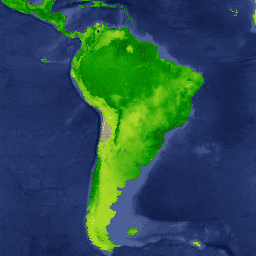
محصول MYD17A3HGF V6.1 اطلاعاتی در مورد بهرهوری اولیه ناخالص و خالص سالانه (GPP و NPP) با وضوح پیکسلی ۵۰۰ متر ارائه میدهد. NPP سالانه از مجموع تمام محصولات فتوسنتز خالص (PSN) 8 روزه (MYD17A2H) از سال مورد نظر بدست میآید. مقدار PSN برابر است با تفاضل ... آکوا گلوبال جیپیپی، ناسا انپیپی، فتوسنتز MYD21A1D.061 دمای سطح زمین آکوا و ضریب انتشار سه باندی روزانه جهانی ۱ کیلومتر 
مجموعه دادههای MYD21A1D به صورت روزانه از محصولات LST میانی سطح ۲ شبکهبندی شده (L2G) در طول روز با وضوح مکانی ۱۰۰۰ متر تولید میشود. فرآیند L2G، دانههای نواری روزانه MOD21 را بر روی یک شبکه سینوسی MODIS نگاشت کرده و تمام مشاهداتی را که بر روی یک سلول شبکهبندی شده قرار میگیرند، ذخیره میکند... آب و هوا ، ضریب انتشار روزانه، LST جهانی MYD21A1N.061 دمای سطح زمین آکوا و ضریب انتشار سه باندی روزانه جهانی ۱ کیلومتر 
مجموعه داده MYD21A1N به صورت روزانه از محصولات LST سطح ۲ شبکهبندی شده (L2G) با وضوح مکانی ۱۰۰۰ متر تولید میشود. فرآیند L2G، دانههای نواری روزانه MOD21 را بر روی یک شبکه سینوسی MODIS نگاشت کرده و تمام مشاهداتی را که بر روی یک سلول شبکهبندی شده قرار میگیرند، ذخیره میکند... آب و هوا ، ضریب انتشار روزانه، LST جهانی MYD21C1.061 دمای سطح زمین Aqua و ضریب انتشار سه باند روزانه L3 جهانی 0.05 درجه CMG 
مجموعه دادههای MYD21C1 به صورت روزانه در یک شبکه مدلسازی اقلیمی (CMG) با زاویه 0.05 درجه (5600 متر در خط استوا) از محصولات LST میانی شبکهبندی شده سطح 2 (L2G) در طول روز تولید میشود. فرآیند L2G، دانههای نواری روزانه MYD21 را بر روی یک شبکه سینوسی MODIS نگاشت کرده و همه ... را ذخیره میکند. آب و هوا ، ضریب انتشار روزانه، LST جهانی MYD21C2.061 دمای سطح زمین Aqua و ضریب انتشار سه بانده 8 روزه L3 Global 0.05 Deg CMG 
مجموعه داده MYD21C2 یک محصول LST ترکیبی ۸ روزه است که از الگوریتمی مبتنی بر روش میانگینگیری ساده استفاده میکند. این الگوریتم میانگین را از تمام دادههای روزانه MYD21A1D و MYD21A1N بدون ابر از دوره ۸ روزه محاسبه میکند. برخلاف مجموعه دادههای MYD21A1 که در آن ... آب و هوا، میزان انتشار، LST جهانی ، ناسا MYD21C3.061 دمای سطح زمین Aqua و ضریب انتشار سه باند ماهانه L3 جهانی 0.05 درجه CMG 
مجموعه داده MYD21C3 یک محصول LST ترکیبی ماهانه است که از الگوریتمی مبتنی بر روش میانگینگیری ساده استفاده میکند. این الگوریتم میانگین را از تمام دادههای روزانه MYD21A1D و MYD21A1N که بدون نیاز به فضای ابری و در بازه زمانی ۸ روزه جمعآوری شدهاند، محاسبه میکند. برخلاف مجموعه دادههای MYD21A1 که در آن ... آب و هوا، میزان انتشار، LST جهانی ، ماهانه MYDOCGA.006 بازتاب اقیانوس آبی روزانه جهانی ۱ کیلومتر 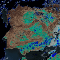
محصول بازتاب اقیانوسی MYDOCGA V6 شامل دادههای بازتاب ۱ کیلومتری از باندهای ۸ تا ۱۶ سنجنده Aqua MODIS است. این محصول به عنوان بازتاب اقیانوسی شناخته میشود، زیرا باندهای ۸ تا ۱۶ در درجه اول برای تولید محصولات اقیانوسی استفاده میشوند، اما این یک محصول اقیانوسی نیست زیرا کاشیها... آکوا، دیلی گلوبال، مودیس، ناسا، اقیانوسها روندهای نظارت بر شدت سوختگی (MTBS) تصاویر شدت سوختگی 
موزاییکهای شدت سوختگی شامل تصاویر رستری موضوعی از کلاسهای شدت سوختگی MTBS برای همه آتشسوزیهای MTBS که در حال حاضر برای ایالات متحده، آلاسکا، هاوایی و پورتوریکو تکمیل شدهاند، میباشد. تصاویر شدت سوختگی موزاییکی شده سالانه توسط ایالت متحده و ... گردآوری میشوند. آتشسوزی اروس ، جنگل جیتیسی، پوشش زمین ، مشتقشده از لندست ارتفاع دیجیتال ناسا SRTM، 30 متر 
دادههای ارتفاعی دیجیتال ماموریت توپوگرافی رادار شاتل (SRTM، به Farr و همکاران، ۲۰۰۷ مراجعه کنید) یک تلاش تحقیقاتی بینالمللی است که مدلهای ارتفاعی دیجیتال را در مقیاس تقریباً جهانی به دست آورده است. این محصول SRTM V3 (SRTM Plus) توسط ناسا JPL با وضوح ۱ ثانیه قوسی ارائه شده است... ارتفاع dem ارتفاع-توپوگرافی ژئوفیزیک ناسا srtm NASADEM: مدل ارتفاعی دیجیتال 30 متری ناسا 
NASADEM پردازش مجدد دادههای SRTM است که با ترکیب دادههای کمکی از مجموعه دادههای ASTER GDEM، ICESat GLAS و PRISM، دقت آن بهبود یافته است. مهمترین پیشرفتهای پردازش شامل کاهش خلأ از طریق بهبود بازآرایی فاز و استفاده از دادههای ICESat GLAS برای کنترل است. مستندات: راهنمای کاربر ارتفاع dem ارتفاع-توپوگرافی ژئوفیزیک ناسا srtm NLCD 2019: پایگاه داده ملی پوشش اراضی USGS، نسخه 2019 
NLCD (پایگاه داده ملی پوشش اراضی) یک پایگاه داده پوشش اراضی مبتنی بر لندست 30 متری است که 8 دوره (2001، 2004، 2006، 2008، 2011، 2013، 2016 و 2019) را در بر میگیرد. دوره نهم برای سال 2021 نیز در اینجا موجود است. تصاویر بر اساس لایه داده نفوذناپذیری برای مناطق شهری ... پوشش زمین blm، کاربری زمین ، پوشش زمین mrlc، nlcd، usgs NLCD 2021: پایگاه داده ملی پوشش اراضی USGS، نسخه 2021 
سازمان زمینشناسی ایالات متحده (USGS)، با همکاری چندین آژانس فدرال، اکنون هفت محصول پایگاه داده ملی پوشش اراضی (NLCD) را توسعه داده و منتشر کرده است: NLCD 1992، 2001، 2006، 2011، 2016، 2019 و 2021. از زمان انتشار در سال 2016، محصولات پوشش اراضی برای فواصل دو تا سه ساله ایجاد شدند ... پوشش زمین blm، کاربری زمین ، پوشش زمین mrlc، nlcd، usgs اعلامیه: USGS GAP PAD-US نسخه ۲.۰ 
PAD-US فهرست ملی رسمی آمریکا از مناطق حفاظتشده زمینی و دریایی ایالات متحده است که به حفظ تنوع زیستی و سایر کاربردهای طبیعی، تفریحی و فرهنگی اختصاص داده شده و از طریق روشهای قانونی یا سایر روشهای مؤثر برای این اهداف مدیریت میشوند. این پایگاه داده به بخشهای ... تفکیک شده است. حق ارتفاق حفاظتی، تعیین حدود زیرساختها، مدیریت مالکیت، مناطق حفاظتشده پوشش سایبان درختی USFS نسخه 2023-5 (CONUS و OCONUS) 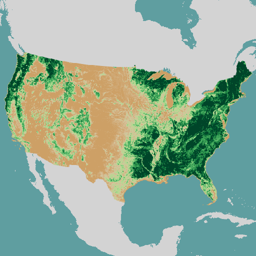
مرور کلی مجموعه دادههای پوشش تاجی درختان (TCC)، که توسط وزارت کشاورزی ایالات متحده، خدمات جنگلداری (USFS) تولید شده است، خروجیهای نقشه سالانه مبتنی بر سنجش از دور هستند که از سال ۱۹۸۵ تا ۲۰۲۳ را در بر میگیرند. این دادهها از پروژه پایگاه داده ملی پوشش اراضی (NLCD) پشتیبانی میکنند که توسط سازمان زمینشناسی ایالات متحده مدیریت میشود... جنگل GTAC، کاربری اراضی، پوشش زمین ، منابع ردکسل، وزارت کشاورزی ایالات متحده، USFS نقشه ملی 10 متری USGS 3DEP بدون درز (1/3 ثانیه قوسی) 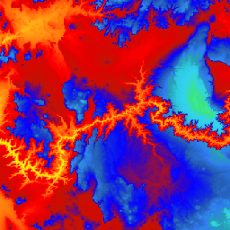
این مجموعه داده یکپارچه 3DEP DEM برای ایالات متحده با پوشش کامل ۴۸ ایالت هممرز، هاوایی و سرزمینهای ایالات متحده است. پوشش آلاسکا در حال حاضر تا حدی در دسترس است و به عنوان بخشی از طرح نقشهبرداری آلاسکا، به پوشش سراسری ایالت گسترش مییابد. فاصله زمین ... نقشه سه بعدی ارتفاعی ، توپوگرافی ارتفاعی، توپوگرافی ژئوفیزیکی نقشه ملی یک متری USGS 3DEP 
این مجموعهای کاشیکاری شده از تصاویر با اندازه پیکسل ۱ متر از برنامه ارتفاع سهبعدی (3DEP) است. دادههای 3DEP به عنوان لایه ارتفاعی نقشه ملی عمل میکنند و اطلاعات ارتفاعی پایه را برای مطالعات علوم زمین و کاربردهای نقشهبرداری در ایالات متحده ارائه میدهند... نقشه سه بعدی ارتفاعی ، توپوگرافی ارتفاعی، توپوگرافی ژئوفیزیکی فراداده مکانی نقشه ملی USGS 3DEP با دقت ۱/۳ ثانیه قوسی (۱۰ متر) 
این جدولی با فراداده برای دارایی DEM 10 متری 3DEP است. فراداده مکانی وسعت واحد کاری (WESM) شامل دادههای لیدار موجود فعلی و اطلاعات اولیه در مورد پروژههای لیدار، از جمله سطح کیفیت لیدار، تاریخهای اخذ دادهها و پیوندهایی به فرادادههای سطح پروژه است. برای اطلاعات بیشتر به ... مراجعه کنید. جدول توپوگرافی-ارتفاع سه بعدی USGS سازمان زمینشناسی آمریکا (USGS) در سال ۲۰۰۱، آلاسکا را از نظر وجود شکاف (GAP) بررسی کرد. 
دادههای اکوسیستمهای زمینی ملی GAP/LANDFIRE طبقهبندی دقیقی از پوشش گیاهی و پوشش زمین برای ایالات متحده، آلاسکا، هاوایی و پورتوریکو ارائه میدهد. اکوسیستمهای GAP/LF 2011 برای ایالات متحده، بهروزرسانیشدهی دادههای پوشش زمین برنامهی ملی تحلیل شکاف - نسخه ۲.۲ است. آلاسکا ... شکاف اکوسیستمها پوشش زمین آتشسوزی زمین USGS پوشش گیاهی USGS GAP CONUS 2011 
دادههای اکوسیستمهای زمینی ملی GAP/LANDFIRE طبقهبندی دقیقی از پوشش گیاهی و پوشش زمین برای ایالات متحده، آلاسکا، هاوایی و پورتوریکو ارائه میدهد. اکوسیستمهای GAP/LF 2011 برای ایالات متحده، بهروزرسانیشدهی دادههای پوشش زمین برنامهی ملی تحلیل شکاف - نسخه ۲.۲ است. آلاسکا ... شکاف اکوسیستمها پوشش زمین آتشسوزی زمین USGS پوشش گیاهی USGS GAP هاوایی 2001 
دادههای اکوسیستمهای زمینی ملی GAP/LANDFIRE طبقهبندی دقیقی از پوشش گیاهی و پوشش زمین برای ایالات متحده، آلاسکا، هاوایی و پورتوریکو ارائه میدهد. اکوسیستمهای GAP/LF 2011 برای ایالات متحده، بهروزرسانیشدهی دادههای پوشش زمین برنامهی ملی تحلیل شکاف - نسخه ۲.۲ است. آلاسکا ... شکاف اکوسیستمها پوشش زمین آتشسوزی زمین USGS پوشش گیاهی USGS GAP پورتوریکو 2001 
The GAP/LANDFIRE National Terrestrial Ecosystems data represents a detailed vegetation and land cover classification for the Conterminous US, Alaska, Hawaii, and Puerto Rico.GAP/LF 2011 Ecosystems for the Conterminous US is an update of the National Gap Analysis Program Land Cover Data - Version 2.2. Alaska … ecosystems gap landcover landfire usgs vegetation USGS Landsat 1 MSS Collection 2 Tier 1 Raw Scenes 
Landsat 1 MSS Collection 2 Tier 1 DN values, representing scaled, calibrated at-sensor radiance. Landsat scenes with the highest available data quality are placed into Tier 1 and are considered suitable for time-series processing analysis. Tier 1 includes Level-1 Precision Terrain (L1TP) processed data that … c2 global l1 landsat lm1 mss USGS Landsat 1 MSS Collection 2 Tier 2 Raw Scenes 
Landsat 1 MSS Collection 2 Tier 2 DN values, representing scaled, calibrated at-sensor radiance. Scenes not meeting Tier 1 criteria during processing are assigned to Tier 2. This includes Systematic terrain (L1GT) and Systematic (L1GS) processed scenes, as well as any L1TP scenes that do … c2 global l1 landsat lm1 mss USGS Landsat 2 MSS Collection 2 Tier 1 Raw Scenes 
Landsat 2 MSS Collection 2 Tier 1 DN values, representing scaled, calibrated at-sensor radiance. Landsat scenes with the highest available data quality are placed into Tier 1 and are considered suitable for time-series processing analysis. Tier 1 includes Level-1 Precision Terrain (L1TP) processed data that … c2 global l2 landsat lm2 mss USGS Landsat 2 MSS Collection 2 Tier 2 Raw Scenes 
Landsat 2 MSS Collection 2 Tier 2 DN values, representing scaled, calibrated at-sensor radiance. Scenes not meeting Tier 1 criteria during processing are assigned to Tier 2. This includes Systematic terrain (L1GT) and Systematic (L1GS) processed scenes, as well as any L1TP scenes that do … c2 global l2 landsat lm2 mss USGS Landsat 3 MSS Collection 2 Tier 1 Raw Scenes 
Landsat 3 MSS Collection 2 Tier 1 DN values, representing scaled, calibrated at-sensor radiance. Landsat scenes with the highest available data quality are placed into Tier 1 and are considered suitable for time-series processing analysis. Tier 1 includes Level-1 Precision Terrain (L1TP) processed data that … c2 global l3 landsat lm3 mss USGS Landsat 3 MSS Collection 2 Tier 2 Raw Scenes 
Landsat 3 MSS Collection 2 Tier 2 DN values, representing scaled, calibrated at-sensor radiance. Scenes not meeting Tier 1 criteria during processing are assigned to Tier 2. This includes Systematic terrain (L1GT) and Systematic (L1GS) processed scenes, as well as any L1TP scenes that do … c2 global l3 landsat lm3 mss USGS Landsat 4 Level 2, Collection 2, Tier 1 
This dataset contains atmospherically corrected surface reflectance and land surface temperature derived from the data produced by the Landsat TM sensor. These images contain 4 visible and near-infrared (VNIR) bands and 2 short-wave infrared (SWIR) bands processed to orthorectified surface reflectance, and one thermal infrared … cfmask cloud fmask global landsat lasrc USGS Landsat 4 Level 2, Collection 2, Tier 2 
This dataset contains atmospherically corrected surface reflectance and land surface temperature derived from the data produced by the Landsat TM sensor. These images contain 4 visible and near-infrared (VNIR) bands and 2 short-wave infrared (SWIR) bands processed to orthorectified surface reflectance, and one thermal infrared … cfmask cloud fmask global landsat lasrc USGS Landsat 4 MSS Collection 2 Tier 1 Raw Scenes 
Landsat 4 MSS Collection 2 Tier 1 DN values, representing scaled, calibrated at-sensor radiance. Landsat scenes with the highest available data quality are placed into Tier 1 and are considered suitable for time-series processing analysis. Tier 1 includes Level-1 Precision Terrain (L1TP) processed data that … c2 global l4 landsat lm4 mss USGS Landsat 4 MSS Collection 2 Tier 2 Raw Scenes 
Landsat 4 MSS Collection 2 Tier 2 DN values, representing scaled, calibrated at-sensor radiance. Scenes not meeting Tier 1 criteria during processing are assigned to Tier 2. This includes Systematic terrain (L1GT) and Systematic (L1GS) processed scenes, as well as any L1TP scenes that do … c2 global l4 landsat lm4 mss USGS Landsat 4 TM Collection 2 Tier 1 Raw Scenes 
Landsat 4 TM Collection 2 Tier 1 DN values, representing scaled, calibrated at-sensor radiance. Landsat scenes with the highest available data quality are placed into Tier 1 and are considered suitable for time-series processing analysis. Tier 1 includes Level-1 Precision Terrain (L1TP) processed data that … c2 global l4 landsat lt4 radiance USGS Landsat 4 TM Collection 2 Tier 1 TOA Reflectance 
Landsat 4 TM Collection 2 Tier 1 calibrated top-of-atmosphere (TOA) reflectance. Calibration coefficients are extracted from the image metadata. See Chander et al. (2009) for details on the TOA computation. global landsat satellite-imagery toa usgs USGS Landsat 4 TM Collection 2 Tier 2 Raw Scenes 
Landsat 4 TM Collection 2 Tier 2 DN values, representing scaled, calibrated at-sensor radiance. Scenes not meeting Tier 1 criteria during processing are assigned to Tier 2. This includes Systematic terrain (L1GT) and Systematic (L1GS) processed scenes, as well as any L1TP scenes that do … c2 global l4 landsat lt4 radiance USGS Landsat 4 TM Collection 2 Tier 2 TOA Reflectance 
Landsat 4 TM Collection 2 Tier 2 calibrated top-of-atmosphere (TOA) reflectance. Calibration coefficients are extracted from the image metadata. See Chander et al. (2009) for details on the TOA computation. global landsat satellite-imagery toa usgs USGS Landsat 5 Level 2, Collection 2, Tier 1 
This dataset contains atmospherically corrected surface reflectance and land surface temperature derived from the data produced by the Landsat TM sensor. These images contain 4 visible and near-infrared (VNIR) bands and 2 short-wave infrared (SWIR) bands processed to orthorectified surface reflectance, and one thermal infrared … cfmask cloud fmask global landsat lasrc USGS Landsat 5 Level 2, Collection 2, Tier 2 
This dataset contains atmospherically corrected surface reflectance and land surface temperature derived from the data produced by the Landsat TM sensor. These images contain 4 visible and near-infrared (VNIR) bands and 2 short-wave infrared (SWIR) bands processed to orthorectified surface reflectance, and one thermal infrared … cfmask cloud fmask global landsat lasrc USGS Landsat 5 MSS Collection 2 Tier 1 Raw Scenes 
Landsat 5 MSS Collection 2 Tier 1 DN values, representing scaled, calibrated at-sensor radiance. Landsat scenes with the highest available data quality are placed into Tier 1 and are considered suitable for time-series processing analysis. Tier 1 includes Level-1 Precision Terrain (L1TP) processed data that … c2 global l5 landsat lm5 mss USGS Landsat 5 MSS Collection 2 Tier 2 Raw Scenes 
Landsat 5 MSS Collection 2 Tier 2 DN values, representing scaled, calibrated at-sensor radiance. Scenes not meeting Tier 1 criteria during processing are assigned to Tier 2. This includes Systematic terrain (L1GT) and Systematic (L1GS) processed scenes, as well as any L1TP scenes that do … c2 global l5 landsat lm5 mss USGS Landsat 5 TM Collection 2 Tier 1 Raw Scenes 
Landsat 5 TM Collection 2 Tier 1 DN values, representing scaled, calibrated at-sensor radiance. Landsat scenes with the highest available data quality are placed into Tier 1 and are considered suitable for time-series processing analysis. Tier 1 includes Level-1 Precision Terrain (L1TP) processed data that … c2 global l5 landsat lt5 radiance USGS Landsat 5 TM Collection 2 Tier 1 TOA Reflectance 
Landsat 5 TM Collection 2 Tier 1 calibrated top-of-atmosphere (TOA) reflectance. Calibration coefficients are extracted from the image metadata. See Chander et al. (2009) for details on the TOA computation. global landsat satellite-imagery toa usgs USGS Landsat 5 TM Collection 2 Tier 2 Raw Scenes 
Landsat 5 TM Collection 2 Tier 2 DN values, representing scaled, calibrated at-sensor radiance. Scenes not meeting Tier 1 criteria during processing are assigned to Tier 2. This includes Systematic terrain (L1GT) and Systematic (L1GS) processed scenes, as well as any L1TP scenes that do … c2 global l5 landsat lt5 radiance USGS Landsat 5 TM Collection 2 Tier 2 TOA Reflectance 
Landsat 5 TM Collection 2 Tier 2 calibrated top-of-atmosphere (TOA) reflectance. Calibration coefficients are extracted from the image metadata. See Chander et al. (2009) for details on the TOA computation. global landsat satellite-imagery toa usgs USGS Landsat 7 Collection 2 Tier 1 Raw Scenes 
Landsat 7 Collection 2 Tier 1 DN values, representing scaled, calibrated at-sensor radiance. Landsat scenes with the highest available data quality are placed into Tier 1 and are considered suitable for time-series processing analysis. Tier 1 includes Level-1 Precision Terrain (L1TP) processed data that have … c2 etm global l7 landsat le7 USGS Landsat 7 Collection 2 Tier 1 TOA Reflectance 
Landsat 7 Collection 2 Tier 1 calibrated top-of-atmosphere (TOA) reflectance. Calibration coefficients are extracted from the image metadata. See Chander et al. (2009) for details on the TOA computation. Note that Landsat 7's orbit has been drifting to an earlier acquisition time since 2017. تصاویر ماهوارهای لندست جهانی c2 متعلق به سازمان ملل متحد USGS Landsat 7 Collection 2 Tier 1 and Real-Time data Raw Scenes 
Landsat 7 Collection 2 Tier 1 and Real-Time data DN values, representing scaled, calibrated at-sensor radiance. Landsat scenes with the highest available data quality are placed into Tier 1 and are considered suitable for time-series processing analysis. Tier 1 includes Level-1 Precision Terrain (L1TP) processed … c2 etm global l7 landsat le7 USGS Landsat 7 Collection 2 Tier 1 and Real-Time data TOA Reflectance 
Landsat 7 Collection 2 Tier 1 and Real-Time data calibrated top-of-atmosphere (TOA) reflectance. Calibration coefficients are extracted from the image metadata. See Chander et al. (2009) for details on the TOA computation. Note that Landsat 7's orbit has been drifting to an earlier acquisition time … تصاویر ماهوارهای لندست جهانی c2 متعلق به سازمان ملل متحد USGS Landsat 7 Collection 2 Tier 2 Raw Scenes 
Landsat 7 Collection 2 Tier 2 DN values, representing scaled, calibrated at-sensor radiance. Scenes not meeting Tier 1 criteria during processing are assigned to Tier 2. This includes Systematic terrain (L1GT) and Systematic (L1GS) processed scenes, as well as any L1TP scenes that do not … c2 etm global l7 landsat le7 USGS Landsat 7 Collection 2 Tier 2 TOA Reflectance 
Landsat 7 Collection 2 Tier 2 calibrated top-of-atmosphere (TOA) reflectance. Calibration coefficients are extracted from the image metadata. See Chander et al. (2009) for details on the TOA computation. Note that Landsat 7's orbit has been drifting to an earlier acquisition time since 2017. تصاویر ماهوارهای لندست جهانی c2 متعلق به سازمان ملل متحد USGS Landsat 7 Level 2, Collection 2, Tier 1 
This dataset contains atmospherically corrected surface reflectance and land surface temperature derived from the data produced by the Landsat 7 ETM+ sensor. These images contain 4 visible and near-infrared (VNIR) bands and 2 short-wave infrared (SWIR) bands processed to orthorectified surface reflectance, and one thermal … cfmask cloud etm fmask global landsat USGS Landsat 7 Level 2, Collection 2, Tier 2 
This dataset contains atmospherically corrected surface reflectance and land surface temperature derived from the data produced by the Landsat 7 ETM+ sensor. These images contain 4 visible and near-infrared (VNIR) bands and 2 short-wave infrared (SWIR) bands processed to orthorectified surface reflectance, and one thermal … cfmask cloud etm fmask global landsat USGS Landsat 8 Collection 2 Tier 1 Raw Scenes 
Landsat 8 Collection 2 Tier 1 DN values, representing scaled, calibrated at-sensor radiance. Landsat scenes with the highest available data quality are placed into Tier 1 and are considered suitable for time-series processing analysis. Tier 1 includes Level-1 Precision Terrain (L1TP) processed data that have … c2 global l8 landsat lc8 oli-tirs USGS Landsat 8 Collection 2 Tier 1 TOA Reflectance 
Landsat 8 Collection 2 Tier 1 calibrated top-of-atmosphere (TOA) reflectance. Calibration coefficients are extracted from the image metadata. See Chander et al. (2009) for details on the TOA computation. Landsat scenes with the highest available data quality are placed into Tier 1 and are considered … تصاویر ماهوارهای لندست جهانی c2 متعلق به سازمان ملل متحد USGS Landsat 8 Collection 2 Tier 1 and Real-Time data Raw Scenes 
Landsat 8 Collection 2 Tier 1 and Real-Time data DN values, representing scaled, calibrated at-sensor radiance. Landsat scenes with the highest available data quality are placed into Tier 1 and are considered suitable for time-series processing analysis. Tier 1 includes Level-1 Precision Terrain (L1TP) processed … c2 global l8 landsat lc8 nrt USGS Landsat 8 Collection 2 Tier 1 and Real-Time data TOA Reflectance 
Landsat 8 Collection 2 Tier 1 and Real-Time data calibrated top-of-atmosphere (TOA) reflectance. Calibration coefficients are extracted from the image metadata. See Chander et al. (2009) for details on the TOA computation. Landsat scenes with the highest available data quality are placed into Tier 1 … c2 global l8 landsat lc8 satellite-imagery USGS Landsat 8 Collection 2 Tier 2 Raw Scenes 
Landsat 8 Collection 2 Tier 2 DN values, representing scaled, calibrated at-sensor radiance. Scenes not meeting Tier 1 criteria during processing are assigned to Tier 2. This includes Systematic terrain (L1GT) and Systematic (L1GS) processed scenes, as well as any L1TP scenes that do not … c2 global l8 landsat lc8 oli-tirs USGS Landsat 8 Collection 2 Tier 2 TOA Reflectance 
Landsat 8 Collection 2 Tier 2 calibrated top-of-atmosphere (TOA) reflectance. Calibration coefficients are extracted from the image metadata. See Chander et al. (2009) for details on the TOA computation. Scenes not meeting Tier 1 criteria during processing are assigned to Tier 2. This includes Systematic … تصاویر ماهوارهای لندست جهانی c2 متعلق به سازمان ملل متحد ماهواره لندست ۸ سازمان زمینشناسی آمریکا، سطح ۲، مجموعه ۲، ردیف ۱ 
This dataset contains atmospherically corrected surface reflectance and land surface temperature derived from the data produced by the Landsat 8 OLI/TIRS sensors. These images contain 5 visible and near-infrared (VNIR) bands and 2 short-wave infrared (SWIR) bands processed to orthorectified surface reflectance, and one thermal … cfmask cloud fmask global l8sr landsat USGS Landsat 8 Level 2, Collection 2, Tier 2 
This dataset contains atmospherically corrected surface reflectance and land surface temperature derived from the data produced by the Landsat 8 OLI/TIRS sensors. These images contain 5 visible and near-infrared (VNIR) bands and 2 short-wave infrared (SWIR) bands processed to orthorectified surface reflectance, and one thermal … cfmask cloud fmask global l8sr landsat صحنههای خام رده ۱ از مجموعه ۲ لندست ۹ سازمان زمینشناسی آمریکا 
Landsat 9 Collection 2 Tier 1 DN values, representing scaled, calibrated at-sensor radiance. Landsat scenes with the highest available data quality are placed into Tier 1 and are considered suitable for time-series processing analysis. Tier 1 includes Level-1 Precision Terrain (L1TP) processed data that have … c2 global l9 landsat lc9 oli-tirs بازتاب TOA رده ۱ از مجموعه ۲ ماهواره لندست ۹ سازمان زمینشناسی آمریکا 
Landsat 9 Collection 2 Tier 1 calibrated top-of-atmosphere (TOA) reflectance. Calibration coefficients are extracted from the image metadata. See Chander et al. (2009) for details on the TOA computation. Landsat scenes with the highest available data quality are placed into Tier 1 and are considered … تصاویر ماهوارهای لندست جهانی c2 متعلق به سازمان ملل متحد USGS Landsat 9 Collection 2 Tier 2 Raw Scenes 
Landsat 9 Collection 2 Tier 2 DN values, representing scaled, calibrated at-sensor radiance. Scenes not meeting Tier 1 criteria during processing are assigned to Tier 2. This includes Systematic terrain (L1GT) and Systematic (L1GS) processed scenes, as well as any L1TP scenes that do not … c2 global l9 landsat lc9 oli-tirs USGS Landsat 9 Collection 2 Tier 2 TOA Reflectance 
Landsat 9 Collection 2 Tier 2 calibrated top-of-atmosphere (TOA) reflectance. Calibration coefficients are extracted from the image metadata. See Chander et al. (2009) for details on the TOA computation. Scenes not meeting Tier 1 criteria during processing are assigned to Tier 2. This includes Systematic … c2 global l9 landsat lc9 satellite-imagery USGS Landsat 9 Level 2, Collection 2, Tier 1 
This dataset contains atmospherically corrected surface reflectance and land surface temperature derived from the data produced by the Landsat 9 OLI/TIRS sensors. These images contain 5 visible and near-infrared (VNIR) bands and 2 short-wave infrared (SWIR) bands processed to orthorectified surface reflectance, and one thermal … cfmask cloud fmask global l9sr landsat ماهواره لندست ۹ سازمان زمینشناسی آمریکا (USGS) سطح ۲، مجموعه ۲، ردیف ۲ 
This dataset contains atmospherically corrected surface reflectance and land surface temperature derived from the data produced by the Landsat 9 OLI/TIRS sensors. These images contain 5 visible and near-infrared (VNIR) bands and 2 short-wave infrared (SWIR) bands processed to orthorectified surface reflectance, and one thermal … cfmask cloud fmask global l9sr landsat
Datasets tagged usgs in Earth Engine
[null,null,[],[],[]]