אימות תמונות חסרות ב-Data Catalog
קל לארגן דפים בעזרת אוספים
אפשר לשמור ולסווג תוכן על סמך ההעדפות שלך.
המטרה של המסמך הזה היא לעזור לכם לקבוע אם נכס חסר ב-Earth Engine Data Catalog (נכון לעכשיו, Landsat, Sentinel ו-MODIS).
השלבים מתארים איך:
דברים נפוצים שכדאי לקחת בחשבון
רמת עיבוד: יכול להיות שחלק מהתמונות לא יהיו זמינות ברמת עיבוד או במוצר מסוימים. לדוגמה, יכול להיות שתמונות באיכות נמוכה לא יעברו עיבוד ברמה הגבוהה ביותר.
כיסוי מרחבי-זמן: אין ערובה לתדירות קבועה של עדכון לכל מערך נתונים. הבדלים במשימות של החיישן, באיכות התמונה ובניהול הארכיון יכולים להשפיע על הזמינות של נתוני הספק.
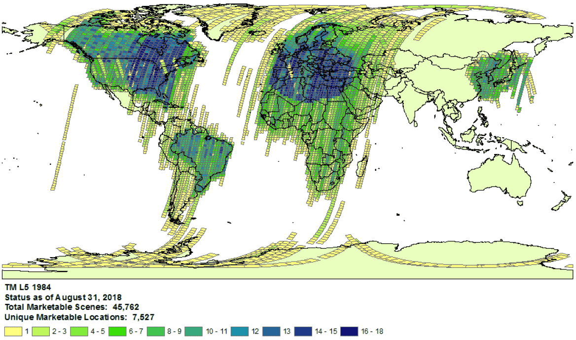
דוגמה לכיסוי האוסף של Landsat 5 בשנת 1984.
- בחירת ספק: הנתונים מוטמעים ב-Earth Engine Data Catalog מספק שנבחר לכל מערך נתונים. יכול להיות שהספק לא מציע ארכיון משימות מלא. לדוגמה, מערכי נתונים של Landsat מוטמעים מארכיון USGS, שבו ידוע שחסרות תמונות מתחנות קליטה מסוימות בתקופות מסוימות (למידע נוסף, ראו המאמצים של LGAC).
Landsat
נתוני Landsat מוטמעים מהסקר הגאולוגי של ארצות הברית (USGS).
מוודאים את הזמינות של כיסוי Landsat בזמן ובאזור הרלוונטיים.
מבצעים חיפוש ב-Earth Engine כדי לקבל רשימה של כל הנכסים בזמן ובאזור העניין. חשוב לוודא שלא הוחרג בטעות אף נכס בקוד.
לפניכם סקריפט לדוגמה. חשוב לוודא שאתם מייבאים את האוסף עם הרמה המתאימה של עיבוד ורמה מתאימה של שכבת האחסון (מידע נוסף על המבנה של אוסף Landsat).
מחפשים נכסים שעשויים להיות חסרים בקטלוג USGS Earth Explorer (במדריך העזרה מפורטות הוראות מפורטות לביצוע חיפוש ולבחירת מערכי נתונים).
חשוב לוודא שאתם משווים בין המוצרים ורמות העיבוד הנכונים (ראו את המבנה של אוסף Landsat).
לתשומת ליבכם: מוצרים של השתקפות פני השטח נוצרים רק לתמונות Landsat ברמת עיבוד L1TP.
כדי לשתף הוכחה מפורטת לנכסים חסרים, שולחים פנייה עם מזהה המוצר של הספק וקישור לסקריפט של Earth Engine Code Editor שמאשר את היעדר הנכסים.
Sentinel
נתוני Sentinel מוטמעים מאתר Copernicus Dataspace.
מוודאים שזמינה כיסוי של Sentinel בזמן ובאזור העניין (ראו פרטי המשימה).
הערה: מוצרים ברמה 2A של Sentinel-2 נוצרים באופן שיטתי בחלק הקרקעי של המערכת באירופה בלבד מאז מרץ 2018, והייצור שלהם הופץ לכל העולם בדצמבר 2018 (פרטים נוספים זמינים במדריך למשתמש של ESA).
בסופו של דבר, הם יווצרו מחדש כחלק מאוסף 1.
מבצעים חיפוש ב-Earth Engine כדי לקבל רשימה של כל הנכסים בזמן ובאזור העניין. חשוב לוודא שלא הוחרג בטעות אף נכס בקוד. לפניכם סקריפט לדוגמה. חשוב לוודא שאתם מייבאים את האוסף עם רמת העיבוד המתאימה.
מחפשים נכסים שעשויים להיות חסרים בקטלוג של Copernicus.
כדי לשתף הוכחה מפורטת לנכסים חסרים, שולחים פנייה עם מזהה המוצר של הספק וקישור לסקריפט של Earth Engine Code Editor שמאשר את היעדר הנכסים.
MODIS
נתוני MODIS מוטמעים מ-Land Processes Distributed Active Archive Center (LP DAAC).
מבצעים חיפוש ב-Earth Engine כדי לקבל רשימה של כל הנכסים בזמן ובאזור העניין. חשוב לוודא שלא הוחרג בטעות אף נכס בקוד. הנה סקריפט לדוגמה. חשוב לוודא שאתם מייבאים את המוצר הרצוי.
מחפשים נכסים שעשויים להיות חסרים במאגר הנתונים של USGS ושעדיין לא נוספו ל-Earth Engine. עוברים לתיקייה המתאימה ומאתרים את הספריות העדכניות ביותר שזמינות.
כדי לשתף הוכחה מפורטת לנכסים חסרים, שולחים פנייה עם מזהה המוצר של הספק וקישור לסקריפט של Earth Engine Code Editor שמאשר את היעדר הנכסים.
אלא אם צוין אחרת, התוכן של דף זה הוא ברישיון Creative Commons Attribution 4.0 ודוגמאות הקוד הן ברישיון Apache 2.0. לפרטים, ניתן לעיין במדיניות האתר Google Developers. Java הוא סימן מסחרי רשום של חברת Oracle ו/או של השותפים העצמאיים שלה.
עדכון אחרון: 2025-07-25 (שעון UTC).
[null,null,["עדכון אחרון: 2025-07-25 (שעון UTC)."],[[["\u003cp\u003eThis document provides guidance to determine if a Landsat, Sentinel, or MODIS asset is missing from the Earth Engine Data Catalog.\u003c/p\u003e\n"],["\u003cp\u003eUsers can verify potential missing assets by checking the provider's catalog and comparing it against the Earth Engine catalog.\u003c/p\u003e\n"],["\u003cp\u003eDetailed information, including the provider's product ID and an Earth Engine script, must be submitted when reporting missing assets.\u003c/p\u003e\n"],["\u003cp\u003eVariances in data availability may occur due to factors like processing levels, spatiotemporal coverage, and provider data archives.\u003c/p\u003e\n"]]],["To find missing assets in the Earth Engine Data Catalog, first, check provider catalogs (USGS, Copernicus, or LP DAAC) for coverage availability. Next, search Earth Engine, ensuring no filters exclude assets. Compare results to the provider's catalog. For Landsat, use USGS Earth Explorer; for Sentinel, use the Copernicus catalog; and for MODIS, use the USGS Data Pool. Finally, report any discrepancies to the Earth Engine team via a ticket, including the provider's product ID and an Earth Engine script link.\n"],null,["# Verify Missing Images in the Data Catalog\n\nThe purpose of this document is to help you determine if an asset is missing\nin the Earth Engine Data Catalog (currently Landsat, Sentinel, and MODIS).\n\nThe steps outlined describe how to:\n\n- Check for available assets in Earth Engine's and providers' catalogs.\n\n- Collect information needed to submit confirmation of a missing\n asset to the Earth Engine data team.\n\nCommon things to consider\n-------------------------\n\n- **Processing level**: not all images may be available for a given processing\n level or product. For instance, low-quality images may not be processed\n to the highest level.\n\n- **Spatiotemporal coverage**: a regular cadence is not\n guaranteed for each dataset. Variation in sensor tasking, image quality,\n and archive management can affect provider data availability.\n\n\nExample of Landsat 5\n[collection coverage](https://landsat.usgs.gov/usgs-landsat-global-archive) for\n1984.\n\n- **Provider choice** : data are ingested into the Earth Engine Data Catalog from a selected provider per dataset. It is possible that the provider does not offer a complete mission archive. For example, Landsat datasets are ingested from the USGS archive, which is known to be missing imagery from certain receiving stations for certain periods of time (see the [LGAC effort](https://www.usgs.gov/land-resources/nli/landsat/landsat-global-archive-consolidation?qt-science_support_page_related_con=3#qt-science_support_page_related_con) for more information).\n\nLandsat\n-------\n\nLandsat data are ingested from the\n[U.S. Geological Survey](https://www.usgs.gov/land-resources/nli/landsat)\n(USGS).\n\n1. Confirm\n [Landsat coverage availability](https://landsat.usgs.gov/usgs-landsat-global-archive)\n for the time and area of interest.\n\n2. Perform a search in Earth Engine to get a list of all assets for the time and\n area of interest. Take care to ensure no assets have been accidentally\n filtered out within your code.\n Here is an [example script](https://code.earthengine.google.com/975bff3a2ff955e5f884005b5dd2bafb);\n be sure you are importing the collection with the right tier and processing\n level (learn more\n [about the Landsat collection structure](https://developers.google.com/earth-engine/landsat#landsat-collection-structure)).\n\n3. Look for potentially missing assets in the\n [USGS Earth Explorer](https://earthexplorer.usgs.gov/) catalog (see the help\n guide for detailed steps on\n [performing a search](https://lta.cr.usgs.gov/EEHelp/ee_tutorial_search_criteria)\n and [selecting datasets](https://lta.cr.usgs.gov/EEHelp/ee_tutorial_search_datasets)).\n Make sure you are comparing the right products and processing levels\n ([see Landsat collection structure](https://developers.google.com/earth-engine/landsat#landsat-collection-structure)).\n Note that surface reflectance products are only generated for Landsat images with\n processing level\n [L1TP](https://www.usgs.gov/land-resources/nli/landsat/landsat-levels-processing).\n\n4. Share detailed evidence of missing assets by submitting a\n [ticket](https://issuetracker.google.com/issues/new?component=184406&template=1254745)\n with the provider's product ID and a\n [link](https://developers.google.com/earth-engine/playground#get-link)\n to an Earth Engine Code Editor script confirming the absence of the assets.\n\nSentinel\n--------\n\nSentinel data are ingested from the\n[Copernicus Dataspace site](https://dataspace.copernicus.eu/).\n\n1. Confirm\n Sentinel coverage availability for the time and area of interest (see\n [mission details](https://sentinel.esa.int/web/sentinel/missions)).\n\n *Note* : Sentinel-2 Level-2A products are systematically generated at the\n ground segment over Europe only since March 2018, and the production\n was extended to global in December 2018 (see\n [ESA User Guide](https://sentinel.esa.int/web/sentinel/user-guides/sentinel-2-msi)\n for more details).\n They will eventually be regenerated as a part of Collection 1.\n2. Perform a search in Earth Engine to get a list of all assets for the time and\n area of interest. Take care to ensure no assets have been accidentally\n filtered out within your code. Here is an\n [example script](https://code.earthengine.google.com/4bebc6b8b44807a2001bc34d49fc25eb);\n be sure you are importing the collection with the right processing\n level.\n\n3. Look for potentially missing assets in the\n [Copernicus catalog](https://dataspace.copernicus.eu/browser/).\n\n4. Share detailed evidence of missing assets by submitting a\n [ticket](https://issuetracker.google.com/issues/new?component=184406&template=1254745)\n with the provider's product ID and a\n [link](https://developers.google.com/earth-engine/playground#get-link)\n to an Earth Engine Code Editor script confirming the absence of the assets.\n\nMODIS\n-----\n\nMODIS data are ingested from the\n[Land Processes Distributed Active Archive Center](https://lpdaac.usgs.gov/)\n(LP DAAC).\n\n1. Perform a search in Earth Engine to get a list of all assets for the time and\n area of interest. Take care to ensure no assets have been accidentally\n filtered out within your code. Here is an\n [example script](https://code.earthengine.google.com/848200c362694900b6027b30b0e99677);\n be sure you are importing the intended product.\n\n2. Look for potentially missing assets in the\n [USGS Data Pool](https://lpdaac.usgs.gov/tools/data-pool/) that have not been\n added to Earth Engine. Navigate to the appropriate folder and identify the\n latest directories available.\n\n - Datasets starting with \"MOD\" are in\n \"[Terra MODIS](https://e4ftl01.cr.usgs.gov/MOLT/)\"\n\n - Datasets starting with \"MYD\" are in\n \"[Aqua MODIS](https://e4ftl01.cr.usgs.gov/MOLA/)\"\n\n - Datasets starting with \"MCD\" are in\n \"[Combined MODIS](https://e4ftl01.cr.usgs.gov/MOTA/)\"\n\n - Datasets starting with \"VNP\" are in\n \"[S-NPP VIIRS](https://e4ftl01.cr.usgs.gov/VIIRS/)\"\n\n3. Share detailed evidence of missing assets by submitting a\n [ticket](https://issuetracker.google.com/issues/new?component=184406&template=1254745)\n with the provider's product ID and a\n [link](https://developers.google.com/earth-engine/playground#get-link)\n to an Earth Engine Code Editor script confirming the absence of the assets."]]