공지사항:
2025년 4월 15일 전에 Earth Engine 사용을 위해 등록된 모든 비상업용 프로젝트는 Earth Engine 액세스를 유지하기 위해
비상업용 자격 요건을 인증해야 합니다.
Data Catalog에서 누락된 이미지 확인
컬렉션을 사용해 정리하기
내 환경설정을 기준으로 콘텐츠를 저장하고 분류하세요.
이 문서의 목적은 Earth Engine 데이터 카탈로그 (현재 Landsat, Sentinel, MODIS)에 애셋이 누락되었는지 확인하는 것입니다.
다음 단계에서는 다음 작업을 수행하는 방법을 설명합니다.
일반적인 고려사항
처리 수준: 특정 처리 수준 또는 제품에 따라 일부 이미지를 사용할 수 없을 수 있습니다. 예를 들어 품질이 낮은 이미지는 최고 수준으로 처리되지 않을 수 있습니다.
시공간적 노출 범위: 각 데이터 세트의 정기적 주기가 보장되지 않습니다. 센서 작업, 이미지 품질, 보관 파일 관리의 차이는 제공업체 데이터 가용성에 영향을 미칠 수 있습니다.
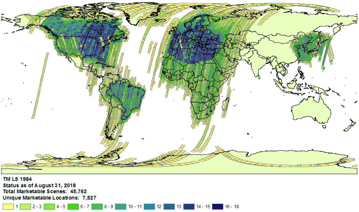
1984년 Landsat 5 수집 범위의 예시입니다.
- 제공업체 선택: 데이터 세트별로 선택된 제공업체의 데이터가 Earth Engine Data Catalog로 처리됩니다. 제공업체에서 전체 미션 보관 파일을 제공하지 않을 수 있습니다. 예를 들어 Landsat 데이터 세트는 특정 기간 동안 특정 수신소의 이미지가 누락된 것으로 알려진 USGS 보관 파일에서 처리됩니다 (자세한 내용은 LGAC 작업 참고).
Landsat
Landsat 데이터는 미국 지질조사국(USGS)에서 처리합니다.
관심 있는 시간과 지역의 Landsat 적용 범위 사용 가능 여부를 확인합니다.
Earth Engine에서 검색을 실행하여 관심 시간 및 관심 지역에 대한 모든 애셋 목록을 가져옵니다. 코드 내에서 실수로 확장 소재가 필터링되지 않았는지 확인합니다.
다음은 스크립트 예시입니다. 올바른 등급 및 처리 수준으로 컬렉션을 가져와야 합니다 (Landsat 컬렉션 구조에 대해 자세히 알아보기).
USGS Earth Explorer 카탈로그에서 누락된 애셋이 있는지 확인합니다 (검색 및 데이터 세트 선택에 관한 자세한 단계는 도움말 가이드를 참고하세요).
올바른 제품 및 처리 수준을 비교하고 있는지 확인합니다(Landsat 컬렉션 구조 참고).
표면 반사율 제품은 처리 수준이 L1TP인 Landsat 이미지에 대해서만 생성됩니다.
제공업체의 제품 ID와 애셋이 없음을 확인하는 Earth Engine Code Editor 스크립트의 링크가 포함된 티켓을 제출하여 누락된 애셋에 대한 자세한 증거를 공유합니다.
Sentinel
Sentinel 데이터는 Copernicus Dataspace 사이트에서 처리됩니다.
관심 있는 시간과 지역의 Sentinel 노출 범위 사용 가능 여부를 확인합니다 (임무 세부정보 참고).
참고: Sentinel-2 Level-2A 제품은 2018년 3월부터 유럽의 지상 세그먼트에서만 체계적으로 생성되었으며, 2018년 12월에 전 세계로 확대되었습니다 (자세한 내용은 ESA 사용자 가이드 참고).
이러한 페이지는 결국 컬렉션 1의 일부로 다시 생성됩니다.
Earth Engine에서 검색을 실행하여 관심 시간 및 관심 지역에 대한 모든 애셋 목록을 가져옵니다. 코드 내에서 실수로 확장 소재가 필터링되지 않았는지 확인합니다. 다음은 스크립트 예시입니다. 올바른 처리 수준으로 컬렉션을 가져와야 합니다.
Copernicus 카탈로그에서 누락되었을 수 있는 애셋을 찾습니다.
제공업체의 제품 ID와 애셋이 없음을 확인하는 Earth Engine Code Editor 스크립트의 링크가 포함된 티켓을 제출하여 누락된 애셋에 대한 자세한 증거를 공유합니다.
MODIS
MODIS 데이터는 Land Processes Distributed Active Archive Center(LP DAAC)에서 처리됩니다.
Earth Engine에서 검색을 실행하여 관심 시간 및 관심 지역에 대한 모든 애셋 목록을 가져옵니다. 코드 내에서 실수로 확장 소재가 필터링되지 않았는지 확인합니다. 다음은 스크립트 예시입니다. 원하는 제품을 가져오고 있는지 확인하세요.
USGS 데이터 풀에서 Earth Engine에 추가되지 않은 누락된 애셋이 있는지 확인합니다. 적절한 폴더로 이동하여 사용 가능한 최신 디렉터리를 확인합니다.
제공업체의 제품 ID와 애셋이 없음을 확인하는 Earth Engine Code Editor 스크립트의 링크가 포함된 티켓을 제출하여 누락된 애셋에 대한 자세한 증거를 공유합니다.
달리 명시되지 않는 한 이 페이지의 콘텐츠에는 Creative Commons Attribution 4.0 라이선스에 따라 라이선스가 부여되며, 코드 샘플에는 Apache 2.0 라이선스에 따라 라이선스가 부여됩니다. 자세한 내용은 Google Developers 사이트 정책을 참조하세요. 자바는 Oracle 및/또는 Oracle 계열사의 등록 상표입니다.
최종 업데이트: 2025-07-25(UTC)
[null,null,["최종 업데이트: 2025-07-25(UTC)"],[[["\u003cp\u003eThis document provides guidance to determine if a Landsat, Sentinel, or MODIS asset is missing from the Earth Engine Data Catalog.\u003c/p\u003e\n"],["\u003cp\u003eUsers can verify potential missing assets by checking the provider's catalog and comparing it against the Earth Engine catalog.\u003c/p\u003e\n"],["\u003cp\u003eDetailed information, including the provider's product ID and an Earth Engine script, must be submitted when reporting missing assets.\u003c/p\u003e\n"],["\u003cp\u003eVariances in data availability may occur due to factors like processing levels, spatiotemporal coverage, and provider data archives.\u003c/p\u003e\n"]]],["To find missing assets in the Earth Engine Data Catalog, first, check provider catalogs (USGS, Copernicus, or LP DAAC) for coverage availability. Next, search Earth Engine, ensuring no filters exclude assets. Compare results to the provider's catalog. For Landsat, use USGS Earth Explorer; for Sentinel, use the Copernicus catalog; and for MODIS, use the USGS Data Pool. Finally, report any discrepancies to the Earth Engine team via a ticket, including the provider's product ID and an Earth Engine script link.\n"],null,["# Verify Missing Images in the Data Catalog\n\nThe purpose of this document is to help you determine if an asset is missing\nin the Earth Engine Data Catalog (currently Landsat, Sentinel, and MODIS).\n\nThe steps outlined describe how to:\n\n- Check for available assets in Earth Engine's and providers' catalogs.\n\n- Collect information needed to submit confirmation of a missing\n asset to the Earth Engine data team.\n\nCommon things to consider\n-------------------------\n\n- **Processing level**: not all images may be available for a given processing\n level or product. For instance, low-quality images may not be processed\n to the highest level.\n\n- **Spatiotemporal coverage**: a regular cadence is not\n guaranteed for each dataset. Variation in sensor tasking, image quality,\n and archive management can affect provider data availability.\n\n\nExample of Landsat 5\n[collection coverage](https://landsat.usgs.gov/usgs-landsat-global-archive) for\n1984.\n\n- **Provider choice** : data are ingested into the Earth Engine Data Catalog from a selected provider per dataset. It is possible that the provider does not offer a complete mission archive. For example, Landsat datasets are ingested from the USGS archive, which is known to be missing imagery from certain receiving stations for certain periods of time (see the [LGAC effort](https://www.usgs.gov/land-resources/nli/landsat/landsat-global-archive-consolidation?qt-science_support_page_related_con=3#qt-science_support_page_related_con) for more information).\n\nLandsat\n-------\n\nLandsat data are ingested from the\n[U.S. Geological Survey](https://www.usgs.gov/land-resources/nli/landsat)\n(USGS).\n\n1. Confirm\n [Landsat coverage availability](https://landsat.usgs.gov/usgs-landsat-global-archive)\n for the time and area of interest.\n\n2. Perform a search in Earth Engine to get a list of all assets for the time and\n area of interest. Take care to ensure no assets have been accidentally\n filtered out within your code.\n Here is an [example script](https://code.earthengine.google.com/975bff3a2ff955e5f884005b5dd2bafb);\n be sure you are importing the collection with the right tier and processing\n level (learn more\n [about the Landsat collection structure](https://developers.google.com/earth-engine/landsat#landsat-collection-structure)).\n\n3. Look for potentially missing assets in the\n [USGS Earth Explorer](https://earthexplorer.usgs.gov/) catalog (see the help\n guide for detailed steps on\n [performing a search](https://lta.cr.usgs.gov/EEHelp/ee_tutorial_search_criteria)\n and [selecting datasets](https://lta.cr.usgs.gov/EEHelp/ee_tutorial_search_datasets)).\n Make sure you are comparing the right products and processing levels\n ([see Landsat collection structure](https://developers.google.com/earth-engine/landsat#landsat-collection-structure)).\n Note that surface reflectance products are only generated for Landsat images with\n processing level\n [L1TP](https://www.usgs.gov/land-resources/nli/landsat/landsat-levels-processing).\n\n4. Share detailed evidence of missing assets by submitting a\n [ticket](https://issuetracker.google.com/issues/new?component=184406&template=1254745)\n with the provider's product ID and a\n [link](https://developers.google.com/earth-engine/playground#get-link)\n to an Earth Engine Code Editor script confirming the absence of the assets.\n\nSentinel\n--------\n\nSentinel data are ingested from the\n[Copernicus Dataspace site](https://dataspace.copernicus.eu/).\n\n1. Confirm\n Sentinel coverage availability for the time and area of interest (see\n [mission details](https://sentinel.esa.int/web/sentinel/missions)).\n\n *Note* : Sentinel-2 Level-2A products are systematically generated at the\n ground segment over Europe only since March 2018, and the production\n was extended to global in December 2018 (see\n [ESA User Guide](https://sentinel.esa.int/web/sentinel/user-guides/sentinel-2-msi)\n for more details).\n They will eventually be regenerated as a part of Collection 1.\n2. Perform a search in Earth Engine to get a list of all assets for the time and\n area of interest. Take care to ensure no assets have been accidentally\n filtered out within your code. Here is an\n [example script](https://code.earthengine.google.com/4bebc6b8b44807a2001bc34d49fc25eb);\n be sure you are importing the collection with the right processing\n level.\n\n3. Look for potentially missing assets in the\n [Copernicus catalog](https://dataspace.copernicus.eu/browser/).\n\n4. Share detailed evidence of missing assets by submitting a\n [ticket](https://issuetracker.google.com/issues/new?component=184406&template=1254745)\n with the provider's product ID and a\n [link](https://developers.google.com/earth-engine/playground#get-link)\n to an Earth Engine Code Editor script confirming the absence of the assets.\n\nMODIS\n-----\n\nMODIS data are ingested from the\n[Land Processes Distributed Active Archive Center](https://lpdaac.usgs.gov/)\n(LP DAAC).\n\n1. Perform a search in Earth Engine to get a list of all assets for the time and\n area of interest. Take care to ensure no assets have been accidentally\n filtered out within your code. Here is an\n [example script](https://code.earthengine.google.com/848200c362694900b6027b30b0e99677);\n be sure you are importing the intended product.\n\n2. Look for potentially missing assets in the\n [USGS Data Pool](https://lpdaac.usgs.gov/tools/data-pool/) that have not been\n added to Earth Engine. Navigate to the appropriate folder and identify the\n latest directories available.\n\n - Datasets starting with \"MOD\" are in\n \"[Terra MODIS](https://e4ftl01.cr.usgs.gov/MOLT/)\"\n\n - Datasets starting with \"MYD\" are in\n \"[Aqua MODIS](https://e4ftl01.cr.usgs.gov/MOLA/)\"\n\n - Datasets starting with \"MCD\" are in\n \"[Combined MODIS](https://e4ftl01.cr.usgs.gov/MOTA/)\"\n\n - Datasets starting with \"VNP\" are in\n \"[S-NPP VIIRS](https://e4ftl01.cr.usgs.gov/VIIRS/)\"\n\n3. Share detailed evidence of missing assets by submitting a\n [ticket](https://issuetracker.google.com/issues/new?component=184406&template=1254745)\n with the provider's product ID and a\n [link](https://developers.google.com/earth-engine/playground#get-link)\n to an Earth Engine Code Editor script confirming the absence of the assets."]]