Duyuru:
15 Nisan 2025'ten önce Earth Engine'i kullanmak için kaydedilen tüm ticari olmayan projelerin Earth Engine erişimini sürdürmek için
ticari olmayan uygunluğu doğrulaması gerekir.
Data Catalog'da Eksik Resimleri Doğrulama
Koleksiyonlar ile düzeninizi koruyun
İçeriği tercihlerinize göre kaydedin ve kategorilere ayırın.
Bu dokümanın amacı, Earth Engine Veri Kataloğu'nda (şu anda Landsat, Sentinel ve MODIS) bir öğenin eksik olup olmadığını belirlemenize yardımcı olmaktır.
Aşağıdaki adımlarda aşağıdakilerin nasıl yapılacağı açıklanmaktadır:
Dikkate alınması gereken yaygın noktalar
İşleme düzeyi: Belirli bir işleme düzeyi veya ürün için tüm resimler kullanılamayabilir. Örneğin, düşük kaliteli resimler en yüksek düzeyde işlenmeyebilir.
Uzamsal ve zamansal kapsam: Her veri kümesi için düzenli bir sıklık garanti edilmez. Sensör görevi, görüntü kalitesi ve arşiv yönetimiyle ilgili farklılıklar, sağlayıcı verilerinin kullanılabilirliğini etkileyebilir.
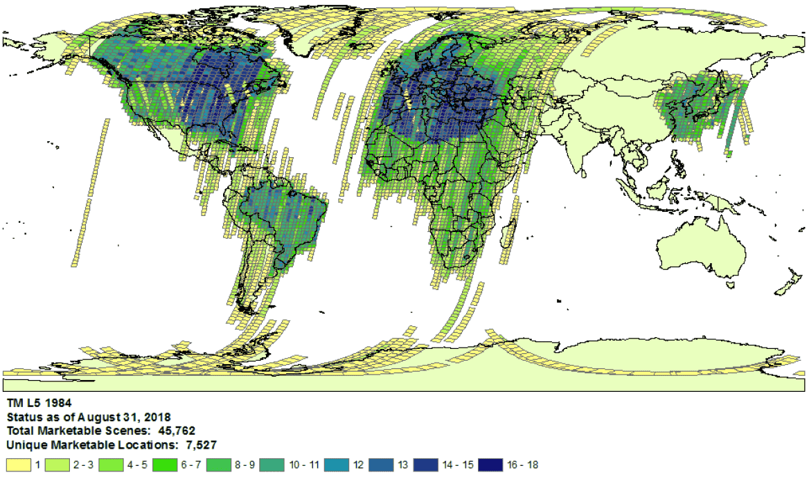
1984'teki Landsat 5 toplama kapsamı örneği.
- Sağlayıcı seçimi: Veriler, veri kümesi başına seçilen bir sağlayıcıdan Earth Engine Veri Kataloğu'na aktarılır. Sağlayıcı, tam bir görev arşivi sunmuyor olabilir. Örneğin, Landsat veri kümeleri USGS arşivinden alınır. Bu arşivde, belirli alıcı istasyonlarından belirli dönemlerde görüntü eksik olduğu bilinir (daha fazla bilgi için LGAC çalışmasına bakın).
Landsat
Landsat verileri ABD Jeoloji Araştırması'ndan (USGS) alınır.
İlgilendiğiniz zaman ve alan için Landsat kapsama durumunu onaylayın.
İlgilendiğiniz zaman ve alan için tüm öğelerin listesini almak üzere Earth Engine'da arama yapın. Kodunuzda yanlışlıkla hiçbir öğenin filtrelenmediğinden emin olun.
Burada bir örnek komut dosyası verilmiştir. Koleksiyonu doğru katman ve işleme düzeyiyle içe aktardığınızdan emin olun (Landsat koleksiyonu yapısı hakkında daha fazla bilgi edinin).
USGS Earth Explorer kataloğunda eksik olabilecek öğeleri arayın (Arama yapma ve veri kümesi seçme ile ilgili ayrıntılı adımlar için yardım kılavuzuna bakın).
Doğru ürünleri ve işleme düzeylerini karşılaştırdığınızdan emin olun (Landsat koleksiyonu yapısına bakın).
Yüzey yansıması ürünlerinin yalnızca işleme düzeyi L1TP olan Landsat görüntüleri için oluşturulduğunu unutmayın.
Sağlayıcının ürün kimliğini ve öğelerin bulunmadığını doğrulayan bir Earth Engine Code Editor komut dosyasının bağlantısını içeren bir destek kaydı göndererek eksik öğelerle ilgili ayrıntılı kanıt paylaşın.
Sentinel
Sentinel verileri Copernicus Dataspace sitesinden alınır.
İlgilenilen zaman ve alan için Sentinel kapsamının kullanılabilirliğini onaylayın (görev ayrıntılarına bakın).
Not: Sentinel-2 Level-2A ürünleri, yalnızca Mart 2018'den beri Avrupa'da yer segmentinde sistematik olarak oluşturulmaktadır ve üretim Aralık 2018'de dünya geneline genişletilmiştir (daha fazla bilgi için ESA Kullanıcı Kılavuzu'na bakın).
Bunlar, 1. koleksiyonun bir parçası olarak yeniden oluşturulur.
İlgilendiğiniz zaman ve alan için tüm öğelerin listesini almak üzere Earth Engine'da arama yapın. Kodunuzda yanlışlıkla hiçbir öğenin filtrelenmediğinden emin olun. Aşağıda bir örnek komut dosyası verilmiştir. Koleksiyonu doğru işleme düzeyiyle içe aktardığınızdan emin olun.
Copernicus kataloğunda eksik olabilecek öğeleri arayın.
Sağlayıcının ürün kimliğini ve öğelerin bulunmadığını doğrulayan bir Earth Engine Code Editor komut dosyasının bağlantısını içeren bir destek kaydı göndererek eksik öğelerle ilgili ayrıntılı kanıt paylaşın.
MODIS
MODIS verileri, Land Processes Distributed Active Archive Center (LP DAAC) kaynağından alınır.
İlgilendiğiniz zaman ve alan için tüm öğelerin listesini almak üzere Earth Engine'da arama yapın. Kodunuzda yanlışlıkla hiçbir öğenin filtrelenmediğinden emin olun. Aşağıda, örnek bir komut dosyası verilmiştir. Amacınıza uygun ürünü içe aktardığınızdan emin olun.
USGS Veri Havuzu'nda Earth Engine'a eklenmemiş, eksik olabilecek öğeleri arayın. Uygun klasöre gidin ve mevcut en son dizinleri belirleyin.
Sağlayıcının ürün kimliğini ve öğelerin bulunmadığını doğrulayan bir Earth Engine Code Editor komut dosyasının bağlantısını içeren bir destek kaydı göndererek eksik öğelerle ilgili ayrıntılı kanıt paylaşın.
Aksi belirtilmediği sürece bu sayfanın içeriği Creative Commons Atıf 4.0 Lisansı altında ve kod örnekleri Apache 2.0 Lisansı altında lisanslanmıştır. Ayrıntılı bilgi için Google Developers Site Politikaları'na göz atın. Java, Oracle ve/veya satış ortaklarının tescilli ticari markasıdır.
Son güncelleme tarihi: 2025-07-25 UTC.
[null,null,["Son güncelleme tarihi: 2025-07-25 UTC."],[[["\u003cp\u003eThis document provides guidance to determine if a Landsat, Sentinel, or MODIS asset is missing from the Earth Engine Data Catalog.\u003c/p\u003e\n"],["\u003cp\u003eUsers can verify potential missing assets by checking the provider's catalog and comparing it against the Earth Engine catalog.\u003c/p\u003e\n"],["\u003cp\u003eDetailed information, including the provider's product ID and an Earth Engine script, must be submitted when reporting missing assets.\u003c/p\u003e\n"],["\u003cp\u003eVariances in data availability may occur due to factors like processing levels, spatiotemporal coverage, and provider data archives.\u003c/p\u003e\n"]]],["To find missing assets in the Earth Engine Data Catalog, first, check provider catalogs (USGS, Copernicus, or LP DAAC) for coverage availability. Next, search Earth Engine, ensuring no filters exclude assets. Compare results to the provider's catalog. For Landsat, use USGS Earth Explorer; for Sentinel, use the Copernicus catalog; and for MODIS, use the USGS Data Pool. Finally, report any discrepancies to the Earth Engine team via a ticket, including the provider's product ID and an Earth Engine script link.\n"],null,["# Verify Missing Images in the Data Catalog\n\nThe purpose of this document is to help you determine if an asset is missing\nin the Earth Engine Data Catalog (currently Landsat, Sentinel, and MODIS).\n\nThe steps outlined describe how to:\n\n- Check for available assets in Earth Engine's and providers' catalogs.\n\n- Collect information needed to submit confirmation of a missing\n asset to the Earth Engine data team.\n\nCommon things to consider\n-------------------------\n\n- **Processing level**: not all images may be available for a given processing\n level or product. For instance, low-quality images may not be processed\n to the highest level.\n\n- **Spatiotemporal coverage**: a regular cadence is not\n guaranteed for each dataset. Variation in sensor tasking, image quality,\n and archive management can affect provider data availability.\n\n\nExample of Landsat 5\n[collection coverage](https://landsat.usgs.gov/usgs-landsat-global-archive) for\n1984.\n\n- **Provider choice** : data are ingested into the Earth Engine Data Catalog from a selected provider per dataset. It is possible that the provider does not offer a complete mission archive. For example, Landsat datasets are ingested from the USGS archive, which is known to be missing imagery from certain receiving stations for certain periods of time (see the [LGAC effort](https://www.usgs.gov/land-resources/nli/landsat/landsat-global-archive-consolidation?qt-science_support_page_related_con=3#qt-science_support_page_related_con) for more information).\n\nLandsat\n-------\n\nLandsat data are ingested from the\n[U.S. Geological Survey](https://www.usgs.gov/land-resources/nli/landsat)\n(USGS).\n\n1. Confirm\n [Landsat coverage availability](https://landsat.usgs.gov/usgs-landsat-global-archive)\n for the time and area of interest.\n\n2. Perform a search in Earth Engine to get a list of all assets for the time and\n area of interest. Take care to ensure no assets have been accidentally\n filtered out within your code.\n Here is an [example script](https://code.earthengine.google.com/975bff3a2ff955e5f884005b5dd2bafb);\n be sure you are importing the collection with the right tier and processing\n level (learn more\n [about the Landsat collection structure](https://developers.google.com/earth-engine/landsat#landsat-collection-structure)).\n\n3. Look for potentially missing assets in the\n [USGS Earth Explorer](https://earthexplorer.usgs.gov/) catalog (see the help\n guide for detailed steps on\n [performing a search](https://lta.cr.usgs.gov/EEHelp/ee_tutorial_search_criteria)\n and [selecting datasets](https://lta.cr.usgs.gov/EEHelp/ee_tutorial_search_datasets)).\n Make sure you are comparing the right products and processing levels\n ([see Landsat collection structure](https://developers.google.com/earth-engine/landsat#landsat-collection-structure)).\n Note that surface reflectance products are only generated for Landsat images with\n processing level\n [L1TP](https://www.usgs.gov/land-resources/nli/landsat/landsat-levels-processing).\n\n4. Share detailed evidence of missing assets by submitting a\n [ticket](https://issuetracker.google.com/issues/new?component=184406&template=1254745)\n with the provider's product ID and a\n [link](https://developers.google.com/earth-engine/playground#get-link)\n to an Earth Engine Code Editor script confirming the absence of the assets.\n\nSentinel\n--------\n\nSentinel data are ingested from the\n[Copernicus Dataspace site](https://dataspace.copernicus.eu/).\n\n1. Confirm\n Sentinel coverage availability for the time and area of interest (see\n [mission details](https://sentinel.esa.int/web/sentinel/missions)).\n\n *Note* : Sentinel-2 Level-2A products are systematically generated at the\n ground segment over Europe only since March 2018, and the production\n was extended to global in December 2018 (see\n [ESA User Guide](https://sentinel.esa.int/web/sentinel/user-guides/sentinel-2-msi)\n for more details).\n They will eventually be regenerated as a part of Collection 1.\n2. Perform a search in Earth Engine to get a list of all assets for the time and\n area of interest. Take care to ensure no assets have been accidentally\n filtered out within your code. Here is an\n [example script](https://code.earthengine.google.com/4bebc6b8b44807a2001bc34d49fc25eb);\n be sure you are importing the collection with the right processing\n level.\n\n3. Look for potentially missing assets in the\n [Copernicus catalog](https://dataspace.copernicus.eu/browser/).\n\n4. Share detailed evidence of missing assets by submitting a\n [ticket](https://issuetracker.google.com/issues/new?component=184406&template=1254745)\n with the provider's product ID and a\n [link](https://developers.google.com/earth-engine/playground#get-link)\n to an Earth Engine Code Editor script confirming the absence of the assets.\n\nMODIS\n-----\n\nMODIS data are ingested from the\n[Land Processes Distributed Active Archive Center](https://lpdaac.usgs.gov/)\n(LP DAAC).\n\n1. Perform a search in Earth Engine to get a list of all assets for the time and\n area of interest. Take care to ensure no assets have been accidentally\n filtered out within your code. Here is an\n [example script](https://code.earthengine.google.com/848200c362694900b6027b30b0e99677);\n be sure you are importing the intended product.\n\n2. Look for potentially missing assets in the\n [USGS Data Pool](https://lpdaac.usgs.gov/tools/data-pool/) that have not been\n added to Earth Engine. Navigate to the appropriate folder and identify the\n latest directories available.\n\n - Datasets starting with \"MOD\" are in\n \"[Terra MODIS](https://e4ftl01.cr.usgs.gov/MOLT/)\"\n\n - Datasets starting with \"MYD\" are in\n \"[Aqua MODIS](https://e4ftl01.cr.usgs.gov/MOLA/)\"\n\n - Datasets starting with \"MCD\" are in\n \"[Combined MODIS](https://e4ftl01.cr.usgs.gov/MOTA/)\"\n\n - Datasets starting with \"VNP\" are in\n \"[S-NPP VIIRS](https://e4ftl01.cr.usgs.gov/VIIRS/)\"\n\n3. Share detailed evidence of missing assets by submitting a\n [ticket](https://issuetracker.google.com/issues/new?component=184406&template=1254745)\n with the provider's product ID and a\n [link](https://developers.google.com/earth-engine/playground#get-link)\n to an Earth Engine Code Editor script confirming the absence of the assets."]]