Page Summary
-
Multiple datasets provide global land use and land cover information at varying resolutions and temporal frequencies, including near-real-time updates and historical data back to 2000.
-
ECMWF provides near-real-time atmospheric and wave forecasts globally at 0.25-degree resolution, with updates released twice daily.
-
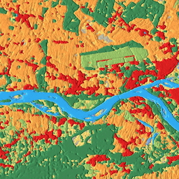
The European Space Agency's WorldCereal project offers global crop maps and active cropland markers at 10-meter resolution.
-
Datasets related to fire, forest proximity, and grassland characteristics are available globally, often at fine spatial resolutions.
-
Various Landsat missions (1-9) offer a range of data products, including raw scenes, TOA reflectance, and atmospherically corrected surface reflectance and land surface temperature, categorized into Tiers 1 and 2 based on quality.
-
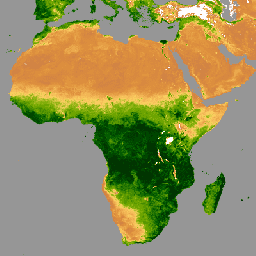
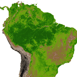
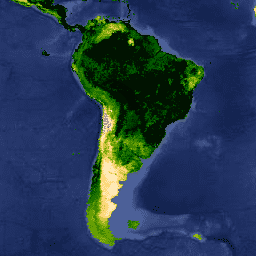
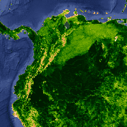
Dynamic World V1
Dynamic World is a 10m near-real-time (NRT) Land Use/Land Cover (LULC) dataset that includes class probabilities and label information for nine classes. Dynamic World predictions are available for the Sentinel-2 L1C collection from 2015-06-27 to present. The revisit frequency of Sentinel-2 is between 2-5 days … global google landcover landuse landuse-landcover nrt -
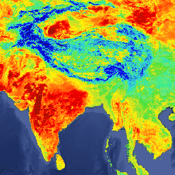
ECMWF Near-Realtime IFS Atmospheric Forecasts

This dataset contains 15-day forecasts of the atmospheric model variables generated by the ECMWF Integrated Forecasting System (IFS) at 0.25 degree resolution. We refer to these as Near-Realtime (NRT) because new products are released twice a day after the release of the ECMWF realtime forecast … climate dewpoint ecmwf forecast global humidity -
ECMWF Near-Realtime IFS Wave (Short-Cutoff) Forecasts
This dataset contains 6-day forecasts of the wave model fields generated by the ECMWF Integrated Forecasting System (IFS) at 0.25 degree resolution. We refer to these as Near-Realtime (NRT) because new products are released twice a day after the release of the ECMWF realtime forecast … climate ecmwf forecast global oceans -
ECMWF Near-Realtime IFS Wave Forecasts

This dataset contains 15-day forecasts of the wave model fields generated by the ECMWF Integrated Forecasting System (IFS) at 0.25 degree resolution. We refer to these as Near-Realtime (NRT) because new products are released twice a day after the release of the ECMWF realtime forecast … climate ecmwf forecast global oceans -
ESA WorldCereal 10 m v100
The European Space Agency (ESA) WorldCereal 10 m 2021 product suite consists of global-scale annual and seasonal crop maps and their related confidence. They were generated as part of the ESA-WorldCereal project. More information on the content of these products and the methodology used to … agriculture copernicus crop esa global landcover -
ESA WorldCereal AEZ v100
The European Space Agency (ESA) WorldCereal classification system aims for product generation within one month after the end of a particular growing season. Due to the dynamic nature of these growing seasons across the globe, a global stratification into Agro-Ecological Zones (AEZ) was performed based … agriculture boundaries crop esa global table -
ESA WorldCereal Active Cropland 10 m v100
The European Space Agency (ESA) WorldCereal Active Cropland 10 m 2021 product suite contains global-scale seasonal active cropland markers. They were generated as part of the ESA-WorldCereal project. The active cropland products indicate whether or not a pixel identified as temporary crops has been actively … agriculture copernicus crop esa global landcover -
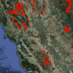
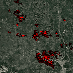
FireCCI51: MODIS Fire_cci Burned Area Pixel Product, Version 5.1
The MODIS Fire_cci Burned Area pixel product version 5.1 (FireCCI51) is a monthly global ~250m spatial resolution dataset containing information on burned area as well as ancillary data. It is based on surface reflectance in the Near Infrared (NIR) band from the MODIS instrument onboard … burn cci climate-change copernicus esa fire -
Forest proximate people (FPP) 1.0
The "Forest Proximate People" (FPP) dataset is one of the data layers contributing to the development of indicator #13, "number of forest-dependent people in extreme poverty," of the Collaborative Partnership on Forests (CPF) Global Core Set of forest-related indicators (GCS). The FPP dataset provides an … agriculture fao forest global plant-productivity population -
GPW Annual Dominant Class of Grasslands v1
This dataset provides global annual dominant class maps of grasslands (cultivated and natural/semi-natural) from 2000 to 2022 at 30-m spatial resolution. Produced by the Land & Carbon Lab Global Pasture Watch initiative, the mapped grassland extent includes any land cover type, which contains at least … global global-pasture-watch land landcover landuse landuse-landcover -
GPW Annual Probabilities of Cultivated Grasslands v1
This dataset provides global annual probability maps of cultivated grassland from 2000 to 2022 at 30-m spatial resolution. Produced by the Land & Carbon Lab Global Pasture Watch initiative, the mapped grassland extent includes any land cover type, which contains at least 30% of dry … global global-pasture-watch land landcover landuse landuse-landcover -
GPW Annual Probabilities of Natural/Semi-natural Grasslands v1
This dataset provides global annual probability maps of natural/semi-natural grassland from 2000 to 2022 at 30-m spatial resolution. Produced by the Land & Carbon Lab Global Pasture Watch initiative, the mapped grassland extent includes any land cover type, which contains at least 30% of dry … global global-pasture-watch land landcover landuse landuse-landcover -
GPW Annual short vegetation height v1

This dataset provides global median vegetation height from 2000 at 30-m spatial resolution. Produced by the Land & Carbon Lab’s Global Pasture Watch initiative, this dataset provides median vegetation height values (50th percentile) globally at 30-m spatial resolution from 2000 onwards. The dataset is based … canopy global global-pasture-watch land landcover plant-productivity -
GPW Annual uncalibrated Gross Primary Productivity (uGPP) v1
This dataset provides global uncalibrated EO-based Gross Primary Productivity from 2000 at 30-m spatial resolution. Produced by the Land & Carbon Lab Global Pasture Watch initiative, the current dataset provides Gross Primary Productivity (GPP) values globally at 30-m spatial resolution from 2000 onwards. GPP values … global global-pasture-watch land landcover landuse plant-productivity -
Global ALOS CHILI (Continuous Heat-Insolation Load Index)

CHILI is a surrogate for effects of insolation and topographic shading on evapotranspiration represented by calculating insolation at early afternoon, sun altitude equivalent to equinox. It is based on the 30m "AVE" band of JAXA's ALOS DEM (available in EE as JAXA/ALOS/AW3D30_V1_1). The Conservation Science … aspect csp elevation elevation-topography ergo geophysical -
Global ALOS Landforms
The ALOS Landform dataset provides landform classes created by combining the Continuous Heat-Insolation Load Index (ALOS CHILI) and the multi-scale Topographic Position Index (ALOS mTPI) datasets. It is based on the 30m "AVE" band of JAXA's ALOS DEM (available in EE as JAXA/ALOS/AW3D30_V1_1). The Conservation … aspect csp elevation elevation-topography ergo geophysical -
Global ALOS Topographic Diversity
Topographic diversity (D) is a surrogate variable that represents the variety of temperature and moisture conditions available to species as local habitats. It expresses the logic that a higher variety of topo-climate niches should support higher diversity (especially plant) and support species persistence given climatic … aspect csp elevation elevation-topography ergo geophysical -
Global ALOS mTPI (Multi-Scale Topographic Position Index)

The mTPI distinguishes ridge from valley forms. It is calculated using elevation data for each location subtracted by the mean elevation within a neighborhood. mTPI uses moving windows of radius (km): 115.8, 89.9, 35.5, 13.1, 5.6, 2.8, and 1.2. It is based on the 30m … aspect csp elevation elevation-topography ergo geophysical -
Global Annual Mangrove Extent (1984-2023)

The CGMD-Extent30 (Continuous Global Mangrove Dynamics-Annual Mangrove Extent at 30-m resolution) dataset provides global annual mangrove extent from 1984 to 2023. The dataset is distributed as a single Earth Engine FeatureCollection, with each feature representing a mapped mangrove polygon for a specific year. The dataset … annual coastal forest-biomass global landsat-derived landuse-landcover -
Global Annual Mangrove Fractional Canopy Cover (1984-2023)

This dataset provides global annual mangrove fractional canopy cover (FCC) at 30-m spatial resolution from 1984 to 2023 to support large-scale analyses of long-term mangrove dynamics, including canopy degradation and recovery, blue carbon assessment, and coastal ecosystem monitoring. FCC quantifies the proportion of each Landsat … annual coastal forest-biomass global landsat-derived mangrove -
Global Mangrove Forests Distribution, v1 (2000)
The database was prepared using Landsat satellite data from the year 2000. More than 1,000 Landsat scenes obtained from the USGS Earth Resources Observation and Science Center (EROS) were classified using hybrid supervised and unsupervised digital image classification techniques. This database is the first, most … annual ciesin forest-biomass global landsat-derived mangrove -
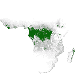
Global Map of Oil Palm Plantations
The dataset is a 10m global industrial and smallholder oil palm map for 2019. It covers areas where oil palm plantations were detected. The classified images are the output of a convolutional neural network based on Sentinel-1 and Sentinel-2 half-year composites. See article for additional … agriculture biodiversity conservation crop global landuse -
Global SRTM CHILI (Continuous Heat-Insolation Load Index)
CHILI is a surrogate for effects of insolation and topographic shading on evapotranspiration represented by calculating insolation at early afternoon, sun altitude equivalent to equinox. It is based on the 30m SRTM DEM (available in EE as USGS/SRTMGL1_003). The Conservation Science Partners (CSP) Ecologically Relevant … aspect csp elevation elevation-topography ergo geophysical -
Global SRTM Landforms

The SRTM Landform dataset provides landform classes created by combining the Continuous Heat-Insolation Load Index (SRTM CHILI) and the multi-scale Topographic Position Index (SRTM mTPI) datasets. It is based on the 30m SRTM DEM (available in EE as USGS/SRTMGL1_003). The Conservation Science Partners (CSP) Ecologically … aspect csp elevation elevation-topography ergo geophysical -
Global SRTM Topographic Diversity

Topographic diversity (D) is a surrogate variable that represents the variety of temperature and moisture conditions available to species as local habitats. It expresses the logic that a higher variety of topo-climate niches should support higher diversity (especially plant) and support species persistence given climatic … aspect csp elevation elevation-topography ergo geophysical -
Global SRTM mTPI (Multi-Scale Topographic Position Index)
The mTPI distinguishes ridge from valley forms. It is calculated using elevation data for each location subtracted by the mean elevation within a neighborhood. mTPI uses moving windows of radius (km): 115.8, 89.9, 35.5, 13.1, 5.6, 2.8, and 1.2. It is based on the 30m … aspect csp elevation elevation-topography ergo geophysical -
IUCN Global Ecosystem Typology Level 3: 1.0
The Global Ecosystem Typology is a taxonomy of ecosystems based on their unique characteristics. It is a global classification system that provides a consistent framework for describing and classifying ecological ecosystems. The Global Ecosystem Typology has six levels. The top three levels (realms, functional biomes, … ecosystem ecosystems global table -
Landsat Global Land Survey 1975
The Global Land Survey (GLS) 1975 is a global collection of imagery from the Landsat Multispectral Scanner (MSS). Most scenes were acquired by Landsat 1-3 in 1972-1983. A few gaps in the Landsat 1-3 data have been filled with scenes acquired by Landsat 4-5 during … global gls landsat radiance satellite-imagery usgs -
MCD12Q2.006 Land Cover Dynamics Yearly Global 500m
The Terra and Aqua combined Moderate Resolution Imaging Spectroradiometer (MODIS) Land Cover Dynamics (MCD12Q2) Version 6.1 data product provides global land surface phenology metrics at yearly intervals. The MCD12Q2 Version 6.1 data product is derived from time series of the 2-band Enhanced Vegetation Index (EVI2) … evi global landuse-landcover modis onset-greenness phenology -
MCD15A3H.061 MODIS Leaf Area Index/FPAR 4-Day Global 500m
The MCD15A3H Version 6.1 Moderate Resolution Imaging Spectroradiometer (MODIS) Level 4, Combined Fraction of Photosynthetically Active Radiation (FPAR), and Leaf Area Index (LAI) product is a 4-day composite data set with 500 meter pixel size. The algorithm chooses the best pixel available from all the … fpar global lai modis nasa plant-productivity -
MCD19A1.061: Land Surface BRF Daily L2G Global 500m and 1km
The MCD19A1 Version 6.1 data product is a Moderate Resolution Imaging Spectroradiometer (MODIS) Terra and Aqua combined Land Surface Bidirectional Reflectance Factor (BRF) gridded Level 2 product produced daily at 500 meter and 1 kilometer resolution. For more information see the MAIAC user guide. aerosol aod aqua daily global maiac -
MCD19A2.061: Terra & Aqua MAIAC Land Aerosol Optical Depth Daily 1km
The MCD19A2 V6.1 data product is a MODIS Terra and Aqua combined Multi-angle Implementation of Atmospheric Correction (MAIAC) Land Aerosol Optical Depth (AOD) gridded Level 2 product produced daily at 1 km resolution. For more information see the MAIAC user guide. NOTE: This product has … aerosol aod aqua atmosphere daily global -
MCD43A1.061 MODIS BRDF-Albedo Model Parameters Daily 500m
The MCD43A1 V6.1 Bidirectional Reflectance Distribution Function and Albedo (BRDF/Albedo) Model Parameters dataset is a 500 meter daily 16-day product. The Julian date represents the 9th day of the 16-day retrieval period, and consequently the observations are weighted to estimate the BRDF/Albedo for that day. … albedo brdf daily global modis nasa -
MCD43A2.061 MODIS BRDF-Albedo Quality Daily 500m
The MCD43A2 V6.1 Bidirectional Reflectance Distribution Function and Albedo (BRDF/Albedo) Quality dataset is a 500 meter daily 16-day product. It contains all the quality information for the corresponding 16-day MCD43A3 Albedo and the MCD43A4 Nadir-BRDF (NBAR) products. The MCD43A2 contains individual band quality and observation … albedo brdf daily global modis nasa -
MCD43A3.061 MODIS Albedo Daily 500m
The MCD43A3 V6.1 Albedo Model dataset is a daily 16-day product. It provides both directional hemispherical reflectance (black sky albedo) and bihemispherical reflectance (white sky albedo) for each of the MODIS surface reflectance bands (band 1 through band 7) as well as 3 broad spectrum … albedo black-sky daily global modis nasa -
MCD43A4.061 MODIS Nadir BRDF-Adjusted Reflectance Daily 500m
The MCD43A4 V6.1 Nadir Bidirectional Reflectance Distribution Function Adjusted Reflectance (NBAR) product provides 500 meter reflectance data of the MODIS "land" bands 1-7. These are adjusted using a bidirectional reflectance distribution function to model the values as if they were collected from a nadir view. … albedo brdf daily global modis nasa -
MCD43C3.061 BRDF/Albedo Daily L3 0.05 Deg CMG
The MCD43C3 Version 6.1 Bidirectional Reflectance Distribution Function and Albedo (BRDF/Albedo) Albedo dataset is produced daily using 16 days of Terra and Aqua MODIS data in a 0.05 degree (5,600 meters at the equator) Climate Modeling Grid (CMG). Data are temporally weighted to the ninth … albedo black-sky brdf daily global modis -
MCD64A1.061 MODIS Burned Area Monthly Global 500m
The Terra and Aqua combined MCD64A1 Version 6.1 Burned Area data product is a monthly, global gridded 500m product containing per-pixel burned-area and quality information. The MCD64A1 burned-area mapping approach employs 500m MODIS Surface Reflectance imagery coupled with 1km MODIS active fire observations. The algorithm … burn change-detection fire geophysical global mcd64a1 -
MOD08_M3.061 Terra Atmosphere Monthly Global Product
MOD08_M3 V6.1 is an atmosphere global product that contains monthly 1 x 1 degree grid average values of atmospheric parameters. These parameters are related to atmospheric aerosol particle properties, total ozone burden, atmospheric water vapor, cloud optical and physical properties, and atmospheric stability indices. The … atmosphere climate geophysical global modis monthly -
MOD09A1.061 Terra Surface Reflectance 8-Day Global 500m

The MOD09A1 V6.1 product provides an estimate of the surface spectral reflectance of Terra MODIS bands 1-7 at 500m resolution and corrected for atmospheric conditions such as gasses, aerosols, and Rayleigh scattering. Along with the seven reflectance bands is a quality layer and four observation … 8-day global modis nasa satellite-imagery sr -
MOD09GA.061 Terra Surface Reflectance Daily Global 1km and 500m
The MODIS Surface Reflectance products provide an estimate of the surface spectral reflectance as it would be measured at ground level in the absence of atmospheric scattering or absorption. Low-level data are corrected for atmospheric gases and aerosols. MOD09GA version 6.1 provides bands 1-7 in … daily global modis nasa satellite-imagery sr -
MOD09GQ.061 Terra Surface Reflectance Daily Global 250m
The MODIS Surface Reflectance products provide an estimate of the surface spectral reflectance as it would be measured at ground level in the absence of atmospheric scattering or absorption. Low-level data are corrected for atmospheric gases and aerosols. MOD09GQ version 6.1 provides bands 1 and … daily global modis nasa satellite-imagery sr -
MOD09Q1.061 Terra Surface Reflectance 8-Day Global 250m
The MOD09Q1 product provides an estimate of the surface spectral reflectance of bands 1 and 2 at 250m resolution and corrected for atmospheric conditions such as gasses, aerosols, and Rayleigh scattering. Along with the two reflectance bands, a quality layer is also included. For each … 8-day global mod09q1 modis nasa satellite-imagery -
MOD10A1.061 Terra Snow Cover Daily Global 500m
The MOD10A1 V6.1 Snow Cover Daily Global 500m product contains snow cover, snow albedo, fractional snow cover, and quality assessment (QA) data. Snow cover data are based on a snow mapping algorithm that employs a Normalized Difference Snow Index (NDSI) and other criteria tests. General … albedo cryosphere daily geophysical global modis -
MOD10A2.061 Terra Snow Cover 8-Day L3 Global 500m

MOD10A2 is a snow cover dataset from the MODIS on the Terra satellite. The dataset reports the maximum snow cover extent during an eight-day period at the resolution of 500 m. An eight-day compositing period was chosen because that is the exact ground track repeat … cryosphere daily geophysical global modis nasa -
MOD11A1.061 Terra Land Surface Temperature and Emissivity Daily Global 1km

The MOD11A1 V6.1 product provides daily land surface temperature (LST) and emissivity values in a 1200 x 1200 kilometer grid. The temperature value is derived from the MOD11_L2 swath product. Above 30 degrees latitude, some pixels may have multiple observations where the criteria for clear-sky … climate daily emissivity global lst modis -
MOD11A2.061 Terra Land Surface Temperature and Emissivity 8-Day Global 1km

The MOD11A2 V6.1 product provides an average 8-day land surface temperature (LST) in a 1200 x 1200 kilometer grid. Each pixel value in MOD11A2 is a simple average of all the corresponding MOD11A1 LST pixels collected within that 8 day period. The MOD11A2 does a … 8-day climate emissivity global lst mod11a2 -
MOD13A1.061 Terra Vegetation Indices 16-Day Global 500m

The MOD13A1 V6.1 product provides a Vegetation Index (VI) value at a per pixel basis. There are two primary vegetation layers. The first is the Normalized Difference Vegetation Index (NDVI) which is referred to as the continuity index to the existing National Oceanic and Atmospheric … 16-day evi global modis nasa ndvi -
MOD13A2.061 Terra Vegetation Indices 16-Day Global 1km
The MOD13A2 V6.1 product provides two Vegetation Indices (VI): the Normalized Difference Vegetation Index (NDVI) and the Enhanced Vegetation Index (EVI). The NDVI is referred to as the continuity index to the existing National Oceanic and Atmospheric Administration-Advanced Very High Resolution Radiometer (NOAA-AVHRR) derived NDVI. … 16-day evi global modis nasa ndvi -
MOD13A3.061 Vegetation Indices Monthly L3 Global 1 km SIN Grid
The MOD13A3 V6.1 product data is provided monthly at 1 kilometer (km) spatial resolution. In generating this monthly product, the algorithm ingests all the MOD13A2 products that overlap the month and employs a weighted temporal average. Vegetation indices are used for global monitoring of vegetation … evi global modis monthly nasa ndvi -
MOD13C1.061: Terra Vegetation Indices 16-Day L3 Global 0.05 Deg Climate Modeling Grid
The Terra Moderate Resolution Imaging Spectroradiometer (MODIS) Vegetation Indices 16-Day (MOD13C1) Version 6.1 product provides a Vegetation Index (VI) value at a per pixel basis. There are two primary vegetation layers. The first is the Normalized Difference Vegetation Index (NDVI), which maintains continuity with the … 16-day global nasa terra usgs vegetation -
MOD13Q1.061 Terra Vegetation Indices 16-Day Global 250m
The MOD13Q1 V6.1 product provides a Vegetation Index (VI) value at a per pixel basis. There are two primary vegetation layers. The first is the Normalized Difference Vegetation Index (NDVI) which is referred to as the continuity index to the existing National Oceanic and Atmospheric … 16-day evi global modis nasa ndvi -
MOD14A1.061: Terra Thermal Anomalies & Fire Daily Global 1km
The MOD14A1 V6.1 dataset provides daily fire mask composites at 1km resolution derived from the MODIS 4- and 11-micrometer radiances. The fire detection strategy is based on absolute detection of a fire (when the fire strength is sufficient to detect), and on detection relative to … daily fire global modis nasa terra -
MOD14A2.061: Terra Thermal Anomalies & Fire 8-Day Global 1km

The MOD14A2 V6.1 dataset provides 8-day fire mask composites at 1km resolution. It contains the maximum value of the individual pixel classes over the compositing period. Along with the fire mask, an associated quality information layer is also provided. Documentation: User's Guide Algorithm Theoretical Basis … 8-day fire global modis nasa terra -
MOD15A2H.061: Terra Leaf Area Index/FPAR 8-Day Global 500m
The MOD15A2H V6.1 MODIS combined Leaf Area Index (LAI) and Fraction of Photosynthetically Active Radiation (FPAR) product is an 8-day composite dataset at 500m resolution. The algorithm chooses the "best" pixel available from all the acquisitions of the Terra sensor from within the 8-day period. … 8-day fpar global lai modis nasa -
MOD16A2.061: Terra Net Evapotranspiration 8-Day Global 500m
The MOD16A2 Version 6.1 Evapotranspiration/Latent Heat Flux product is an 8-day composite product produced at 500 meter pixel resolution. The algorithm used for the MOD16 data product collection is based on the logic of the Penman-Monteith equation, which includes inputs of daily meteorological reanalysis data … 8-day evapotranspiration global mod16a2 modis nasa -
MOD16A2: MODIS Global Terrestrial Evapotranspiration 8-Day Global 1km
The MOD16A2 V105 product provides information about 8-day global terrestrial evapotranspiration at 1km pixel resolution. Evapotranspiration (ET) is the sum of evaporation and plant transpiration from the Earth's surface to the atmosphere. With long-term ET data, the effects of changes in climate, land use, and … 8-day evapotranspiration global mod16a2 modis water-vapor -
MOD16A2GF.061: Terra Net Evapotranspiration Gap-Filled 8-Day Global 500m
The Terra Moderate Resolution Imaging Spectroradiometer (MODIS) MOD16A2GF Version 6.1 Evapotranspiration/Latent Heat Flux (ET/LE) product is a year-end gap-filled 8-day composite dataset produced at 500 meter (m) pixel resolution. The algorithm used for the MOD16 data product collection is based on the logic of the … 8-day evapotranspiration global modis nasa water-vapor -
MOD17A2H.061: Terra Gross Primary Productivity 8-Day Global 500m
The MOD17A2H V6.1 Gross Primary Productivity (GPP) product is a cumulative 8-day composite with a 500m pixel size. The product is based on the radiation-use efficiency concept and can be potentially used as inputs to data models to calculate terrestrial energy, carbon, water cycle processes, … 8-day global gpp modis nasa photosynthesis -
MOD17A2HGF.061: Terra Gross Primary Productivity 8-Day Global 500m
The MOD17A2HGF Version 6.1 Gross Primary Productivity (GPP) product is a cumulative 8-day composite of values with 500 meter (m) pixel size based on the radiation use efficiency concept that can be potentially used as inputs to data models to calculate terrestrial energy, carbon, water … 8-day global gpp modis nasa photosynthesis -
MOD17A3HGF.061: Terra Net Primary Production Gap-Filled Yearly Global 500m

The MOD17A3HGF V6.1 product provides information about annual Gross and Net Primary Productivity (GPP and NPP) at 500m pixel resolution. Annual NPP is derived from the sum of all 8-day Net Photosynthesis(PSN) products (MOD17A2H) from the given year. The PSN value is the difference of … global gpp nasa npp photosynthesis plant-productivity -
MOD21A1D.061 Terra Land Surface Temperature and 3-Band Emissivity Daily Global 1km

The MOD21A1D dataset is produced daily from daytime Level 2 Gridded (L2G) intermediate LST products at a spatial resolution of 1,000 meters. The L2G process maps the daily MOD21 swath granules onto a sinusoidal MODIS grid and stores all observations falling over a gridded cell … climate daily emissivity global lst nasa -
MOD21A1N.061 Terra Land Surface Temperature and 3-Band Emissivity Daily Global 1km

The MOD21A1N dataset is produced daily from nighttime Level 2 Gridded (L2G) intermediate LST products at a spatial resolution of 1,000 meters. The L2G process maps the daily MOD21 swath granules onto a sinusoidal MODIS grid and stores all observations falling over a gridded cell … climate daily emissivity global lst nasa -
MOD21C1.061 Terra Land Surface Temperature and 3-Band Emissivity Daily L3 Global 0.05 Deg CMG

The MOD21C1 dataset is produced daily in a 0.05 degree (5,600 meters at the equator) Climate Modeling Grid (CMG) from daytime Level 2 Gridded (L2G) intermediate LST products. The L2G process maps the daily MOD21 swath granules onto a sinusoidal MODIS grid and stores all … climate daily emissivity global lst nasa -
MOD21C2.061 Terra Land Surface Temperature and 3-Band Emissivity 8-Day L3 Global 0.05 Deg CMG
The MOD21C2 dataset is an 8-day composite LST product that uses an algorithm based on a simple averaging method. The algorithm calculates the average from all the cloud free MOD21A1D and MOD21A1N daily acquisitions from the 8-day period. Unlike the MOD21A1 data sets where the … climate emissivity global lst nasa surface-temperature -
MOD21C3.061 Terra Land Surface Temperature and 3-Band Emissivity Monthly L3 Global 0.05 Deg CMG

The MOD21C3 dataset is a monthly composite LST product that uses an algorithm based on a simple averaging method. The algorithm calculates the average from all the cloud free MOD21A1D and MOD21A1N daily acquisitions from the 8-day period. Unlike the MOD21A1 data sets where the … climate emissivity global lst monthly nasa -
MOD44B.061 Terra Vegetation Continuous Fields Yearly Global 250m

The Terra MODIS Vegetation Continuous Fields (VCF) product is a sub-pixel-level representation of surface vegetation cover estimates globally. Designed to continuously represent Earth's terrestrial surface as a proportion of basic vegetation traits, it provides a gradation of three surface cover components: percent tree cover, percent … annual geophysical global landuse-landcover modis nasa -
MODOCGA.006 Terra Ocean Reflectance Daily Global 1km

The MODOCGA V6 ocean reflectance product consists of 1 kilometer reflectance data from Terra MODIS bands 8-16. The product is referred to as ocean reflectance, because bands 8-16 are used primarily to produce ocean products, but this is not an ocean product as the tiles … daily global modis nasa oceans reflectance -
MYD08_M3.061 Aqua Atmosphere Monthly Global Product

MYD08_M3 V6.1 is an atmosphere global product that contains monthly 1 x 1 degree grid average values of atmospheric parameters. These parameters are related to atmospheric aerosol particle properties, total ozone burden, atmospheric water vapor, cloud optical and physical properties, and atmospheric stability indices. The … aqua atmosphere climate geophysical global modis -
MYD09A1.061 Aqua Surface Reflectance 8-Day Global 500m
The MYD09A1 V6.1 product provides an estimate of the surface spectral reflectance of Aqua MODIS bands 1-7 at 500m resolution and corrected for atmospheric conditions such as gasses, aerosols, and Rayleigh scattering. Along with the seven reflectance bands is a quality layer and four observation … 8-day aqua global modis nasa satellite-imagery -
MYD09GA.061 Aqua Surface Reflectance Daily Global 1km and 500m

The MODIS Surface Reflectance products provide an estimate of the surface spectral reflectance as it would be measured at ground level in the absence of atmospheric scattering or absorption. Low-level data are corrected for atmospheric gases and aerosols. MYD09GA version 6.1 provides bands 1-7 in … aqua daily global modis nasa satellite-imagery -
MYD09GQ.061 Aqua Surface Reflectance Daily Global 250m

The MODIS Surface Reflectance products provide an estimate of the surface spectral reflectance as it would be measured at ground level in the absence of atmospheric scattering or absorption. Low-level data are corrected for atmospheric gases and aerosols. MYD09GQ version 6.1 provides bands 1 and … aqua daily global modis nasa satellite-imagery -
MYD09Q1.061 Aqua Surface Reflectance 8-Day Global 250m

The MYD09Q1 product provides an estimate of the surface spectral reflectance of bands 1 and 2 at 250m resolution and corrected for atmospheric conditions such as gasses, aerosols, and Rayleigh scattering. Along with the two reflectance bands, a quality layer is also included. For each … 8-day aqua global modis nasa satellite-imagery -
MYD10A1.061 Aqua Snow Cover Daily Global 500m

The MYD10A1 V6 Snow Cover Daily Global 500m product contains snow cover, snow albedo, fractional snow cover, and quality assessment (QA) data. Snow cover data are based on a snow mapping algorithm that employs a Normalized Difference Snow Index (NDSI) and other criteria tests. General … albedo aqua cryosphere daily geophysical global -
MYD11A1.061 Aqua Land Surface Temperature and Emissivity Daily Global 1km

The MYD11A1 V6.1 product provides daily land surface temperature (LST) and emissivity values in a 1200 x 1200 kilometer grid. The temperature value is derived from the MYD11_L2 swath product. Above 30 degrees latitude, some pixels may have multiple observations where the criteria for clear-sky … aqua climate daily emissivity global lst -
MYD11A2.061 Aqua Land Surface Temperature and Emissivity 8-Day Global 1km
The MYD11A2 V6.1 product provides an average 8-day land surface temperature (LST) in a 1200 x 1200 kilometer grid. Each pixel value in MYD11A2 is a simple average of all the corresponding MYD11A1 LST pixels collected within that 8 day period. The MYD11A2 does a … 8-day aqua climate emissivity global lst -
MYD13A1.061 Aqua Vegetation Indices 16-Day Global 500m
The MYD13A1 V6.1 product provides a Vegetation Index (VI) value at a per pixel basis. There are two primary vegetation layers. The first is the Normalized Difference Vegetation Index (NDVI) which is referred to as the continuity index to the existing National Oceanic and Atmospheric … 16-day aqua evi global modis nasa -
MYD13A2.061 Aqua Vegetation Indices 16-Day Global 1km

The MYD13A2 V6.1 product provides two Vegetation Indices (VI): the Normalized Difference Vegetation Index (NDVI) and the Enhanced Vegetation Index (EVI). The NDVI is referred to as the continuity index to the existing National Oceanic and Atmospheric Administration-Advanced Very High Resolution Radiometer (NOAA-AVHRR) derived NDVI. … 16-day aqua evi global modis nasa -
MYD13A3.061 Aqua Vegetation Indices Monthly L3 Global 1 km SIN Grid
The Aqua Moderate Resolution Imaging Spectroradiometer (MODIS) Vegetation Indices (MYD13A3) Version 6.1 data are provided monthly at 1 kilometer (km) spatial resolution as a gridded Level 3 product in the sinusoidal projection. In generating this monthly product, the algorithm ingests all the MYD13A2 products that … aqua evi global modis monthly nasa -
MYD13C1.061: Aqua Vegetation Indices 16-Day L3 Global 0.05 Deg CMG
The Aqua Moderate Resolution Imaging Spectroradiometer (MODIS) Vegetation Indices 16-Day (MYD13C1) Version 6.1 product provides a Vegetation Index (VI) value at a per pixel basis. There are two primary vegetation layers. The first is the Normalized Difference Vegetation Index (NDVI), which maintains continuity with the … 16-day aqua global nasa usgs vegetation -
MYD13Q1.061 Aqua Vegetation Indices 16-Day Global 250m
The MYD13Q1 V6.1 product provides a Vegetation Index (VI) value at a per pixel basis. There are two primary vegetation layers. The first is the Normalized Difference Vegetation Index (NDVI) which is referred to as the continuity index to the existing National Oceanic and Atmospheric … 16-day aqua evi global modis nasa -
MYD14A1.061: Aqua Thermal Anomalies & Fire Daily Global 1km

The MYD14A1 V6.1 dataset provides daily fire mask composites at 1km resolution derived from the MODIS 4- and 11-micrometer radiances. The fire detection strategy is based on absolute detection of a fire (when the fire strength is sufficient to detect), and on detection relative to … aqua daily fire global modis nasa -
MYD14A2.061: Aqua Thermal Anomalies & Fire 8-Day Global 1km
The MYD14A2 V6.1 dataset provides 8-day fire mask composites at 1km resolution. It contains the maximum value of the individual pixel classes over the compositing period. Along with the fire mask, an associated quality information layer is also provided. Documentation: User's Guide Algorithm Theoretical Basis … 8-day aqua fire global modis nasa -
MYD15A2H.061: Aqua Leaf Area Index/FPAR 8-Day Global 500m
The MYD15A2H V6.1 MODIS combined Leaf Area Index (LAI) and Fraction of Photosynthetically Active Radiation (FPAR) product is an 8-day composite dataset at 500m resolution. The algorithm chooses the "best" pixel available from all the acquisitions of the Aqua sensor from within the 8-day period. … 8-day aqua fpar global lai modis -
MYD16A2.061: Aqua Net Evapotranspiration 8-Day L4 Global 500m SIN Grid V061
The MYD16A2 Version 6.1 Evapotranspiration/Latent Heat Flux product is an 8-day composite product at 500 meter pixel resolution. The algorithm used for the MOD16 data product collection is based on the logic of the Penman-Monteith equation, which includes inputs of daily meteorological reanalysis data along … 8-day evapotranspiration global modis nasa water-vapor -
MYD17A2H.061: Aqua Gross Primary Productivity 8-Day Global 500m
The MYD17A2H V6.1 Gross Primary Productivity (GPP) product is a cumulative 8-day composite with a 500m resolution. The product is based on the radiation-use efficiency concept and can be potentially used as inputs to data models to calculate terrestrial energy, carbon, water cycle processes, and … 8-day aqua global gpp modis nasa -
MYD17A3HGF.061: Aqua Net Primary Production Gap-Filled Yearly Global 500m

The MYD17A3HGF V6.1 product provides information about annual Gross and Net Primary Productivity (GPP and NPP) at 500m pixel resolution. Annual NPP is derived from the sum of all 8-day Net Photosynthesis(PSN) products (MYD17A2H) from the given year. The PSN value is the difference of … aqua global gpp nasa npp photosynthesis -
MYD21A1D.061 Aqua Land Surface Temperature and 3-Band Emissivity Daily Global 1km
The MYD21A1D dataset is produced daily from daytime Level 2 Gridded (L2G) intermediate LST products at a spatial resolution of 1,000 meters. The L2G process maps the daily MOD21 swath granules onto a sinusoidal MODIS grid and stores all observations falling over a gridded cell … aqua climate daily emissivity global lst -
MYD21A1N.061 Aqua Land Surface Temperature and 3-Band Emissivity Daily Global 1km

The MYD21A1N dataset is produced daily from nighttime Level 2 Gridded (L2G) intermediate LST products at a spatial resolution of 1,000 meters. The L2G process maps the daily MOD21 swath granules onto a sinusoidal MODIS grid and stores all observations falling over a gridded cell … aqua climate daily emissivity global lst -
MYD21C1.061 Aqua Land Surface Temperature and 3-Band Emissivity Daily L3 Global 0.05 Deg CMG

The MYD21C1 dataset is produced daily in a 0.05 degree (5,600 meters at the equator) Climate Modeling Grid (CMG) from daytime Level 2 Gridded (L2G) intermediate LST products. The L2G process maps the daily MYD21 swath granules onto a sinusoidal MODIS grid and stores all … aqua climate daily emissivity global lst -
MYD21C2.061 Aqua Land Surface Temperature and 3-Band Emissivity 8-Day L3 Global 0.05 Deg CMG

The MYD21C2 dataset is an 8-day composite LST product that uses an algorithm based on a simple averaging method. The algorithm calculates the average from all the cloud free MYD21A1D and MYD21A1N daily acquisitions from the 8-day period. Unlike the MYD21A1 data sets where the … aqua climate emissivity global lst nasa -
MYD21C3.061 Aqua Land Surface Temperature and 3-Band Emissivity Monthly L3 Global 0.05 Deg CMG

The MYD21C3 dataset is a monthly composite LST product that uses an algorithm based on a simple averaging method. The algorithm calculates the average from all the cloud free MYD21A1D and MYD21A1N daily acquisitions from the 8-day period. Unlike the MYD21A1 data sets where the … aqua climate emissivity global lst monthly -
MYDOCGA.006 Aqua Ocean Reflectance Daily Global 1km
The MYDOCGA V6 ocean reflectance product consists of 1 kilometer reflectance data from Aqua MODIS bands 8-16. The product is referred to as ocean reflectance, because bands 8-16 are used primarily to produce ocean products, but this is not an ocean product as the tiles … aqua daily global modis nasa oceans -
Overture Maps - Places: Place

The Overture Maps Places theme contains more than 64 million point representations of real-world entities: businesses, schools, hospitals, religious organizations, landmarks, mountain peaks, and much more. Each place record includes location coordinates, names, categories, contact information (websites, social media, emails, phones), brand information, addresses, and … global infrastructure-boundaries map population publisher-dataset urban -
Primary Humid Tropical Forests
Primary humid tropical forests provide numerous global ecosystem services, but are under continuing threat of clearing from economic drivers. To facilitate national land use planning and balancing the goals of economic development and maintenance of ecosystem services, a primary humid tropical forest map was created … forest forest-biomass global landsat-derived umd -
RESOLVE Ecoregions 2017
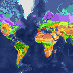
The RESOLVE Ecoregions dataset, updated in 2017, offers a depiction of the 846 terrestrial ecoregions that represent our living planet. View the stylized map at https://ecoregions2017.appspot.com/ or in Earth Engine. Ecoregions, in the simplest definition, are ecosystems of regional extent. Specifically, ecoregions represent distinct assemblages … biodiversity conservation ecoregions ecosystems global table -
SPEIbase: Standardised Precipitation-Evapotranspiration Index database, Version 2.10

The Global SPEI database (SPEIbase) offers long-time robust information about drought conditions at the global scale, with a 0.5 degree pixel size and monthly cadence. It provides SPEI time scales from 1 to 48 months. The Standardized Precipitation-Evapotranspiration Index (SPEI) expresses, as a standardized variate … climate climate-change drought evapotranspiration global monthly -
Satellite Embedding V1

The Google Satellite Embedding dataset is a global, analysis-ready collection of learned geospatial embeddings. Each 10-meter pixel in this dataset is a 64-dimensional representation, or "embedding vector," that encodes temporal trajectories of surface conditions at and around that pixel as measured by various Earth observation … annual global google landsat-derived satellite-imagery sentinel1-derived -
TerraClimate: Monthly Climate and Climatic Water Balance for Global Terrestrial Surfaces, University of Idaho
TerraClimate is a dataset of monthly climate and climatic water balance for global terrestrial surfaces. It uses climatically aided interpolation, combining high-spatial resolution climatological normals from the WorldClim dataset, with coarser spatial resolution, but time-varying data from CRU Ts4.0 and the Japanese 55-year Reanalysis (JRA55). … climate drought evapotranspiration geophysical global merced -
Tree proximate people (TPP) 1.0
The "Tree Proximate People" (TPP) is one of the datasets contributing to the development of indicator #13, number of forest-dependent people in extreme poverty, of the Collaborative Partnership on Forests (CPF) Global Core Set of forest-related indicators (GCS). The TPP dataset provides 4 different estimates … agriculture fao forest global plant-productivity population -
USGS Landsat 1 MSS Collection 2 Tier 1 Raw Scenes

Landsat 1 MSS Collection 2 Tier 1 DN values, representing scaled, calibrated at-sensor radiance. Landsat scenes with the highest available data quality are placed into Tier 1 and are considered suitable for time-series processing analysis. Tier 1 includes Level-1 Precision Terrain (L1TP) processed data that … c2 global l1 landsat lm1 mss -
USGS Landsat 1 MSS Collection 2 Tier 2 Raw Scenes

Landsat 1 MSS Collection 2 Tier 2 DN values, representing scaled, calibrated at-sensor radiance. Scenes not meeting Tier 1 criteria during processing are assigned to Tier 2. This includes Systematic terrain (L1GT) and Systematic (L1GS) processed scenes, as well as any L1TP scenes that do … c2 global l1 landsat lm1 mss -
USGS Landsat 2 MSS Collection 2 Tier 1 Raw Scenes
Landsat 2 MSS Collection 2 Tier 1 DN values, representing scaled, calibrated at-sensor radiance. Landsat scenes with the highest available data quality are placed into Tier 1 and are considered suitable for time-series processing analysis. Tier 1 includes Level-1 Precision Terrain (L1TP) processed data that … c2 global l2 landsat lm2 mss -
USGS Landsat 2 MSS Collection 2 Tier 2 Raw Scenes

Landsat 2 MSS Collection 2 Tier 2 DN values, representing scaled, calibrated at-sensor radiance. Scenes not meeting Tier 1 criteria during processing are assigned to Tier 2. This includes Systematic terrain (L1GT) and Systematic (L1GS) processed scenes, as well as any L1TP scenes that do … c2 global l2 landsat lm2 mss -
USGS Landsat 3 MSS Collection 2 Tier 1 Raw Scenes

Landsat 3 MSS Collection 2 Tier 1 DN values, representing scaled, calibrated at-sensor radiance. Landsat scenes with the highest available data quality are placed into Tier 1 and are considered suitable for time-series processing analysis. Tier 1 includes Level-1 Precision Terrain (L1TP) processed data that … c2 global l3 landsat lm3 mss -
USGS Landsat 3 MSS Collection 2 Tier 2 Raw Scenes

Landsat 3 MSS Collection 2 Tier 2 DN values, representing scaled, calibrated at-sensor radiance. Scenes not meeting Tier 1 criteria during processing are assigned to Tier 2. This includes Systematic terrain (L1GT) and Systematic (L1GS) processed scenes, as well as any L1TP scenes that do … c2 global l3 landsat lm3 mss -
USGS Landsat 4 Level 2, Collection 2, Tier 1

This dataset contains atmospherically corrected surface reflectance and land surface temperature derived from the data produced by the Landsat TM sensor. These images contain 4 visible and near-infrared (VNIR) bands and 2 short-wave infrared (SWIR) bands processed to orthorectified surface reflectance, and one thermal infrared … cfmask cloud fmask global landsat lasrc -
USGS Landsat 4 Level 2, Collection 2, Tier 2

This dataset contains atmospherically corrected surface reflectance and land surface temperature derived from the data produced by the Landsat TM sensor. These images contain 4 visible and near-infrared (VNIR) bands and 2 short-wave infrared (SWIR) bands processed to orthorectified surface reflectance, and one thermal infrared … cfmask cloud fmask global landsat lasrc -
USGS Landsat 4 MSS Collection 2 Tier 1 Raw Scenes

Landsat 4 MSS Collection 2 Tier 1 DN values, representing scaled, calibrated at-sensor radiance. Landsat scenes with the highest available data quality are placed into Tier 1 and are considered suitable for time-series processing analysis. Tier 1 includes Level-1 Precision Terrain (L1TP) processed data that … c2 global l4 landsat lm4 mss -
USGS Landsat 4 MSS Collection 2 Tier 2 Raw Scenes

Landsat 4 MSS Collection 2 Tier 2 DN values, representing scaled, calibrated at-sensor radiance. Scenes not meeting Tier 1 criteria during processing are assigned to Tier 2. This includes Systematic terrain (L1GT) and Systematic (L1GS) processed scenes, as well as any L1TP scenes that do … c2 global l4 landsat lm4 mss -
USGS Landsat 4 TM Collection 2 Tier 1 Raw Scenes

Landsat 4 TM Collection 2 Tier 1 DN values, representing scaled, calibrated at-sensor radiance. Landsat scenes with the highest available data quality are placed into Tier 1 and are considered suitable for time-series processing analysis. Tier 1 includes Level-1 Precision Terrain (L1TP) processed data that … c2 global l4 landsat lt4 radiance -
USGS Landsat 4 TM Collection 2 Tier 1 TOA Reflectance

Landsat 4 TM Collection 2 Tier 1 calibrated top-of-atmosphere (TOA) reflectance. Calibration coefficients are extracted from the image metadata. See Chander et al. (2009) for details on the TOA computation. global landsat satellite-imagery toa usgs -
USGS Landsat 4 TM Collection 2 Tier 2 Raw Scenes

Landsat 4 TM Collection 2 Tier 2 DN values, representing scaled, calibrated at-sensor radiance. Scenes not meeting Tier 1 criteria during processing are assigned to Tier 2. This includes Systematic terrain (L1GT) and Systematic (L1GS) processed scenes, as well as any L1TP scenes that do … c2 global l4 landsat lt4 radiance -
USGS Landsat 4 TM Collection 2 Tier 2 TOA Reflectance

Landsat 4 TM Collection 2 Tier 2 calibrated top-of-atmosphere (TOA) reflectance. Calibration coefficients are extracted from the image metadata. See Chander et al. (2009) for details on the TOA computation. global landsat satellite-imagery toa usgs -
USGS Landsat 5 Level 2, Collection 2, Tier 1

This dataset contains atmospherically corrected surface reflectance and land surface temperature derived from the data produced by the Landsat TM sensor. These images contain 4 visible and near-infrared (VNIR) bands and 2 short-wave infrared (SWIR) bands processed to orthorectified surface reflectance, and one thermal infrared … cfmask cloud fmask global landsat lasrc -
USGS Landsat 5 Level 2, Collection 2, Tier 2

This dataset contains atmospherically corrected surface reflectance and land surface temperature derived from the data produced by the Landsat TM sensor. These images contain 4 visible and near-infrared (VNIR) bands and 2 short-wave infrared (SWIR) bands processed to orthorectified surface reflectance, and one thermal infrared … cfmask cloud fmask global landsat lasrc -
USGS Landsat 5 MSS Collection 2 Tier 1 Raw Scenes

Landsat 5 MSS Collection 2 Tier 1 DN values, representing scaled, calibrated at-sensor radiance. Landsat scenes with the highest available data quality are placed into Tier 1 and are considered suitable for time-series processing analysis. Tier 1 includes Level-1 Precision Terrain (L1TP) processed data that … c2 global l5 landsat lm5 mss -
USGS Landsat 5 MSS Collection 2 Tier 2 Raw Scenes

Landsat 5 MSS Collection 2 Tier 2 DN values, representing scaled, calibrated at-sensor radiance. Scenes not meeting Tier 1 criteria during processing are assigned to Tier 2. This includes Systematic terrain (L1GT) and Systematic (L1GS) processed scenes, as well as any L1TP scenes that do … c2 global l5 landsat lm5 mss -
USGS Landsat 5 TM Collection 2 Tier 1 Raw Scenes

Landsat 5 TM Collection 2 Tier 1 DN values, representing scaled, calibrated at-sensor radiance. Landsat scenes with the highest available data quality are placed into Tier 1 and are considered suitable for time-series processing analysis. Tier 1 includes Level-1 Precision Terrain (L1TP) processed data that … c2 global l5 landsat lt5 radiance -
USGS Landsat 5 TM Collection 2 Tier 1 TOA Reflectance

Landsat 5 TM Collection 2 Tier 1 calibrated top-of-atmosphere (TOA) reflectance. Calibration coefficients are extracted from the image metadata. See Chander et al. (2009) for details on the TOA computation. global landsat satellite-imagery toa usgs -
USGS Landsat 5 TM Collection 2 Tier 2 Raw Scenes

Landsat 5 TM Collection 2 Tier 2 DN values, representing scaled, calibrated at-sensor radiance. Scenes not meeting Tier 1 criteria during processing are assigned to Tier 2. This includes Systematic terrain (L1GT) and Systematic (L1GS) processed scenes, as well as any L1TP scenes that do … c2 global l5 landsat lt5 radiance -
USGS Landsat 5 TM Collection 2 Tier 2 TOA Reflectance

Landsat 5 TM Collection 2 Tier 2 calibrated top-of-atmosphere (TOA) reflectance. Calibration coefficients are extracted from the image metadata. See Chander et al. (2009) for details on the TOA computation. global landsat satellite-imagery toa usgs -
USGS Landsat 7 Collection 2 Tier 1 Raw Scenes

Landsat 7 Collection 2 Tier 1 DN values, representing scaled, calibrated at-sensor radiance. Landsat scenes with the highest available data quality are placed into Tier 1 and are considered suitable for time-series processing analysis. Tier 1 includes Level-1 Precision Terrain (L1TP) processed data that have … c2 etm global l7 landsat le7 -
USGS Landsat 7 Collection 2 Tier 1 TOA Reflectance

Landsat 7 Collection 2 Tier 1 calibrated top-of-atmosphere (TOA) reflectance. Calibration coefficients are extracted from the image metadata. See Chander et al. (2009) for details on the TOA computation. Note that Landsat 7's orbit has been drifting to an earlier acquisition time since 2017. c2 global landsat satellite-imagery toa usgs -
USGS Landsat 7 Collection 2 Tier 1 and Real-Time data Raw Scenes

Landsat 7 Collection 2 Tier 1 and Real-Time data DN values, representing scaled, calibrated at-sensor radiance. Landsat scenes with the highest available data quality are placed into Tier 1 and are considered suitable for time-series processing analysis. Tier 1 includes Level-1 Precision Terrain (L1TP) processed … c2 etm global l7 landsat le7 -
USGS Landsat 7 Collection 2 Tier 1 and Real-Time data TOA Reflectance

Landsat 7 Collection 2 Tier 1 and Real-Time data calibrated top-of-atmosphere (TOA) reflectance. Calibration coefficients are extracted from the image metadata. See Chander et al. (2009) for details on the TOA computation. Note that Landsat 7's orbit has been drifting to an earlier acquisition time … c2 global landsat satellite-imagery toa usgs -
USGS Landsat 7 Collection 2 Tier 2 Raw Scenes

Landsat 7 Collection 2 Tier 2 DN values, representing scaled, calibrated at-sensor radiance. Scenes not meeting Tier 1 criteria during processing are assigned to Tier 2. This includes Systematic terrain (L1GT) and Systematic (L1GS) processed scenes, as well as any L1TP scenes that do not … c2 etm global l7 landsat le7 -
USGS Landsat 7 Collection 2 Tier 2 TOA Reflectance

Landsat 7 Collection 2 Tier 2 calibrated top-of-atmosphere (TOA) reflectance. Calibration coefficients are extracted from the image metadata. See Chander et al. (2009) for details on the TOA computation. Note that Landsat 7's orbit has been drifting to an earlier acquisition time since 2017. c2 global landsat satellite-imagery toa usgs -
USGS Landsat 7 Level 2, Collection 2, Tier 1

This dataset contains atmospherically corrected surface reflectance and land surface temperature derived from the data produced by the Landsat 7 ETM+ sensor. These images contain 4 visible and near-infrared (VNIR) bands and 2 short-wave infrared (SWIR) bands processed to orthorectified surface reflectance, and one thermal … cfmask cloud etm fmask global landsat -
USGS Landsat 7 Level 2, Collection 2, Tier 2
This dataset contains atmospherically corrected surface reflectance and land surface temperature derived from the data produced by the Landsat 7 ETM+ sensor. These images contain 4 visible and near-infrared (VNIR) bands and 2 short-wave infrared (SWIR) bands processed to orthorectified surface reflectance, and one thermal … cfmask cloud etm fmask global landsat -
USGS Landsat 8 Collection 2 Tier 1 Raw Scenes

Landsat 8 Collection 2 Tier 1 DN values, representing scaled, calibrated at-sensor radiance. Landsat scenes with the highest available data quality are placed into Tier 1 and are considered suitable for time-series processing analysis. Tier 1 includes Level-1 Precision Terrain (L1TP) processed data that have … c2 global l8 landsat lc8 oli-tirs -
USGS Landsat 8 Collection 2 Tier 1 TOA Reflectance

Landsat 8 Collection 2 Tier 1 calibrated top-of-atmosphere (TOA) reflectance. Calibration coefficients are extracted from the image metadata. See Chander et al. (2009) for details on the TOA computation. Landsat scenes with the highest available data quality are placed into Tier 1 and are considered … c2 global landsat satellite-imagery toa usgs -
USGS Landsat 8 Collection 2 Tier 1 and Real-Time data Raw Scenes

Landsat 8 Collection 2 Tier 1 and Real-Time data DN values, representing scaled, calibrated at-sensor radiance. Landsat scenes with the highest available data quality are placed into Tier 1 and are considered suitable for time-series processing analysis. Tier 1 includes Level-1 Precision Terrain (L1TP) processed … c2 global l8 landsat lc8 nrt -
USGS Landsat 8 Collection 2 Tier 1 and Real-Time data TOA Reflectance

Landsat 8 Collection 2 Tier 1 and Real-Time data calibrated top-of-atmosphere (TOA) reflectance. Calibration coefficients are extracted from the image metadata. See Chander et al. (2009) for details on the TOA computation. Landsat scenes with the highest available data quality are placed into Tier 1 … c2 global l8 landsat lc8 satellite-imagery -
USGS Landsat 8 Collection 2 Tier 2 Raw Scenes

Landsat 8 Collection 2 Tier 2 DN values, representing scaled, calibrated at-sensor radiance. Scenes not meeting Tier 1 criteria during processing are assigned to Tier 2. This includes Systematic terrain (L1GT) and Systematic (L1GS) processed scenes, as well as any L1TP scenes that do not … c2 global l8 landsat lc8 oli-tirs -
USGS Landsat 8 Collection 2 Tier 2 TOA Reflectance
Landsat 8 Collection 2 Tier 2 calibrated top-of-atmosphere (TOA) reflectance. Calibration coefficients are extracted from the image metadata. See Chander et al. (2009) for details on the TOA computation. Scenes not meeting Tier 1 criteria during processing are assigned to Tier 2. This includes Systematic … c2 global landsat satellite-imagery toa usgs -
USGS Landsat 8 Level 2, Collection 2, Tier 1

This dataset contains atmospherically corrected surface reflectance and land surface temperature derived from the data produced by the Landsat 8 OLI/TIRS sensors. These images contain 5 visible and near-infrared (VNIR) bands and 2 short-wave infrared (SWIR) bands processed to orthorectified surface reflectance, and one thermal … cfmask cloud fmask global l8sr landsat -
USGS Landsat 8 Level 2, Collection 2, Tier 2

This dataset contains atmospherically corrected surface reflectance and land surface temperature derived from the data produced by the Landsat 8 OLI/TIRS sensors. These images contain 5 visible and near-infrared (VNIR) bands and 2 short-wave infrared (SWIR) bands processed to orthorectified surface reflectance, and one thermal … cfmask cloud fmask global l8sr landsat -
USGS Landsat 9 Collection 2 Tier 1 Raw Scenes

Landsat 9 Collection 2 Tier 1 DN values, representing scaled, calibrated at-sensor radiance. Landsat scenes with the highest available data quality are placed into Tier 1 and are considered suitable for time-series processing analysis. Tier 1 includes Level-1 Precision Terrain (L1TP) processed data that have … c2 global l9 landsat lc9 oli-tirs -
USGS Landsat 9 Collection 2 Tier 1 TOA Reflectance

Landsat 9 Collection 2 Tier 1 calibrated top-of-atmosphere (TOA) reflectance. Calibration coefficients are extracted from the image metadata. See Chander et al. (2009) for details on the TOA computation. Landsat scenes with the highest available data quality are placed into Tier 1 and are considered … c2 global landsat satellite-imagery toa usgs -
USGS Landsat 9 Collection 2 Tier 2 Raw Scenes

Landsat 9 Collection 2 Tier 2 DN values, representing scaled, calibrated at-sensor radiance. Scenes not meeting Tier 1 criteria during processing are assigned to Tier 2. This includes Systematic terrain (L1GT) and Systematic (L1GS) processed scenes, as well as any L1TP scenes that do not … c2 global l9 landsat lc9 oli-tirs -
USGS Landsat 9 Collection 2 Tier 2 TOA Reflectance
Landsat 9 Collection 2 Tier 2 calibrated top-of-atmosphere (TOA) reflectance. Calibration coefficients are extracted from the image metadata. See Chander et al. (2009) for details on the TOA computation. Scenes not meeting Tier 1 criteria during processing are assigned to Tier 2. This includes Systematic … c2 global l9 landsat lc9 satellite-imagery -
USGS Landsat 9 Level 2, Collection 2, Tier 1

This dataset contains atmospherically corrected surface reflectance and land surface temperature derived from the data produced by the Landsat 9 OLI/TIRS sensors. These images contain 5 visible and near-infrared (VNIR) bands and 2 short-wave infrared (SWIR) bands processed to orthorectified surface reflectance, and one thermal … cfmask cloud fmask global l9sr landsat -
USGS Landsat 9 Level 2, Collection 2, Tier 2

This dataset contains atmospherically corrected surface reflectance and land surface temperature derived from the data produced by the Landsat 9 OLI/TIRS sensors. These images contain 5 visible and near-infrared (VNIR) bands and 2 short-wave infrared (SWIR) bands processed to orthorectified surface reflectance, and one thermal … cfmask cloud fmask global l9sr landsat -
WAPOR Dekadal Transpiration 3.0

The transpiration (T) data component (dekadal, in mm/day) is the actual transpiration of the vegetation canopy. The value of each pixel represents the average daily actual transpiration for that specific dekad. agriculture fao global wapor water water-vapor -
WDKBA: World Database of Key Biodiversity Areas (KBAs) - March 2026

If you are interested in accessing the KBA dataset please complete the KBA data request form which will allow access directly in GEE once approved. Key Biodiversity Areas (KBAs) are 'sites contributing significantly to the global persistence of biodiversity’, in terrestrial, freshwater and marine ecosystems. … biodiversity boundaries ecosystems global iucn management